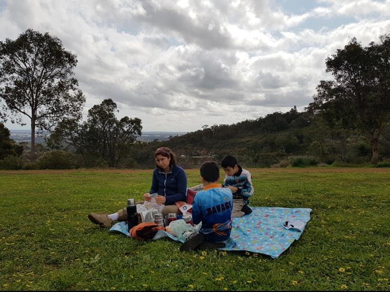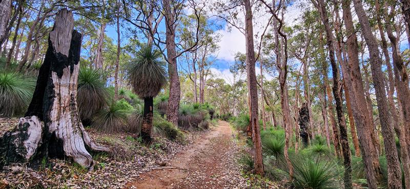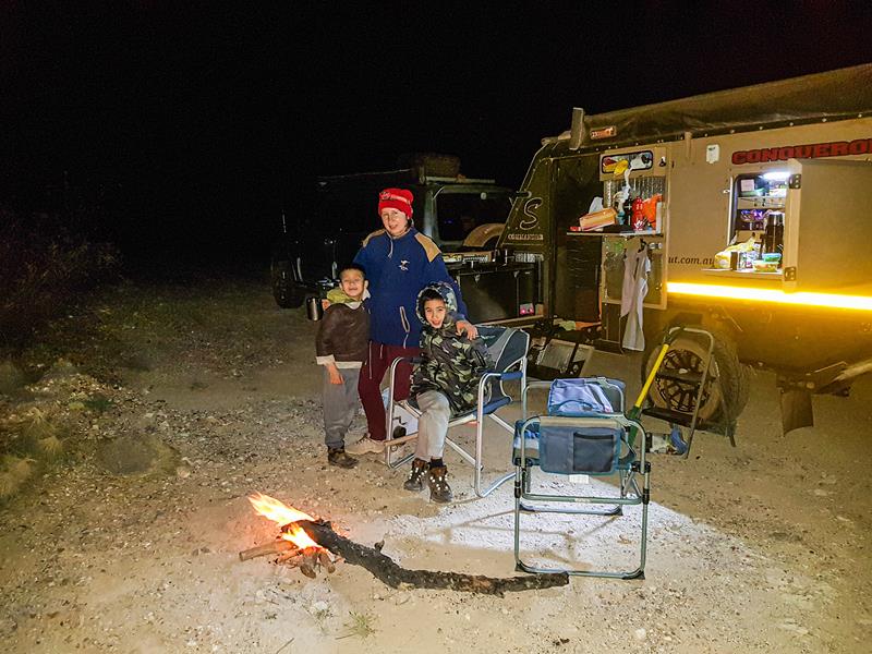
We are a family of four and are nuts about traveling. Our name reflects this! We love sharing the joy and love of traveling and adventure! Let's the fun begin!
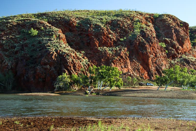
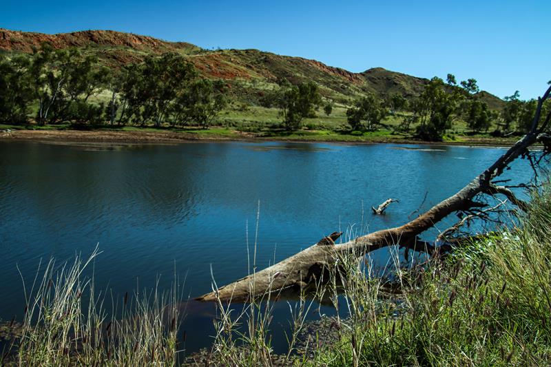
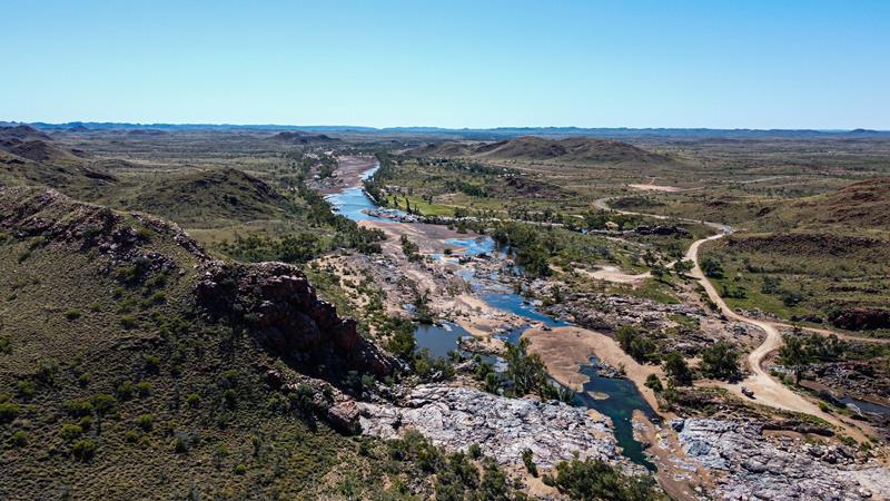
Pilbara doesn’t stop to surprise us. There always seems to be the next hidden gem, waiting to be discovered, explored and delight our eyes and souls. On our way to the Gibb River Road last year, we stopped at Doolena Gorge near Marble Bar. It is a marvelous place with nice scenery. When there is enough of water, the gorge fills up with water from the De Drey River. It becomes then a pleasant picnic and camping spot. Swimming is permitted there and dogs are allowed.
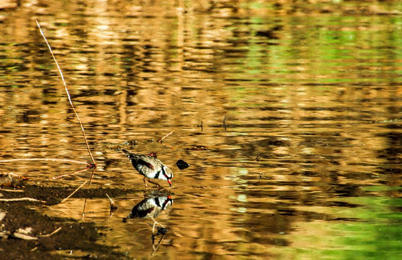
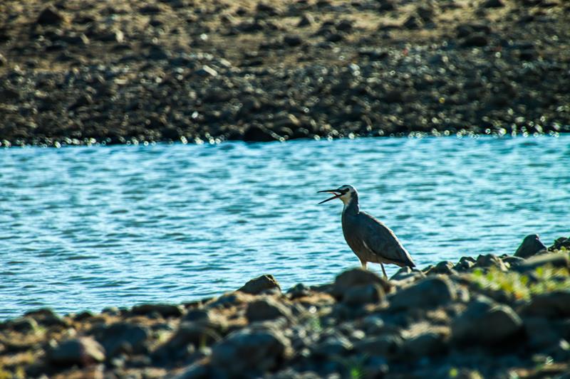
Doolena Gorge is also a heaven for birds. (Below left: Black-fronted Dotterel. Below right: White-faced Heron.)
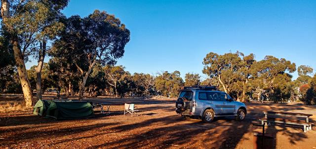
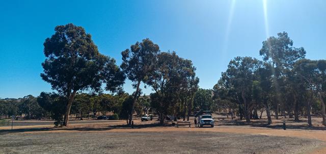
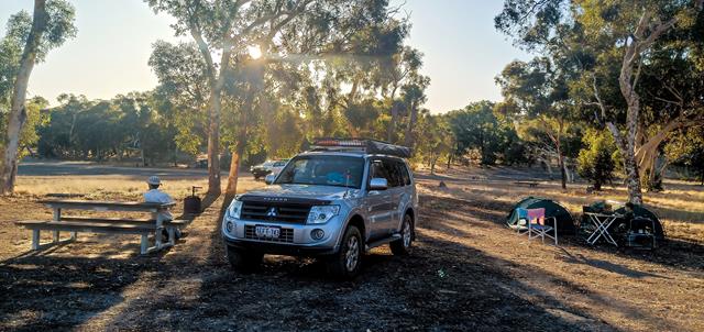
You can camp for free there but must be self-sufficient as there are no facilities.
It is a privilege and honour to camp for free at places like this – pristine, rugged and beautiful. So, please look after our outback.
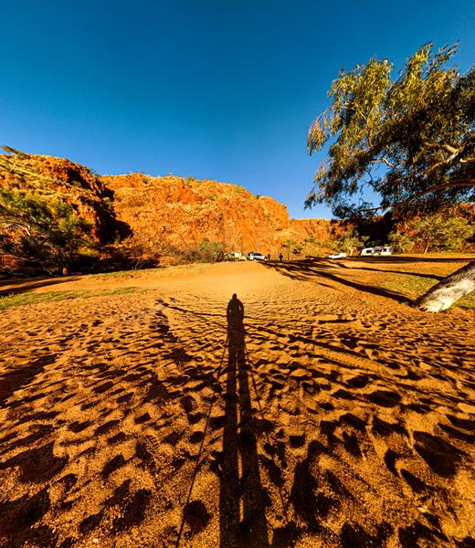
Perspective
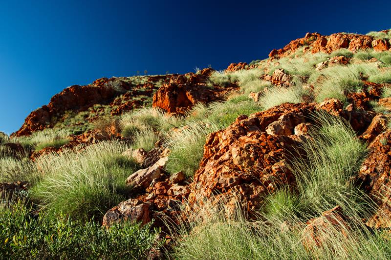
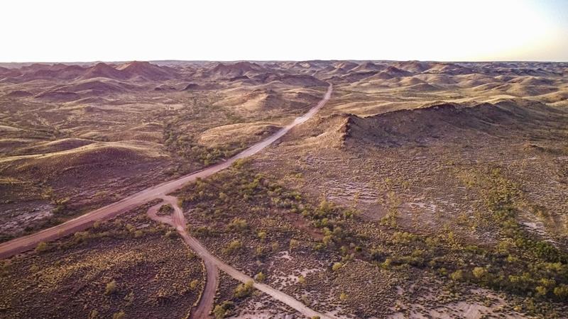
There is a distinct beauty in the rugged landscape of the Pilbara outback – red iron rich rocks, yellow-green spinifex against the bright blue sky.
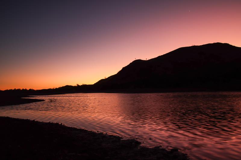
Sunsets and sunrises are particularly beautiful and special in the outback. There is no better way to watch them then when you camp as you can catch different colours of the sky minut changed by setting and rising sun, minute by minute.
Where is Doolena Gorge?
Doolena Gorge is approximately 41 kilometres north of Marble Bar on the Marble Bar-Port Hedland Road. The turning is just after Coongan River crossing on the left. Even though it is rated as 4WD, the dirt road is not long and we think it would be fine for a 2WD if you take it easy and slow (although you might not be able to go all the way). When you get to the place, you can go closer to the actual gorge if you have a 4WD.
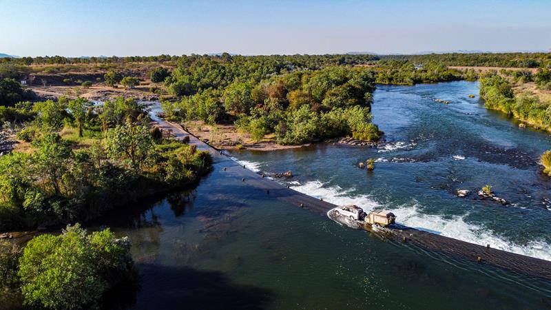
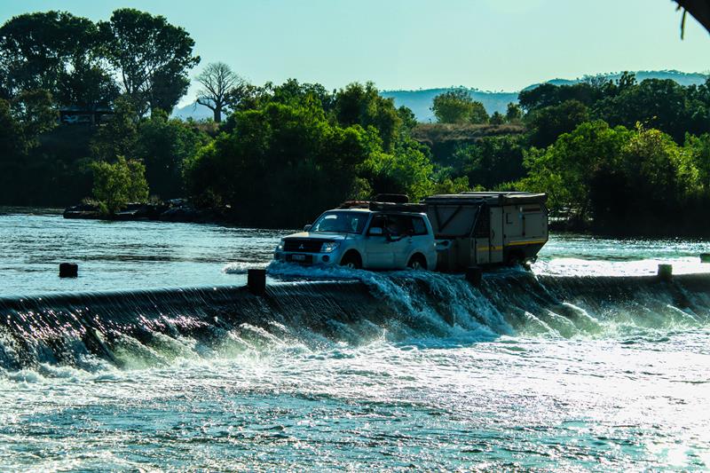
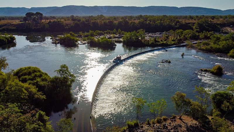
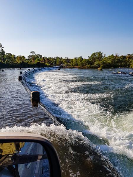
Ivanhoe River Crossing, north of Kununurra is an iconic place and a must do for any 4WD enthusiast travelling through the Kimberley Region and the Gibb River Road. It is a concrete one-way causeway over the Ord River, which was part of the main road to Wyndham during the old days. But nowadays, it is a place where travellers go to tick off their “bucket list”. So, it is really just crossing the river and going back. Many people (especially those with no 4WD) come just to watch others do it. It is also a popular fishing spot. Salt water crocodiles inhibit these waters, so swimming is not safe there.
The river crossing is closed during wet season (usually November to March). So, Australian winter, which is considered dry season, is best for visiting and crossing.
Where is Ivanhoe River Crossing?
It is along Ivanhoe Road, 10-15 minutes’ drive north of Kununurra in East Kimberley.
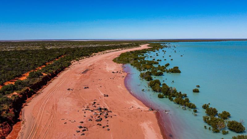
Roebuck Bay is the magical place that delighted and amazed us with its striking colours – red sand, turquoise ocean and green mangroves. It is a great place for a picnic, fishing, not to mention awesome photography (best at high tide). Camping is available at nearby Bird Observatory (we didn’t stay there, so can’t comment).
This place is an internationally significant wetland where you can see a huge number and variety of migratory shorebirds.
Where is Roebuck Bay?
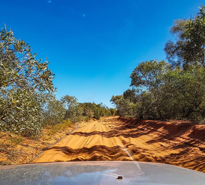
It is on the coast in the Kimberley region of Western Australia. The actual place that is on the picture (Red Sand Beach) is about half an hour drive south of Broome, along Crab Creek Road, 1km from Broome Bird Observatory. The road is sandy and corrugated for 16km or so, so 4WD is recommended.
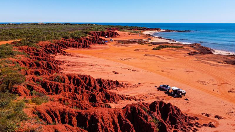
Camping at the base of Pindan cliffs at James Price Point
What is so unique about James Price Point?
James Price Point, 60km north of Broome is absolutely one of our favourites. It’s the place we would like to come back again, despite the corrugated road (roughly 32km of corrugation) to get there. The bright red pindan cliffs backing into the ocean make you feel like you are on another planet. Mars, maybe? The tidal currents at James Price Point are simply phenomenal and so fascinating to observe. Add to this, the thrill of the possibility of finding ancient dinosaur footsteps (at the right tidal conditions) or sight of a dangerous salt water crocodile. James Price Point is so pristine and exquisitely beautiful that you really want to thread lightly and leave no trace of human presence there.
Surprisingly, it is actually the place where you can camp for free. With absolutely no facilities provided, you need to be self-sufficient or hide the traces very carefully (and with hard rocks and no bushland, it is tricky 😊).
Honestly, we think this place is not going to be free forever. So, while it is, take a detour to see it, but take good care of this exceptional place.
Where is James Price Point?
James Prices Point is north of Broome, off Cape Leveque Road. You would need a 4WD to get there and deflate your tyres once you hit the corrugated dirt road.
Tides
The Kimberley coast has the biggest tides in the southern hemisphere. This is due to the shape and size of the continent which allows the tides to grow much larger compared to other places. The difference between high and low tides can be up to 10 meters.
The tide comes really fast. When the water recedes back into the ocean, it creates intricate patterns on the sand, many of which look like paintings of trees. It is such a delight for a photographer or a lover of nature.
James Price Point at dawn, dusk and night
The magical hour (an hour before sunrise and an hour after sunrise) is the best for taking landscape photos. The colours of the sky painted by the setting or rising sun are simply amazing.
Stars and the Milky Way have been attracting people’s attention since the beginning of time. In the old days, sailors and the local Aboriginal people alike, used them to navigate on their journeys. Nowadays, they add such a beautiful background to the pictures taken by many photographers. Even if you are not a photographer, there is hardly anyone, who would be impartial to see the arch of the Milky Way in the dark sky on a cold winter night. There is a sense of mystery and adventure that pulls people’s eyes and souls to the stars that are within many light years of reach from us.
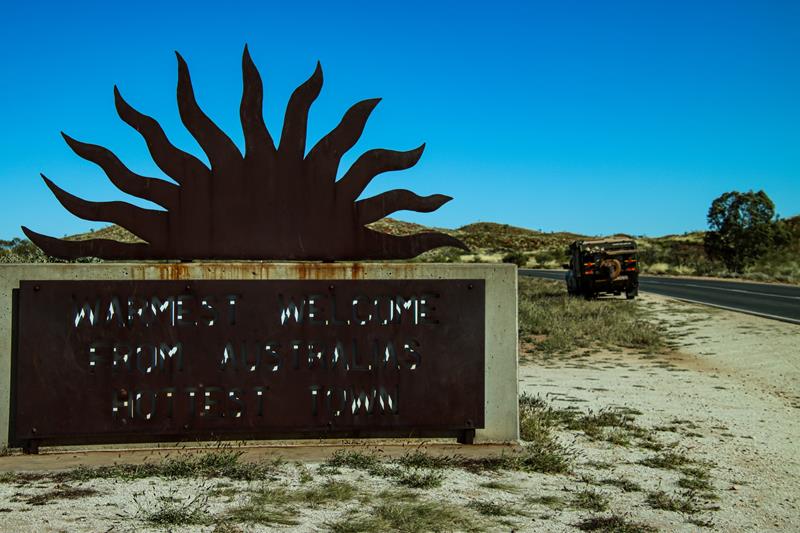
Marble Bar, known as the hottest town in Australia, gets its name from a local deposit of colourful mineral that was thought to be marble and turned out to be jasper.
The jasper deposits cross the Coongan River, forming Marble Bar Pool and adjacent to it Chinaman Pool. Both are both very picturesque picnic spots, only 5 minutes’ drive from Marble Bar town.
Chinaman Pool
Marble Bar is a small mining town, approximately 1500km north east of Perth on the Great Northern Highway.
Marble Bar Pool
Camping in spinifex country
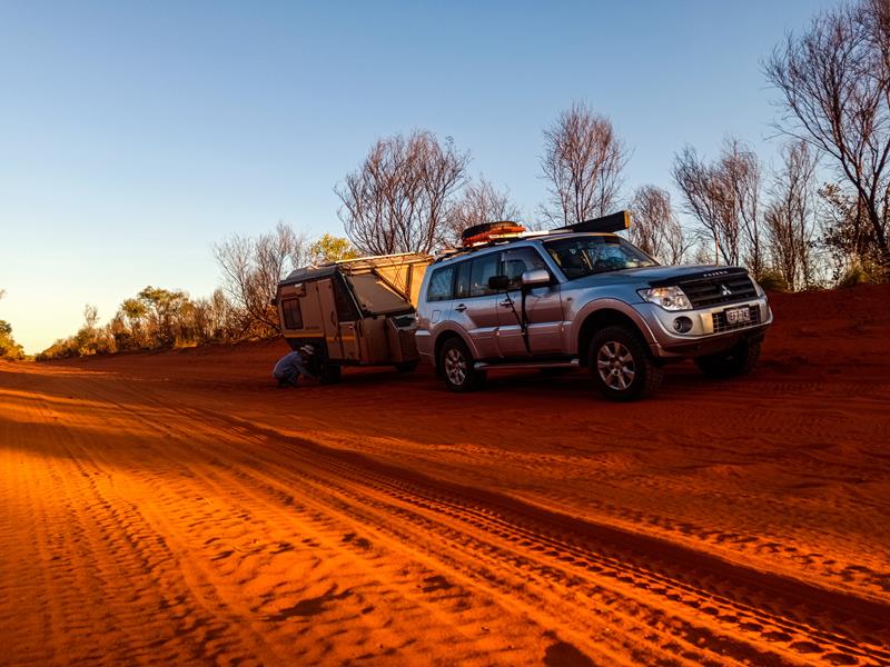
Pilbara is a beautiful region, characterized by red colour, iron rich earth. There are so many pristine places there, including some awesome free camps, waiting to be discovered. But sometimes, the nigh falls before you can reach your destination. This happens to us from time to time. Quite often a solution is to pull out from the road – as long as there is a side road and clearing. On our long trip up north last year, we did just that.
Our camp for that cold night in July was what in Wikicamp is marked as Kate’ Pit. It turned out to be a perfect spot for a night like that.
Morning revealed beautiful scenery – typical Australian outback. Low winter sun was casting warm light onto the rough spiky spinifex grass, contrasting red rocky outcrops and blue sky. Stops like this one become a precious experience because of the opportunity to connect with nature and discover hidden beauty in remote outback.
Kate’s Pit is a large gravel pit, off the road, with no facilities, 38km south of Marble Bar.
Turning to Kate’s Pit camp
We love every bit of Pilbara – including its red rocks and dirt endless roads!
Lesueur National Park is a globally recognised biodiversity hotspot. Spring is the best time to visit it when you can see many of the 900 plant species blooming. But you can still see something flowering at any time of the year. We visited Lesueur National Park in the middle of autumn (April) and found endangered pine banksia flowering quite fascinating.
There is 18km one-way loop scenic drive throughout the park with numerous stopping points and information boards along the way. Interestingly, while the road to the park is a dirt road, the scenic drive inside the Lesueur Park is a sealed road. There are two picnic areas inside the park. Numerous trails of various length and difficulty start from those areas.
Mt Lesueur Trail in Lesueur National Park
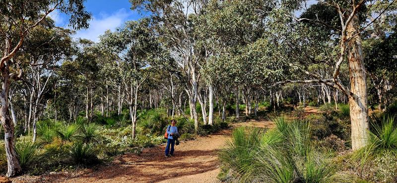
We choose Mt Lesueur Trail, which is 3,5km return walk. It starts as an easy walk on rather flat surfaces and then changes into a moderate difficulty trail as it climbs up the slope.
The top of Mt Lesueur is flat but the views are quite spectacular.
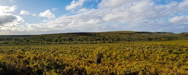
With not many of the wildflowers blooming in April, Grass Trees, Kingia Australis and Pine Banksia were the spotlights for us.
Apart from endangered Pine Banksia, there are also other types of bankias in the park. Firewood bankisa and Bankisa Prionotes are especially spectacular.
How to get there and where to stay
Lesueur Natonal Park is 15 minutes’ drive from Jurien Bay and is easily accessible. There is a standard entry fee per vehicle and no dogs are allowed in the park. The nearest campground (this is where we stayed) is Karda campground.
The Pinnacles (part of the Nambung National Park) near Cervantes do not need introduction. It is one of the most visited places in Western Australia. Located only 2,5-hour drive from Perth along the Indian Ocean Drive, it can be just a day trip or you can take a few days to explore the area. There is a 4,5km driving trail through the desert with many parking bays to stop and enjoy the marvellous creations.
What are exactly the Pinnacles and how were they formed?
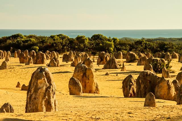
The Pinnacles are natural limestone structures formed thousands of years ago. They are of different shapes and sizes, some as high as 3 meters. Up to date scientists are still puzzled as to how the Pinnacles were formed. There are a few theories which contradict each other and little evidence to support each. The Pinnacles Desert Discovery Centre within the Nambung National Park has some posters explaining different theories. One thing is clear – the Pinnacles are nature’s creations! Interestingly, the Nambung National Park near Cervantes is not the only place in Australia where the Pinnacles are found. But here there is a greatest concentration of them.
Pinnacles are photographer’s delight
Not only the Pinnacles is a very popular attraction but also one of the most photographed iconic places during the day, sunset or night. While there are some amazing pictures by professional photographers out there, here is what we’ve seen.
Pinnacles during the day
During the daytime, the light can be very harsh, unless there are some clouds which make the landscape interesting. In the absence of clouds, you will get better results when shooting closer to the end of the day, when the light is a bit softer. Irrespective of the lighting conditions, the Pinnacles, without doubt, do not fail to impress.
Pinnacles at dusk
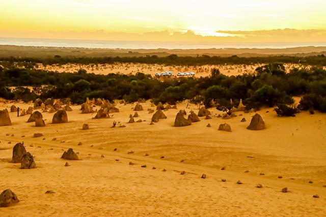
Twilight is a magical time to take pictures. It is the time when the sky is lit with myriad of colours that change by seconds.
Pinnacles at night
This is the most ifficult time to take pictures. But it can be quite rewarding. Just starring at the sky full of stars is already very fulfilling, when a sense of peace and quietness pervades. These pictures were taken a bit early in the evening (between 7 and 9pm). For best results, it would be better to take them around 10-11pm. Apparently, at that time you can see the Milky Way in a shape of an emu. But our kids were too tired and wanted to go back to campground, so these are the shots I managed.
Lake Thetis
Part of Nambung National Park is Lake Thetis. It is a small saline lake and is one of only a few places in Western Australia where stromatolites are found. Stromatolites and their cousins thrombolites are the oldest living lifeforms on the planet. Although the stromatolites in Hamlin Pool at Shark Bay are more impressive, Lake Thetis is still worth a visit on your way to the Pinnacles.
There is a nice but short walk around the lake and you can see many birds resting on stromatolites. People are not allowed to touch or walk on stromatolites but this rule doesn’t apply to birds. 😊
Where can you stay nearby?
There are plenty of accomodation in Cervantes and Jurien Bay, which includes caravan parks, as well as hotels. But if you are after something more simple and nature based, we recommend Karda campground. Although it is a bit further away from Cervantes but it is close to Lesueur National Park, which is worth exploring.
Good to know
There is entry fee of $15 per vehicle (as of April 2023) to Nambung National Park and no dogs are allowed.
While you are at the Pinnacles Desert, watch out for a family of emus.
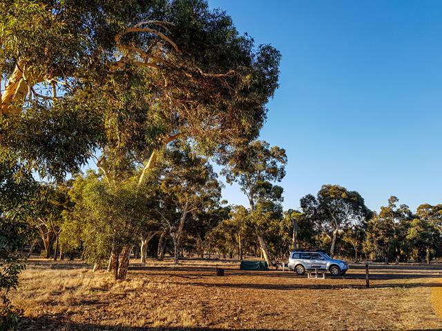
Karda campground is a great nature-based campground, 20km east from Jurien Bay and next to Lesueur National Park. If you are looking for a budget accommodation in that area, Karda campground is an ideal choice. Firstly, it is within the short driving distance from both the Lesueur National Park and the coastal town of Jurien Bay. Secondly, the campground is not too big and not too small. There are 31 sites, located in two loops, and can accommodate all sorts of vehicles and vans, including tents, caravans and trailers. Thirdly, the sites themselves are really huge, which is always very nice. Lastly, each site comes with its own picnic table and firepit. Not to mention that there are two clean and new drop toilets in each loop.
The sites are $11 per adult and $3 per child per night. You would need to book online via Parkstay. We visited Karda campground over the Anzac Day holiday, end of April and there were plenty of spaces available. However, we would recommend booking in advance, as the internet can be quite patchy there.
Unfortunately, no dogs are allowed. There are also no rubbish bins, which keeps the cost a bit lower.
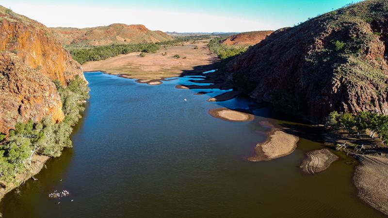
Karda campground is a great place to stay during cooler months of the year. It can be quite hot in summer there. In fact, it is closed from December to February. There are plently of things to do and see around. Biodiversity hot spot Lesueur National Park is just around the corner. Jurien Bay has a lot on offer too. And of course, the famous Pinnalces Desert is only about an hour’s drive away.
Below: view from our swags in the morning. Nice life 🙂
Ellendale Pool and Greenough are two places of interest in Australia’s Mid-West region. They are popular with tourists as short holiday destinations or on the way to Coral Coast. Likewise locals from Geraldton love these places as their weekend gateaway.
Ellendale Pool
Located 51km east from Geraldton, it is an easy 40-minute drive on sealed roads. The natural rock pool, formed by flowing Greenough River is particularly picturesque. Many people swim there, although warning is issued that swimming is not advisable in temperatures higher than 24 degrees due to the presence of bacteria. If not swimming, canoeing can be easily enjoyed on the river. The colours of the gorge are shades of orange which become more dramatic at sunrise and sunset. They cast beautiful reflections into the calm waters of the pool.
The facilities at Ellendale Pool include flushing toilets, outside cold shower, non-drinking water taps, bbqs, picnic tables, rubbish bins, dump point and even a small playground. Dogs on leash are allowed.
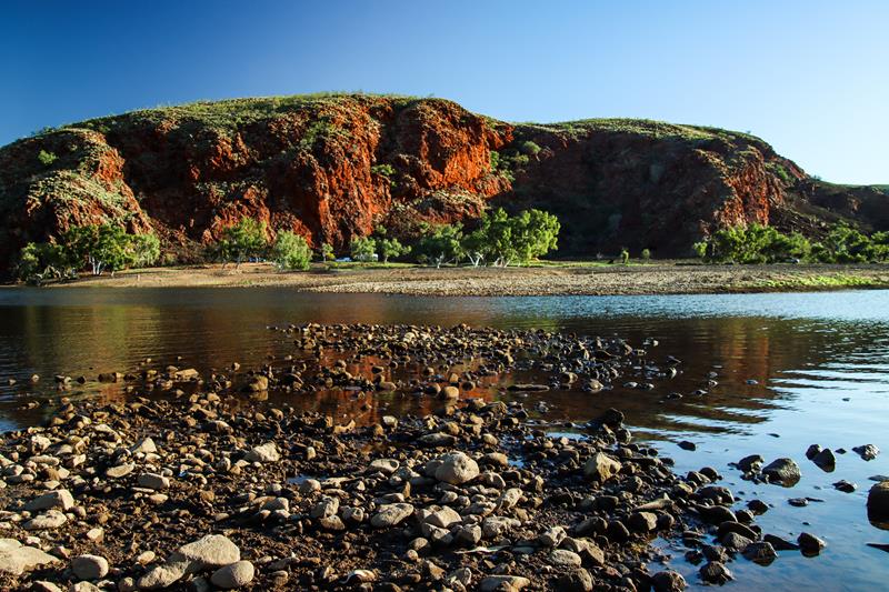
At the moment, the area is free, which makes it very popular with locals and tourists alike. However, we suspect, it won’t be free for long. The place is suitable for both tents/swags and caravans. It does have 2 camping areas but it can fill up quickly.
Ellendale Pool attracts lots of birds. Noisy corellas come in hundreds and visit the place a few times daily. Swallows are in much smaller numbers and quieter but you can still hear them chirping cheerfully in the morning. Australian ringnecks, blue wrens and galahs also frequent the place.
How are the road conditions?
When there is a lot of rain, the road to Ellendale Pool might be closed, as it gets flooded.
The last 1km of Ellendale Pool Road is dirt corrugated road. The good news – it is only a short drive!
Sky wonders at Ellendale Pool
Being far away from the city, there is almost no light pollution at Ellendale Pool, which makes it a great place to watch the night sky.
You can only see sky like this when there is no moon. However, when there is one, we enjoy taking pictures of it too.
Even though trees blocked some of the views of the setting sun, the light from the sun was still visible. From pink to purple to red, the colour of the sky was changing in a matter of a few minutes.
We enjoyed our 3 nights stay at Ellendale Pool, owing to its beauty and excellent facilities. On the other hand, if you are looking for something very quiet and tranquil, it might not be the ideal place as it is a busy place, popular with people and noisy birds alike 😊.
Greenough
Greenough is a small settlement, south of Geraldton, with rich history. Apart from its history, Greenough is also known for its leaning trees. Some of them are lying almost horizontally to the ground. These are eucalyptus species, River Gums. They grow mostly on private properties, but there is one prominent leaning tree, on the Brand Highway, near Greenough settlement, that you can see quite close. Although, there is a fence, so you can’t really touch it. So why do the trees grow sideways in Greenough? Their leaning position is caused by constantly blowing salty southerly winds from the Indian Ocean. The natives of Western Australia say that it is a way of paying respect to the Mother Earth.
Greenough River
Rivers have always been an attraction for people. Being a source of water, rivers attract lots of birdlife. Some of the nicest walks are also along the river banks. If you are around Geraldton, why not enjoy the Greenough River, which meets the ocean at Cape Burney, 10 km south of Geraldton.
Lovers of hiking can take Greenough River Walk Trail. Starting from the Greenough River mouth at Cape Burney, the trail runs in a 17km loop, which you can hike in sections. This is quite an easy hike with the mixed views of the river and coastal vegetation. The trail is shared by bicycles and in some parts by 4WDs.
Devlin Pool, along the trail, is very picturesque. It can be admired from the lookout. Or you can walk down to it and have a swim or go canoeing. We chose to admire from the top 😊.
Although not part of the Greenough River Nature Trail, but still along the river is Bootenal Spring. This place has a historical value, as it is thought to be a site of confrontations between local Aboriginal people and early settlers. We found it quite a picturesque place, although hard to get to the water in some places.
The Walkaway Wind Farm
Located 30 km south of Geraldton, near a small town Walkaway is the Walkaway Wind Farm. The MidWest is one of Australia’s windiest regions. With the wind speed of 20-25km per hour and consistent breeze, the farm is able to generate electricity.
Interesting facts: The production of electricity starts at wind speed 14km/h. The amount of electricity produced increases until the turbines reach the speed 36km/h. When the wind speed exceeds 90km/h, the turbines automatically shut down. The minimum lifetime of a turbine is 25 years. Our observation: all the turbines rotate at different speeds (must be due to the fact that each turbine doesn’t catch the wind equally). Some might even not move, while others continue to rotate.
To conlclude
What did we remember most from this 3 day trip to Ellendale Pool? Little Corellas!
Leeuwin-Naturaliste National Park is undoubtedly one of the most popular attractions in Western Australia. Firstly, it is the best place to explore amazing cave formations, which are more than a hundred in the region, although only a few are open to public. Secondly, you can get up close to stingrays which frequent the waters of Hamelin Bay. Additionally, Leeuwin-Naturaliste National Park offers spectacular coastline with many beautiful swimming beaches, world-class surfing spots and fishing locations. Stretching for 120km along the coast in the South West, from Cape Naturaliste in the north to Cape Leeuwin in the south, the park is also known for its “Cape to Cape Walk” that so many locals and tourist alike undertake all year round. Lastly, Leeuwin Naturaliste NP is just next to famous Margaret River, where you can indulge in gourmet food and wine experience. To emphasise, this is one place to explore!
Caves of Leeuwin-Naturaliste National Park
Spectacular limestone caves lying underneath the ground are unquestionably a reason to visit Leeuwin-Naturaliste National Park. One can marvel at immensely beautiful stalactites, stalagmites and shawls, created by nature over the period thousands of years. While there are more than hundred caves in Leeuwin-Naturaliste National Park, only 6 of them are open to public.
Lake Cave
It is easily accessible, just off Caves Road. While Lake Cave is the smallest and not the grandest of all the caves open to public, it is our favourite. As the name suggests, there is a permanent lake inside the cave, in which you can see beautiful reflections of stalactites and straws. Even though the cave is not big, there are 350 steps to climb down (and then back up), hence one needs to be reasonably fit to accomplish this (our then 8- and 11-year-old kids were well ahead of me, jumping like monkeys over the steps!)
Lake Cave
The entry to the cave (half way down the steps) is through a big sinkhole. Once you are down and inside, looking up into the sky through that hole is particularly an amazing experience.
Entry to Lake Cave
Another beautiful thing about this cave is Suspended Table – two massive columns hanging down from the ceiling, attached to the sheet of flowstone. Over the years the cave’s sandy floor has been completely washed away. As a result the whole structure, weighing several tones, floats on the surface of the lake.
Lake Cave is alive. Once inside, with the lights turned off you can tune to the silence, in which you can hear droplets of water dripping constantly from the tips of straws and stalactites.
Entry to the cave is with the guided tour only. It is worthwhile to book in advance, especially during public and school holidays. We highly recommend this experience and are looking forward to visiting other caves in this region.
Giants Cave
While Lake Cave is the most beautiful, in our opinion, Giants Cave promises the most fun and adventure. It includes climbing vertical ladders, scrambling over rocks, using ropes to get down steep slides.
In addition, you need to squeeze through tight spots (eat more salad and not burgers, if you want to attempt that 😊). It is fun for children and adults alike, if you are up to adventure. Climbing the cave requires some degree of fitness. I felt like I had a very good workout after climbing out of the cave. There is no guide, so you explore this cave on your own, which is part of the fun! Inside it is completely dark but friendly staff provide helmets (really a must!) with torches, as well as brief explanation of what to expect to see.
Apart from the fun part of climbing rocks and ladders, there are beautiful chambers. One of them has a pretty name Ballroom. At 70 meters long, it is indeed big enough for a good dance 😊.
Like in any other limestone cave, you will see many nice nature-crafted decorations, which are very fragile.
Giants Cave is the deepest cave in the Margaret River region at 86 meters deep. It is 575 meters long and takes on average an hour to explore. Check out our short reel about this fun cave on Youtube,Tiktok or Facebook.
Giants Cave is located 20km south of Margaret River town, on Caves Road. It is easily accessible. The cost of visiting the cave is $19 ($9.50 for a child). Being one of the hardest caves to climb, minimum age to visit is 6 years old. It is also one of the quietest caves. For that reason you do not need to book in advance, even during public holidays.
Mammoth Cave
It’s a surprisingly big cavern, although not the largest, filled with striking stalactite and stalagmite formations. It is best known for the fossil remains of long‑extinct Australian megafauna.
The walk is easy overall, even with the 160 steps at the exit. The cave is open for self‑guided audio tours, so there’s no need to book ahead. Here is a short reel about the Mammoth Cave.
Canal Rocks
Canal Rocks is a natural attraction in Leeuwin-Naturaliste National Park. Over a period of thousands of years, mighty Indian Ocean has carved and sculptured granite rocks, cutting through them. This eventually resulted in a narrow channel between the rocks. The views of the canal rocks are simply amazing, no matter where you look from – from above , the bottom of the rocks or the side. Nature is so creative when it does its job. You can climb the rocks or walk across a boardwalk.
Canal Rocks are 4km south of Yallingup, via Canal Rocks Road.
Swimming and stingrays at Hamelin Bay
Hamelin Bay is a beautiful beach between Cape Leeuwin and Cape Naturaliste. It is a long stretch of white sand, turquoise water and coastal cliffs. Being sheltered and protected from the strong winds, Hamelin Bay is great for swimming, snorkeling, as well as fishing. It is especially popular as a place to spot stingrays, which frequent the bay and can get quite close to the shore.
Unfortunately, we didn’t see any (I suppose the timing was wrong – we visited Hamelin Bay in the afternoon, late January). Despite that, we still enjoyed walking on the beach, spotting Sooty Oystercatchers and Liolophura hirtosa (below).
Apparently, you can also drive on the beach (not from the main beach entrance). I learnt that by walking along the beach and spotting tyre tracks, a sign and vehicles in the distance.
Margaret River Mouth
Another place worth visiting is Margaret River Mouth in Prevelly. This is where Indian Ocean meets Margaret River. In summer the river is isolated from the ocean, creating a shallow warm pool, popular with families, as well for canoeing. You can even walk across it to the beach when the conditions are right. The beach itself is 500meter long, partly protected by the reefs. It can be windy there, which creates good surfing opportunities, albeit for beginners. Also there are excellent facilities with toilets and showers at the carpark.
World class surfing at Surfers Point
Surfers Point is undeniably one of the best places to go surfing and kite surfing. It is a prime location especially for advanced surfers, because the waves here are guaranteed year-round, reaching the height of 7-8 meters. A variety of breaks means that there are swells offering varying difficulty. For us, not surfers, it was fun and thrill to watch a group of surfers of various capabilities and experience to jump above the waves, fall into the water, get up and do it all over again time. For one thing, these surfers possess so much strength (mental and physical) to handle the cold, strong winds and numerous falls into the water.
Cowaramup Bay
Cowaramup is a small town known for its 42 life-sized fibreglass cows scattered around the town. It has many other attractions. Millers Ice Creamery was our favourite :). The beaches there are also worth visiting. Cowaramup Bay and particularly Gracetown Beach has interesting rock formations, which make an ideal subject for photography. Add to this clear blue waters, boat in the distance… You see the picture :).
Camping at Conto’s
If you are looking for nature-based camping, look not further than Conto campground. It is a huge campground, 19km south of Margaret River, off Caves Road, just next to Lake Cave and 4km from the beach. Being close to all the main attractions in that region, it is a popular place, especially with families. Nestled among peppermint and grass trees, there are over 100 campsites located within 8 camping areas, arranged in loops.
All camping areas have drop toilets and non-drinking water and some (bigger ones) have shelters, bbqs and dishwashing facilities. Only 2 camping areas (Chudith and Quenda) are suitable for caravans and trailers. Others are for tents and swags, because you can’t reverse in and consequently have to park behind the poles. Some sites have low clearance and narrow parking, and as a result you won’t be able to open your awning.
We stayed at Hamelin in 2023 and were fine with that arrangement for this trip. The cost of the campground was $15 per adult per night. Extra facilities include table and fire ring for each camping spot, chopped wood and rubbish skip bins. Sites need to be booked online via Parkstay site. Being a national park, no dogs are allowed at Conto.
Two years later we stayed at Conto’s again. The price has gone up to $20 per person per night since then. We find it too expensive. In 2025 we stayed at Davies loop. The tiled toilets looked nice but we felt it was unnecessary luxury for bush camping. This did not justify the price increase, in our opinion. But, as the saying goes, beggars cannot be choosy. It is becoming increasingly difficult to find a camping spot close to Perth at a short notice. This campground had availability at the time of booking. So we decided to stay there and enjoy all that Margaret River had to offer.
If you camping at a large campground is not your cup of tea, we recommend camping at Boranup Campground, which is small and secluded.
Conto beaches
There are some good beaches in Leeuwin-Naturaliste National Park. Conto Spring Beach is 3km drive from Conto campground, just off the Caves Road, in the Margaret River region. It is accessible to all vehicles. The beach is great for swimming (on calm days), fishing, surfing and just exploring as it has beautiful rock formations and rock pools. Interestingly, the name of the beach comes from the actual freshwater spring that flows from the limestone ridge into the sand. “Cape to Cape walk track” passes through this beach.
Sunset is always a special time at the beach.
A short driving distance from Conto Spring are a number of points of interest. We Round Rock and Merchant Rock of particular interest, both offering spectacular scenery. Merchant Pool has lots of rocks to climb and powerful waves to watch as they crush against the rocks, creating massive splashes. Not only the beaches are spectacular, but they are also great for fishing.
Below: Merchant Rock (left), Round Rock (right).
Small things to observe at Leeuwin-Naturaliste
Emu, the second-tallest bird (after the ostrich) and can only be found in the wild in Australia, where it is the largest bird (below left).
Welcome Swallow, a small and fast-flying bird (below right).
In conclusion
We hope you have most compelling evidence to visit Leeuwin-Naturaliste National Park. It is easily accessible, there is no entry fee and there is so much to see, do and wonder at, that without a doubt, you’ll find something for yourself there. We certainly didn’t see and experience everything and need to go back.
Do you have a favourite place or experience in Leeuwin-Naturaliste National Park?
To provide the best experiences, we use technologies like cookies to store and/or access device information. Consenting to these technologies will allow us to process data such as browsing behavior or unique IDs on this site. Not consenting or withdrawing consent, may adversely affect certain features and functions.
Functional Always active
The technical storage or access is strictly necessary for the legitimate purpose of enabling the use of a specific service explicitly requested by the subscriber or user, or for the sole purpose of carrying out the transmission of a communication over an electronic communications network.
Preferences
The technical storage or access is necessary for the legitimate purpose of storing preferences that are not requested by the subscriber or user.
Statistics
The technical storage or access that is used exclusively for statistical purposes.The technical storage or access that is used exclusively for anonymous statistical purposes. Without a subpoena, voluntary compliance on the part of your Internet Service Provider, or additional records from a third party, information stored or retrieved for this purpose alone cannot usually be used to identify you.
Marketing
The technical storage or access is required to create user profiles to send advertising, or to track the user on a website or across several websites for similar marketing purposes.