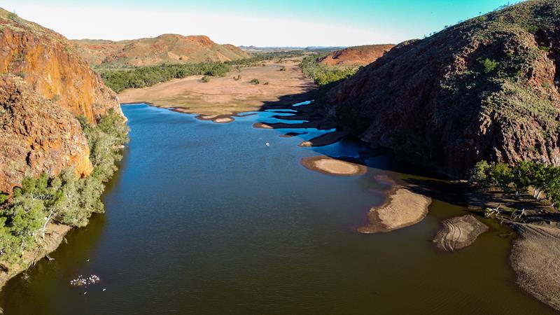
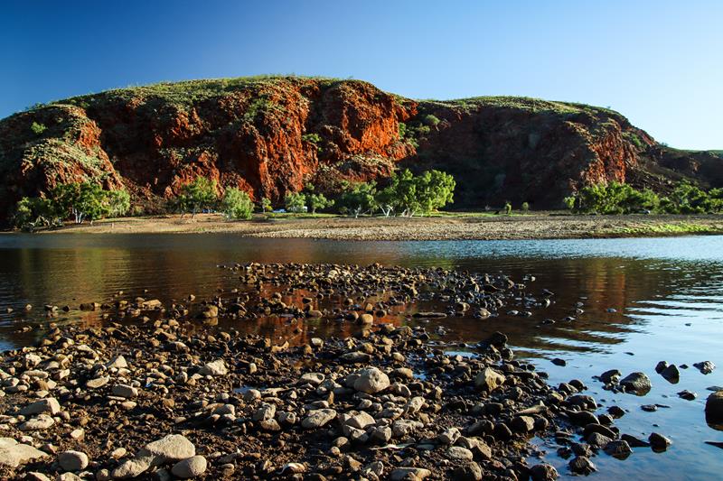
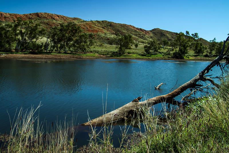
Pilbara doesn’t stop to surprise us. There always seems to be the next hidden gem, waiting to be discovered, explored and delight our eyes and souls. On our way to the Gibb River Road last year, we stopped at Doolena Gorge near Marble Bar. It is a marvelous place with nice scenery. When there is enough of water, the gorge fills up with water from the De Drey River. It becomes then a pleasant picnic and camping spot. Swimming is permitted there and dogs are allowed.
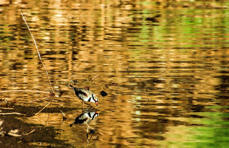
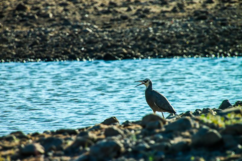
Doolena Gorge is also a heaven for birds. (Below left: Black-fronted Dotterel. Below right: White-faced Heron.)
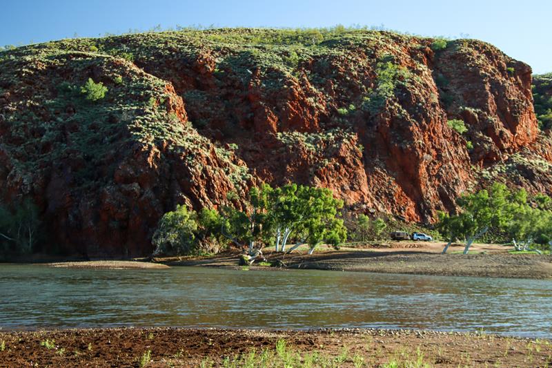
You can camp for free there but must be self-sufficient as there are no facilities.
It is a privilege and honour to camp for free at places like this – pristine, rugged and beautiful. So, please look after our outback.
Perspective
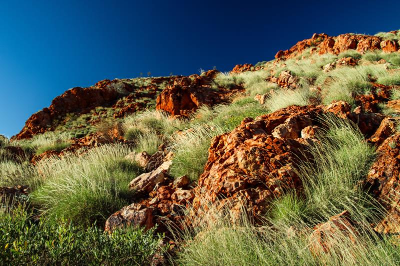
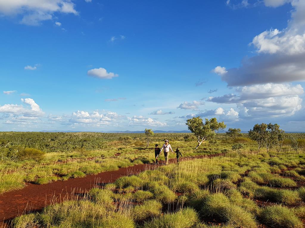
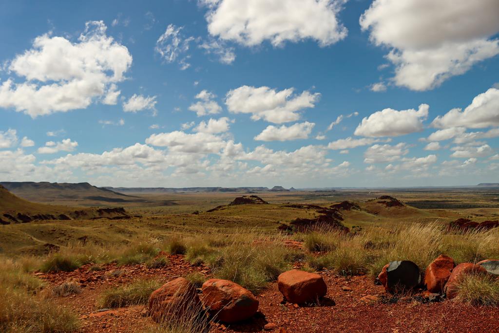
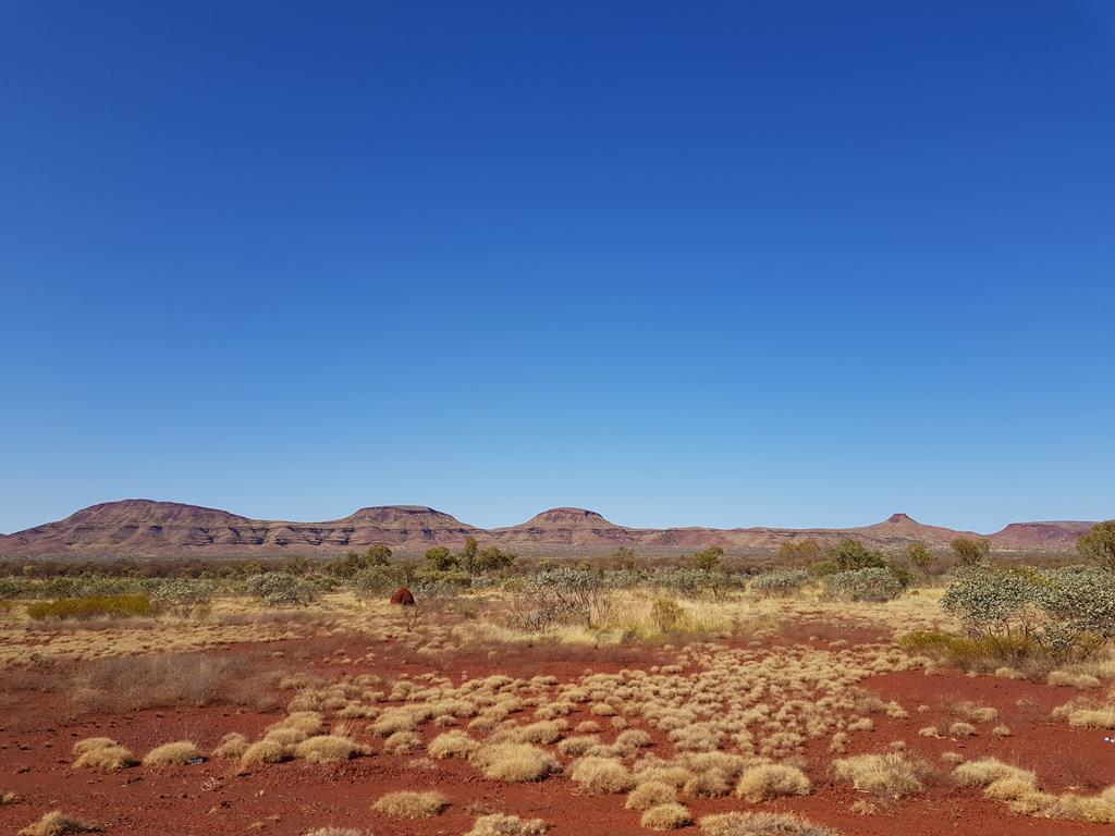
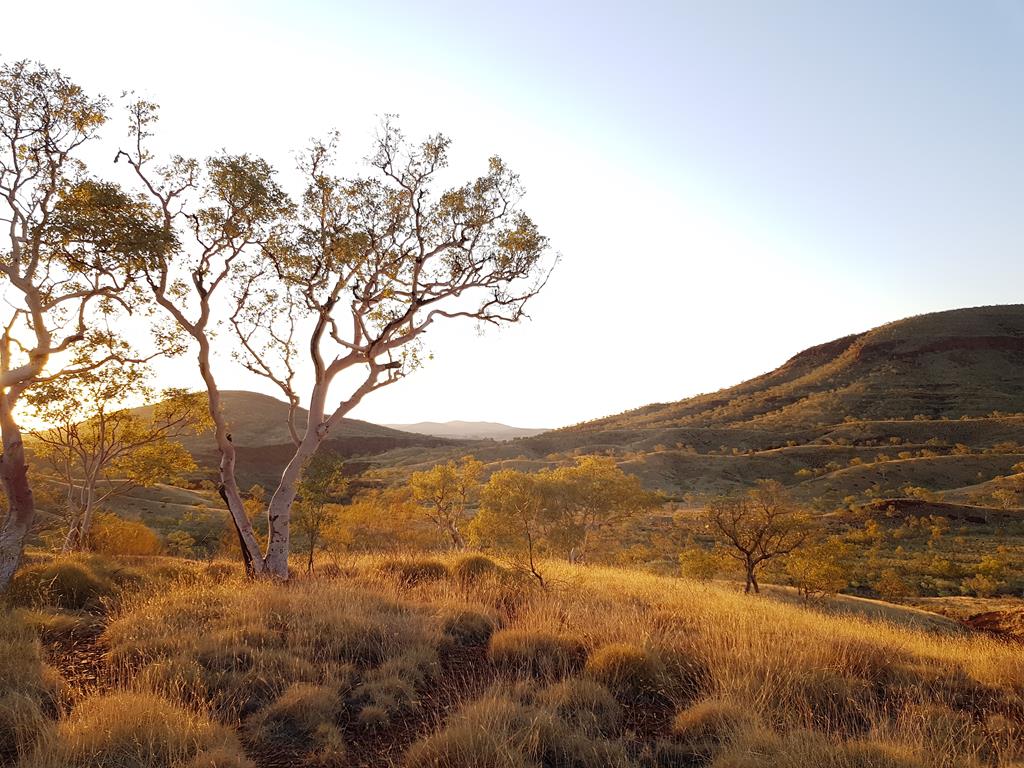
There is a distinct beauty in the rugged landscape of the Pilbara outback – red iron rich rocks, yellow-green spinifex against the bright blue sky.
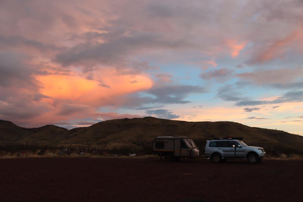
Sunsets and sunrises are particularly beautiful and special in the outback. There is no better way to watch them then when you camp as you can catch different colours of the sky minut changed by setting and rising sun, minute by minute.
Where is Doolena Gorge?
Doolena Gorge is approximately 41 kilometres north of Marble Bar on the Marble Bar-Port Hedland Road. The turning is just after Coongan River crossing on the left. Even though it is rated as 4WD, the dirt road is not long and we think it would be fine for a 2WD if you take it easy and slow (although you might not be able to go all the way). When you get to the place, you can go closer to the actual gorge if you have a 4WD.
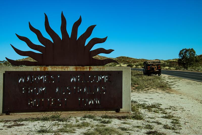
Marble Bar, known as the hottest town in Australia, gets its name from a local deposit of colourful mineral that was thought to be marble and turned out to be jasper.
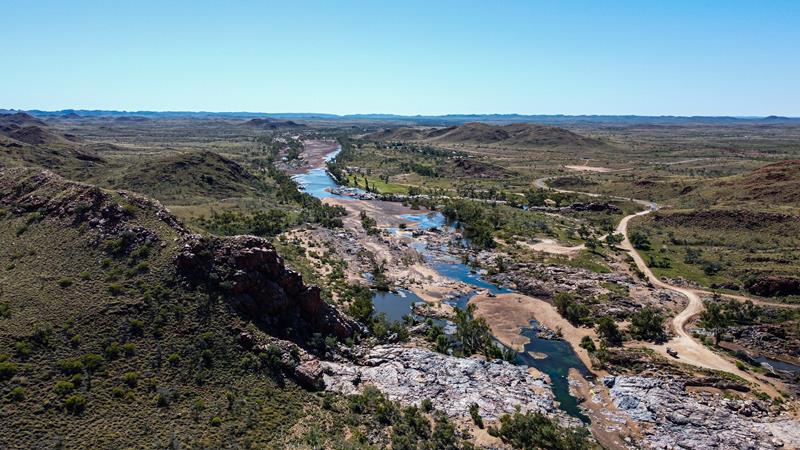
The jasper deposits cross the Coongan River, forming Marble Bar Pool and adjacent to it Chinaman Pool. Both are both very picturesque picnic spots, only 5 minutes’ drive from Marble Bar town.
Chinaman Pool
Marble Bar is a small mining town, approximately 1500km north east of Perth on the Great Northern Highway.
Marble Bar Pool
Camping in spinifex country
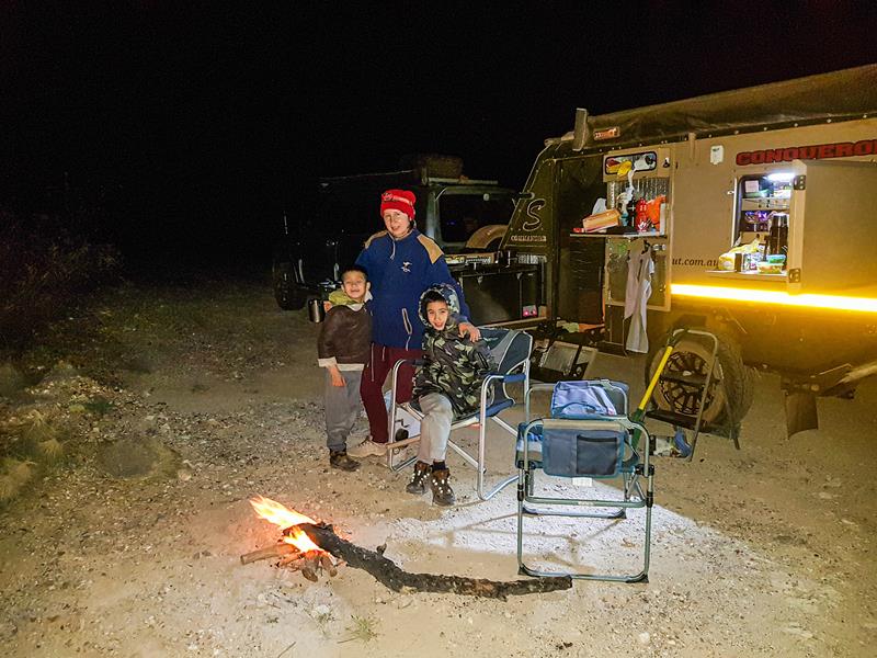
Pilbara is a beautiful region, characterized by red colour, iron rich earth. There are so many pristine places there, including some awesome free camps, waiting to be discovered. But sometimes, the nigh falls before you can reach your destination. This happens to us from time to time. Quite often a solution is to pull out from the road – as long as there is a side road and clearing. On our long trip up north last year, we did just that.
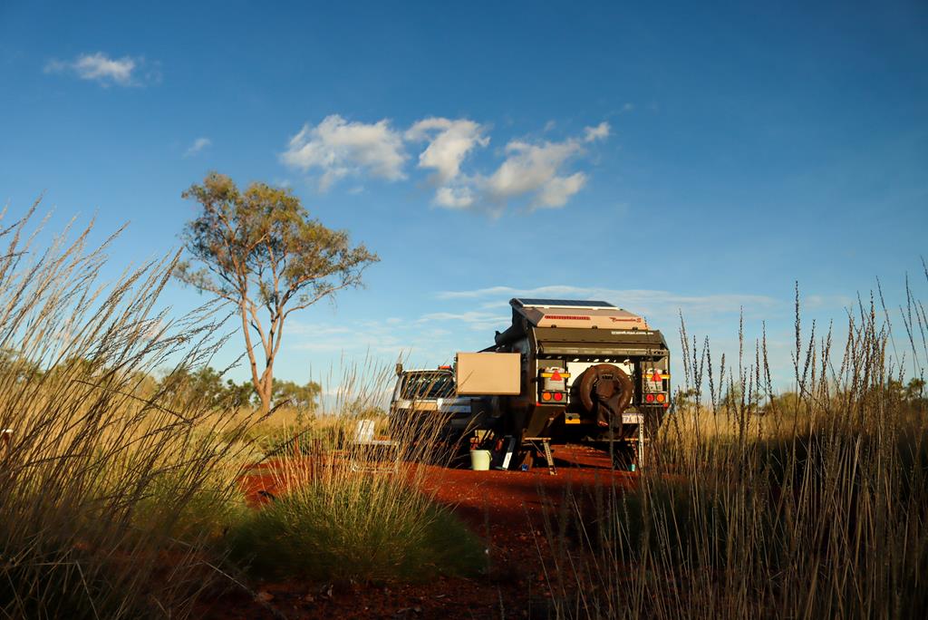
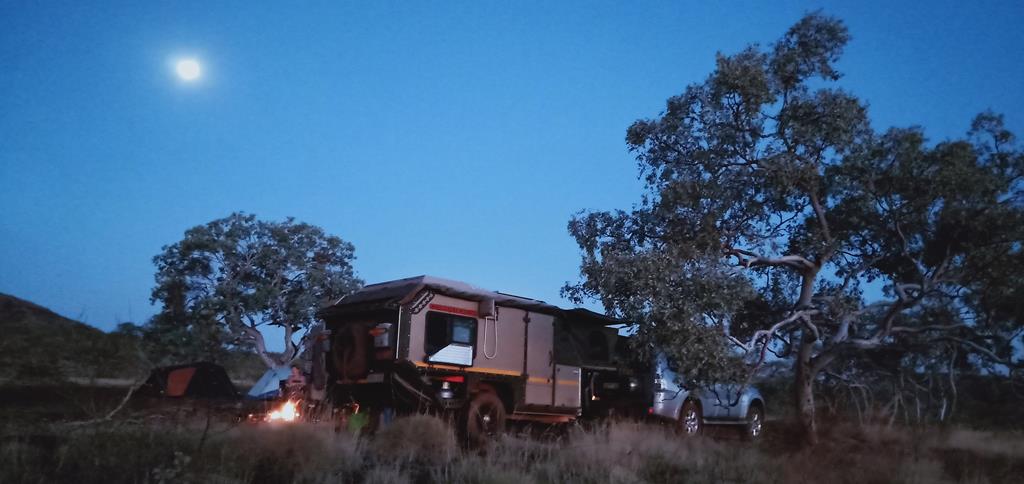
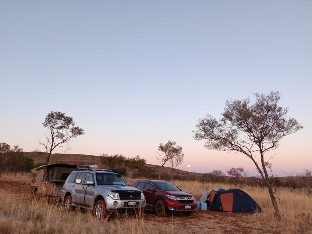
Our camp for that cold night in July was what in Wikicamp is marked as Kate’ Pit. It turned out to be a perfect spot for a night like that.
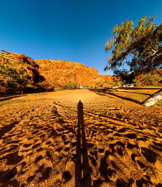
Morning revealed beautiful scenery – typical Australian outback. Low winter sun was casting warm light onto the rough spiky spinifex grass, contrasting red rocky outcrops and blue sky. Stops like this one become a precious experience because of the opportunity to connect with nature and discover hidden beauty in remote outback.
Kate’s Pit is a large gravel pit, off the road, with no facilities, 38km south of Marble Bar.
Turning to Kate’s Pit camp
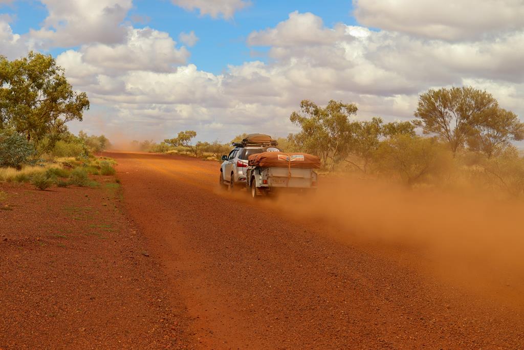
We love every bit of Pilbara – including its red rocks and dirt endless roads!
Sandy Creek, near Newman, is a hidden gem. It is a free camping spot, popular with locals.
After leaving Kalamina Gorge in Karijini National Park (due to heavy rains the park closed), we headed towards Newman to find some place to stay there for a night. We dropped in at the information centre for the kids to buy souvenir coins and for us to get information on the road conditions, as well as some possible places to camp. It was still raining heavily when we left Newman and at 5.30pm it looked quite dark. The ladies at the Information Centre shared with us local’s secret spot – Sandy Creek.
At the entrance to Sandy Creek off Marble Bar Road 100m
Travelling on Great Northern Highway from Newman we turned onto Marble Bar Road and travelled for approximately 24.5km before turning right (after Kalgan Pool track) onto unmarked track. Travelling for about 600 meters we have arrived at what looked like a campground. Ahead of us was a creek which under the rain and in the dark we did not want to attempt crossing. So we followed the track on the right. There was a 4WD Landcruiser Troopy with a pop top and we parked not far away from it.
Camping at Sandy Creek. This is how it looked in the morning.
It rained the whole night but the rain stopped in the morning giving us a much needed break to get out of our very tight and full of stuff dwelling.
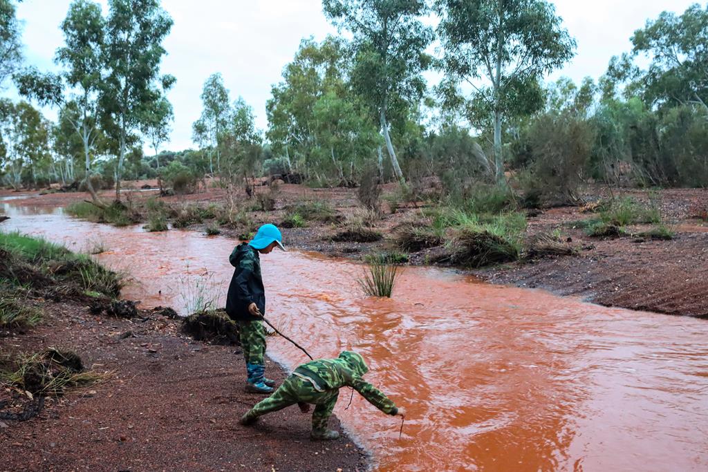
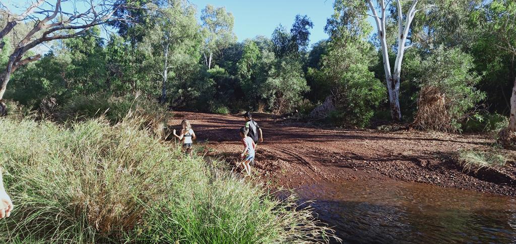
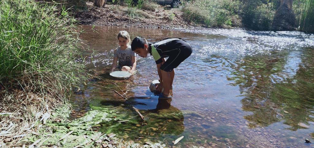
The kids measured the depth of the crossing. It was too deep to wet our boots.
Kids measuring the depth of the water
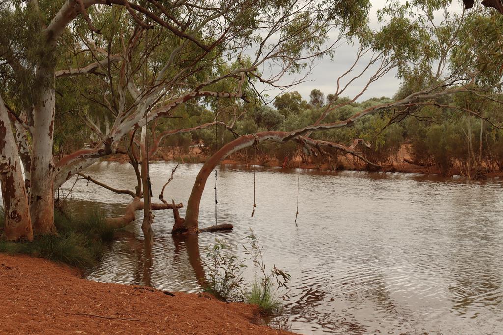
We found a narrower passage further away and jumped over it onto the other side. Sandy Creek was actually further away. It looked like a small river with so much water in it after it rained.
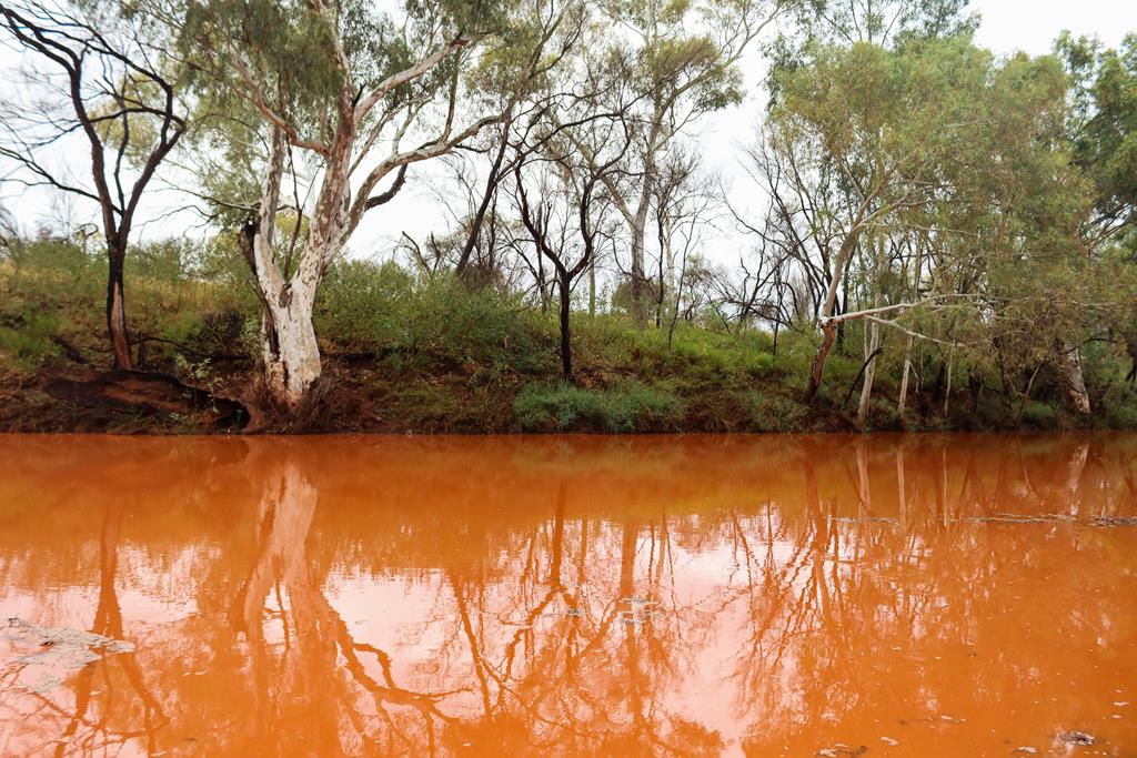
The place looked very beautiful and quite magical even though everything was wet. We decided to get some rest and stay here for another night.
Trees reflected in the orange coloured creek
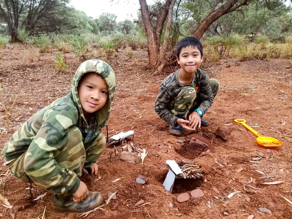
Kids were busy the whole day building houses, bridges (in fact, the whole village!) out of what they found on the ground – stones, leaves and branches.
“Bush” kids
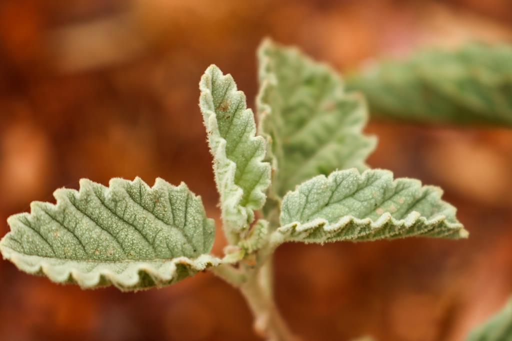
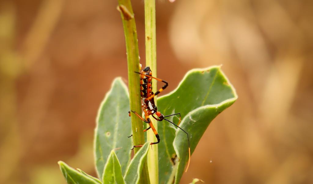
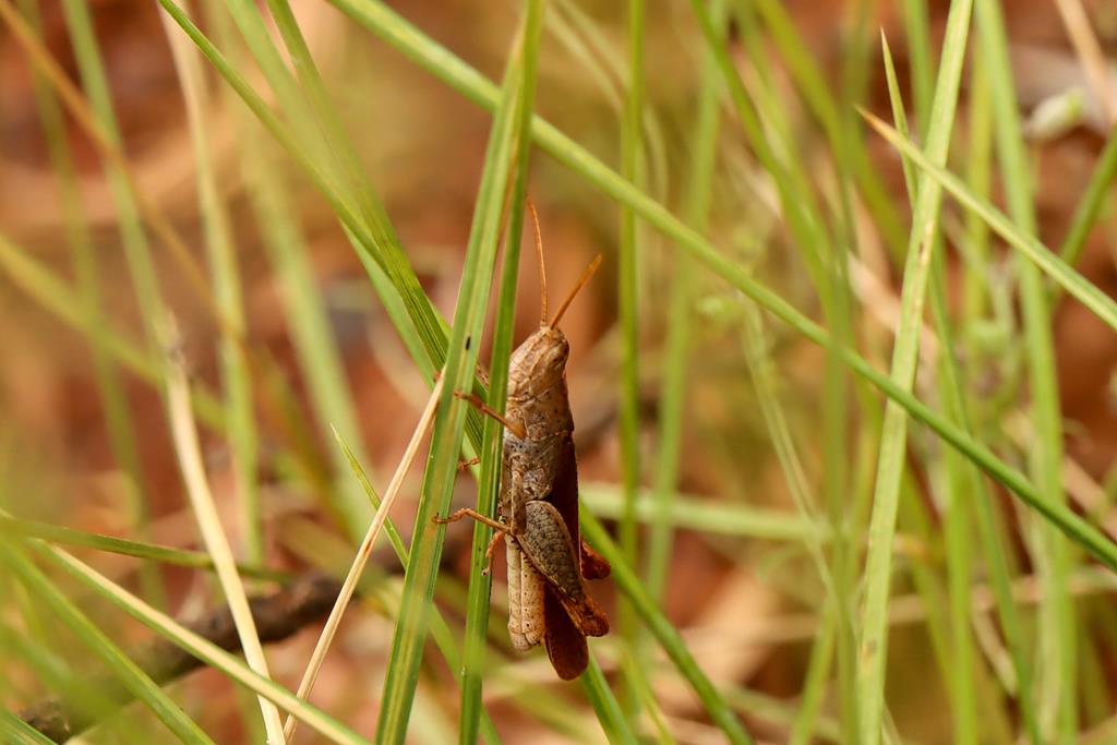
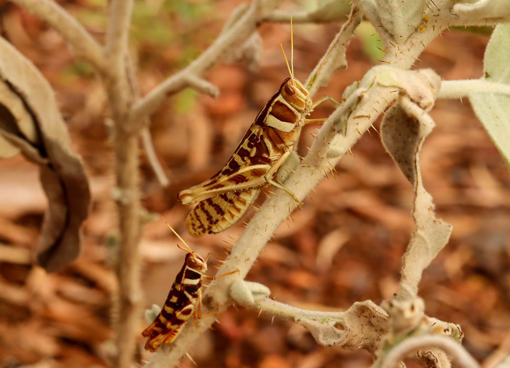
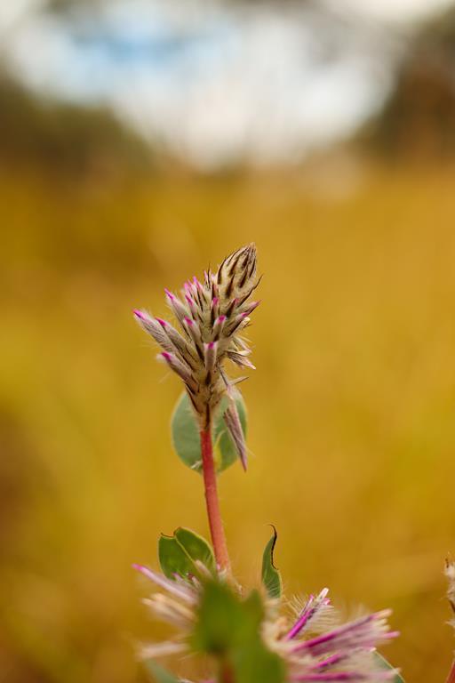
I went for numerous walks around with my camera looking for more insects and flowers to take pictures of.
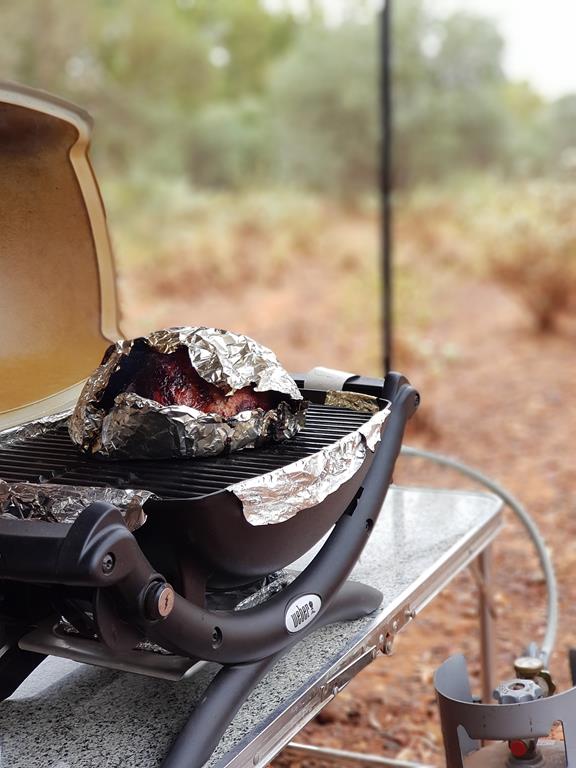
And Brian cooked a nice “Sandy Creek roast” for us.
Sandy Creek roast
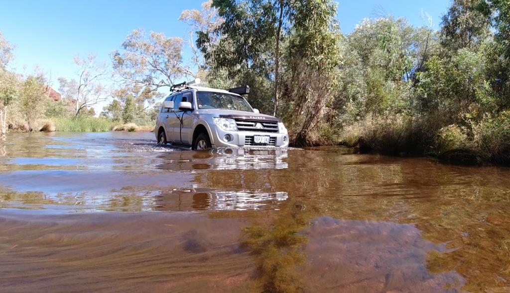
We also drove through the first creek to see what was on the other side. That is where we saw the actual Sandy Creek. There was another camper, a lovely couple, who parked just near the creek. They told us that Sandy Creek was formed because of the water that has been pumped out by the local mine. The first crossing before Sandy Creek was the overflown water from heavy rained that gathered in the ground holes.
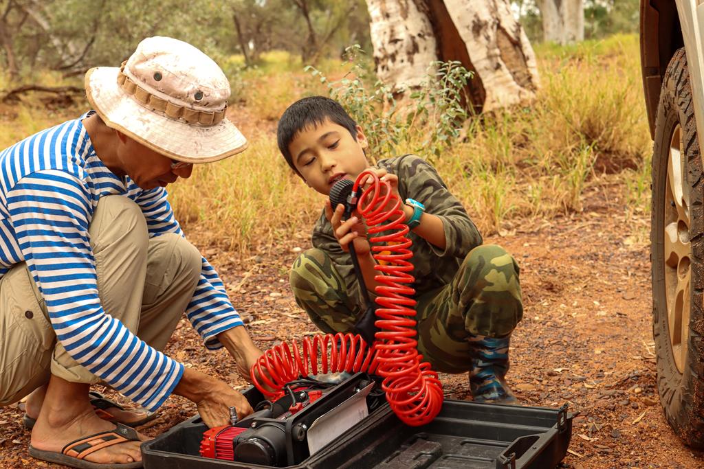
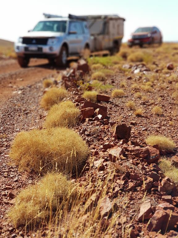
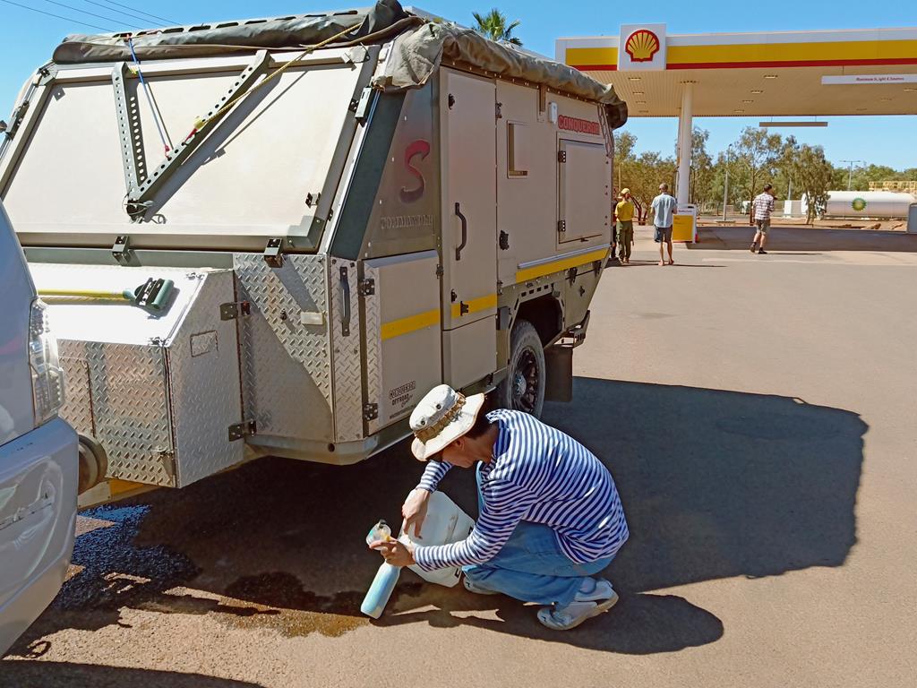
Time to check and pump the tyres before heading home
It was a lovely respite for us. Being on the road for many hours we really enjoyed a day of not driving and going anywhere but simply resting and enjoying the place as it was. A true outback experience.
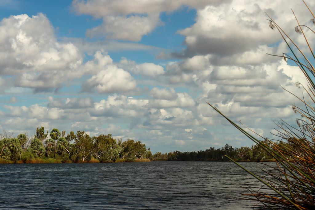
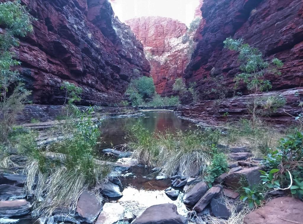
Millstream Chichester National Park in Pilbara is an amazing place to visit (as an extension of the trip to Karijini or a day trip from Karratha). It is the place where gorges with their lush vegetation, pools and rivers form a striking contrast to the rocky, spinifix-covered hills, creating a refreshing and welcoming oasis in Pilbara region desert.
Getting there
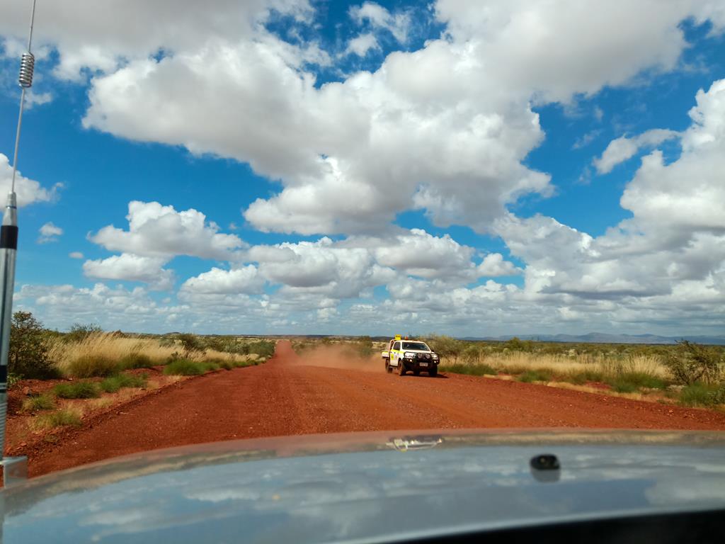
Access to the Millstream-Chichester National Park from Karratha is via a sealed road. It is 134 kilometres, a 2.5 hour drive.To travel from Karijini (we travelled the other way round – from Millstream Chichester down to Karijini), we used Nanutarra-Munjina and Roebourne-Wittenoom roads. The roads for the most part of the journey were unsealed and at times corrugated and it took us nearly 4 hours to get to destination. If you travel from Karijini, visiting Hamersley Gorge – the most remote gorge of Karijini National Park – is a must. It is on the way and it is the place of immense beauty, like everything else in Karijini.
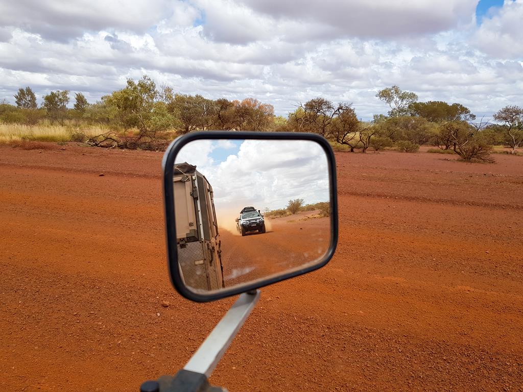
Travelling in the outback can be a lonely experience. This was one of only a few vehicles we saw while travelling on Roebourne-Wittenoom Road from Millstream Chichester to Karijini.
Camping at Millstream Chichester
We stayed at Miliyanha Campground, which is a nice bush camp close to the pools and gorges. For $11 a night (prices back in 2021) you get a huge camping spot, access to drop toilets and kitchen with hot water.
Miliyanha Campground
Wonderful in all respects, the only annoying part of our stay at Miliyanha Campground was ants which were there in thousands. Wearing gum boots, as well as having an ant spray to spray all round the caravan to prevent ants from climbing is a solution though. We had to borrow the ant sprayer from the friendly camp hosts but learnt a lesson to be better prepared next time.
At Miliyanha Campground
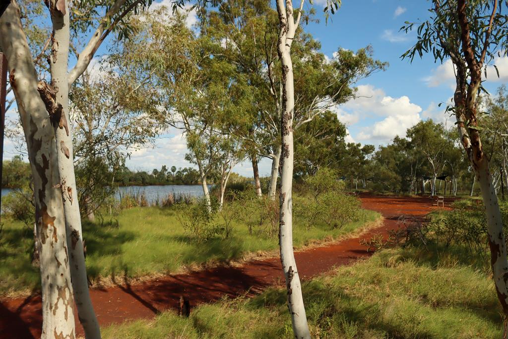
Deep Reach Pool
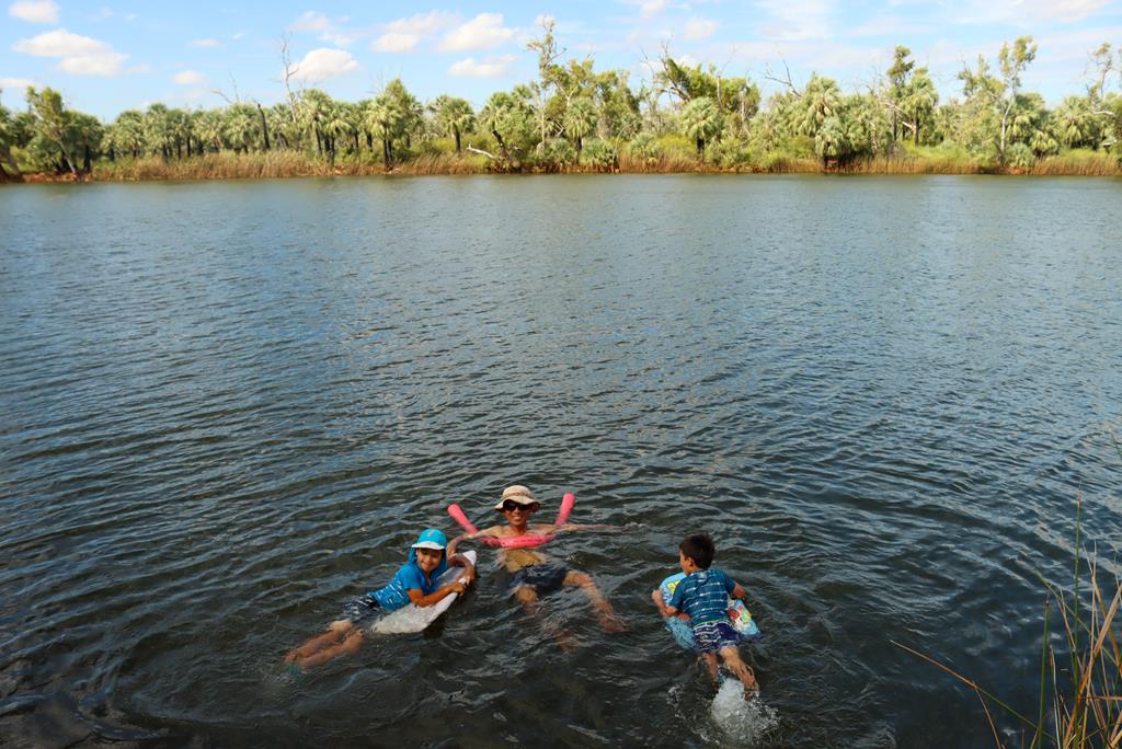
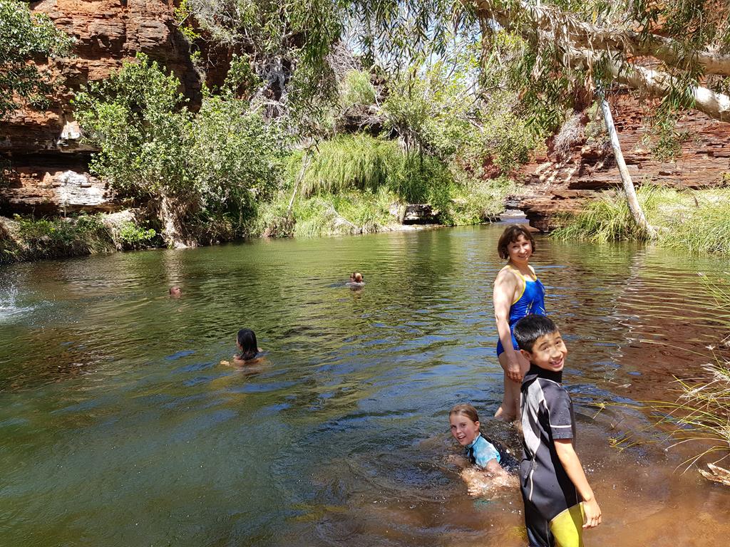
Deep Reach Pool in Millstream Chichester National Park is a large (much larger than you would expect in the desert) permanent pool with warm but quite deep waters. It is rightly considered an oasis in the desert. This is a beautiful place, well maintained and cared for with BBQs and picnic tables. It offers opportunity not just for a refreshing dip but swimming for long distance, if you are up to it and not scared by the serpent Warlu 😊, which according to Yinjibardndi people quietly resides in the pool. As such, this unique place of a cultural significance should be treated with respect and care (motorised watercraft is prohibited there to keep noise to minimum, so as not to disturb the Warlu Serpent).
It goes without saying, Deep Reach Pool was the highlight for our kids, who enjoyed swimming there.
Swimming at Deep Reach Pool
Cliff Top Walk
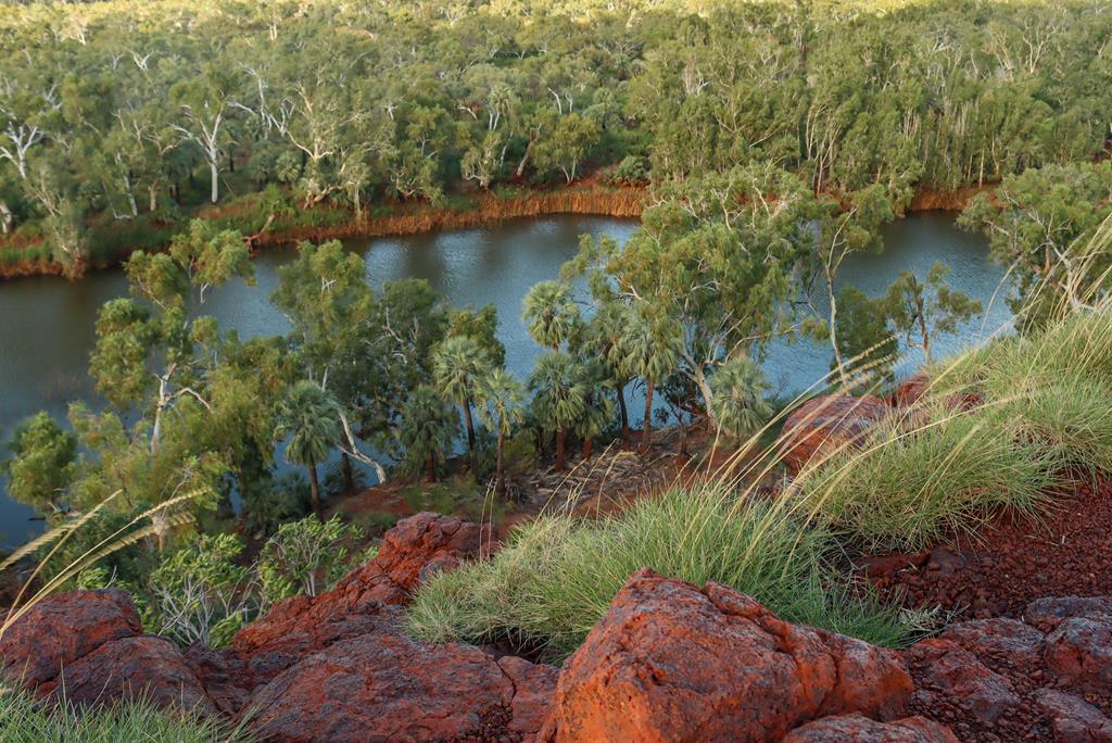
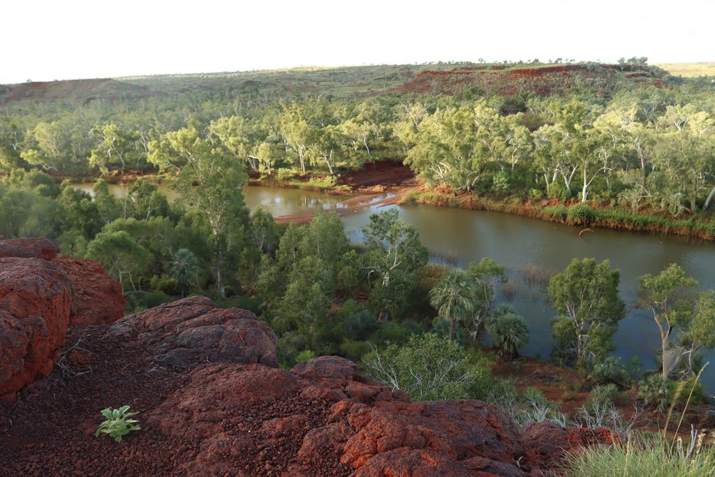
Next to Deep Reach Pool (and only 2km away from Milliynha Campground) is Cliff Top Walk, which is an easy 600m return walk with three vantage points to view the Fortescue River and the distant Hamersley Ranges.
Cliff Top Walk in Millstream
Python Pool
Python Pool in Chichester Range is a fresh water rock pool at the base of an impressive red ochre cliff. It is a great place for swimming and picnic.
Python Pool
Python Pool is about 2.5 hours drive south of Karratha (a popular spot for locals to visit during weekends) or an 1 hour drive from Miliynha Campground in Millstream Range, where we stayed for 2 nights.
On the way to Python Pool
The scenery on the way to Python Pool is quite breath taking. The views kept changing as were were approaching Python Pool.
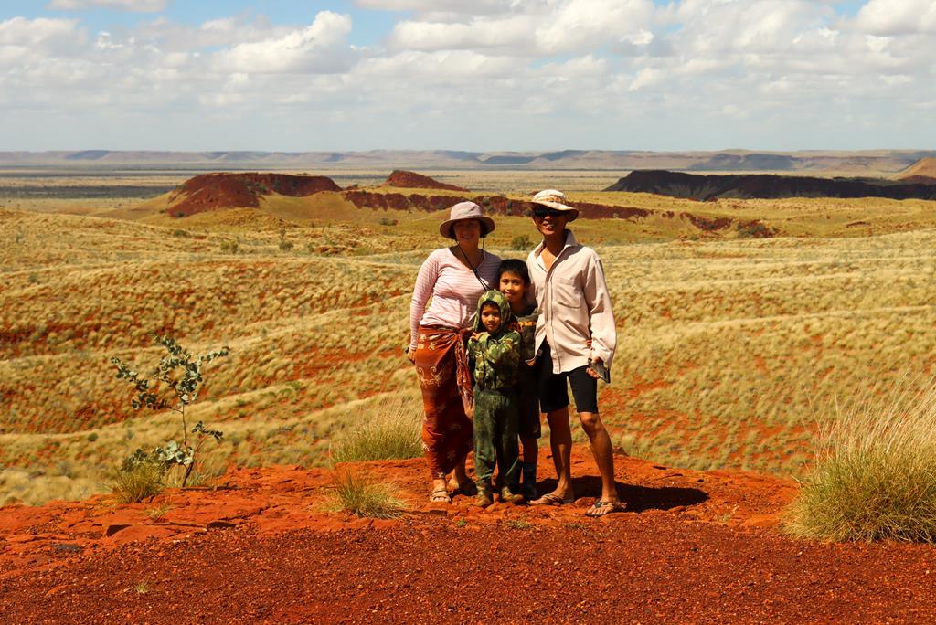
Travel Nut Family at Chichester Range
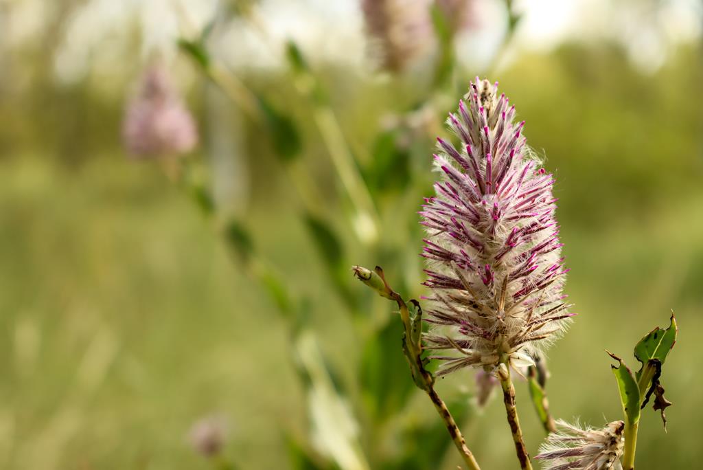
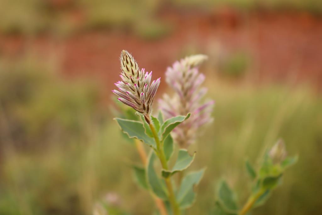
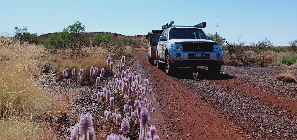
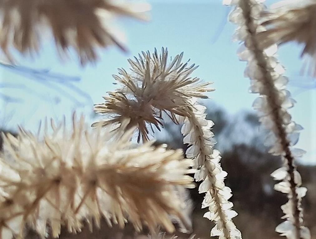
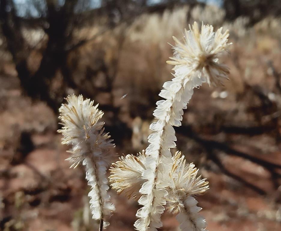
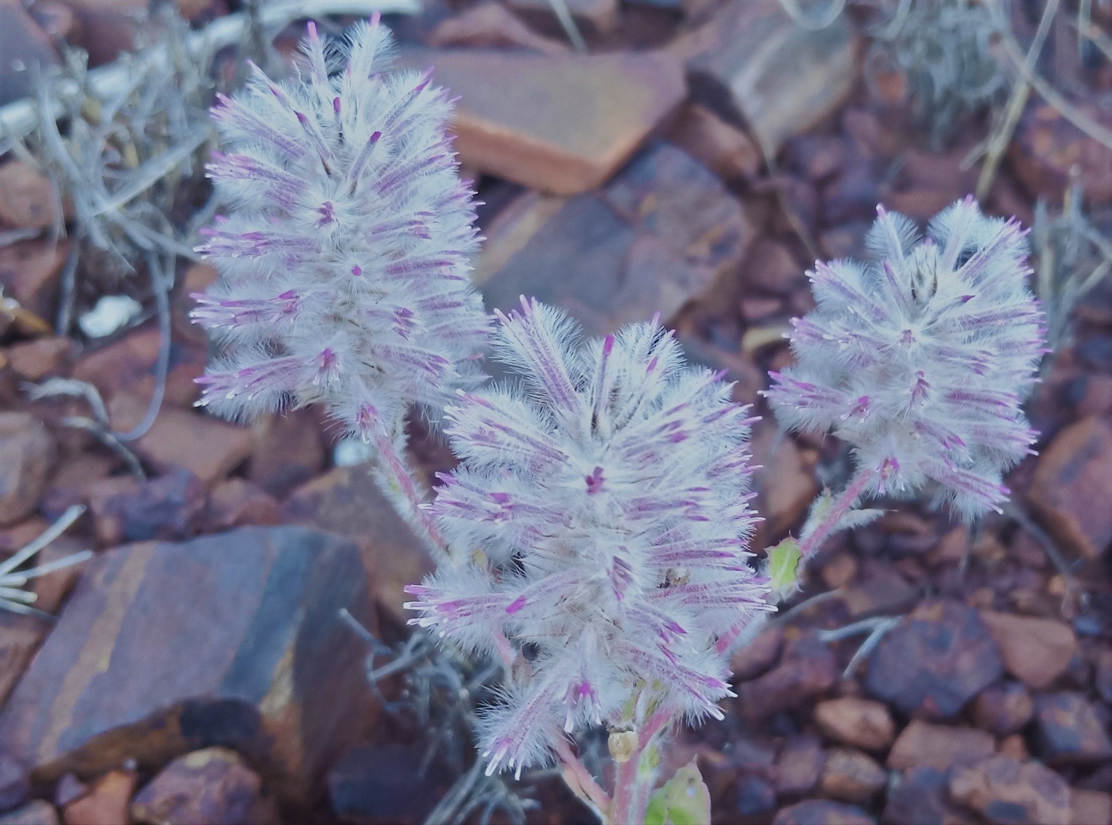
Pilbara region and Millstream Chichester, in particular, is home of spectacular Mulla Mulla plants. You can see lots of them in the red iron ore rich area, growing in carpets or sometimes as a single plant.
Mulla Mulla – an icon of Pilbara
Pilbara Olive Pythons
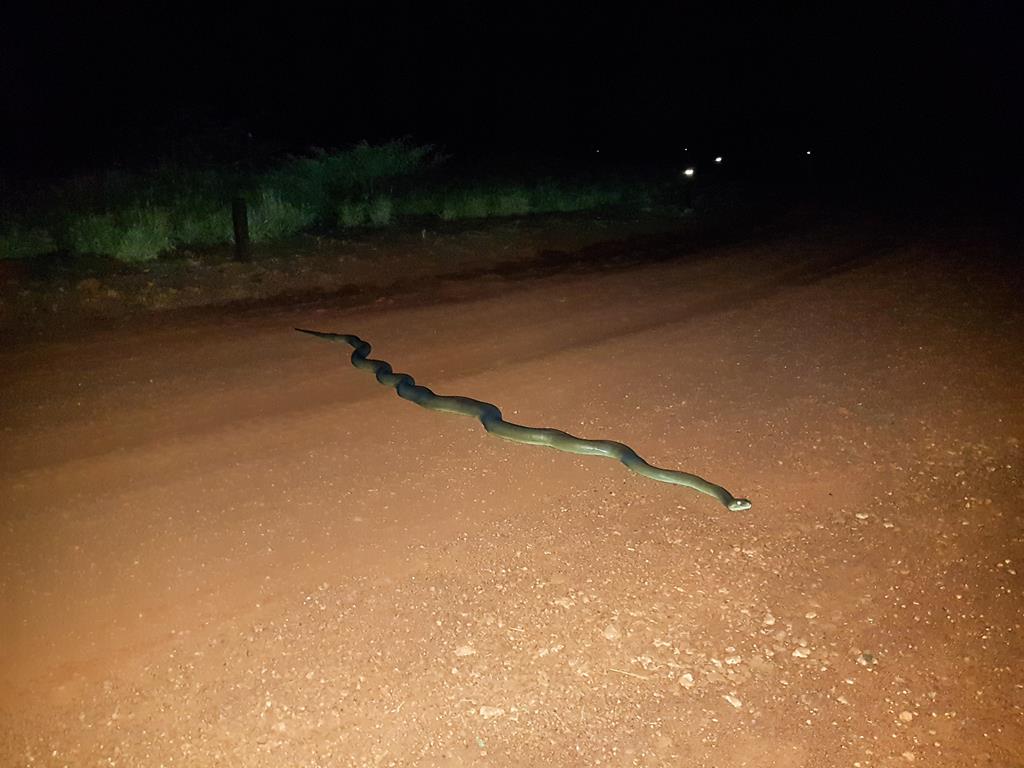
While we didn’t see any, we were told that Python Pool is frequented by Pilbara Olive Pythons (on the outer side of the cliff face). However, we did see this gorgeous beauty in Miliynha Campground, just meters away from our camping spot. On our second night, as Brian left off to the kitchen with loads of dishes to wash, I suddenly heard him screaming: “Bring camera!”. Rushing with a camera to his voice, I saw a huge python lying across the driveway, blocking the path. Luckily, Brian is very cautious and had a torch with him. We estimate the python was around 4 meters.
Pilbara Olive Python at Miliyanha
While not poisonous, the mere size and length scared us. Nevertheless, we were eager to take have a closer look at it and were cautiously getting closer and closer, trying to take better pictures of it. To share the delight of our finding, we called the neighbours to admire the python.
A closer look at the python
Wildlife
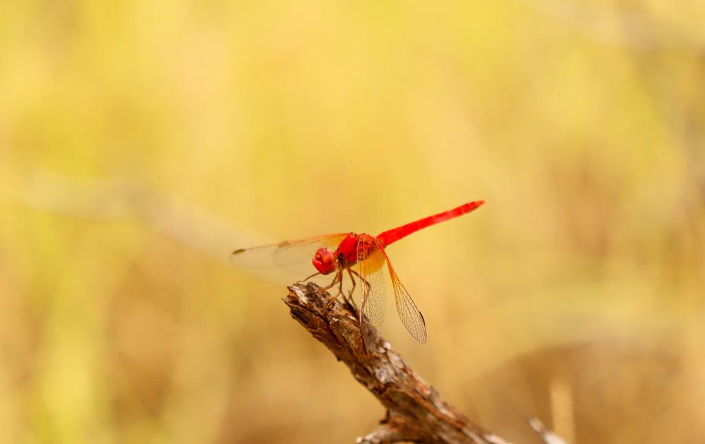
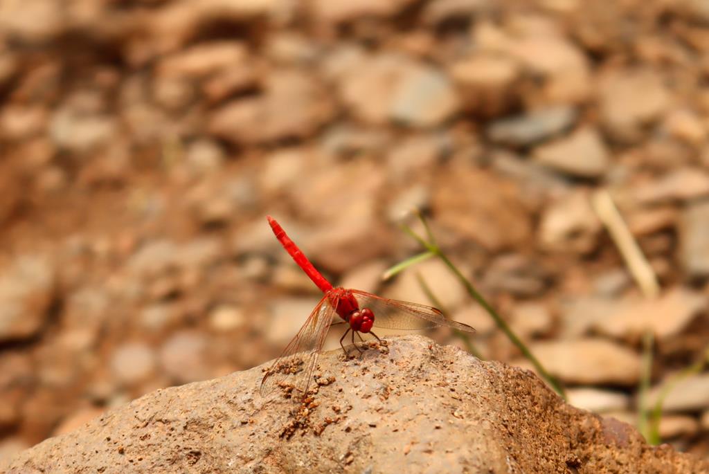
Wildlife is abundant in Millstream Chichester National Park, especially closer to the water. There are 22 species of dragonfly there, including beautiful red and blue dragonflies.
Red dragonfly at Python Pool
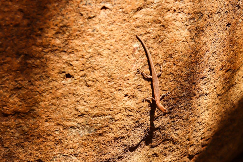
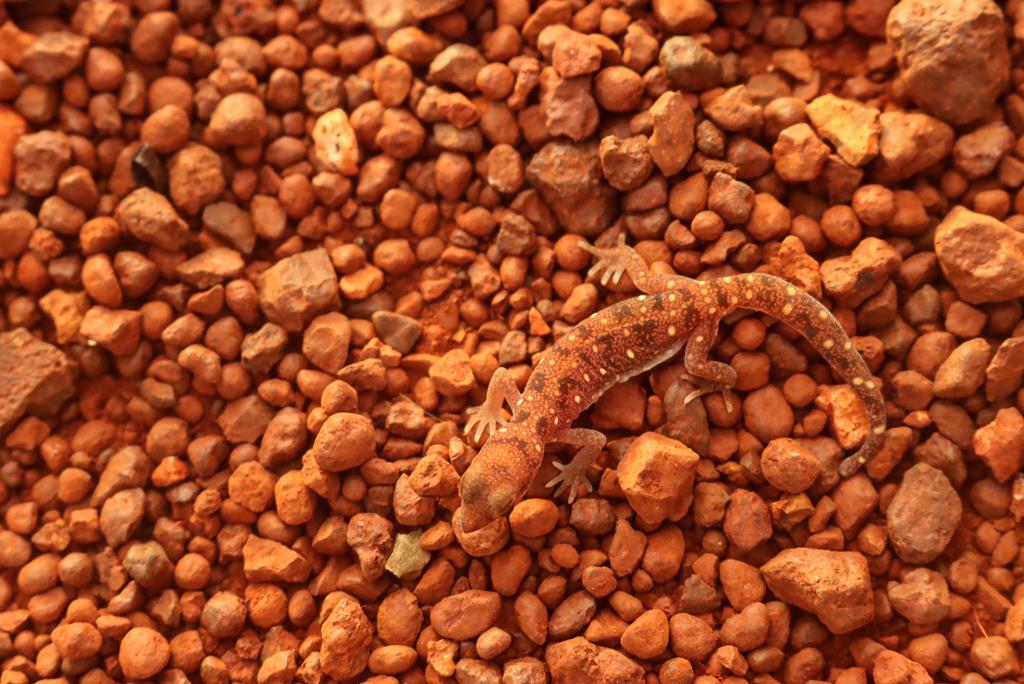
There are a number of various types of lizards in the park.
Lizards at Millstream Chichester
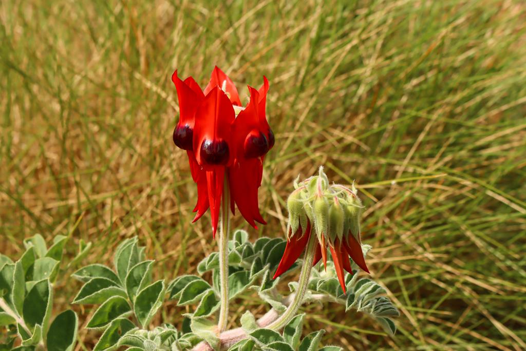
Sturt’s Desert Pea is another icon of Millstream Chichester (found mainly in the Chichester Range) – a unique and beautiful wildflower.
Sturt’s Desert Pea
Millstream Chichester is a wonderful place to explore for a couple of days – to swim in the pools and creeks, admire flora and fauna and simply rest in a beautiful place.
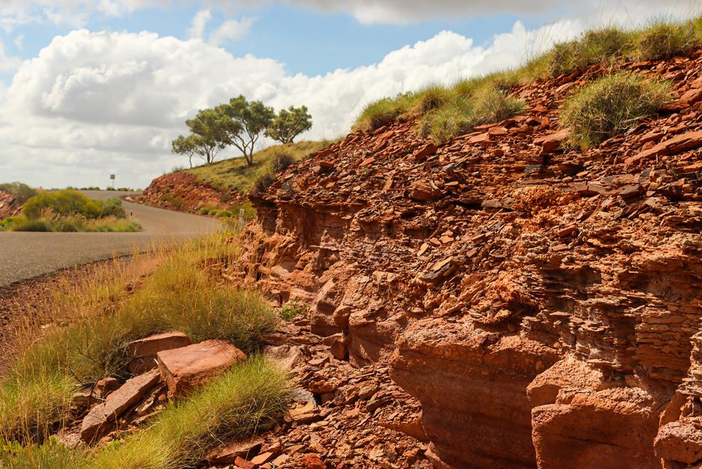
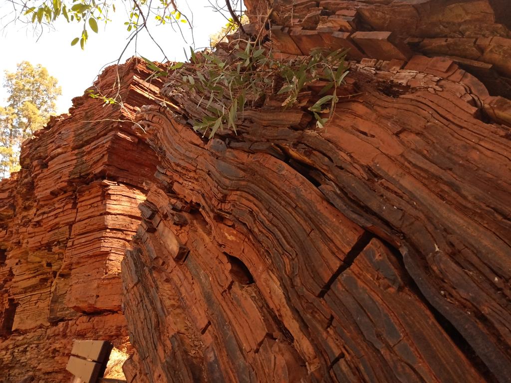
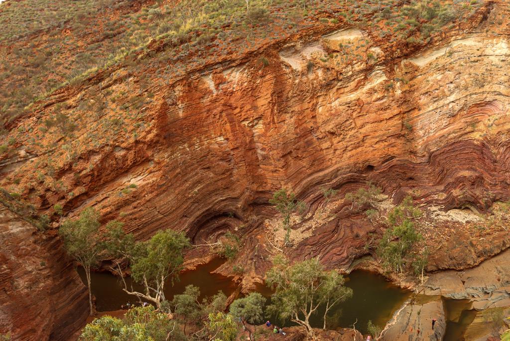
During our journey to Pilbara – fault lines on the mountains in Karijini
Travelling over millions of years in time…
Imagine travelling over time, not a few years but over millions of years teleporting in time on your journey to Pilbara. Dinosaurs roamed the earth on land and in the oceans. Volcanoes erupted. Tectonics plates (probably, upper zone of mantle) shifted Pangea (supercontinent) as it was called about 180 million years ago. It then broke up, separating into segments of continent, to form what we know today as various continents around the world.
It was different then. There were, perhaps, no humans until first historical find revealed humans’ existence in the last thousand years. The land on the continents was different. Further volcanic eruptions happened. Tectonic plates shifted again. Colliding of earth’s crust, land was pushed against to form mountains in one place and others sank to form oceans, lakes, rivers and gorges. Meteorites struck the earth. Deadly ashes spewed into the air, eventually covering the sun for years. Plants died and so did the many species of dinosaurs and reptiles. We were teleported into a few million years ahead to present day.
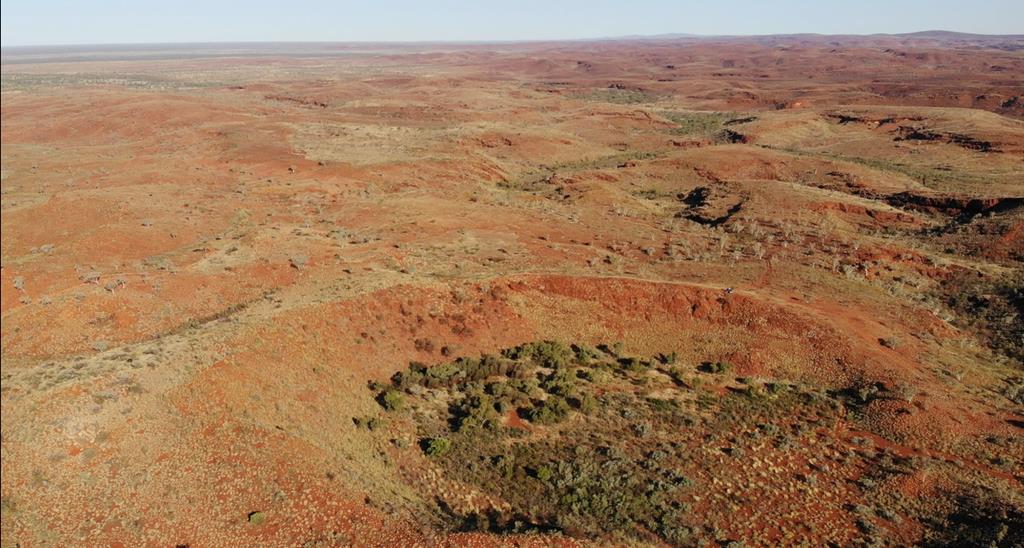
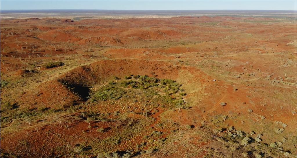
On the edge of Hickman Crater. Aerial drone footage – credit to Andrei Klochkov.
Journey through Pilbara
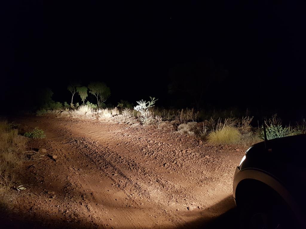
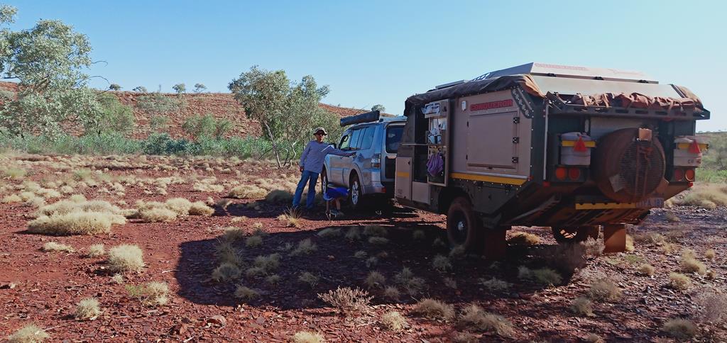
As we approached Newman, my thoughts were interrupted when Andrei Klochkov suggested I consider taking a flight from the domestic airport to alleviate my concerns of breakdown. The offer didn’t last as we took a right turn into off beaten road. As we travelled late into the night, it was like a desperation to find a stopover somewhere. Locating this place was a bit of a chore.But somewhat managed it. We found the trail that went below the rail lines under a bridge. The unsealed road was followed further by a dirt road, corrugation being not that bad initially. Pulling a 5.5 m caravan was one of my biggest concerns.
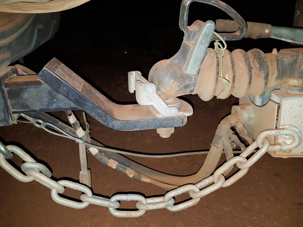
We travelled for nearly 2 hours on a 17km long corrugated road, trying to find our way in the dark night. The vehicle and the caravan rattled left, right, back and forth. I had concerns of failing chassis both in 4WD and caravan or punctured tyres. I prayed for us to arrive to our destination safely and often checked the conditions of the wheels, the chassis, tow bar, etc to ensure all are intake during comfort breaks.
Checking of the rig on the way to Cobbah Downs River Crossing
Cobbah Downs River Crossing camp
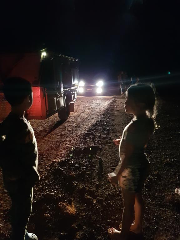
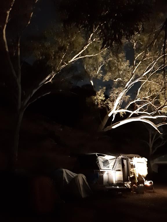
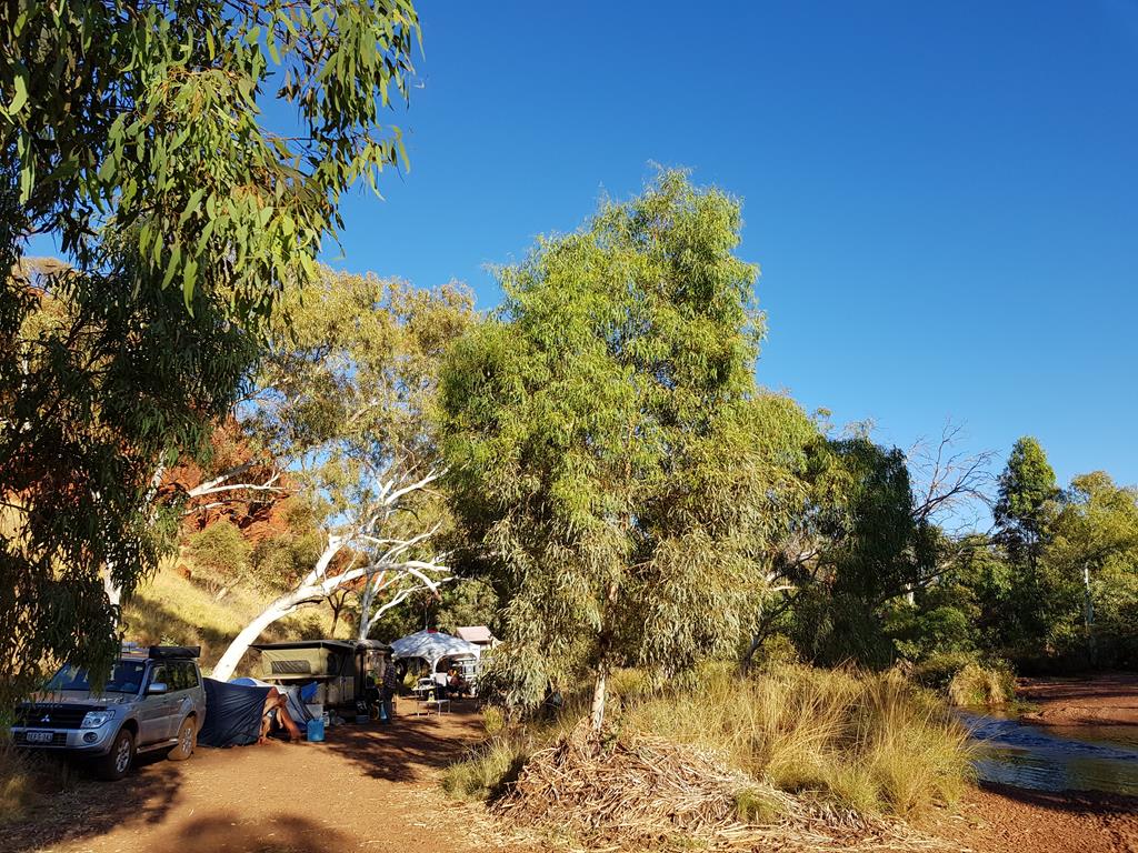
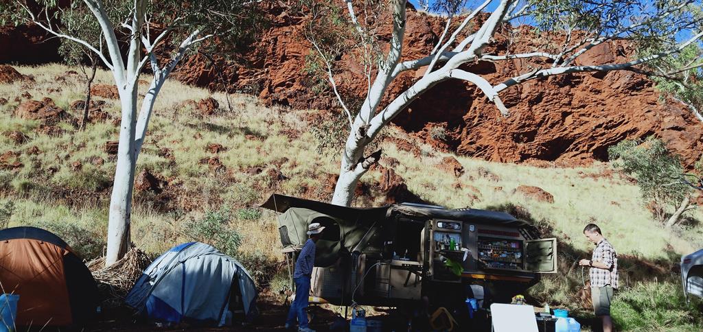
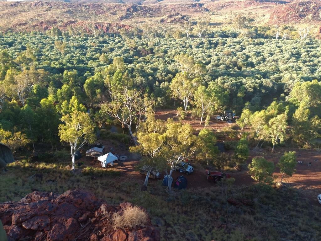
The sound of running water on the side of a stream, and the sight of two vehicle reflectors were a relief to me. I knew we have arrived the destination. We setup camps in Cobbah Downs River Crossing after identifying suitable ground. As we arrived late into the night, we had express meals and quickly retired to bed.
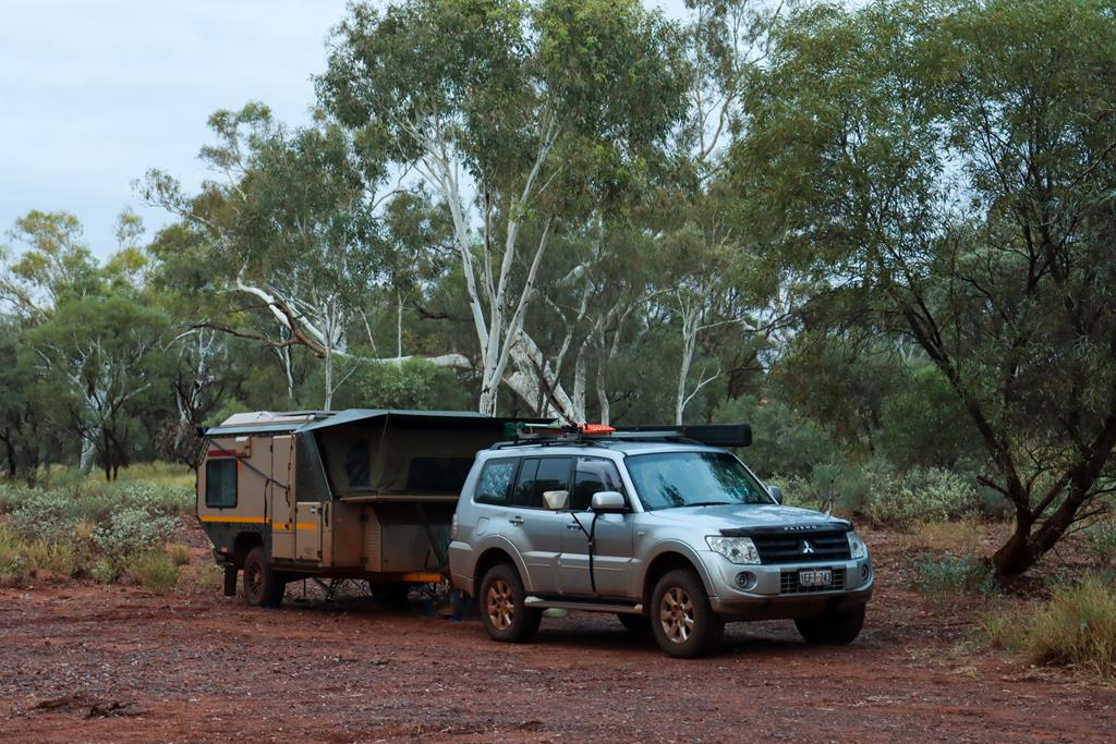
Camping at Cobbah Downs River Crossing
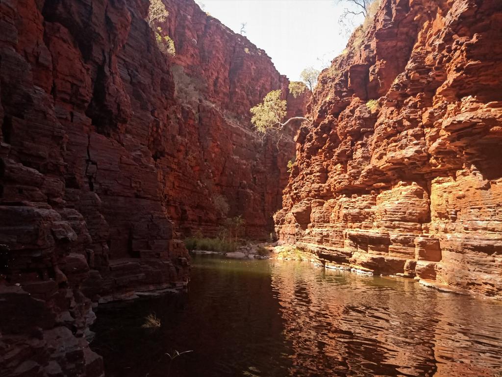
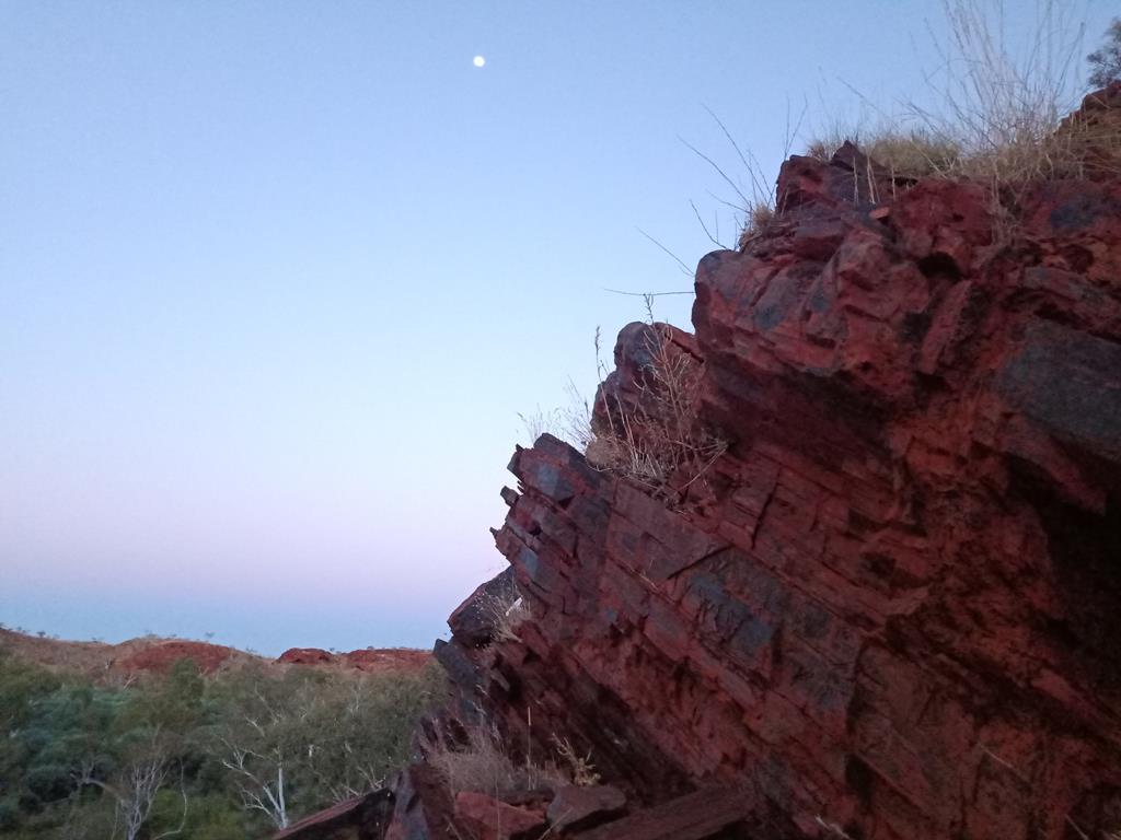
The sun rose and broke the horizon, casting a strong orange colour on the surface of the high rock behind us. I could see, for the first time, the splendour and beauty of this place in its morning glory. Andrei promised that the place will have a pool, nice meals and cocktail bar. It wasn’t a disappointment.
Cobbah Downs River Crossing in the morning
We spent the second night so we could pamper ourselves. The running water from the stream was a blessing. Our two neighbours, after we got acquainted, were wonderful. Brad and Rachel on our left and Elai and Alexis across the stream. The latter group (French and Canadian) were stranded like ‘everyone else from isolation of movement’.
Hickman Crater
We continued the journey and bid farewell to our new found friends. I started to pray when we hit the corrugated trail again. Our next stop was Hickman Meteorite Crater. The journey into the wild took us into no man’s land.
Spinifex land
Upon reaching where we believed we could set camp, we ventured further up in the 4WD on a really bad corrugation trail. Gosh! We rocked in every direction possible. I swore that if things could go wrong, there would be disaster.
The road to Hickman Crater
The sight of the crater was a sight to behold. It was even more awesome from an aerial drone footage.
Aerial drone footage of the Hickman Crater. Credit to Andrei Klochkov
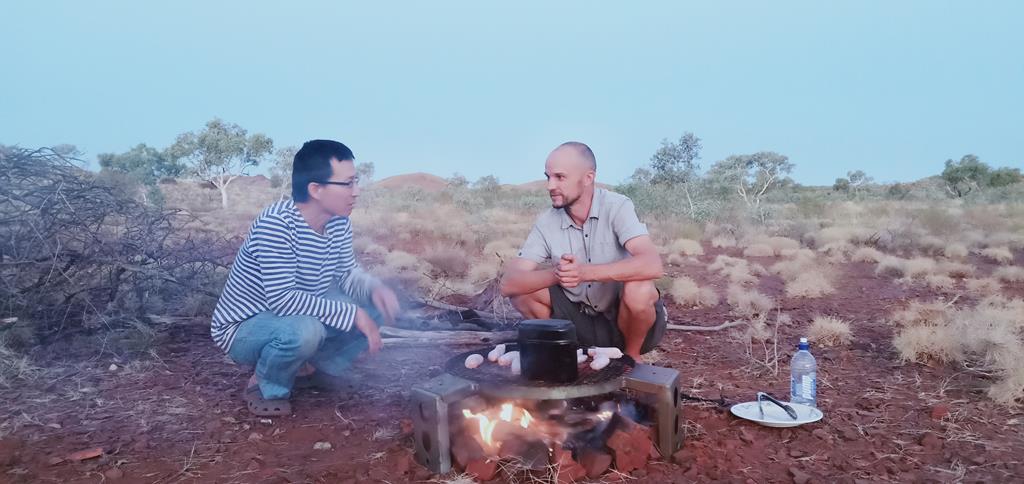
We returned to camp and prepared meals later in the evening.
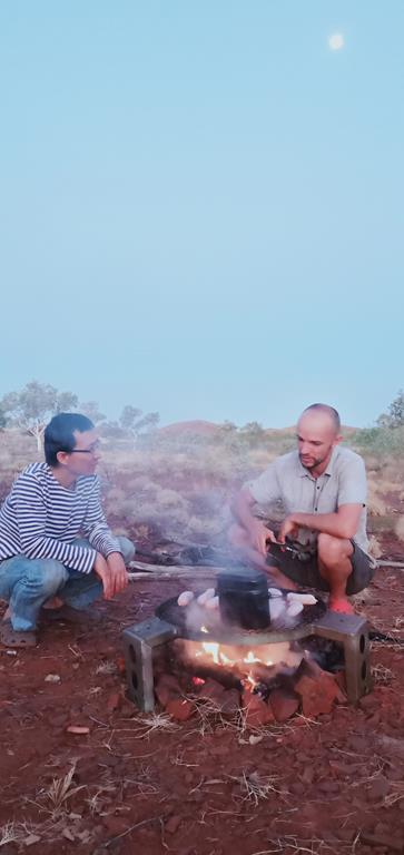
Serious conversation over camp fire
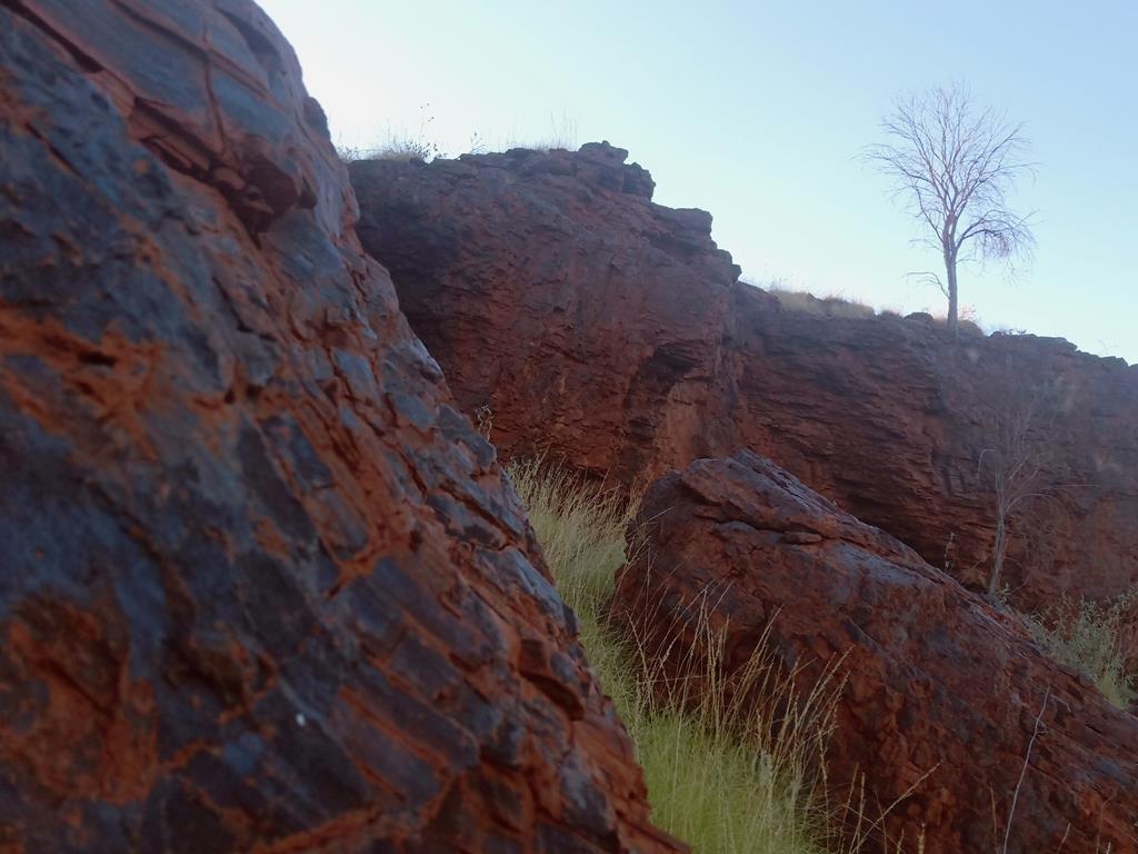
Albert Tognolini – on the doorstep of Karijini
We continued our journey the next day after saying hello to early risers Elai and Alexis who drove by past us. We arrived Albert Tognolini in the mid-afternoon. This site is overlooking the scenic range. It seems that this end of the range shows where land masses were shifted forming mountains with jagged fault lines cut across mountain ranges on its sides, exposing the layered rock surfaces.
Albert Tognolini
As night fell, we had open fire cooked meals in hotpot and other assorted dishes and snacks. Tonic bar was open with multi-talented barman Andrei serving up cocktails.Having a shower behind the camper with a night view of the mountain ranges silhouette from the brightly night moon was extraordinary. Marina Klochkov shouted, ‘there is no running water’ after turning the tap. I whispered to my elder son and he said out aloud ‘put in 50 Rubles and the tap will have running water!” There were bursts of laughter in the group sitting around the table concentrating in the game of ‘Mafia and Citizens’.
Camping at Albert Tognolini
Karijini National Park
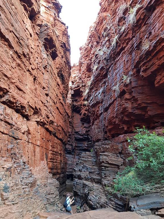
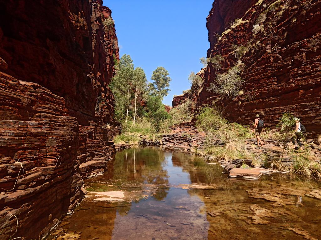
We travelled into the Karijini national park the following morning. First, we visited the gorges (at Fortescue Falls), then to Weano Gorge. We hiked into the gorge in a cautious manner after learning of an accident in the other gorge. As we hiked down precariously step after step, l wondered how it must have been a shocking experience when the earth surfaces opened under the ground when tectonics plates shifted.
Weano Gorge
The sight of the rock walls with its jagged corners protruding out in even angles started to smoothen as we got deeper into the gorge. The erosion of some forms, perhaps from flooding water over many million of years had polished the surfaces.
I stopped frequently looking up to study the rock surface formations. I pointed to my children and emphasised what they had learn from books and no could actually see the real things. All of us had a great time.
Weano Gorge
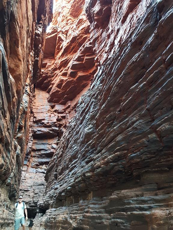
The next day we visited Knox Gorge after packing up and towing the caravan. Another amazing place to excite all of us. The routine of going into the gorge became normal for us, although we still had to be careful as such places are well known for accidents including death every year.
Knox Gorge slot canyon
In conclusion
Words do not do justice to Pilbara. Visit and see for yourselves and indulge and experience millions of years of nature’s history under your feet and the surroundings in this present time as ‘l have lived through times over many millions of years’.
Knox Gorge
Facts sheet:
Distance covered: 3141km
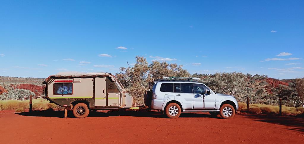
Vehicle: Pajero GLRX diesel
Caravan: A tin box
Free camping: 8 nights
In tow: Russians Mafia and Citizens (social deduction game) that killed each other and all survived the trip 🙂
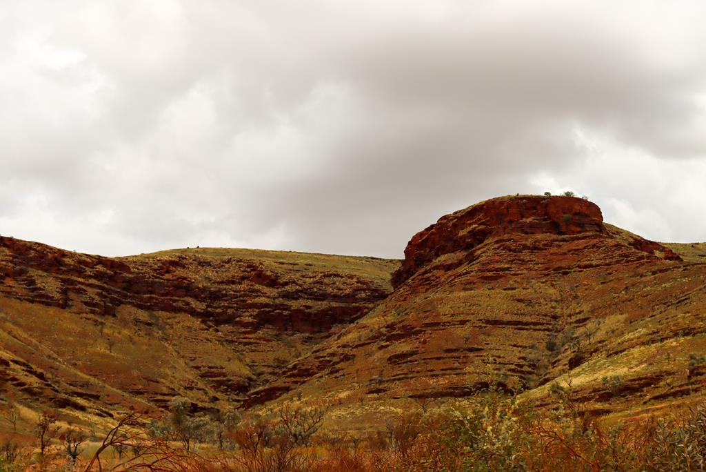
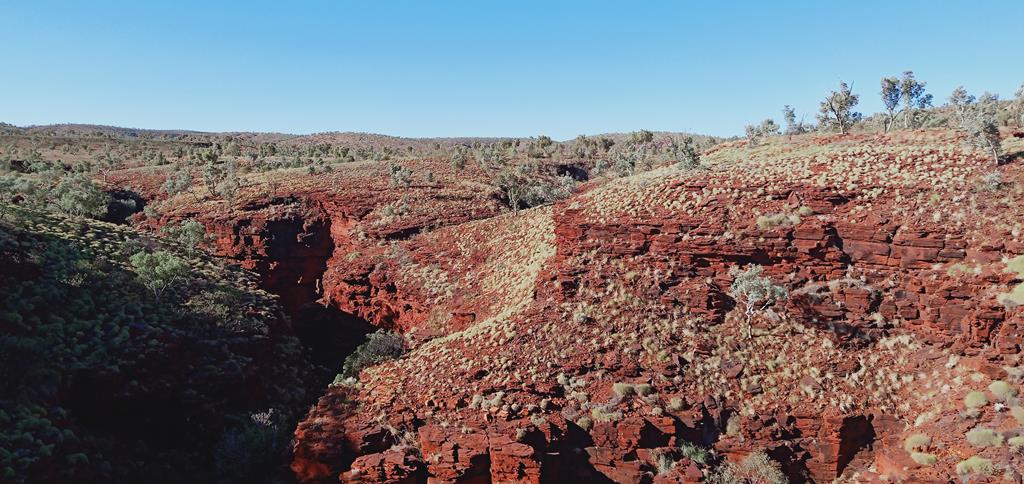
Located approximately 1400km north of Perth and around 80kms north-east of Tom Price, Karijini National Park is the second largest national park in Western Australia and is one of the top 5 most visited places in the state. Originally called Hamersley National Park, it was renamed in 1991 to Karijini, which is Banyjima name for the Hamersley Range in recognition of Aboriginal history. (Source)
Hamersley Range
What is so unique about Karijini National Park?
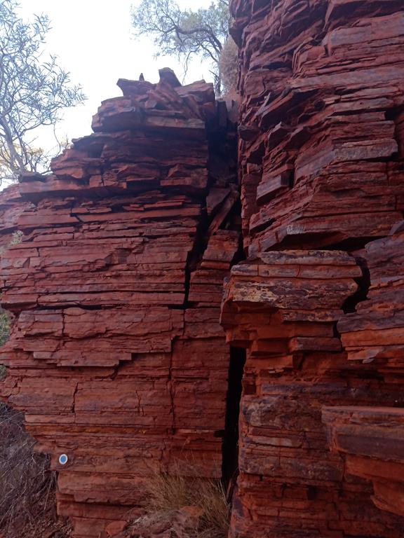
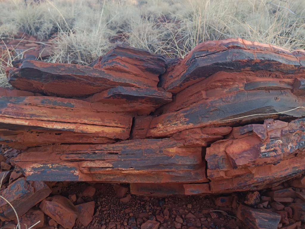
What makes Karijini so unique and unforgettable is its amazing ancient rock formations.
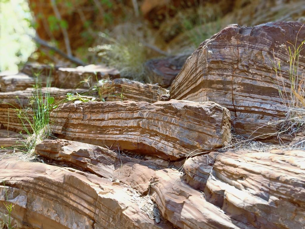
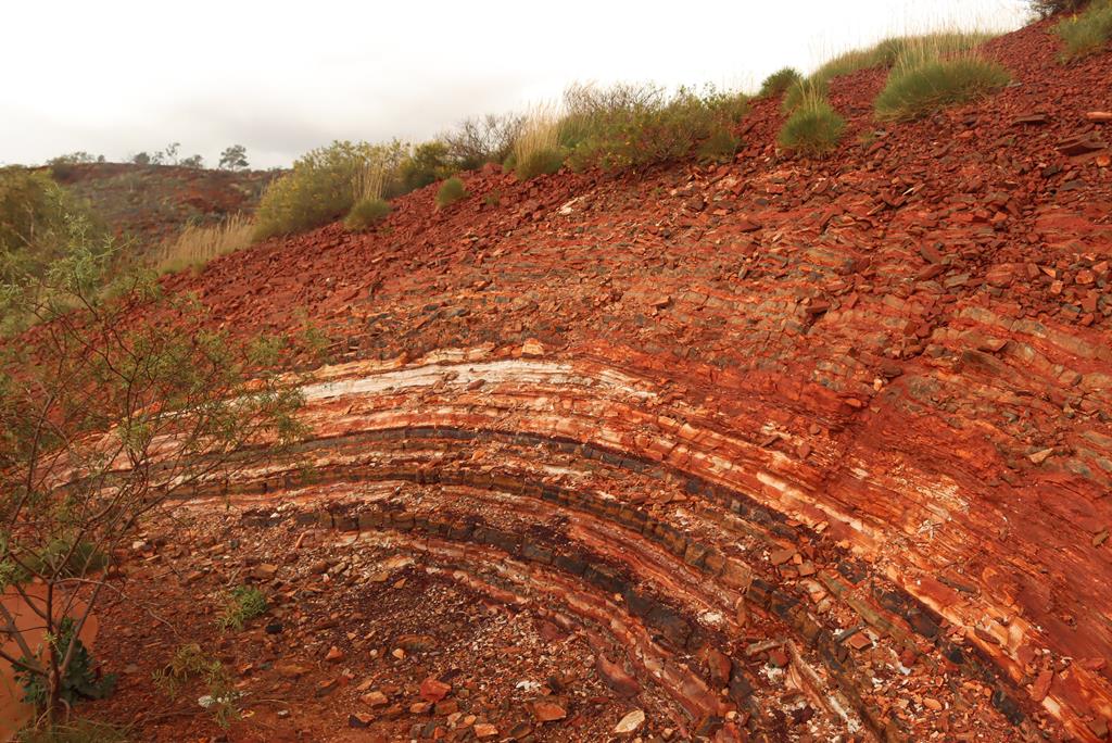
These types of rocks are mostly banded iron formations, which are layered sedimentary rocks composed of alternating chert (a form of quartz) and iron oxide bands. Originally deposited, about 2500 million years ago, they covered some 150 000 km2 and contained about 300 trillion tonnes of iron. We do not see any rocks of this type forming in the world today, and this suggests that conditions in the ancient oceans where they formed were quite different than today, according to WA Museum.
Banded iron formations
Banded iron formations are thought to have formed in sea water as the result of oxygen production by photosynthetic cyanobacteria. The oxygen combined with dissolved iron in Earth’s oceans to form insoluble iron oxides, forming a thin layer on the ocean floor. (Source: Wikipedia) Eventually, the rocks rose up out of the water to form dry land. Rivers and creeks cut through the rocks, forming beautiful gorges, filled with permanent refreshing rock pools and spectacular waterfalls that are the main attractions for thousands of visitors.
Knox Gorge
Gorges in Karijini National Park
There are more than 20 gorges in the national park but only 8 of them are accessible to visitors. Originally we planned to stay 3 nights at Karijini but after spending an extra night at Cobbah Downs River Crossing camp, which was like an oasis in the desert, we only had 2 days to explore Karijini, during which we managed to see 3 of the 8 gorges.
At Dales Gorge Day Use area
Dales Gorge
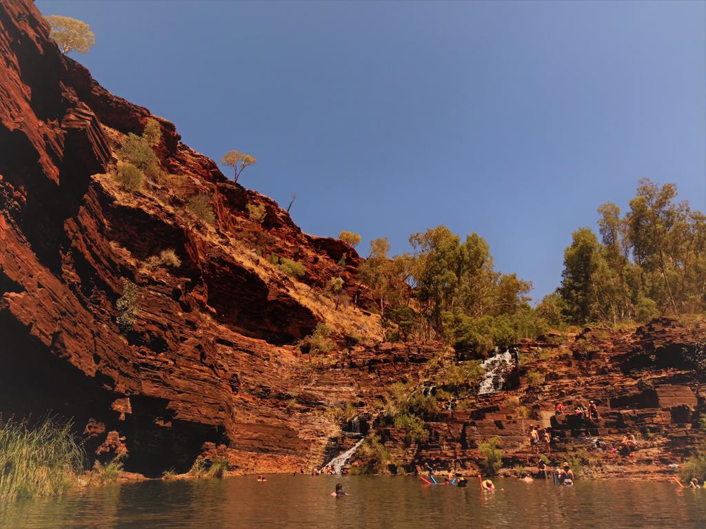
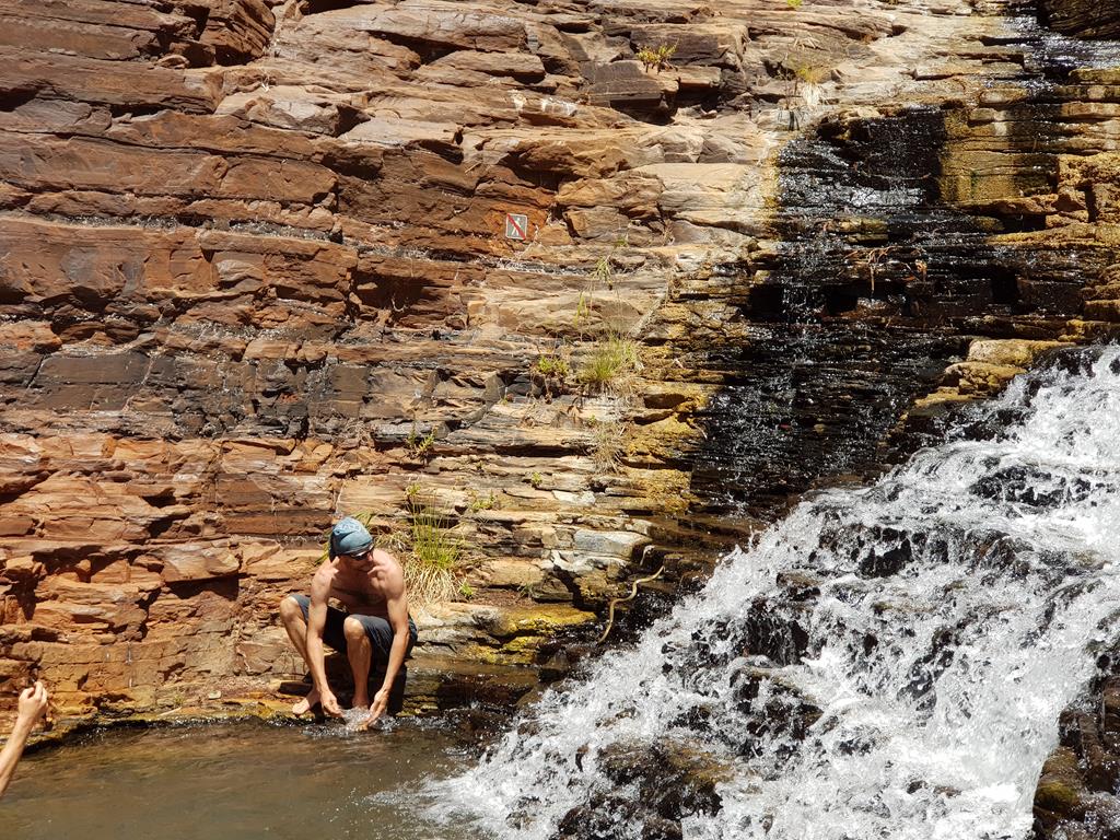
The most accessible and probably, the most popular of all gorges is Dales Gorge. It’s home to 3 highlights: Fortescue Falls, Fern Pool and Circular Pool.
Fortescue Falls is a moderate difficulty 800 meter walk, including some steep steps down from the car park.
Fortescue Falls
We saw a little snake sliding slowly along the rocks. It was rather shy but we managed to capture it on the camera.
Snake on the rocks at Fortescue Falls
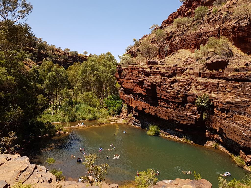
Adjacent to the Falls is the Fern Pool, which is a delight for kids. On a busy day it might look like a public pool with lots of people going for a dip or swim and it is definitely very refreshing when it is hot (we visited Karjini end of September and the average day temperature was around +32 degrees).
Fern Pool
Weano Gorge, Oxer Lookout and Handrail Pool
Oxer Lookout (a short walk from the carpark)
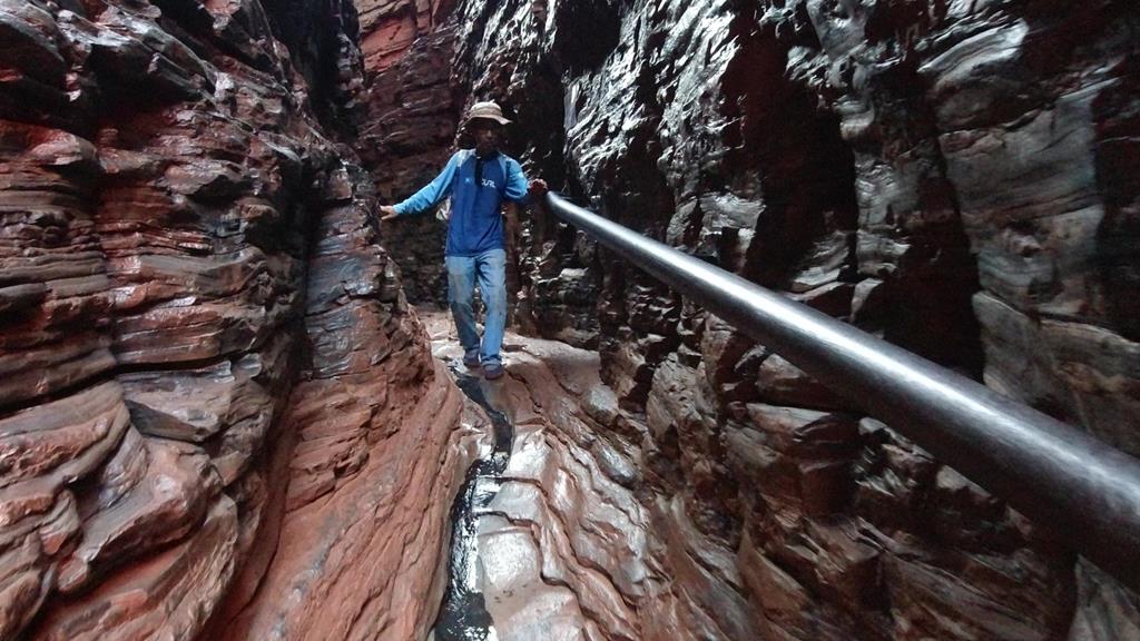
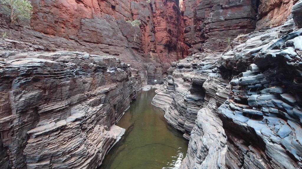
Even though Weano Gorge is considered Class 4, it is a relatively easy walk (1.5km), except for the last part where it becomes steep. Walking through water (appropriate footwear is a must here), along the narrow passages you get a feeling of suddenly immersing into another world – the ancient world of mystery and unknown.
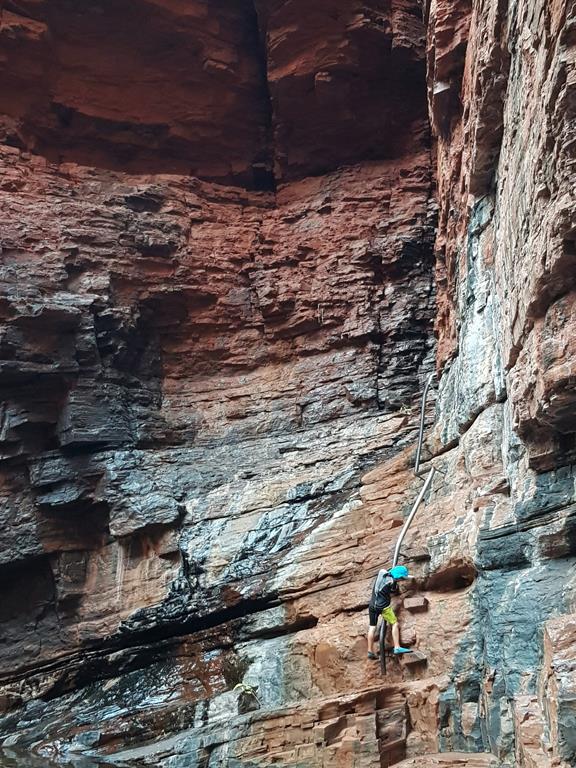
The narrow passage leads to a Handrail Pool. As the name suggests, you need to hold the rail to climb down before you can reach deep and rather cold but so welcoming Handrail Pool.
Brian going down narrow passage of Weano Gorge. Footage from Andrey Klochkov
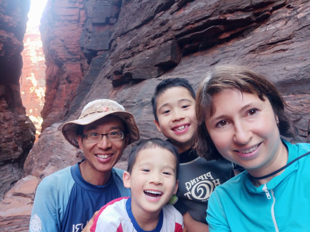
Even though it was quite a steep descent our kids managed without help (our kids were 5 and 8 at that time).
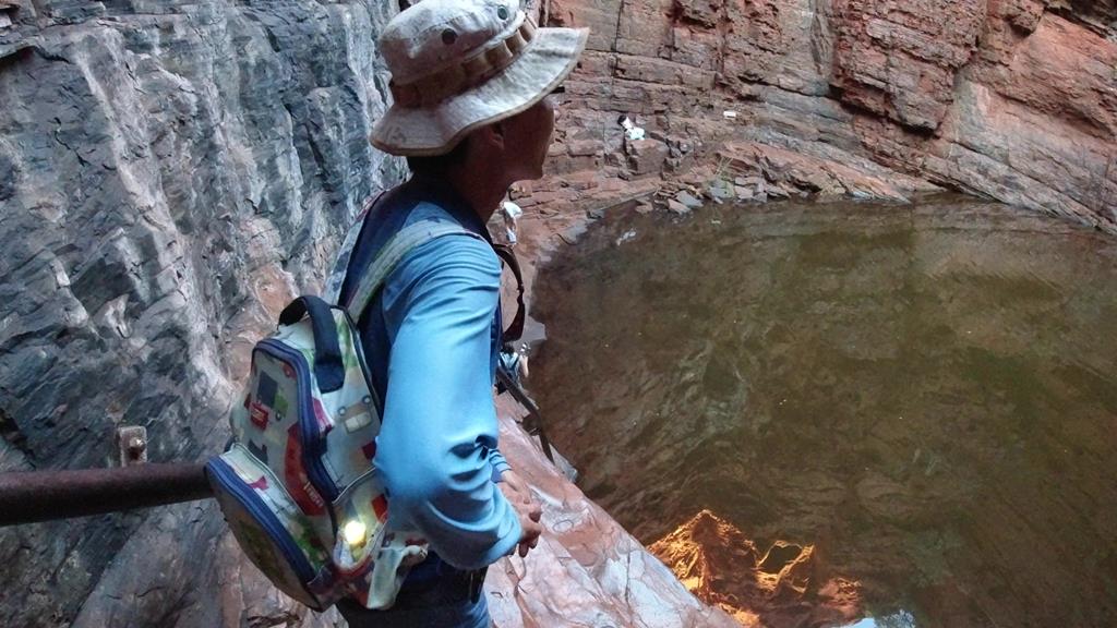
We arrived at the pool quite late with the setting sun shining directly through the gap inside the gorge, making it rather difficult for not experienced photographers to take good pictures 😊. The reward was that we had the pool to ourselves.
I found it the most picturesque gorge among those we visited. It is also one of the longest we visited (2 km), which meant more interesting places we could see 😊.
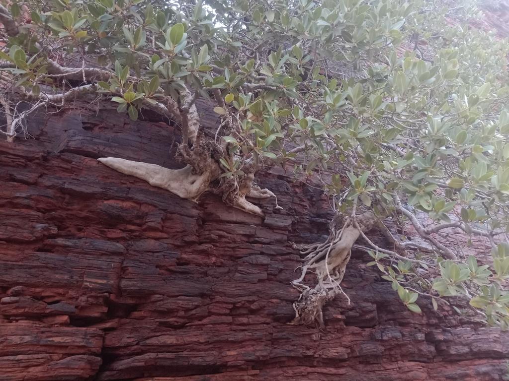
Fig trees clinging to the layered rocks
Initially climbing down was quite challenging. At one point I actually struggled where to put my foot down safely. But once down in the gorge, it is quite an easy walk most of the time, except for a few places where you have to climb over the rocks.
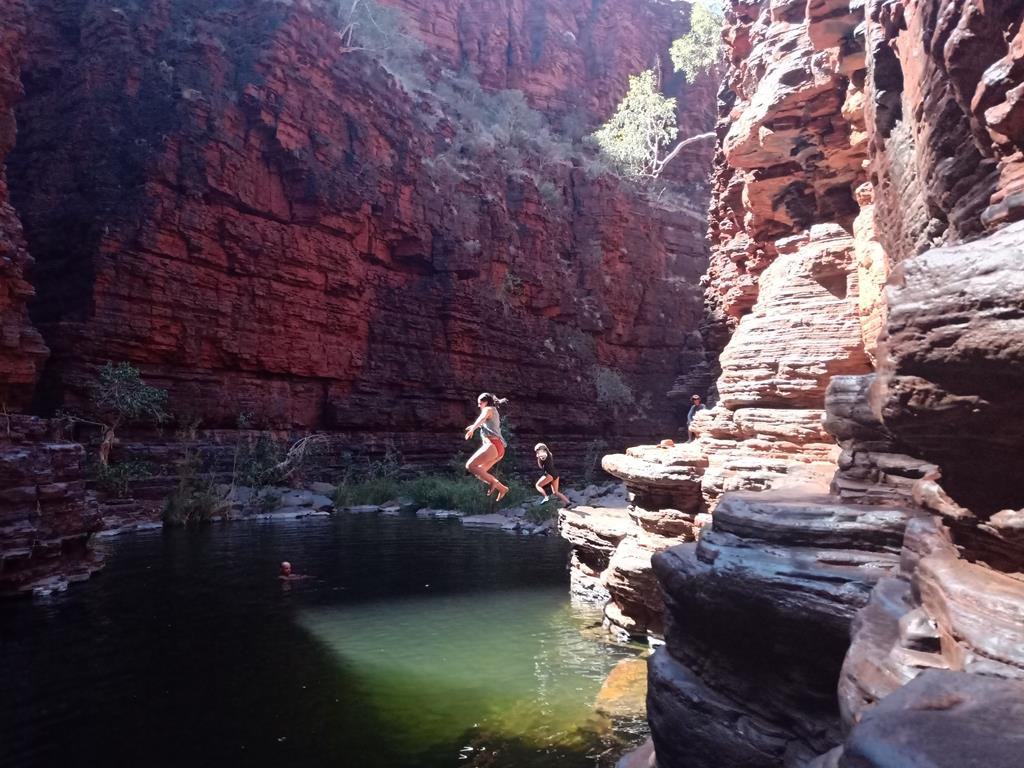
This was the first pool where we could swim. It is quite big, and like most of them, deep.
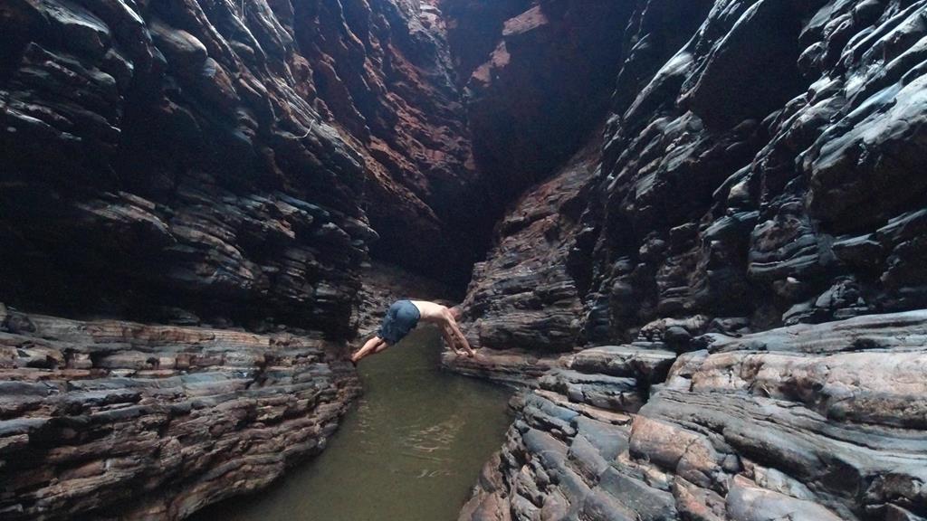
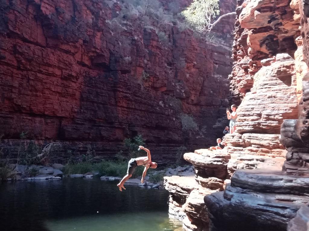
Knox Gorge has a few places where you can swim.
Or jump into….
You can also dive into it.
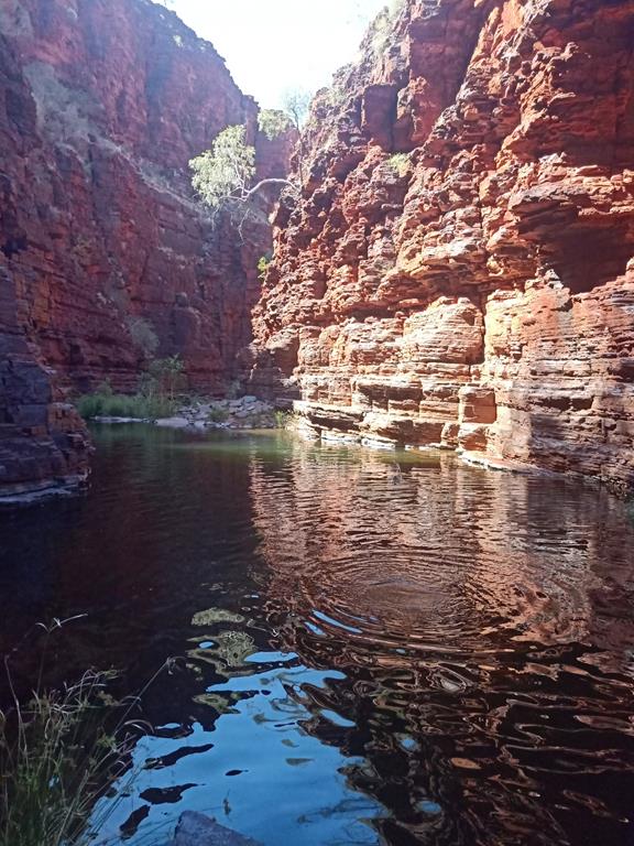
Or throw stones and see mesmerising circles forming on the surface of the water…
Closer to the end of the pathway there is a slot canyon, where you can actually go down into (although we were satisfied with just looking into it).
This is the farthest point we could get to. Beyond it was a sign indicating there was no entry. So, this was to be our late lunch stop.
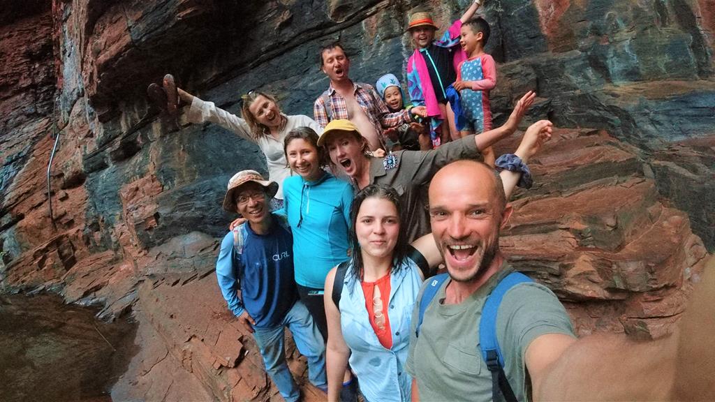
Family selfie at Knox Gorge
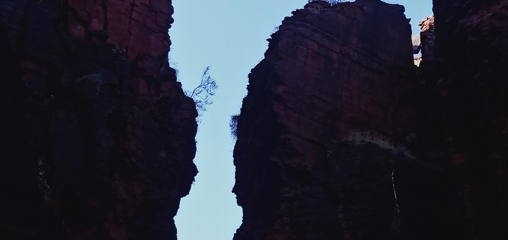
While snacking on the food, I noticed that the two interfacing walls of the gorge looked like a man and woman lovingly looking at each other. How romantically nature has set it up.
Can you see the two faces here?
It is time to go back…
Layered iron oxide rich rocks
More gorges
(from our second trip to Karijini in April 2021)
After spending 2 nights at Millstream Chichester National Park, full of wonderful memories and experiences, we slowly started heading back home. Our route was inland via Karijini. This time we intended to visit a couple of more gorges, in addition to those we’ve already seen.
On the way to Karijini via Roebourne-Wittenoom Road
Hamersley Gorge
This is the most remote gorge in Karijini National Park and it is the only one where you can get without paying national park entry fee if you enter from the north west. We used Roebourne-Wittenoom Road from Millstream Chichester National Park, joining Nanutarra-Munjina Road. Both roads are unsealed with the last section leading to the carpark is sealed.
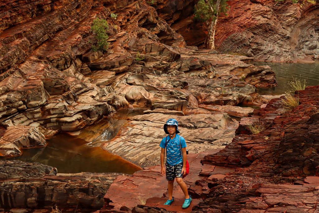
Hamersley Gorge – view from the top
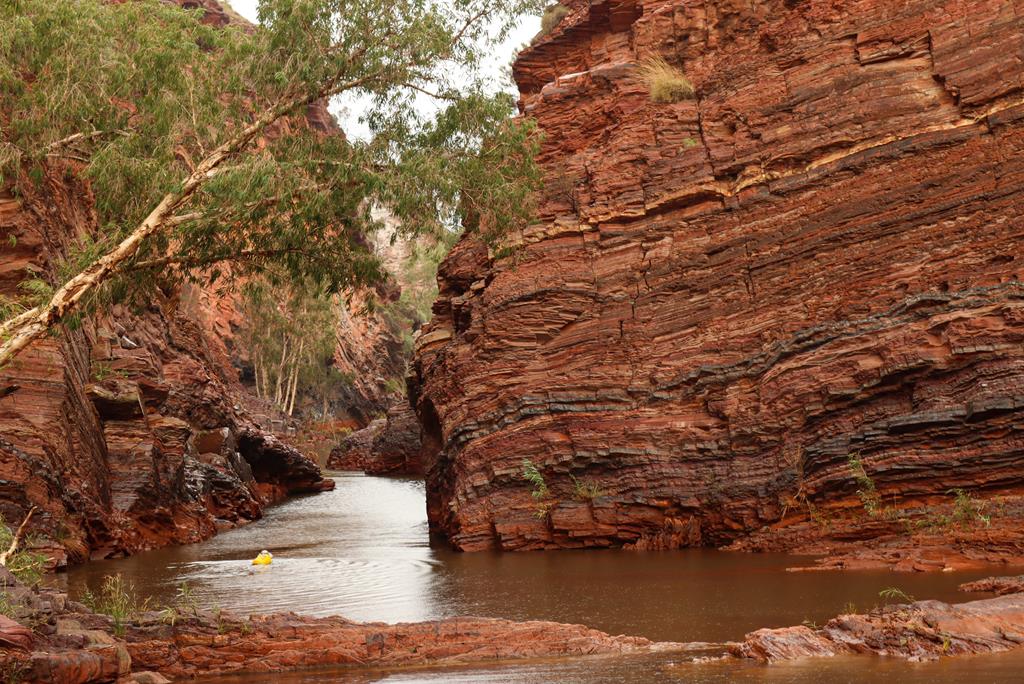
A short (400 meters) but steep and uneven (class 3) walk from the car park takes you down to quite a large permanent pool, which is warmer compared to other pools in more enclosed gorges, like Handrail Pool in Weano Gorge.
Permanent pool in Hamersley Gorge
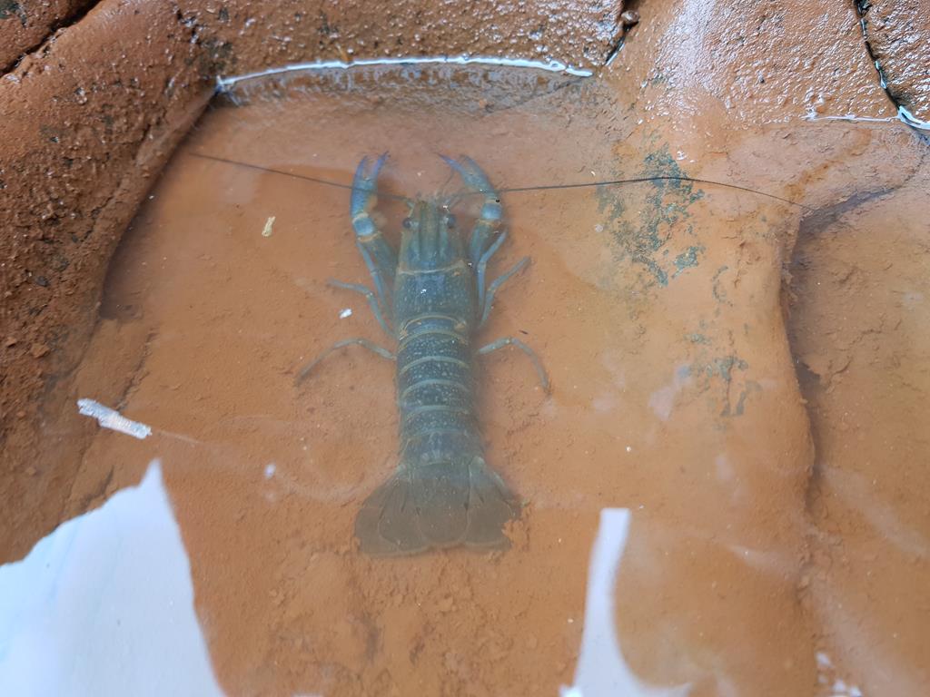
Swimming in a pool was a delight despite the rain. We did take care not to touch the bottom of the pool or else our toes could have been eaten by yabbies 😊.
Yabbies in Hamersley Gorge
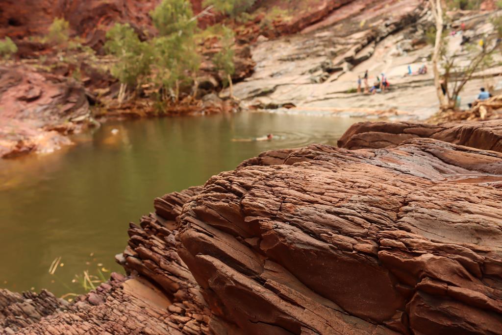
Hamersley Gorge, like all other gorges in Karijini, is full of colour and texture and is rich in geological history. Iron-rich layers of minerals alternating with iron-poor layers created distinctive bands in the rock, which then compressed and folded when the Earth’s surface moved as a result of tectonic plates collision. Eventually the rock pushed upwards and the seasonal rainfall formed rivers, that cut into the rock creating gorges. Work of nature over millions of years has produced these stunning landscapes.
Hamersley Gorge
Joffre Gorge
We tried to visit Joffre Gorge twice. First time, in September 2020, it got closed right in front of our eyes because of an accident (a boy fell into the gorge). Second time, in April 2021, it was closed again – this time because of the heavy rains. Unfortunately, the gorges (or their parts) do get closed quite often.
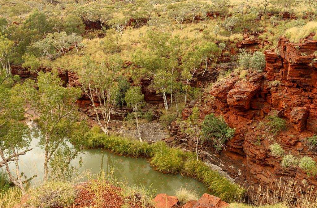
Kalamina Gorge
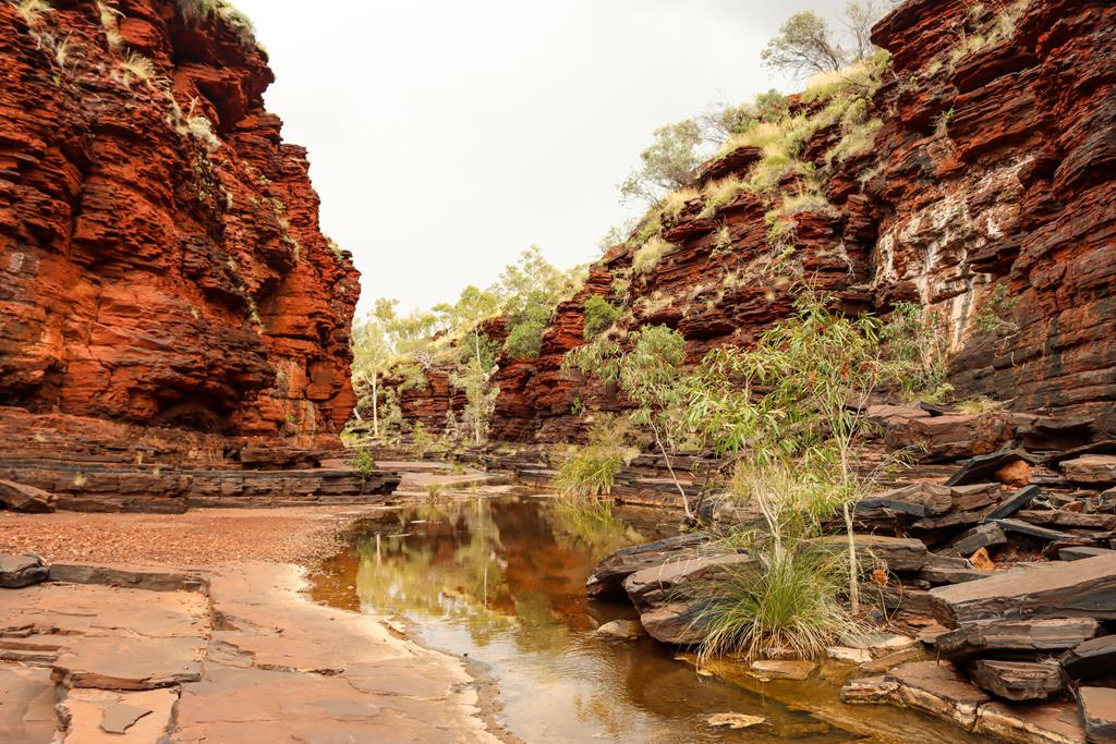
Kalamina Gorge is the shallowest of the gorges in the park. It is an easy 5-minute walk down from the car park to the base of the gorge. It is a delightful and enjoyable walk through along the gorge. A trail crosses the stream a few times. There are picnic tables and toilets at the car park.
Kalamina Gorge – view from the top
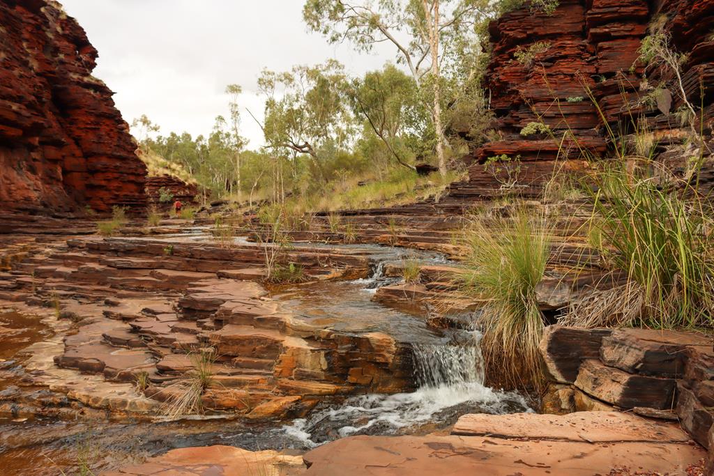
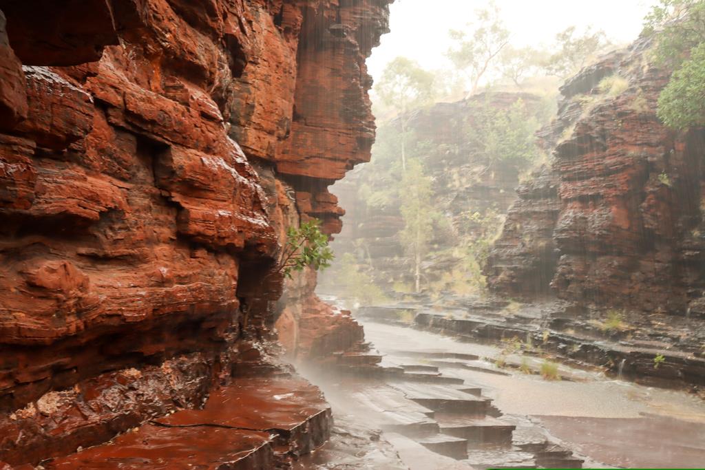
The rain was expected again on our second day in Karijini. We just managed to get down into Kalamina Gorge and take a couple of shots of small waterfalls, when it started to drizzle.
Kalamina Gorge
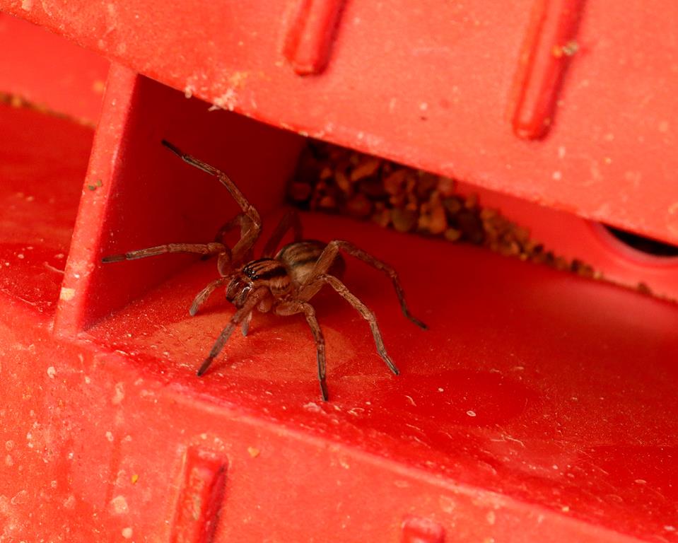
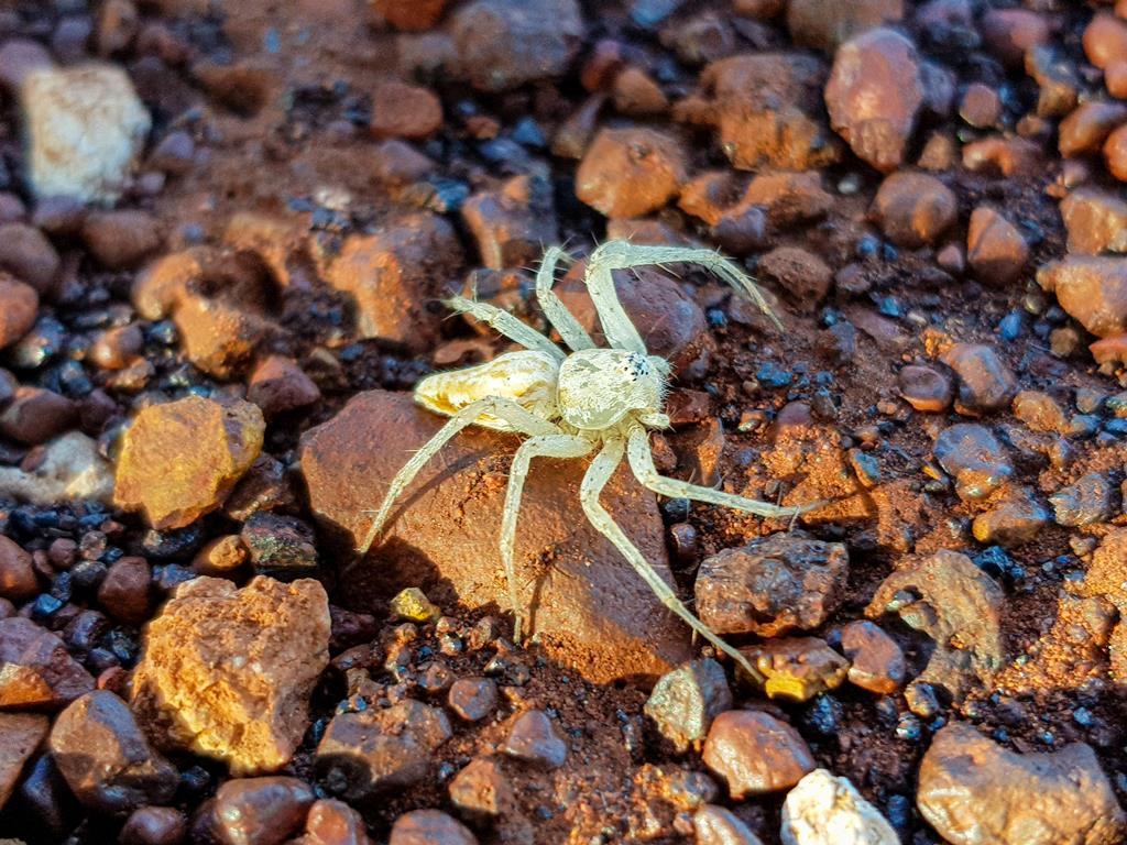
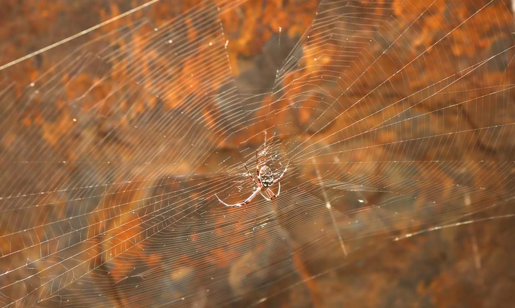
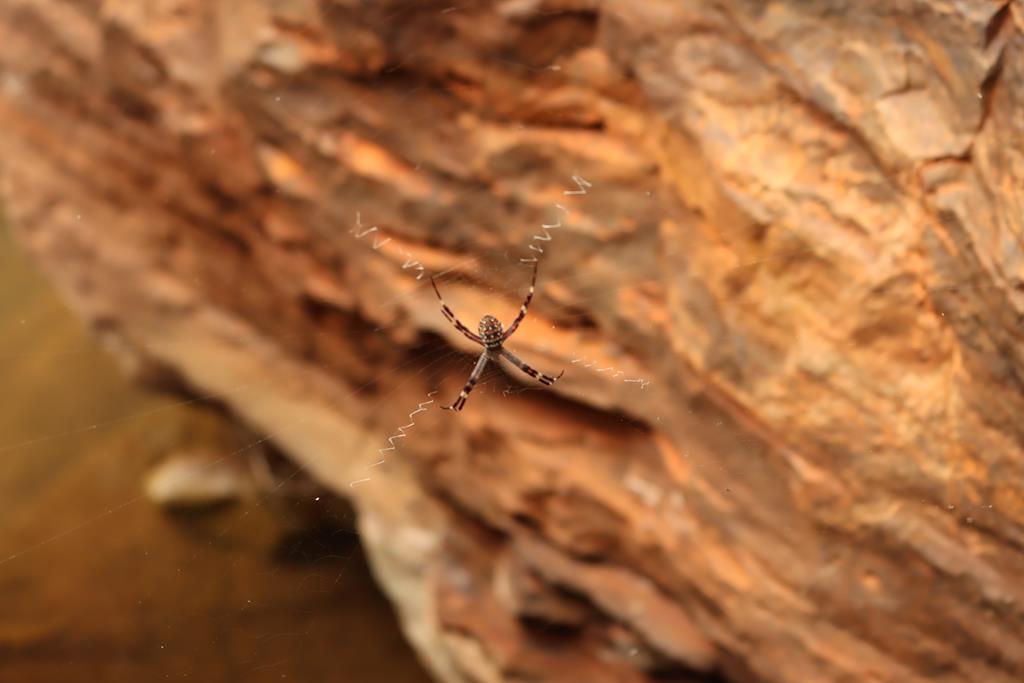
Soon drizzle turned into heavy rain. Brian and the kids turned back while I was still hoping to get to the pool at the end of the gorge. I decided to wait till the rain stops under a small cliff where I managed to stay dry (and most importantly, keep the camera dry). It was not just an idle time for me. I looked up and saw this interesting spider above my head… and another one not far from the first one.
Spiders at Kalamina Gorge
The rain did not subside. I noticed other travellers turning back. One of the ladies in a group asked me if I was by myself and suggested that I go back. Safety comes first. Unwillingly, I turned back. As I rushed through the rain, it started to pour buckets.
Heavy rain in Kalamina Gorge
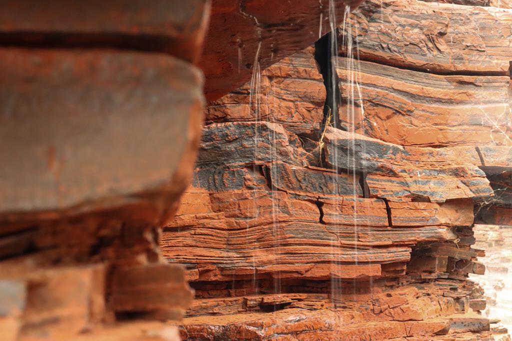
Hiding under another small ledge, I took out a few pictures of the rain. I wanted to remember those moments of the water falling so heavily, that it blocked the colours of the beautiful red iron ore rich rocks.
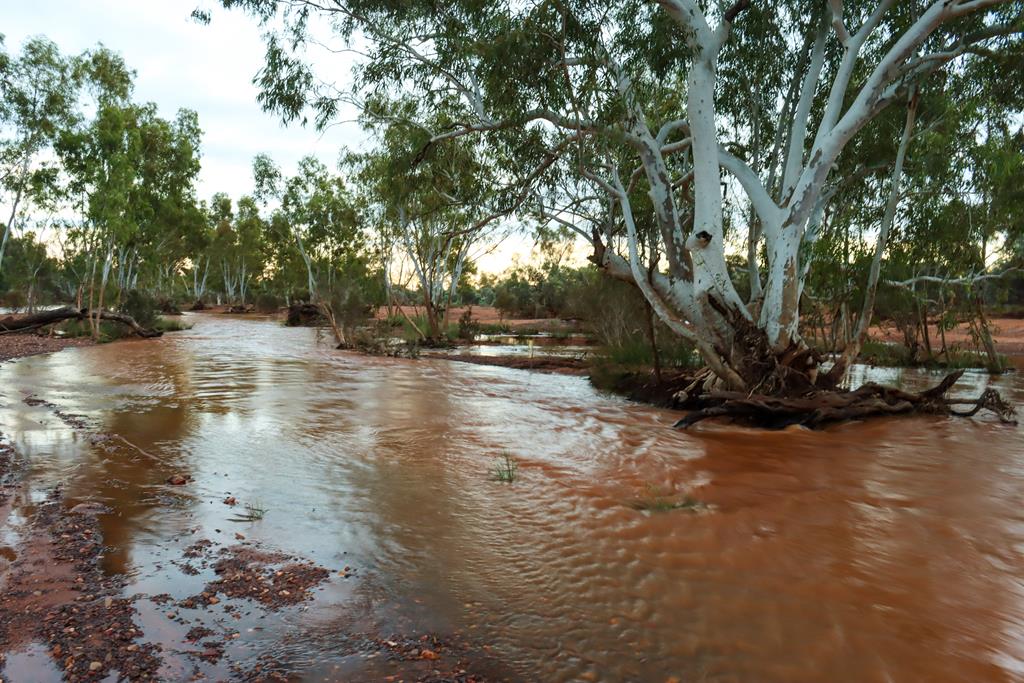
Kalamina Gorge in a heavy rain
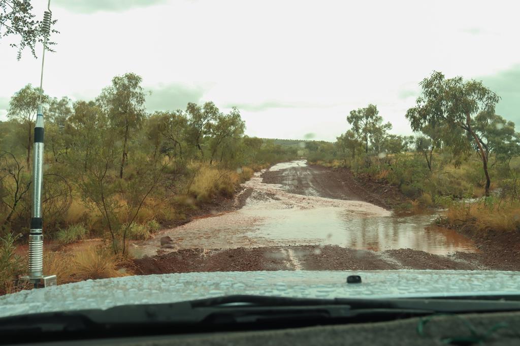
A ranger appeared as I was getting closer to the car park asking if there are more people in the gorge. The park was declared closed.
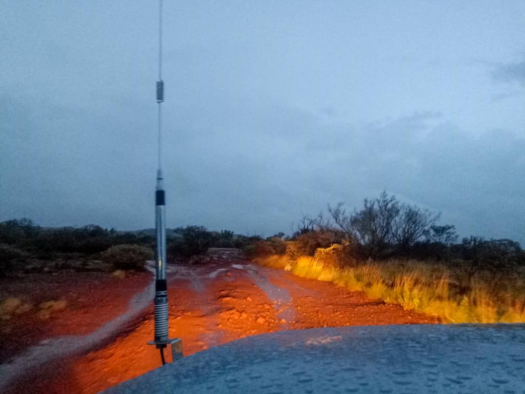
Dirt road turned into muddy floodway in a heavy rain
Where to camp for free in Kariji(just outside of the park)
Karijini is a very popular destination and being such, the two camp grounds and Eco retreat (these are the only places you can camp on the territory of the national park ) are fully booked months ahead during peak season (April to September). So we decided to free camp just outside the Karijini National Park. While it took us a little bit longer to drive to the gorges, it was still an excellent choice, because it meant freedom for us!
Albert Tognolini Rest Area
Our first stop was Albert Tognolini Campground in Juna Downs, which is 67 km away from Karijini National park on the eastern side. It is a huge campground on the hill with magnificent views, individual large secluded bays and plenty of space, so there is always a place for anyone coming late.
Views from Albert Tognolini Rest Area
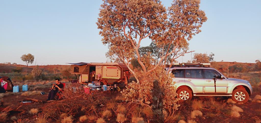
When the sun set down, the temperature dropped and the flies disappeared, making it a comfortable night.
Relaxing by the fire at Albert Tognolini
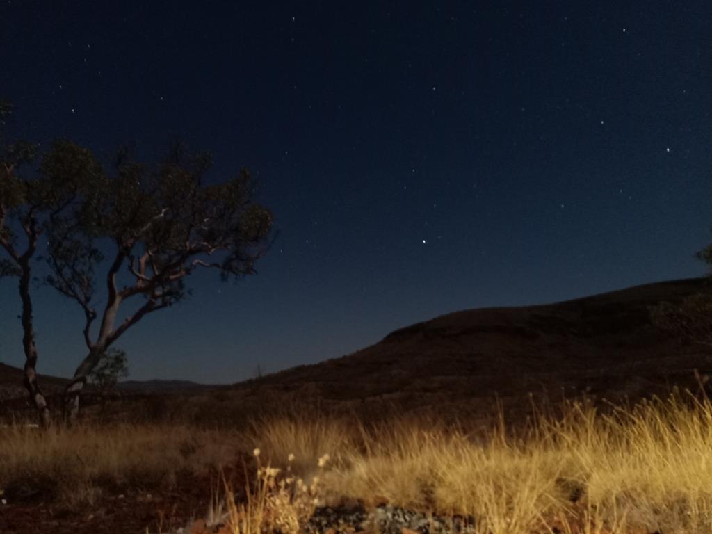
It was a cooling night with moon and stars….
Night at Albert Tognolini
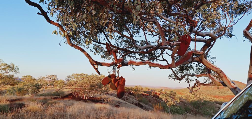
In the morning upon waking up we found that each person has one of his slippers missing. It took us a while to find the missing bits. Guess where?
Someone was being naughty 🙂
Bush Camp-Track Opposite RIP Lookout
After exploring Dales Gorge with its lovely Fortescue Falls and Fern Pool, as well as Weano Gorge, we relocated to the western side and stopped for the night at Bush Camp-Track Opposite RIP Lookout on Karijini Drive in Mount Sheila. It is 65 km from Knox Gorge, where we were heading the following day. The campground is far away from the road not to be disturbed by traffic noise, has designated spots, enough bushes to hide behind… and it was all to ourselves!
Bush Camp-Track Opposite RIP Lookout
RIP Lookout camp
During our second trip to Karijini in April 2021, our camping stop over for the night was RIP lookout (almost opposite Bush Camp-Track we stayed the year before).
RIP Lookout near Tom Price in Mount Sheila
RIP lookout is what the name suggests. It is a small hill offering nice 360-degree view. There are no facilities there. It felt slightly spooky in the evening with all those stones in memory of perished people around. We had no desire to stay outside after our dinner, given that it was already dark and the weather was promising more rain.
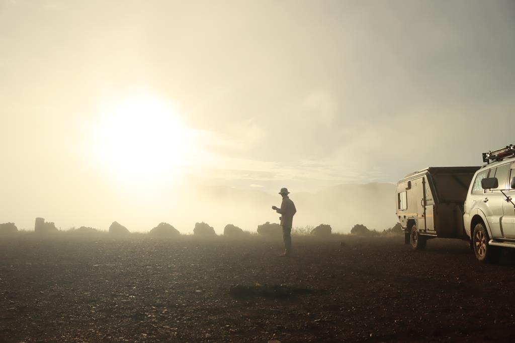
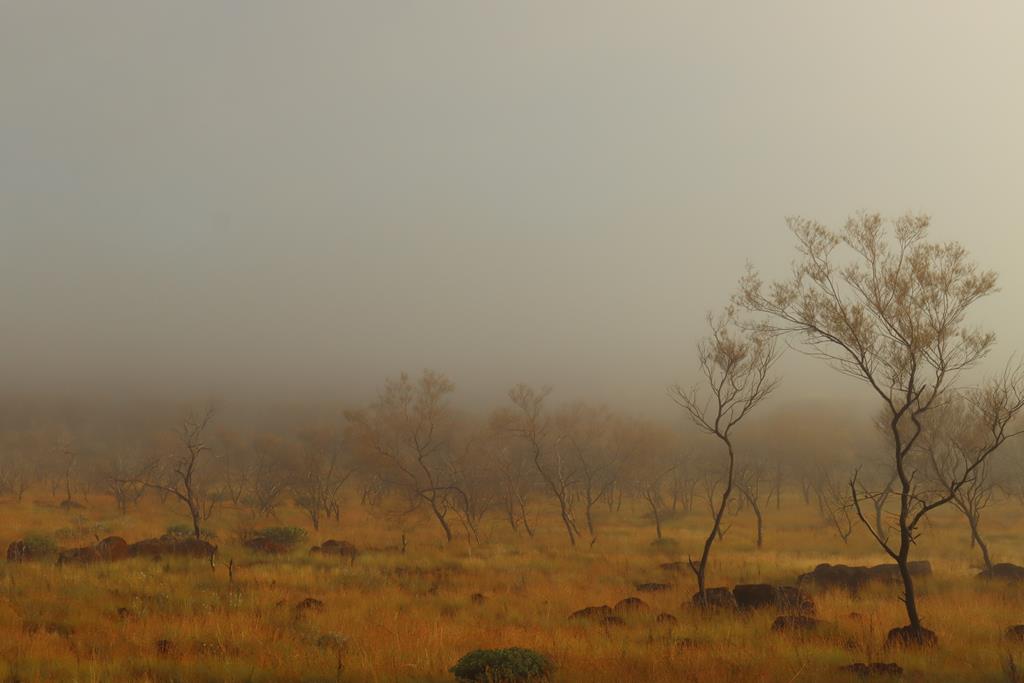
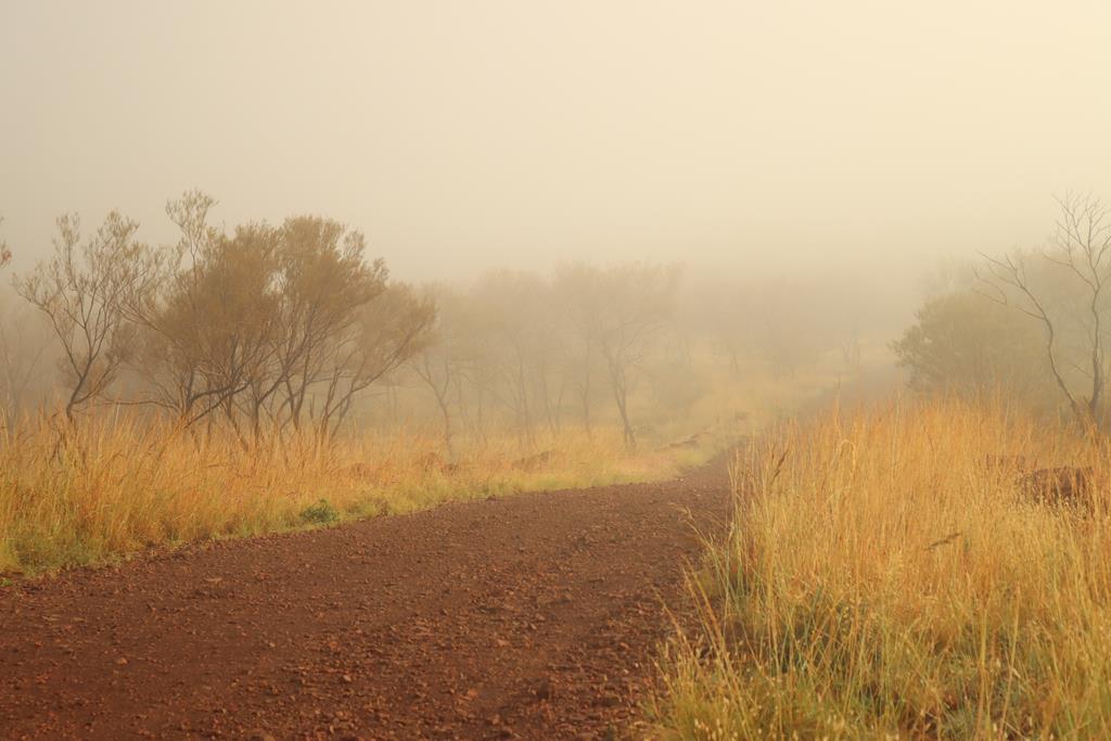
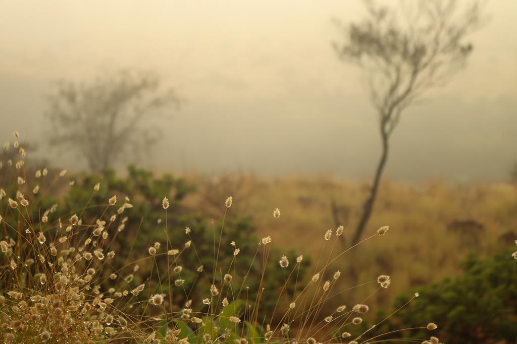
In the morning we were rewarded with the mysterious experience of being enveloped by the cloud.
Mystery in Karijini
We watched a low-lying cloud of thick fog moving from Tom Price across the Hamersley Range towards RIP lookout hill. Soon it was all over us, creating amazing photo opportunities.
Final note for those intending to visit Karijini national park. Plan at least 4 days to explore gorges. April to September is the best time to visit. September worked better for us in terms of weather, because in April we caught a tail of the cyclone that brought heavy rain to the park. Either way, Karijini is an unforgettable place, worth revisiting many times.
Punda Rock Art Site is on the way to Hickman Crater, north of Newman in Pilbara region in Western Australia. It is a restricted area that has cultural significance for Aboriginal people.
Aboriginal art
Aboriginal art has always been a subject of fascination for me. Partly, because it is so unique, partly because it looks very mysterious. The ancient culture of Aboriginals dates back some 60,000 to 80,000 years. To me, something as ancient as that has a lot of meaning and value. Although it is not something that you can understand easily (unless you have some knowledge). Aboriginal people do not have a written language, so their culture and knowledge of the land, beliefs and tribal laws are passed on from generation to generation through art which dates back more than 20,000 years. The stories, history and teachings are recorded in the art.
Punda Rock Art site was on the way to Hickman Crater, where we camped for a night, so I was excited to spend a couple of hours exploring the rock art since it was already on the way.
Rock art can take two main forms: engravings (petroglyphs) and paintings or drawings (pictographs). (Source: National Museum Australia). Petroglyphs are created by removing rock through pecking or hammering, while pictographs are made by applying pigments, such as charcoal, clay, chalk and ochre to the rock. Punda Rock art is classified as petroglyphs.
I must confess that I know so little about the Aboriginal culture and art, then I am in no way claim to be an expert, rather someone who is observing and learning by taking pictures and researching the places we visit.
On directions how to get to Punda Rock Art, check our previous post about Hickman Crater. Please note that a permit is required to travel along BHP Billiton Access Road to get to Punda Rock Art, which can be obtained from Newman Visitor Centre.
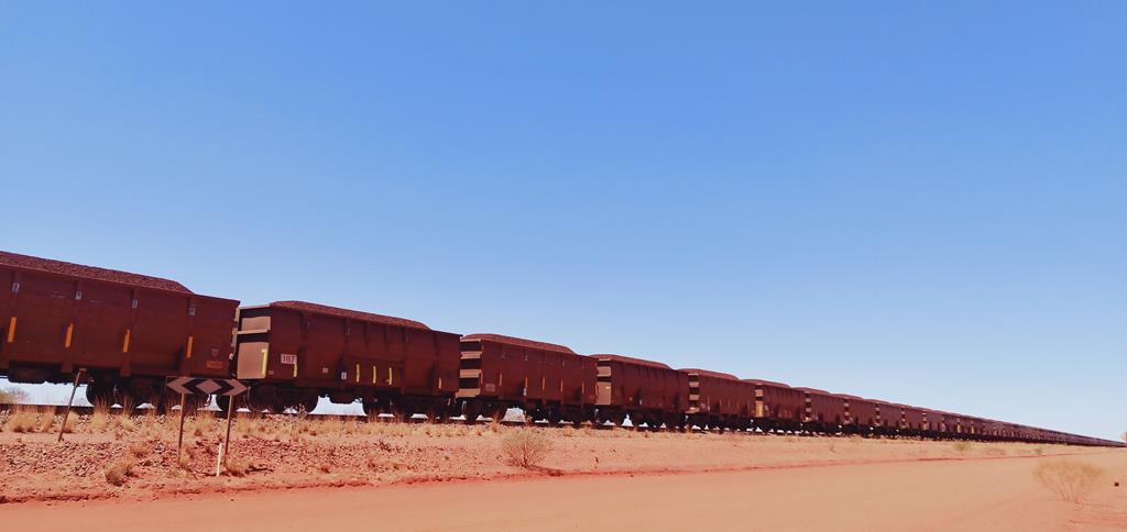
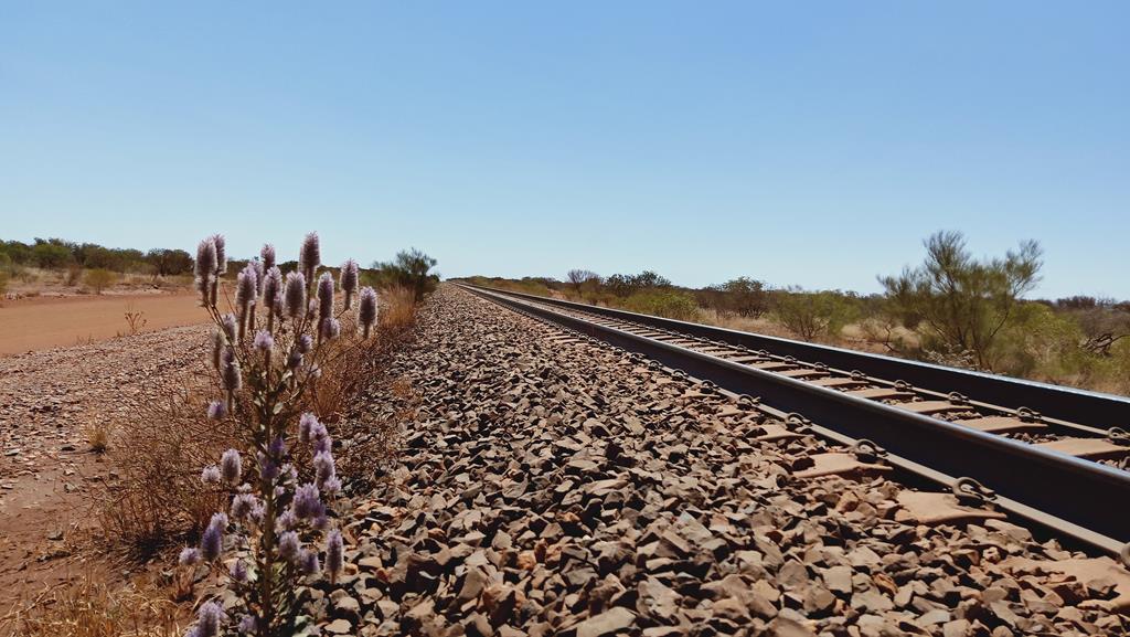
This was on the way back to Newman, along BHP Billiton Access Road. Trains carrying iron ore in Pilbara are very long. On average they have 268 carriages and are 2.8km long but the record-breaking ore train from BHP Billiton company was 7,300 m long, according to Wikipedia.
Hickman Crater is a meteorite impact crater, 35 km north of Newman in Pilbara, Western Australia. It was first discovered in 2007 by Dr Arthur Hickman by chance as he browsed Google Earth. At 260m wide and 30m deep, this almost perfectly circular hole is Australia’s most recently confirmed meteorite impact structure, according to Australian Geographic.
After a quick trip to Newman to fill up diesel and obtain mud maps from Tourist Information Centre, we went back onto the corrugated road we used to get to Cobbah Downs River Crossing. But this time the route was slightly different.
We stopped many times on the way there. Kids found various entertainments during the trip, while adults took pictures of the corrugated road from various angles.
How to get to Hickman Crater
Travelling south (from Newman) on Great Northern Highway, we turned left onto Marble Bar Road and covered approximately 28 km before turning left onto Kalgan Pool Road. Shortly after turning onto Kalgan Road, there is a fork junction. To get to Hickman Crater, we turned right onto access road and travelled approximately 31 km along the BHP Billiton Access Road (good dirty road).
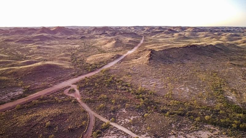
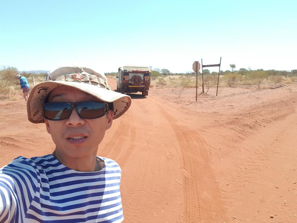
Traveling for 31 km along BHP Billiton Access Road
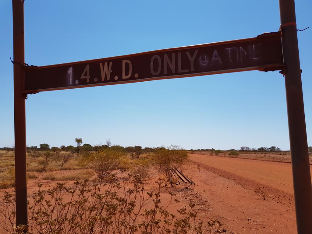
At 356km rail peg we turned left onto the track rated 4WD only.
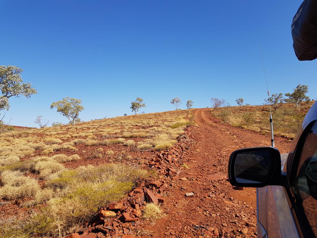
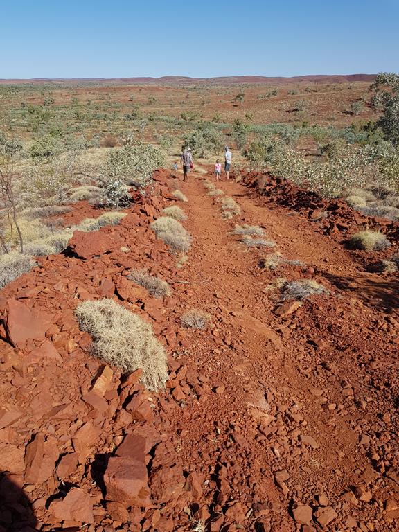
We travelled approximately 13km until we reached a fork. Straight ahead was Punda Rock Art which we were going to visit afterwards. So for now we turned left to get to Hickman Crater. Having covered approximately 9.6km of bulldozer made track we reached a tree and a sign indicating GO STRAIGHT AHEAD. These last 3km is a definitely 4WD only track. It is very rocky up hill and corrugated. Having tried to go ahead, eventually we stopped and turned back. Our friends Iulia and Sergei in a non 4WD vehicle couldn’t make it and we couldn’t leave them.
The bulldozer made track to Hickman Crater
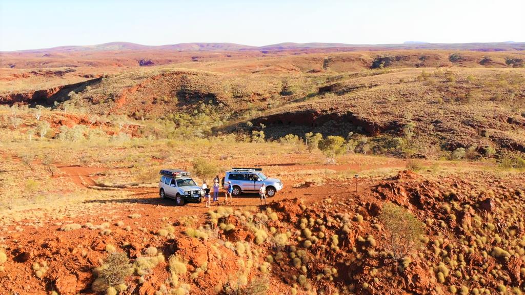
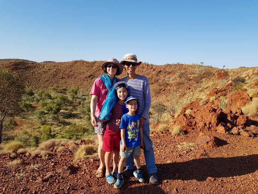
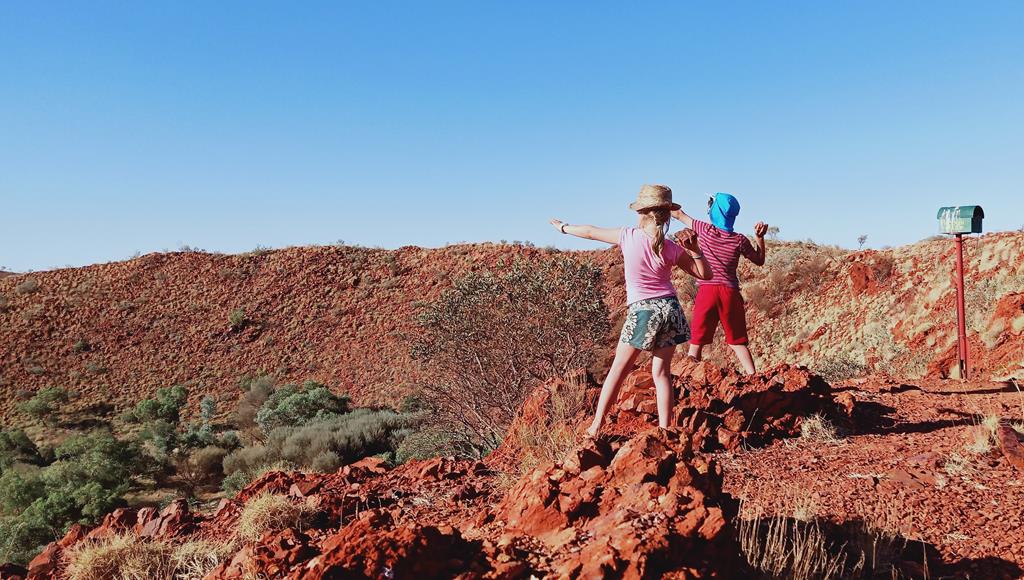
We did make it to the Crater eventually – just without caravan. Taking the left turn from Y junction, the track took us to the Letter box right on the edge of the crater. Below was the Crater itself.
We stayed there for a while, enjoying the solitude, the vast view from the edge of the crater and the heat. Kids were practicing a perfect throw of small stones inside the crater.
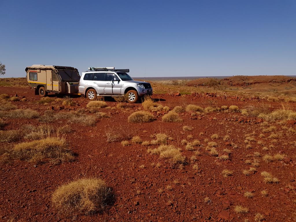
Camping near Hickman Crater
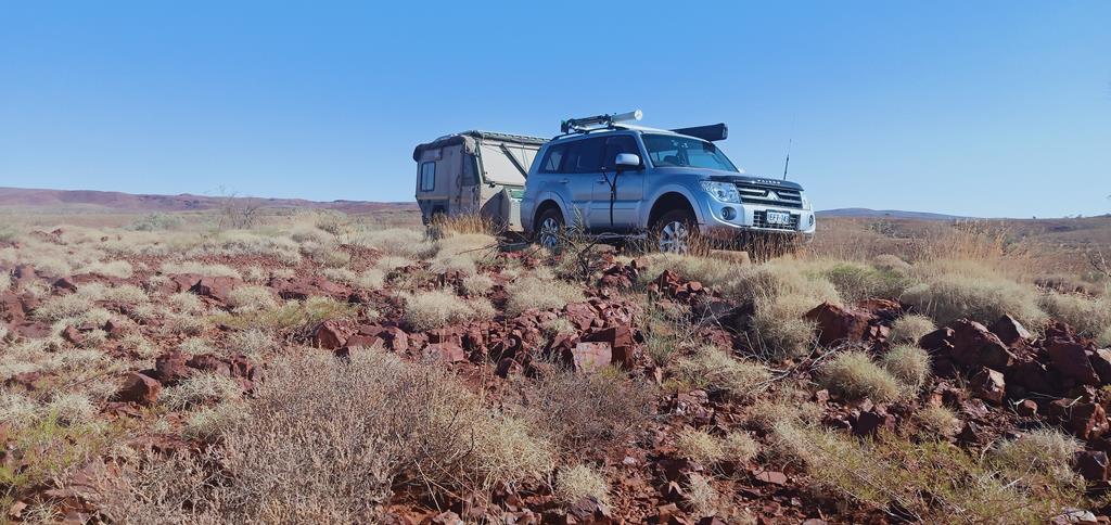
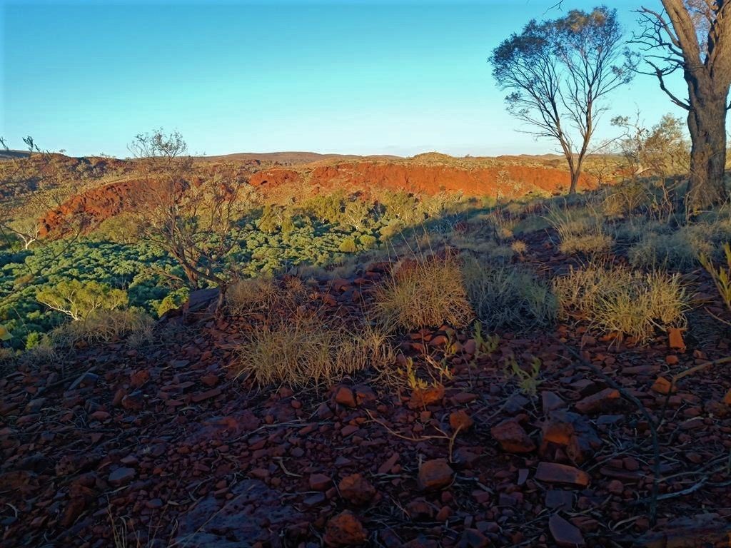
So, not in a crater itself as I hoped, but roughly 3km from Hickman Crater we set up our camp just off the track. This is how the place looked like 😊.
Our Hickman Crater campground
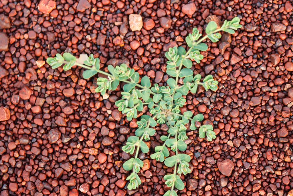
Pilbara region (and this place in particular) is characterized by two things: iron ore rich stones – red in colour and producing metal sounds when you hit them – and spinifex.
Spinifex and iron ore rich stones
Spinifex is an iconic Australian bush plant – very hardy, with needle like sharp leaves, growing in clusters. It looks very unique but it doesn’t feel pleasant when you accidently touch its spikes with your feet.
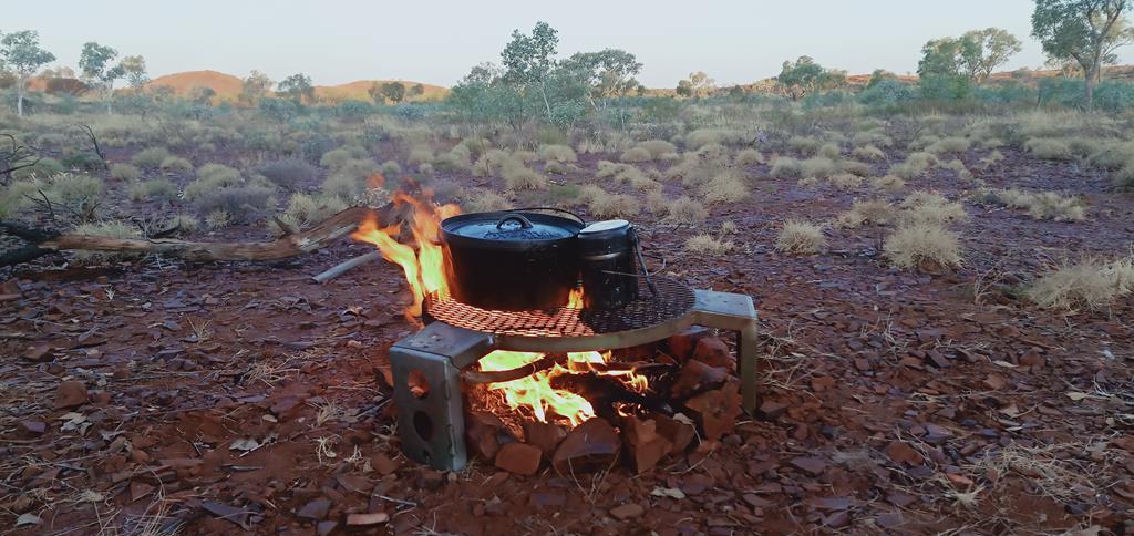
The kids, as usual, were collecting wood for the evening fire and found that spinifex burns quite well. They were desperate to dig as many of the plants as possible while making space for our campground. The adults were preparing meals.
Sausages grilled over the fire and boiled potatoes in the pot tasted delicious!
Dingoes
As we were preparing for the night – part of our team cleaning the dishes and the other part supervising kids taking shower at the back of the caravan – we heard the howling of dingoes in the distance. We could neither see them, nor distinguish by sound how many of them were around. Having cleared the table, kept the food and prudently stored away all the rubbish, we settled for the night in our tents and caravan. Dingoes howled one more time. Laying in bed and looking out of the window, I saw quite distinct outlines of the scarce bushes, our cars and friends’ tents. It was nice and cozy inside the caravan. I felt protected from the unlikely invasion of dingoes and almost wished they would come closer, so I could see them in the moonlight. An encounter with wild dingoes near Hickman Crater in Pilbara! That would have been a nice story to write about 😊.
The next day at Hickman Crater
Before I knew it, the night gave way to day. We were up early, preparing and eating breakfast, then quickly packing up as to avoid the midday heat and annoying flies. There was a long trip back to Newman (nearly 2 hours) but we wanted to stop half way to see Punda Rock Art. Read about it in our next post.
P.s A permit is required to travel on BHP Billiton Access Road to get to Hickman Crater, as well as Cobbah Downs River Crossing and Punda Rock Art. It can be obtained from Newman Tourist Centre for a gold coin donation.
Cobbah Downs River Crossing is a 4WD accessible only free campground along Kalgan River in Pilbara, WA. It lies north of Newman and can be accessed via a restricted track.
Journey to Cobbah Downs River Crossing
Our group of 10 people (including children) enjoyed a wonderful morning exploring beauty and uniqueness of Walga Rock. After a quick meal of sandwiches and fruits, it was time to leave. While our main destination was Karijini, my heart was drawn to Newman and its surroundings where I planned to spend a couple of days before heading to famous gorges of Karijini. My initial plan was to have a night at Wunna Munna, where we could see Aboriginal rock art.
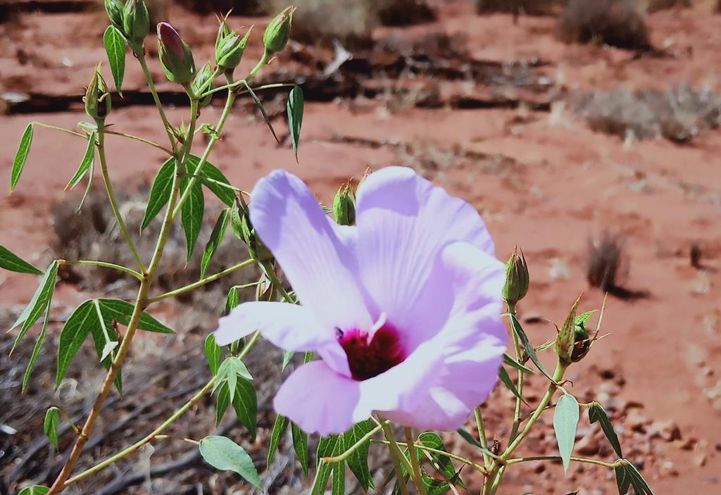
The journey was long. We had to cover more than 600 km and were hoping to get to the destination before sunset. It is always unnerving to set up a camp in the dark. We stopped a few times. Some stops were necessary as we had to fill up diesel and water bottles. At other times we stopped to stretch and move the limbs. I always took this opportunity to take pictures of flowers and scenery.
On the way to Newman
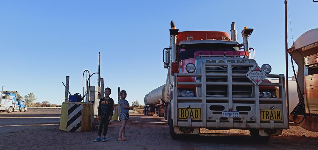
Yet another stop to fill up diesel. While the kids are posing for a picture, I take notice of the famous truck sign that reads “Without trucks Australia stops”. I feel appreciation for the trucks and the hard work truck drivers do, covering long distances through harsh outback every day.
Without trucks Australia stops
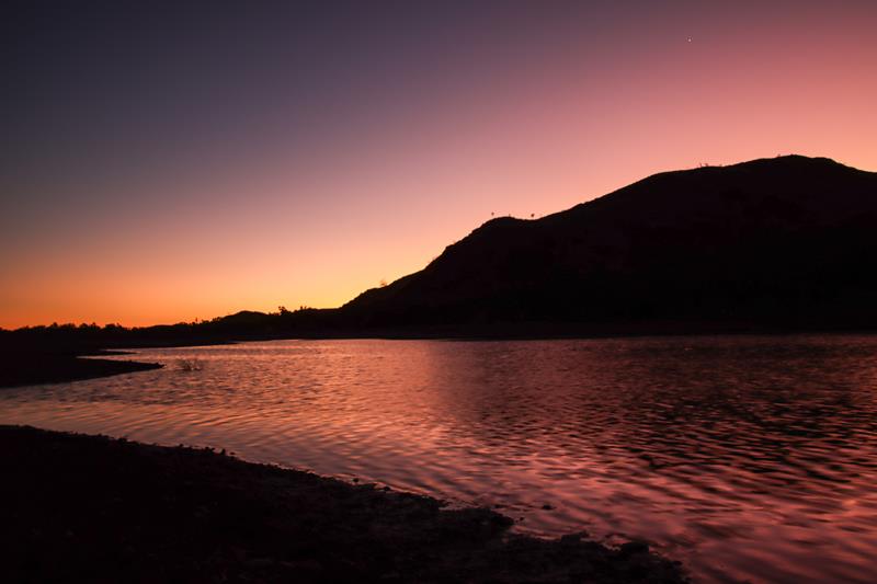
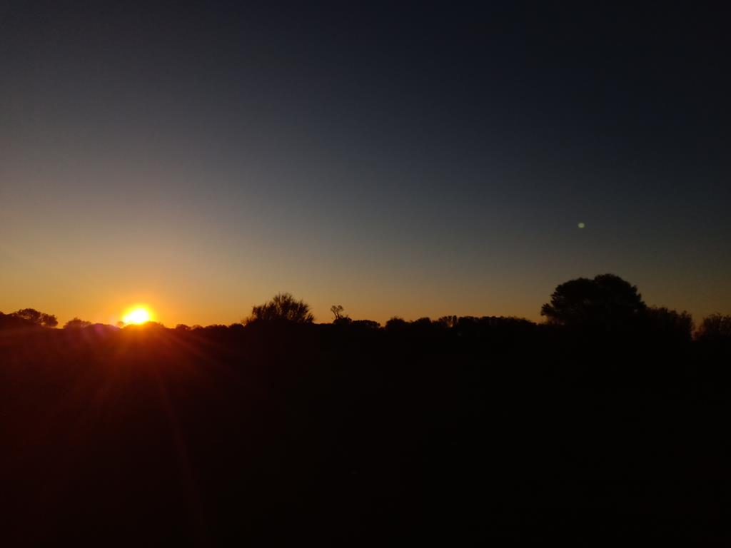
The sun is setting and we are nowhere near our destination. As I look out of the window and take a picture of the sunset, I am amazed to spot the moon next to the sun. Sun is going down and only rays of its light are now visible. The moon is shining brighter with each passing minute.
I am having second thoughts about our stop over and start to discuss with Andrey alternatives. Through wikicamp I found a place that promised to have water, which meant we could take a shower or go for a swim. It was a very welcoming thought, considering that we didn’t have shower for 2 days. I also thought that this place was nearer than Wunna Munna.
Directions to Cobbah Downs River Crossing campground
There are no clear directions to Cobbah Downs River Crossing, so the best way is to obtain a mud map from Newman Visitor Centre. Note that a permit to get there is a requirement. However, traveling at night we had no other option but to locate Cobbah Downs River Crossing campground in wikicamp and then set directions from there when we had internet connection approaching Newman.
Travelling on Great Northern Highway from Perth, we turned right onto Marble Bar Road (somewhat 10 km before Newman) and covered approximately 28 km before turning left onto Kalgan Pool Road. From here this dirt road is rated 4WD, although initially it is not. Shortly after turning onto Kalgan Road, there is a fork junction and we made a mistake here by turning left too soon. The correct way is to go straight underneath the rail line and then, having passed the rail tracks, to turn left. Now we only had to travel for 17 km straight to our destination. However, this was the most difficult part of the journey.
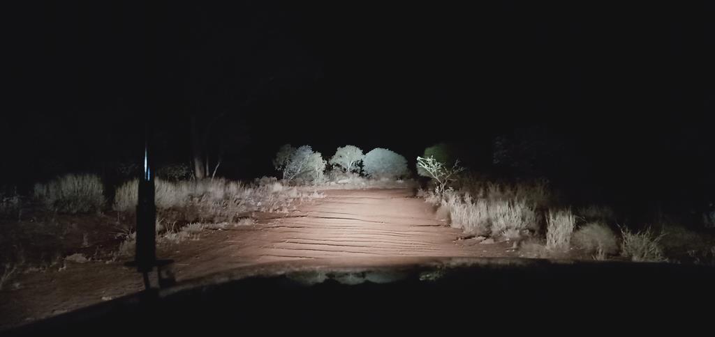
It took us 1.5 hour to cover those 17km on a badly corrugated road. Our Pajero towing 4WD caravan was managing well, but our friends in a non 4WD vehicle had some difficulty. We stopped a few times, waiting for them. Once or twice Captain Andrey had to take a shovel and level some of the holes in the road to make it a bit smoother. The vehicle rattled left and right vigorously. Initially the kids were scared, not even so much because of the rocking. The track was surrounded by bushes and they looked spooky in the moonlight.
Setting up a camp
By the time we finally arrived at our destination at around 9pm, 2 of the 3 kids were fast asleep. Our friends arrived 10 minutes later. We were surprised to see that we were not the only adventurous people here. There were neighbours on our left with a camper and another 4WD with a rooftop tent across the stream.
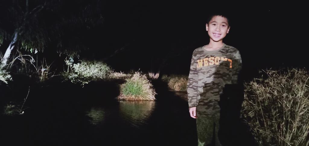
In the dark we heard soothing rustling sound of the running water and we ventured out to wash face and feet which was very pleasant and refreshing.
Cobbah Downs River Crossing at night
After a quick meal of canned food and vegetables we retired to bed.
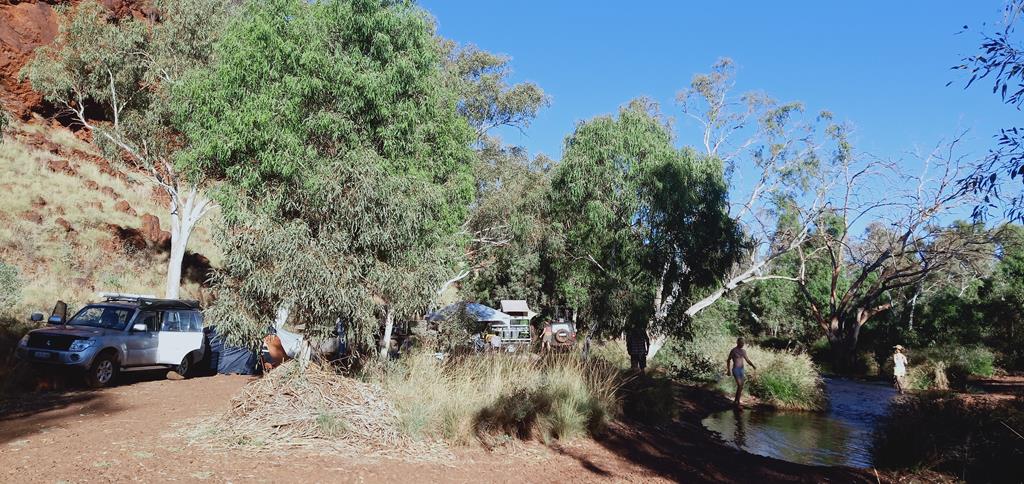
Paradise
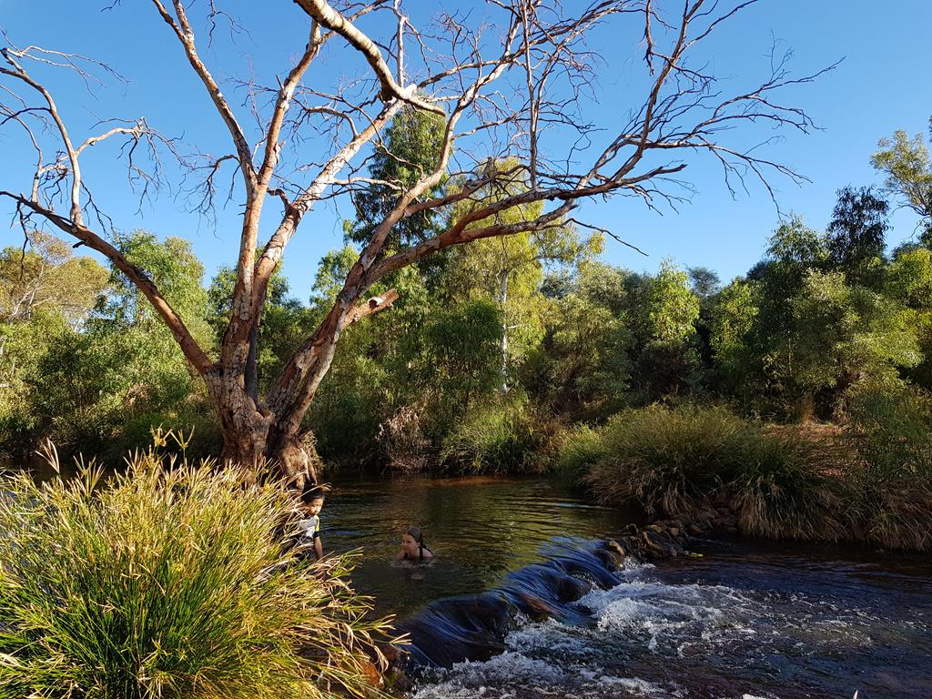
The new day greeted us warmly. We all were eager to explore this beautiful spot and jump into the river for a much-needed cleansing.
This place was so above our expectations (Andrey did jokingly promised that we would have swimming pool with a bar there) that we decided to stay the whole day and an extra night there so we could soak the beauty of this place and recuperate after a lot of driving for the past two days.
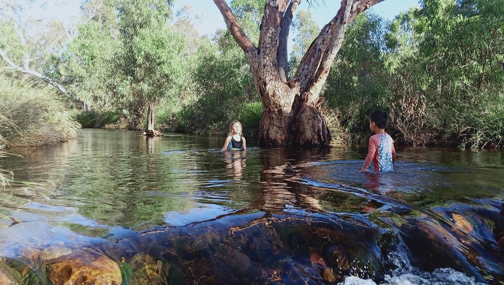
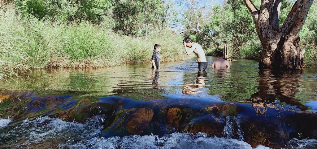
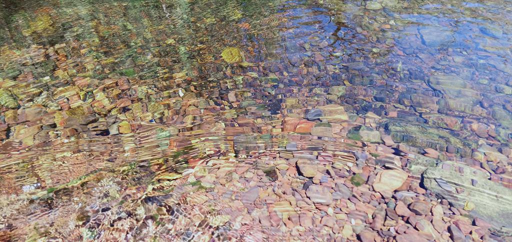
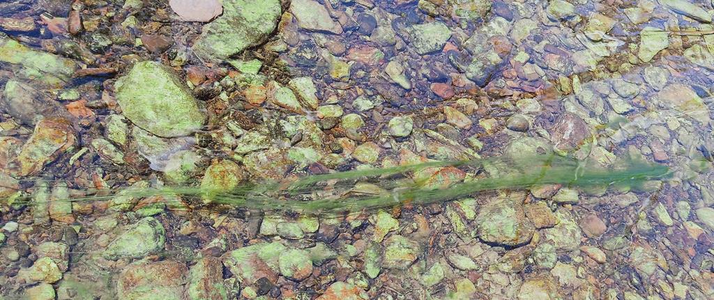
We couldn’t get enough of it. Crystal clear running water, revealing magnificent colours of the rocks and mermaid like seaweed underneath was mesmerizing. Where the rocks piled, the water was cascading, forming nice waterfalls and little swirls which were a delight to observe. The kids were having great time chasing each other in the water, while the adults cleansed themselves thoroughly by soaking.
4WDriving baptism
While snacking on fruits we watched a number of 4WDs pass by across the stream.
Tracks from 4WDs crossing the river
This is where a strong desire to do the same was born in me. Neither me, nor my husband has never done this before and we were pretty much novice in real 4WD driving. Like a bird mother that kicks our her youngsters, Andrey refused to drive and said that we must do it ourselves. Let’s go for it! I was thrilled at the opportunity! The kids readily jumped at the back.
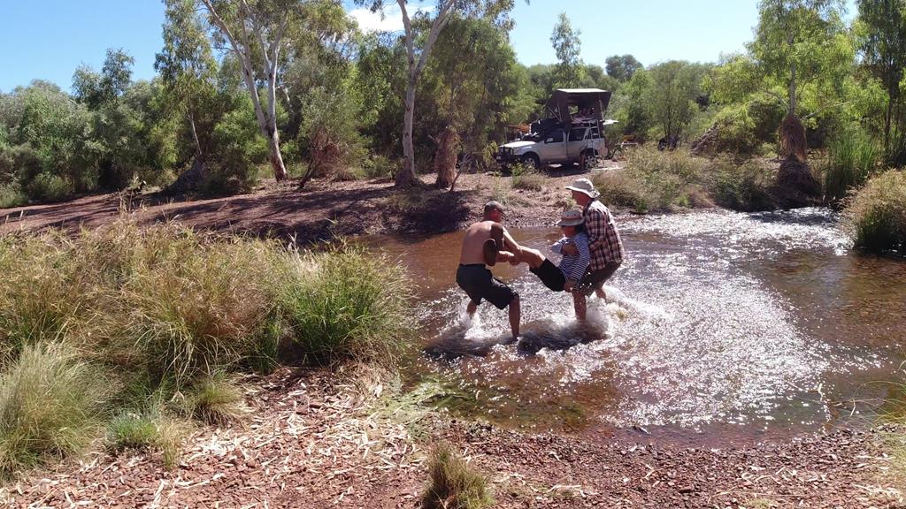
It was a true sense of adventure and achievement driving across the river for the first time. The key here was not to stop and keep driving all the way. Our achievement was celebrated by a Baptism ceremony performed by Andrey and Sergei, signifying that we are now officially 4WD travelers (Brian being the head of the family was the one to receive it 😊).
Brian being baptized as a real 4WD traveler!
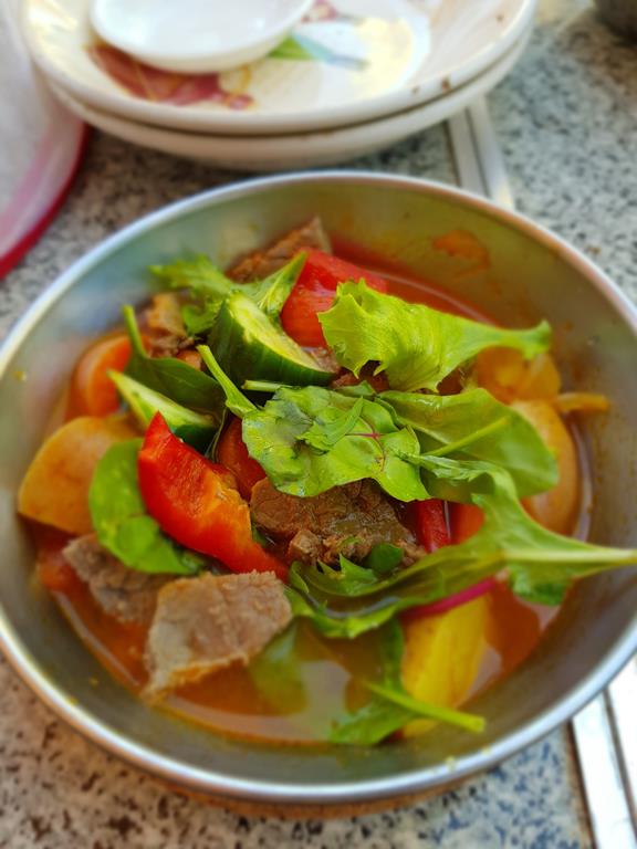
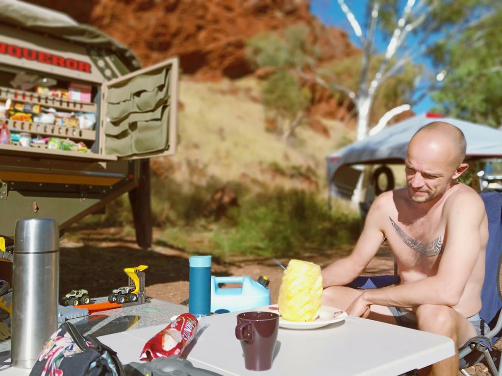
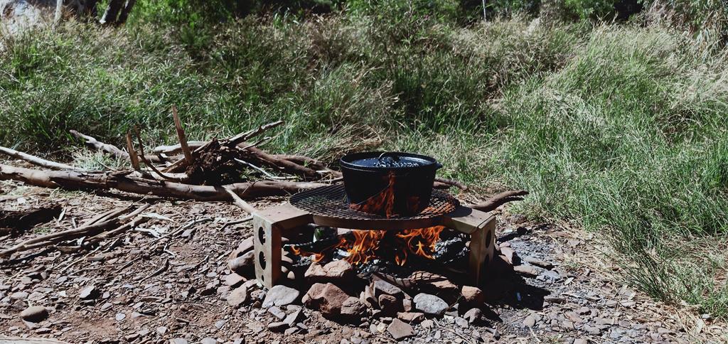
Having running water at our disposal meant that we could use it not only for a swim or bath, but also for cooking. Ultimately, true camping means utilizing what the nature gives you, including water. Hot soup prepared with water from the stream in a campfire stove tasted delicious!
Cooking meals on an open fire stoveKids looking for fishes
Hiking around
Having rested after lunch, part of our group set off climbing up the hill and exploring that area. The colours of the blue sky, red earth and green bushes formed a magnificent contrast.
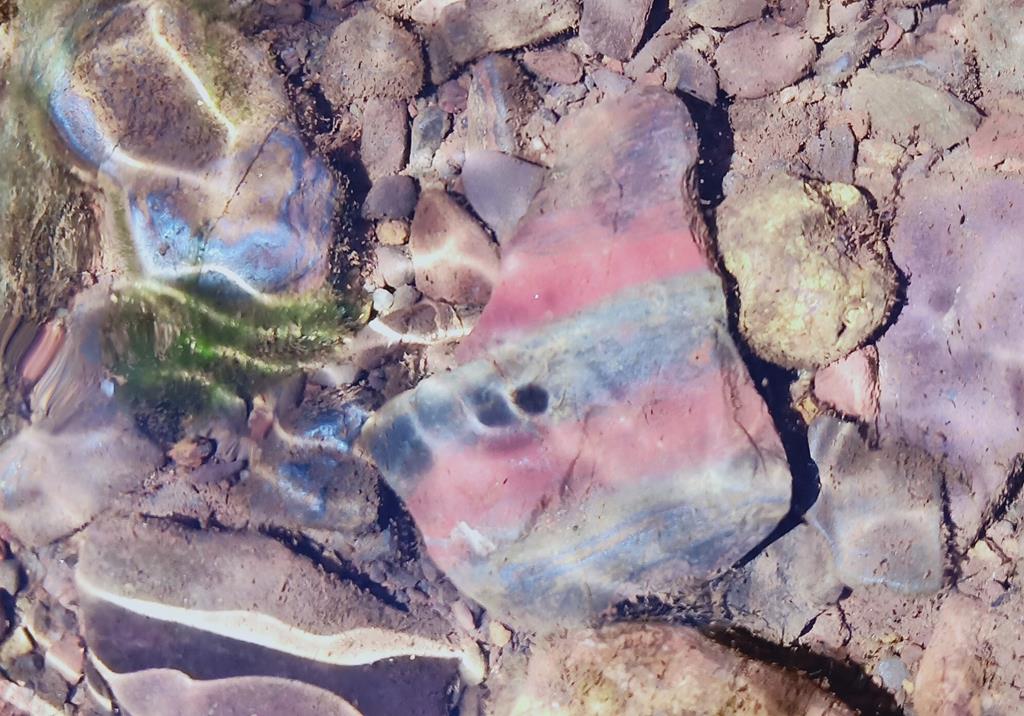
Climbing up the hill, while stepping on the rocks, we discovered that they produce metallic sound, when they hit each other, indicating just how much iron ore they contain. The rocks were of various sizes, colour shades and patterns.
The only way I could leave this paradise is by first capturing numerous images on the camera, so that I could remember and reminiscence the “out of this world” beauty of this amazing and unspoiled place in Pilbara.
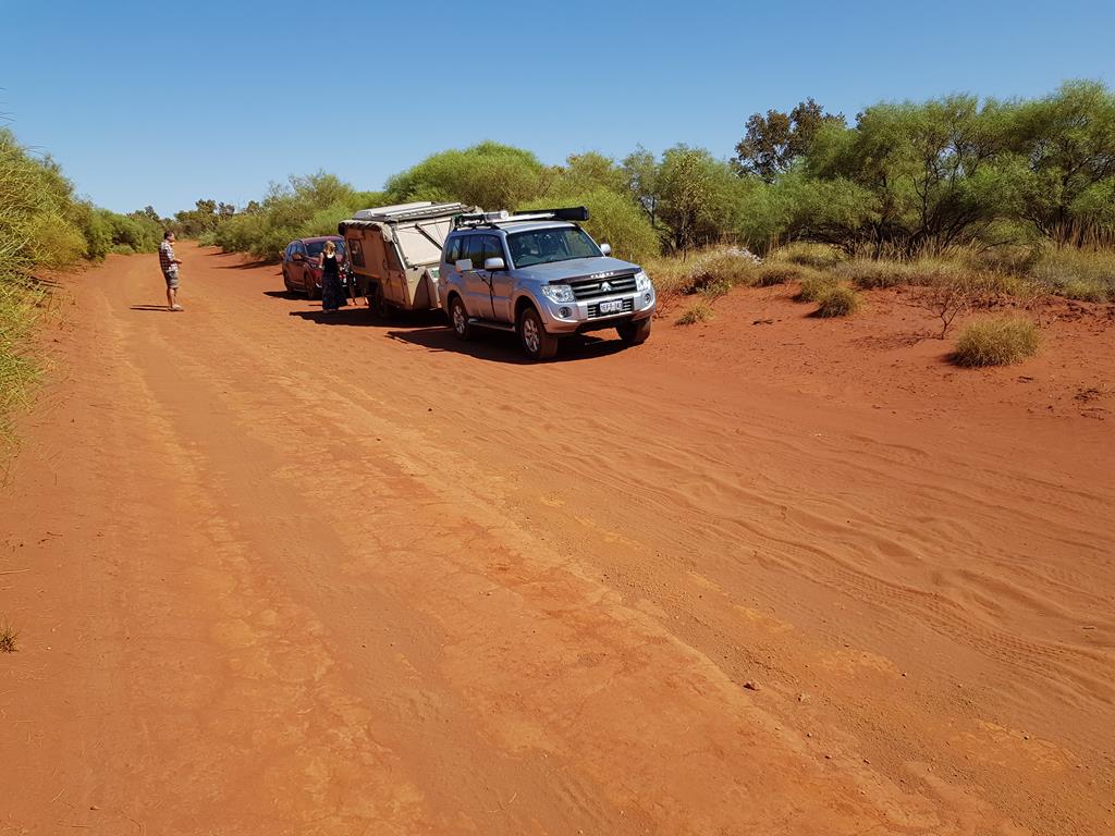
Driving back to Newman, we saw in the daylight just how bad the corrugation was.
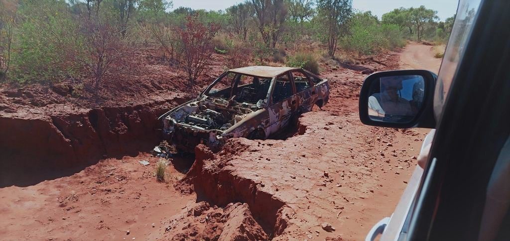
One of the many stops on the 17km long corrugated road to Cobbah Downs RiverRelics on the trail
But the trip seemed to be shorter and a little bit easier than the night journey two days ago. Fascinated with Pilbara region we wanted to explore a few more places before heading to Karijini. See in you in the next post!
Manage Cookie Consent
To provide the best experiences, we use technologies like cookies to store and/or access device information. Consenting to these technologies will allow us to process data such as browsing behavior or unique IDs on this site. Not consenting or withdrawing consent, may adversely affect certain features and functions.
Functional Always active
The technical storage or access is strictly necessary for the legitimate purpose of enabling the use of a specific service explicitly requested by the subscriber or user, or for the sole purpose of carrying out the transmission of a communication over an electronic communications network.
Preferences
The technical storage or access is necessary for the legitimate purpose of storing preferences that are not requested by the subscriber or user.
Statistics
The technical storage or access that is used exclusively for statistical purposes.The technical storage or access that is used exclusively for anonymous statistical purposes. Without a subpoena, voluntary compliance on the part of your Internet Service Provider, or additional records from a third party, information stored or retrieved for this purpose alone cannot usually be used to identify you.
Marketing
The technical storage or access is required to create user profiles to send advertising, or to track the user on a website or across several websites for similar marketing purposes.