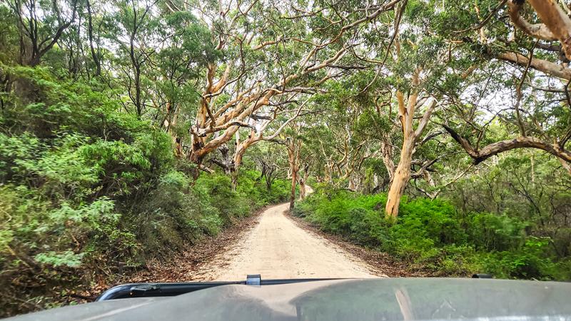
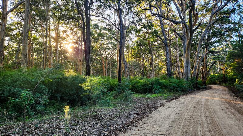
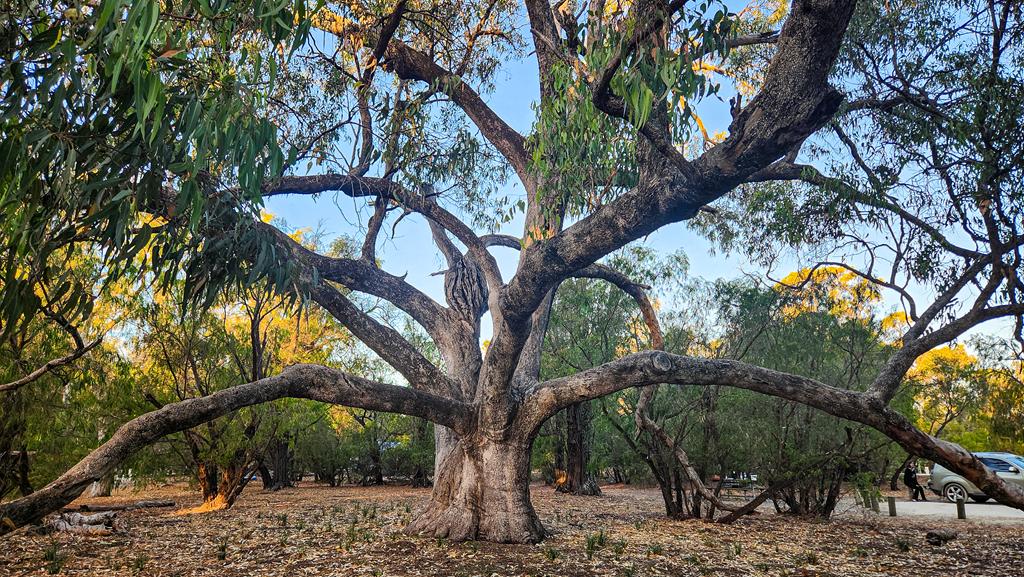
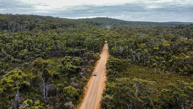
Boranup Karri Forest Drive is one of Australia’s most striking forest experiences. It is part of Leeuwin-Naturaliste National Park and Margaret River region in the South West of Western Australia. The towering karri trees, with some of them reaching 60 metres, create a serene atmosphere. Following Caves Road and the adjoining Boranup Drive is a sensory delight. Check out this short reel. Boranup Lookout is a great place for a picnic or just a rest stop and is easy to get to.
Boranup Drive itself is unsealed but well maintained and easily manageable in a 2WD.
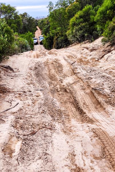
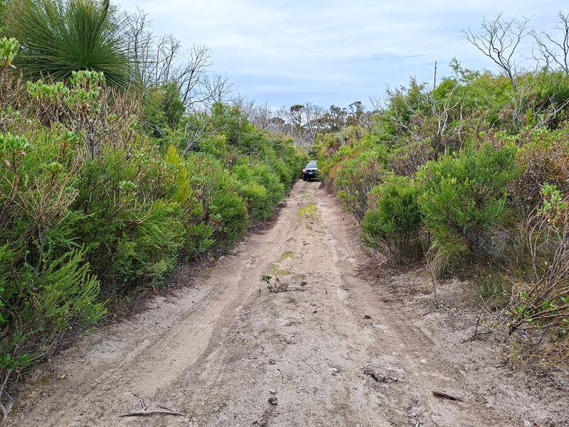
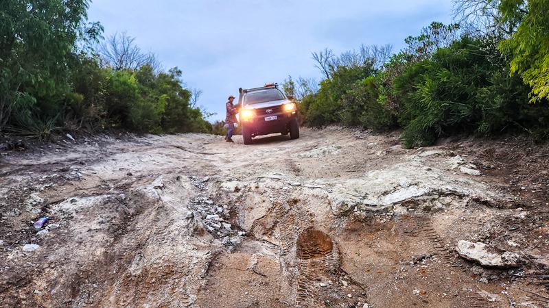
Beyond it, however, numerous side tracks branch off into the forest, and those are strictly 4WD territory. Some are soft and sandy, others so narrow that pin stripes are unavoidable.
We had our share of adrenaline recently exploring a few of them. Our aim was to get to Boranup Hill Lookout (different from Boranup Lookout) but we had to turn back as it was getting dark and we were still nowhere near the destination. Here is a short reel about the drive.
Boranup Campground
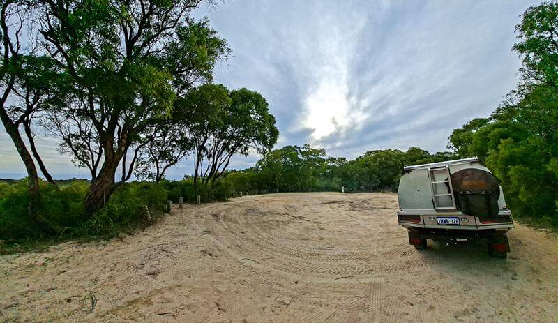
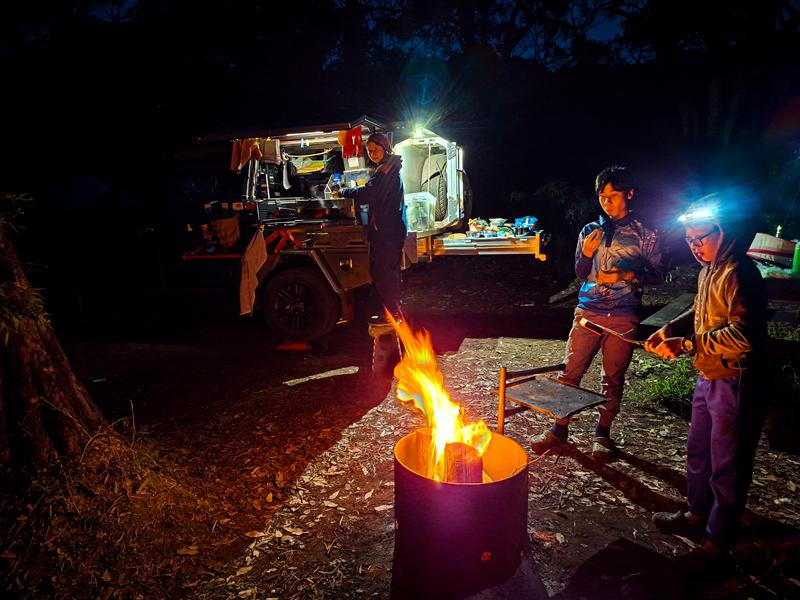
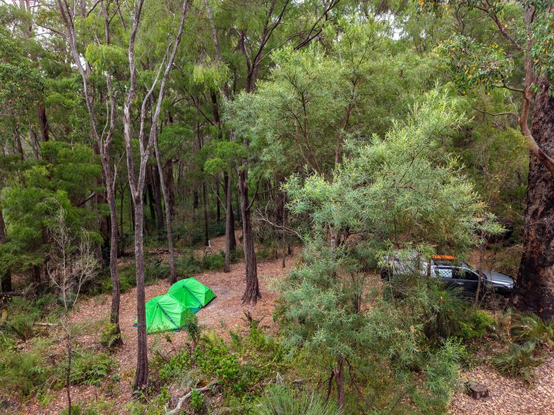
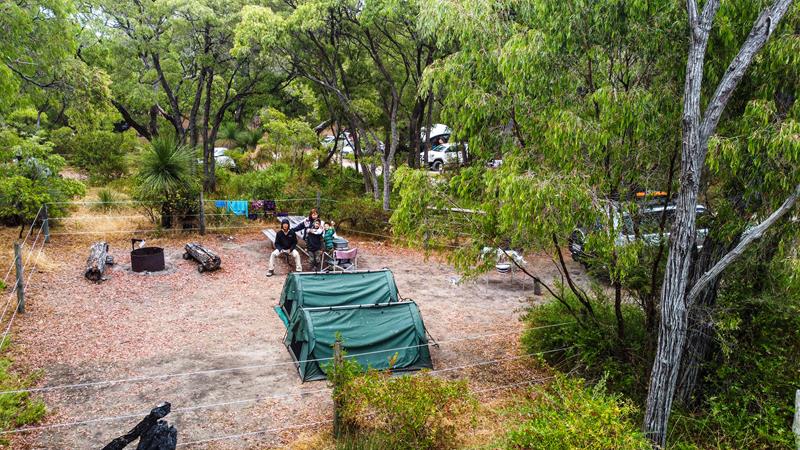
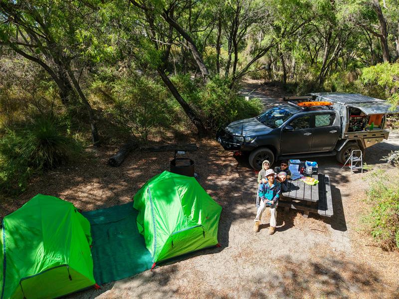
We spent two relaxing nights at Boranup Campground in Leeuwin–Naturaliste National Park over the ANZAC Day long weekend. It’s a tiny campground with only seven sites, each spaced far enough apart to feel private. The setting in the karri forest is beautiful, and we loved having our own fire ring and table at the site. We even had a possum visiting us at night, which was fun to watch :).
The only downsides were the uneven ground (a small issue if you’re tenting 😊) and the road nearby. It was quiet at night, but once the light came up, a few cars started passing. We also checked out Jarradene Campground. It’s much larger and has great facilities with sinks, BBQs, shelters and bins. But it’s pricier, and the sites felt more open and close to the driveway. Even with its quirks, Boranup would still be our pick. The campground is managed by DBCA and needs to be booked online.
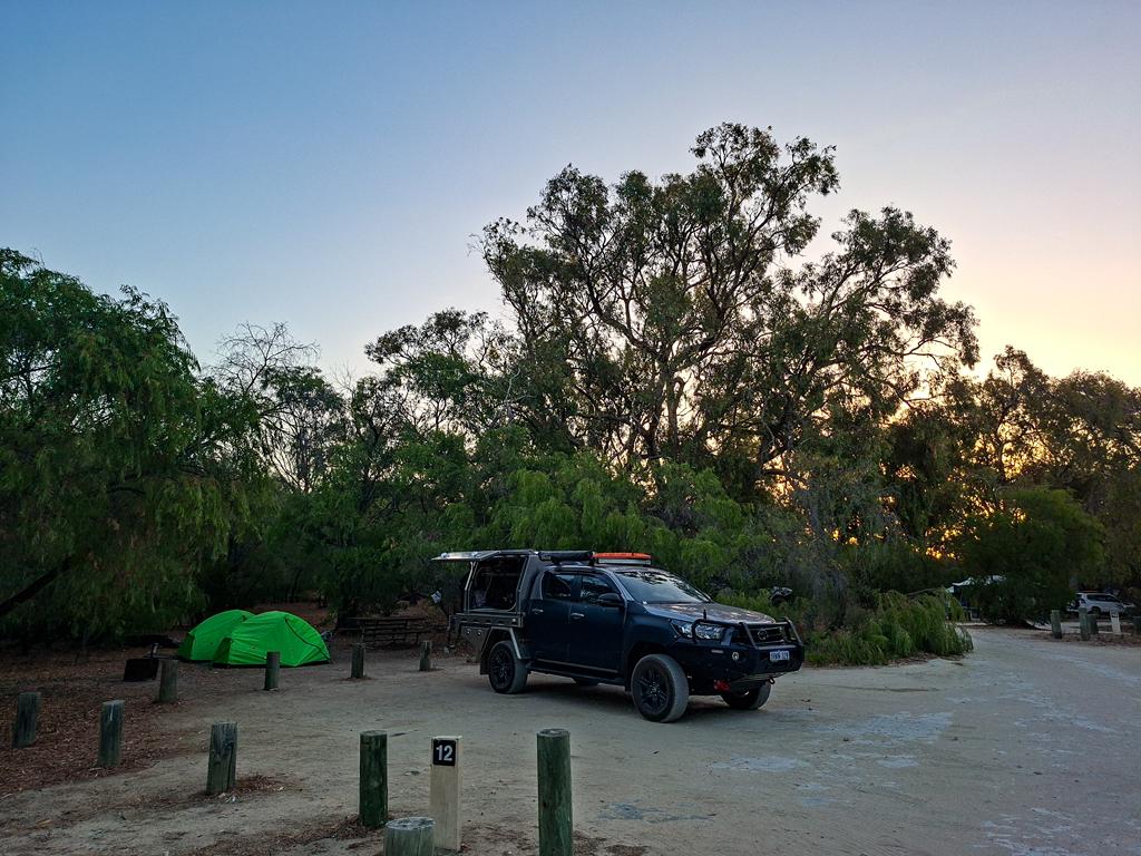
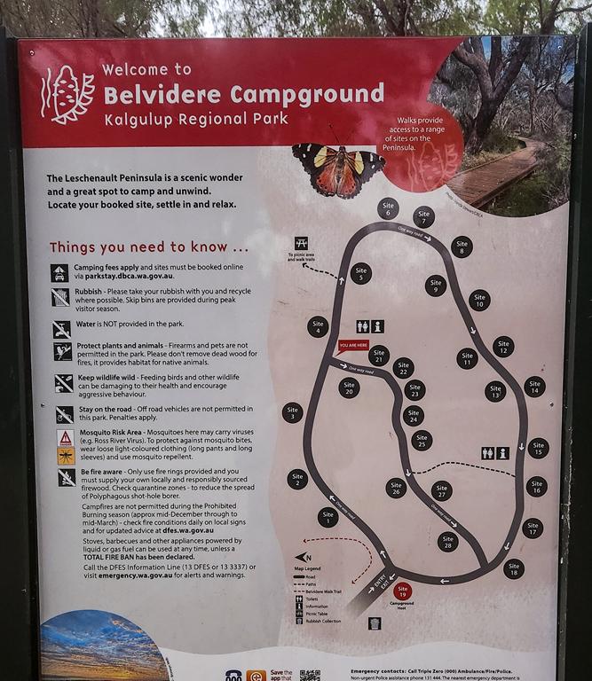
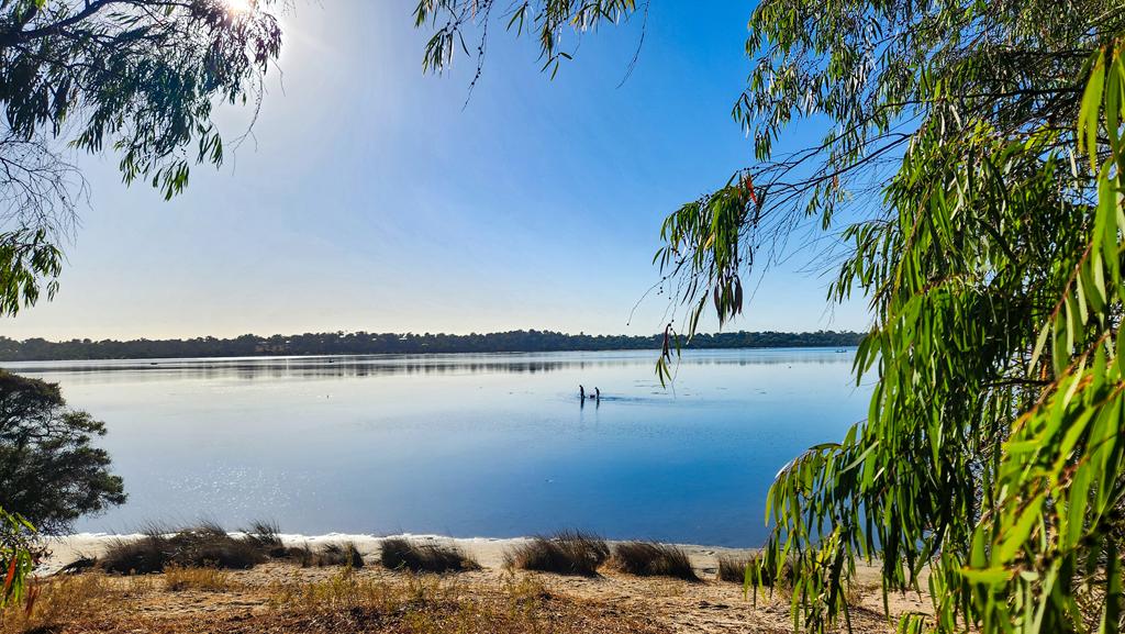
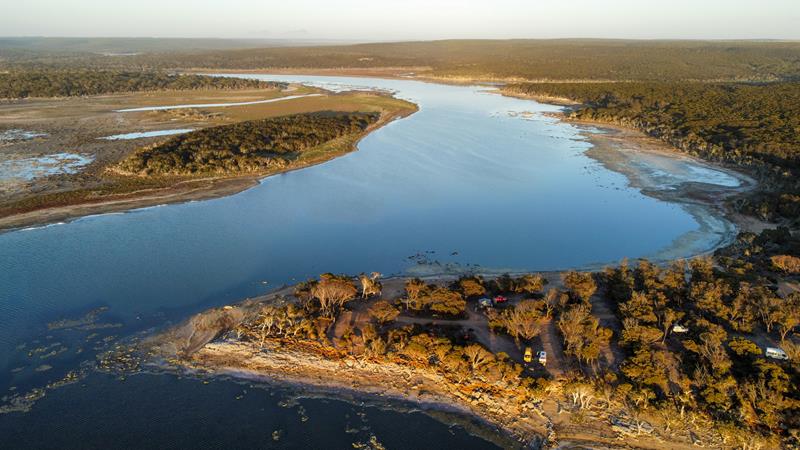
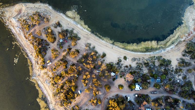
Less than 2 hours drive from Perth, Belvidere campground within Leschenault Peninsula Conservation Park is an ideal option for a quick getaway from Perth. The campground is set among beautiful Tuart trees with lots of wildlife around.
Facilities
The campground is a medium size, equipped with two toilet blocks on different ends. The place is easily accessed with a 2WD, although the last 4 or 5 km is a dirt corrugated road. Campground is suitable for all types of vehicles and set ups. Having said that, please note that reversing in a caravan or trailer might be an issue due to poles separating the parking and tent area. Sites have picnic tables and fire rings.
A pro-tip for future visitors: the mosquitoes are quite persistent, so definitely come prepared with repellent and maybe some coils to keep them at, especially in the evenings!
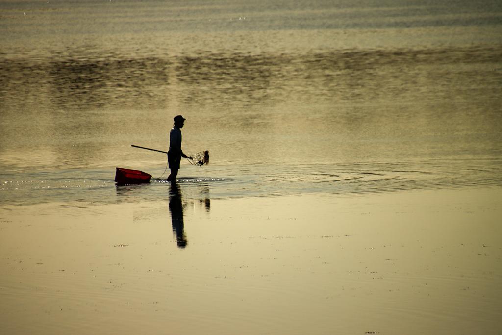
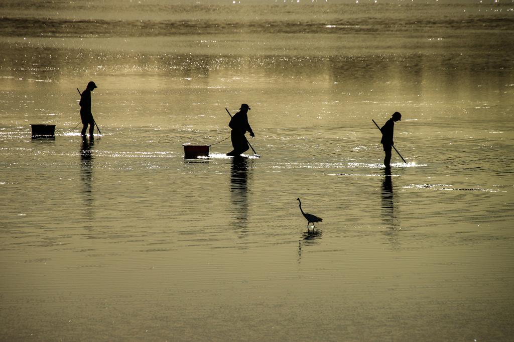
Fishing, especially crabbing is a popular activity there.
There are also a few easy walking trails, varying in length. You can walk from the campground to the estuary and picnic area, along the estuary and all the way to the beach.
If your idea of leisure is a swim or a slow beachcombing wander, Belvidere Beach lies only 2.5 km away. It’s a quick five‑minute drive or a pleasant 25–30 minute walk through tuart and peppermint woodland.
Wildlife
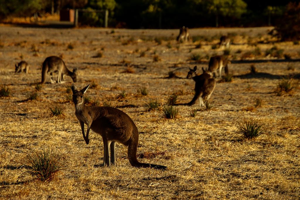
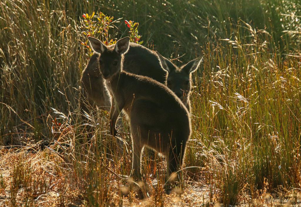
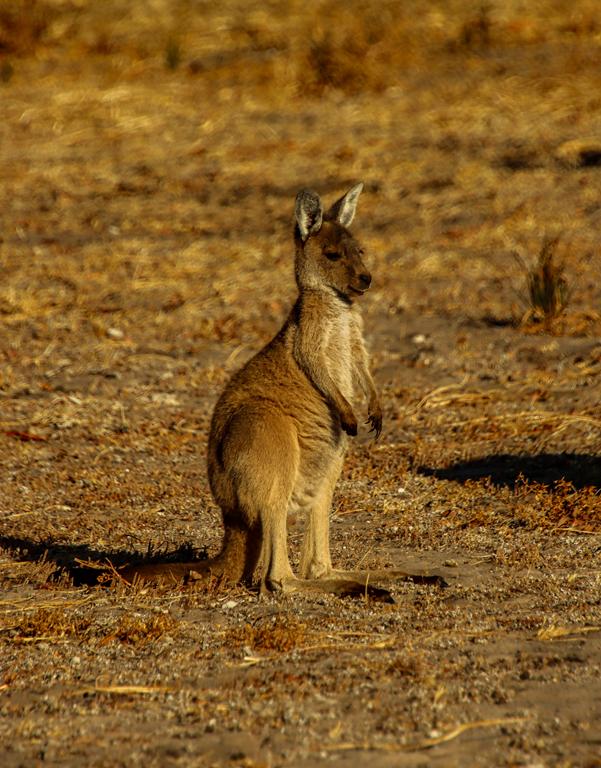
Expect to see kangaroos hoping around the tents. They are even in much bigger numbers near the estuary, which is a fantastic spot to see these incredible marsupials grazing. You can see and, even more so, hear many parrots in the Tuart trees.
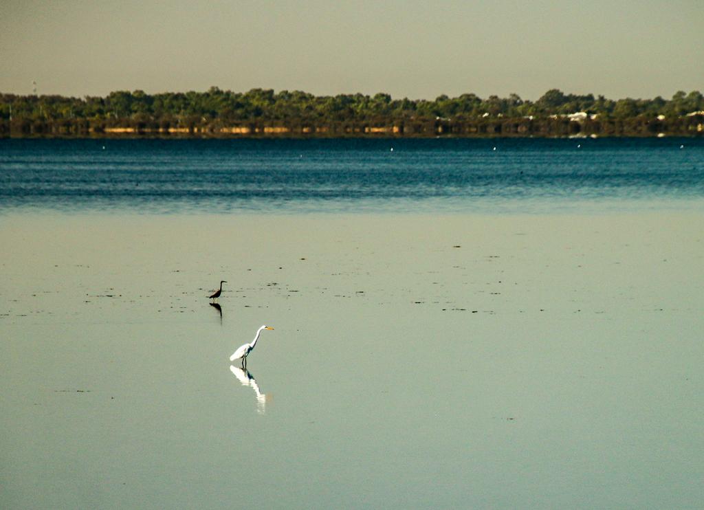
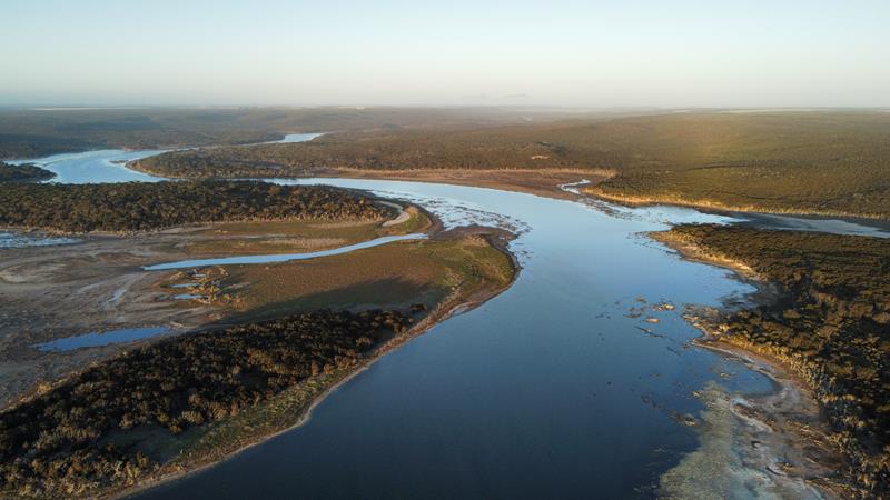
Leschenault Estuary is a haven for waterbirds, with more than 60 species recorded.
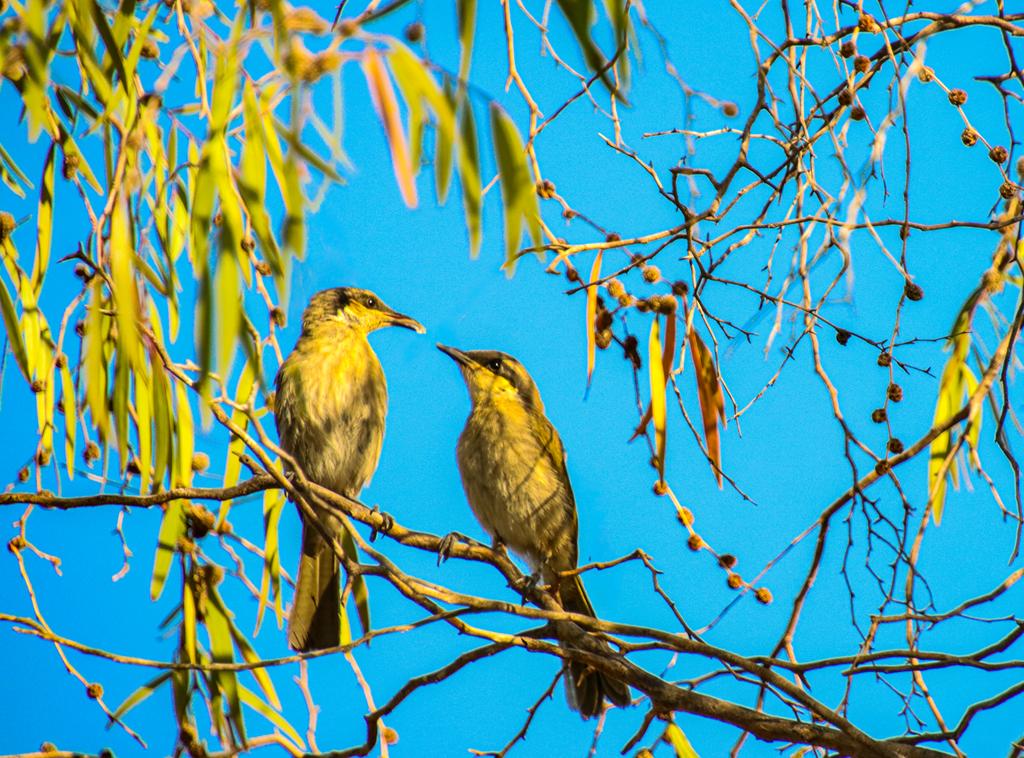
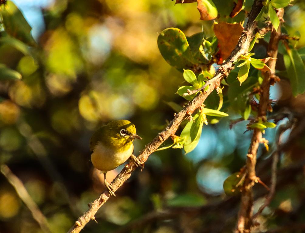
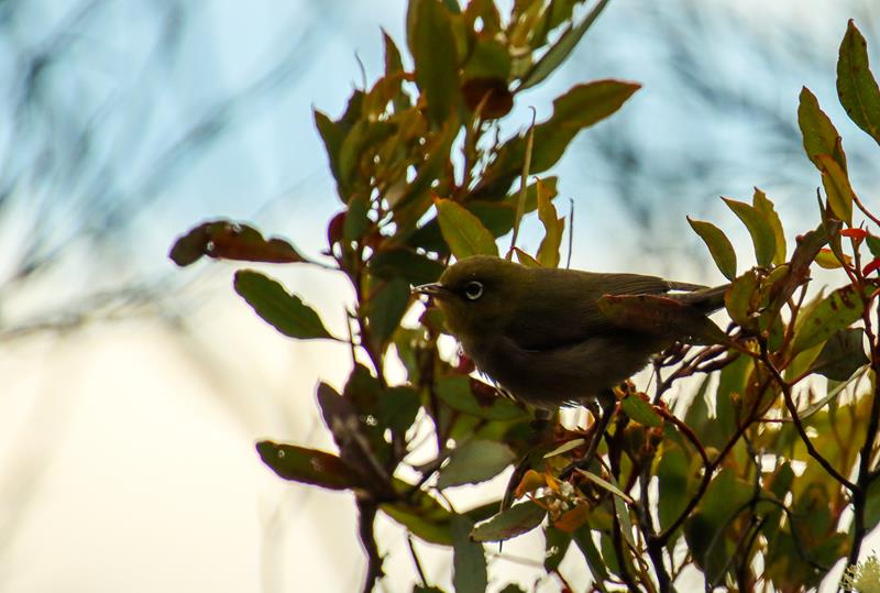
Bush birds are also abundant here, filling the mornings with cheerful birdsong.
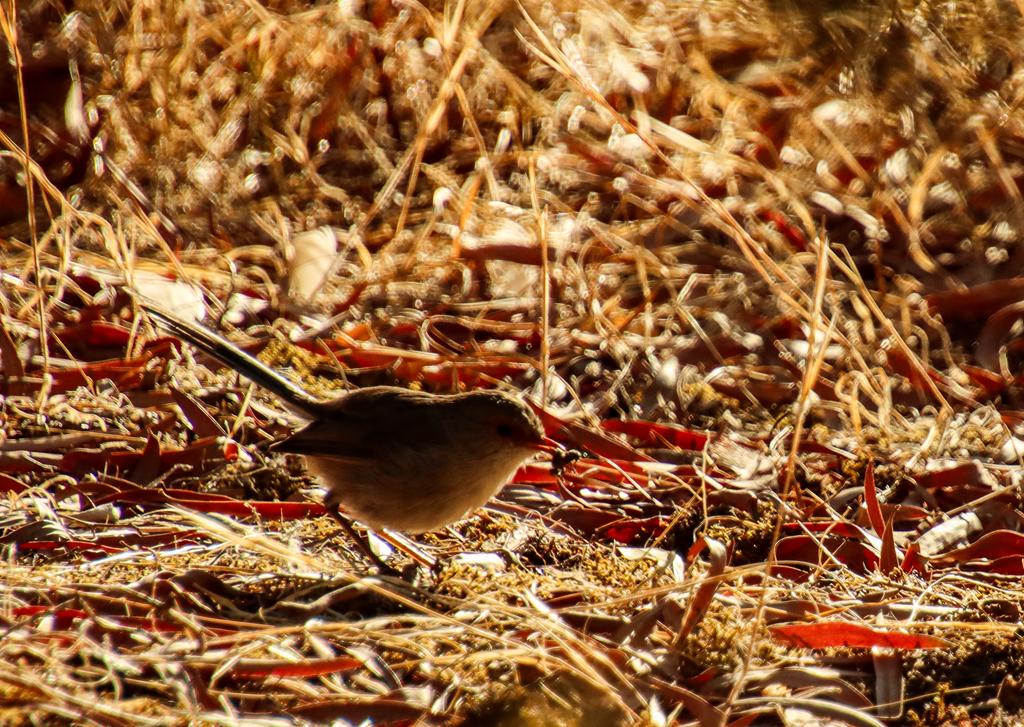
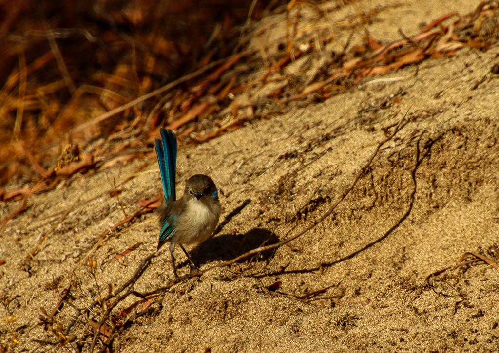
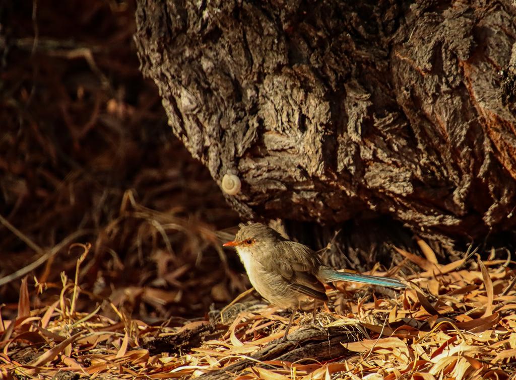
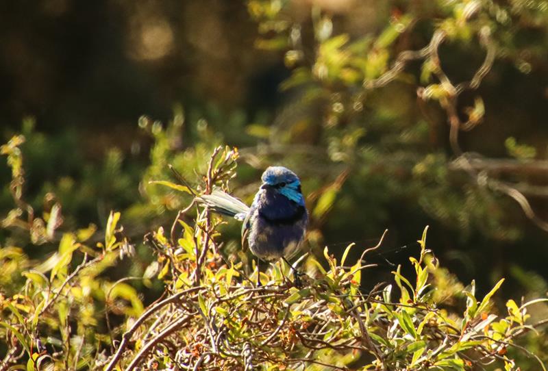
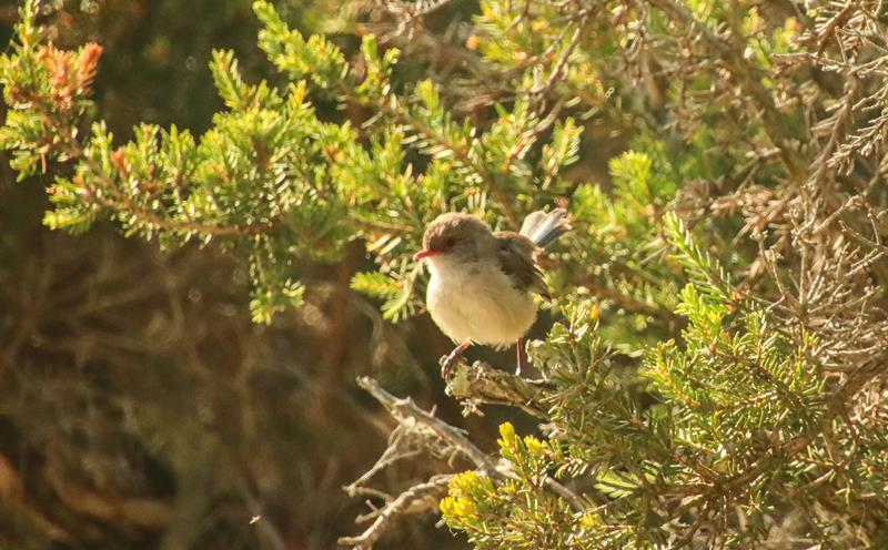
Splendid fairywren female with an insect (above left), splendid fairywren non-breeding male (above middle), splendid fairywren female.
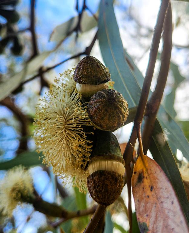
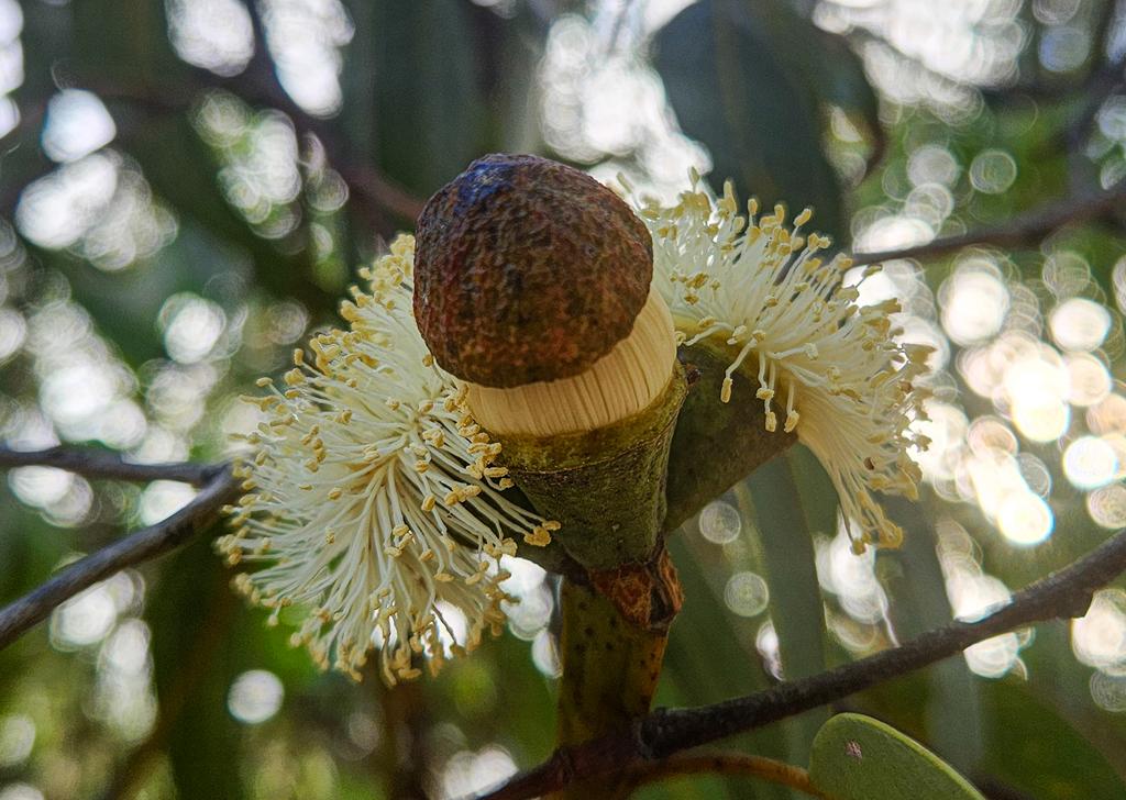
If you love flora, you will appreciate the beauty of magnificent tuart trees. This Eucalyptus gomphocephala can reach 40m high with a 25m branch span. A true giant with stunning, cone-budded flowers. Simply mesmerizing!
Photography
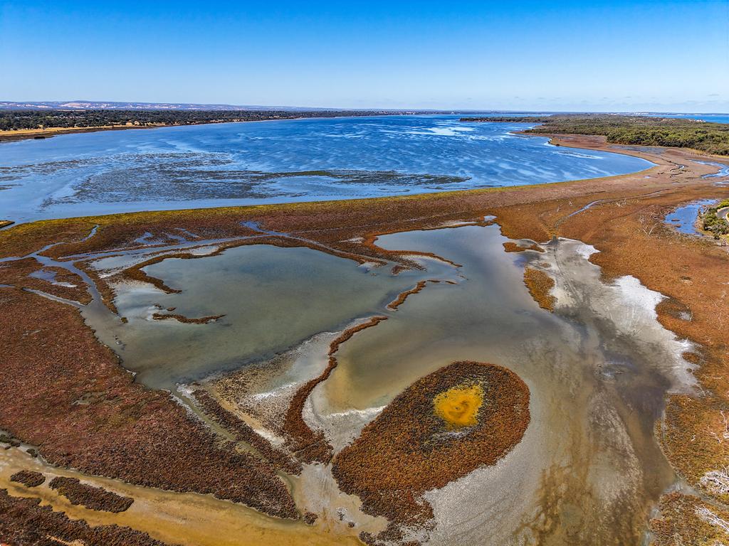
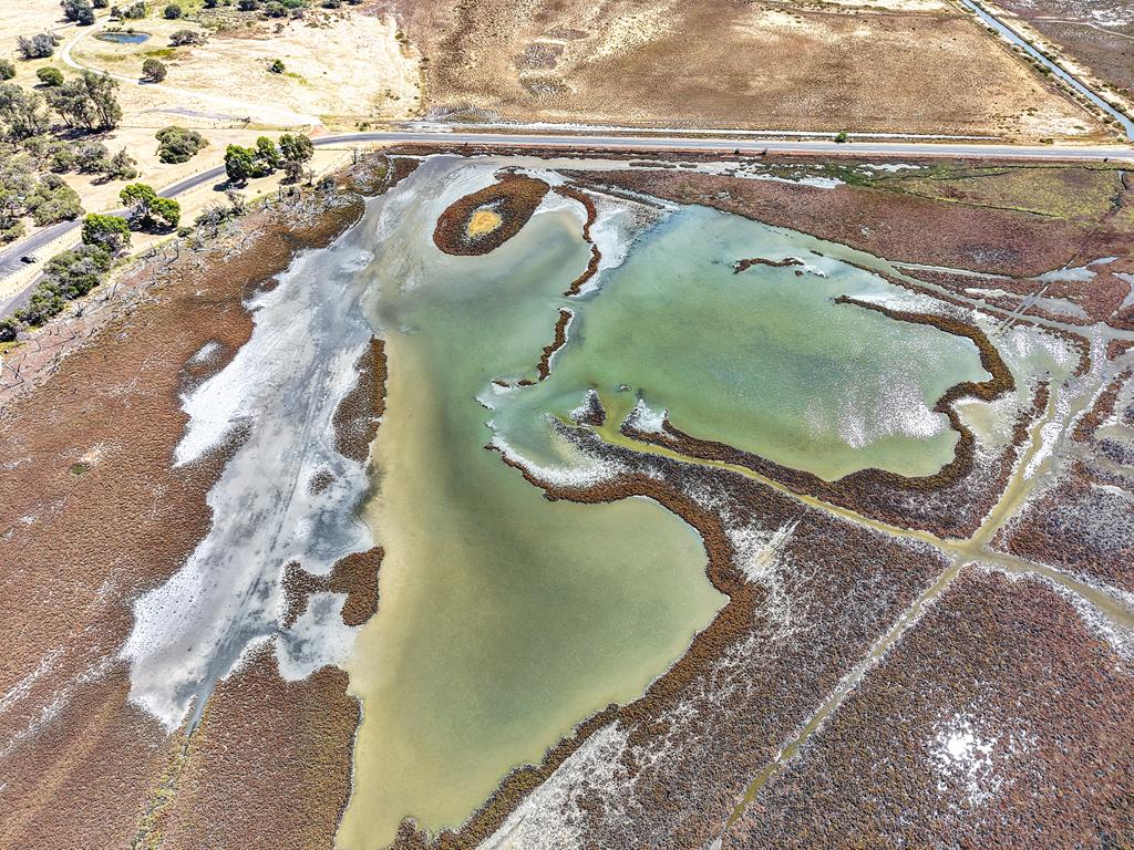
Apart from wildlife photography, Leschenault Estuary offers many opportunities to capture beautiful shots. The drone’s eye view showcases the stunning contrast of deep blues and earthy marsh tones, forming intricate patterns unseen from the ground. It’s a reminder of the hidden artistry all around us.
Where is Belvidere Campground
Belvidere Campground sits on the Leschenault Peninsula, about 20 km north of Bunbury. It’s part of the Leschenault Peninsula Conservation Park.
So, why such an interesting name and what does it mean – Snottygobble? It is actually a tree, also known as Persoonia longifolia, which grows in abundance at Snottygobble Loop campground.
Camping location and facilities
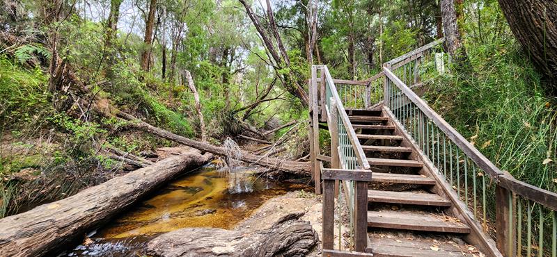
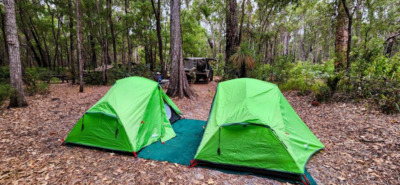
Snottygobble Loop campground is located at the border of D’Entrecasteaux National Park and Greater Hawke National Park in Australia’s Southwest. It is a secluded little campground near Carey Brook and amidst thick jarrah-marri forest. There are 11 campsites, including 1 group site. The sites are suitable for tents and swags only, as the barrier prevents you from reversing in. Entrance to individual campgrounds is narrow in most cases, so putting an awning might not be possible. We couldn’t open ours but luckily we didn’t need it). Some sites have picnic tables, others have fire rings to be used between April and November. Only two sites have both picnic tables and fire rings (2 and #8). There are drop toilets and a communal shelter, which can be considered as a kitchen. The sheltered place has a table and a water tank with non-portable water.
Things to do
The best thing about the campground is that it is quite secluded, if you want privacy. Although, the forest amplifies all the sounds, so there is very good acoustics there 😊. There are nice walking trails along the Carey Brook. You can walk to the next campground (Grasstree Hollow), which is only 2km away. You can also walk in the opposite direction to Goblin Swamp. Or you can drive a few more km to Donnely river and launch your boat there.
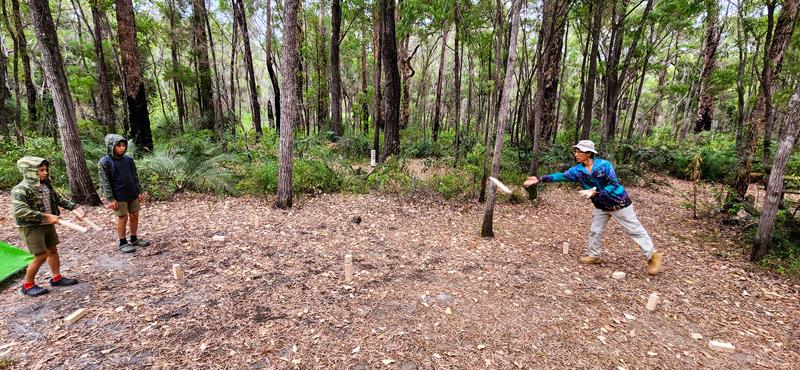
It was a relaxing holiday that we spent at Snottygobble Loop campground. We played games (and we don’t often do that 😊), did some walking, visited ice-creamery and chocolate factories.
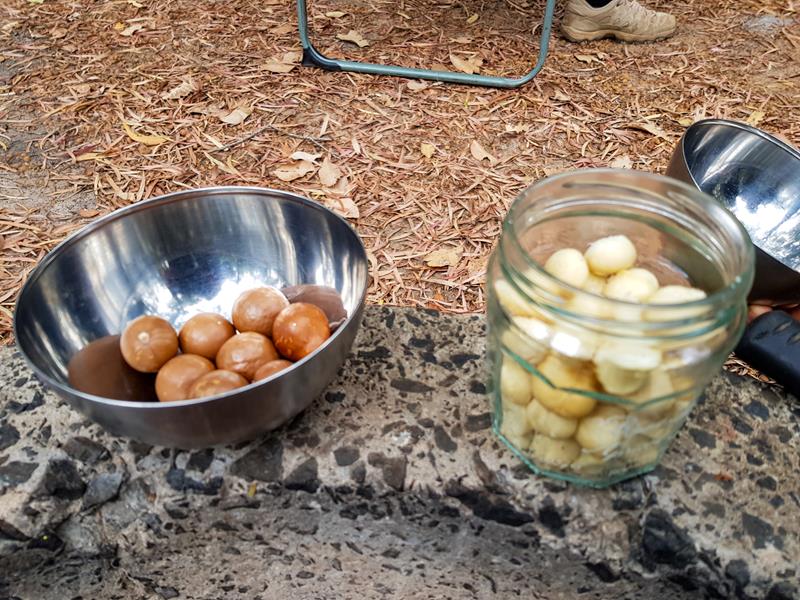
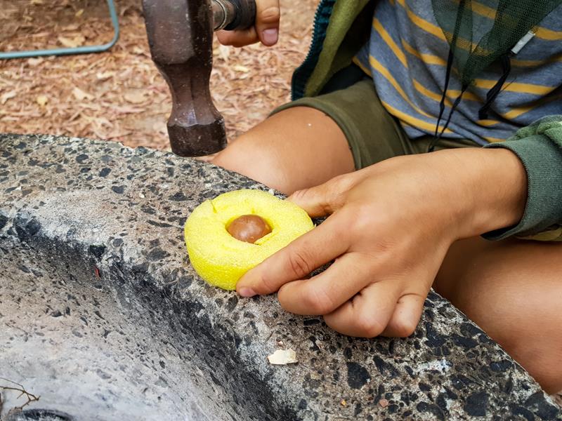
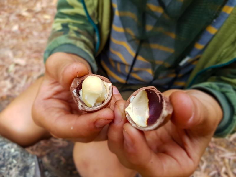
We also bought a bag of shelled macadamia nuts from Nannup and kids had a good time cracking them (all of them!)
Goblin Swamp is 2km away from Snottygobble Loop campground. It is an interesting place, with a mixture of mystery and spookiness in it. It was dry when we visited it in January and the roots of the paperbark trees were exposed. They were also burnt a few years ago. Now, still looking black with a contrasting new bright green growth, the trees look quite eerie. Goblins are said to live there too 😊.
Fees and bookings
Technically, Snottygobble camp is in Hawke National Park, so there is no park entry fee. Camping fees are $15 per person per night and you need to book the sites online via Parkstay WA. We camped at Snottygobble during Australia Day long weekend in 2025. The campground was fully booked, although 1 or 2 campgrounds were empty. Our neighbour had to relocate to Warren NP after 1 night, because his site was booked, but no one arrived that night.
In conclusion
We generally prefer camping by the beach where we can see sunrise and sunset, but with everything being fully booked weeks and months ahead, we were happy staying in the forest for a change :). It is a nice campground, if you don’t mind staying in tents/swags and don’t need lots of space around your vehicle (e.g. for an awning).
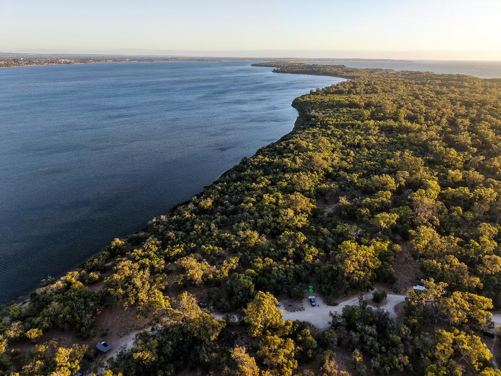
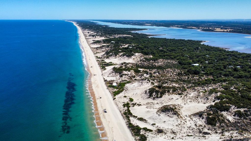
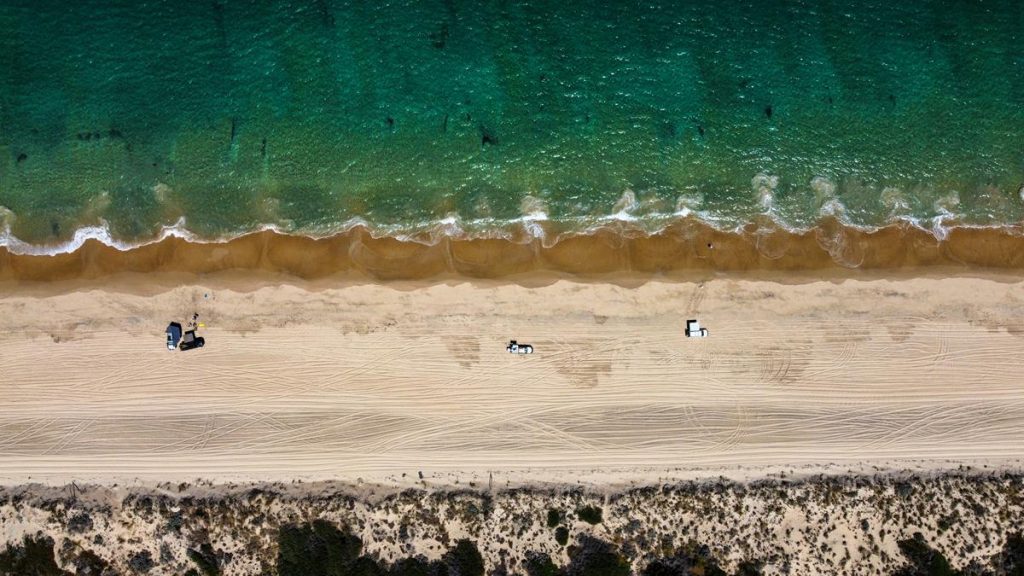
Myalup beach is one of the 4WD beaches along the 60km stretch (between Tims Thicket to the north and Binningup to the south). It is a beautiful beach with soft white sand and spectacular colours of the ocean.
The sand dunes separate the ocean and Lake Preston running parallel to the coast for many kms. From the bird’s eye view, this looks quite amazing. The access to Myalup beach is very easy, right from the carpark.
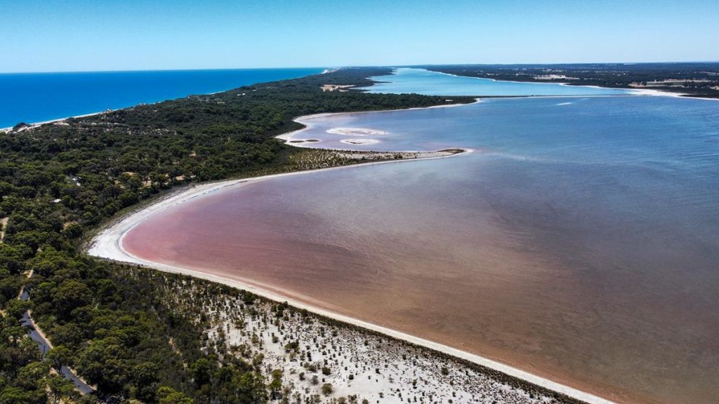
Lake Preston near Myalup beach
Lake Preston, just north of Myalup, is an usual lake. Stretching for 30 km, it is the longest lake in Yalgorup National Park. It is also the closest to the coast. The lake is shallow and very saline, providing favourable conditions for salt-loving halobacteria to flourish which makes the water turn pink. Looks amazing from above!
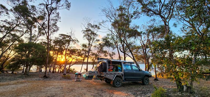
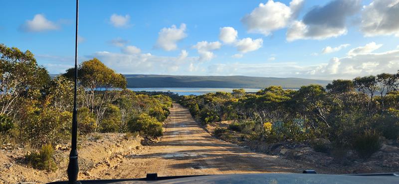
Millers Point bush camp ground turned out to be much better than we expected. Located on the shore of Beaufort Inlet, it is easily accessable, being only 6km dirt road from Borden-Bremer Road, 50km west of Bremer Bay in the Great Southen region of Western Australia.
Not just overnight stop
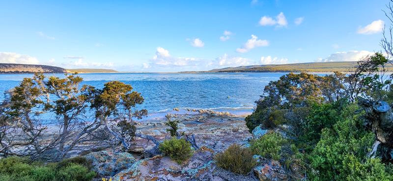
Millers Point bush camp can be used as a base to explore all the beautiful beaches around Bremer Bay, or you can stay at the camp, relaxing and enjoying the nature. The inlet is beautiful.
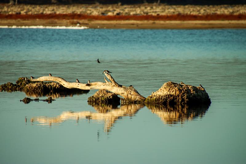
There are many birds to watch there, both on shore and in the trees and bushes.
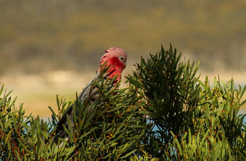
Above: Silvereye (top left), Blue Wren male (top middle), Blue Wren female (top right), Galah (bottom left), Welcome Swallows (bottom right).
There are easy bush walks around and 4WD tracks nearby to test your limits. One of the attractions at Millers Point camp is Crocodile Rock, which is part of 1,5km walk to the lookout. It is particularly impressive at sunrise. I took this picture just before 5am. Things that you do when you want to take good photos :).
You can also go fishing and kayaking at the inlet.
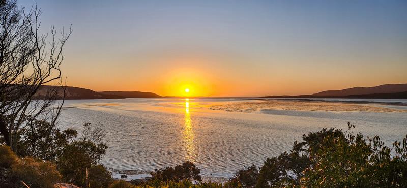
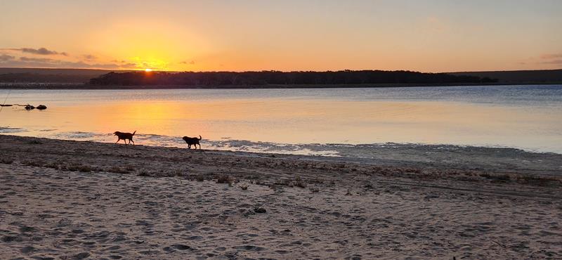
The beauty of camping at the inlet is that you don’t need to walk far to enjoy sunset. This was pretty much the view from our camping spot at Millers Point bush camp.
Cost and facilities
The campground has basic facilities, like renovated toilet (well-stocked with toilet paper) and bins. The cost is $10 per night per person (no charge for kids), which is only half of what we would have paid staying at the national park with the same facilities for a family of 4. Friendly on-site care-taker Frank collects the money and looks after the place quite well. The camp area is quite big, with no defined spots, so you are almost guaranteed to have one, even when arriving late.
Dogs and campfires (in season) are allowed.
In conclusion
We spent wonderful 3 nights at Millers Point over the Xmas period, enjoying the place and the company of friendly neighbors (Liz and Hank). It is one of those places that we would like to visit again.
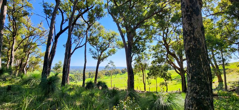
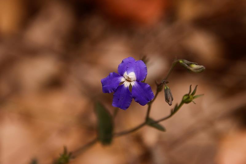
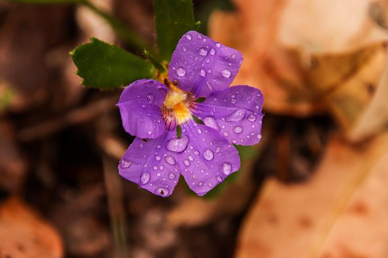
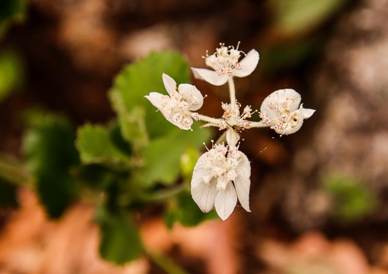
Harvey Wildflower Ridge Walk is a must for wildflower enthusiasts. The walk is 1,4km loop and is quite easy with a few manageable slopes. As you climb higher, you will enjoy beautiful views of the ridge and nearby Harvey Dam. The trail is open all year round but is best enjoyed in spring when masses of wildflowers are blooming. These pictures were taken early October.
Boronia species (above left), Cowslip orchid Caladenia flava (above top right), Diuris longifolia Purple Pansy Orchid (above bottom right).
Stylidium androsaceum Book Triggerplant (above top left), Stylidium schoenoides Cow Kicks Triggerplant (above bottom left), Thelymitra macrophylla Scented Sun Orchid (above right).
Harvey Wildflower Ridge Walk location and extra info
Harvey Wildflower Rige Walk is located just outside of Harvey, in the South West, under 2 hours drive south from Perth. It is on Honeymoon Road, off South Western Highway.
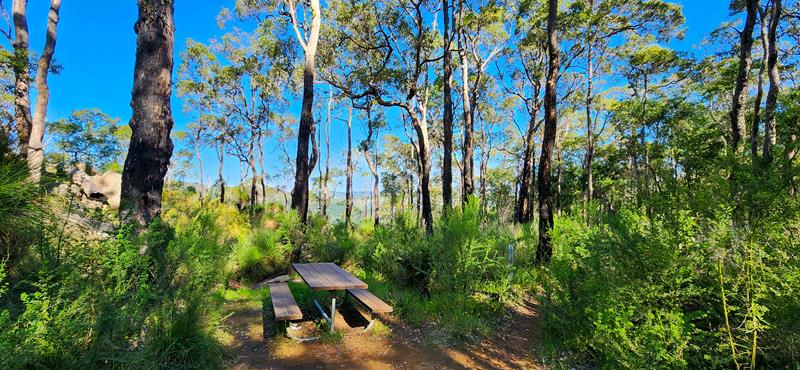
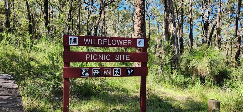
There are secluded picnic facilities with gorgeous views but no toilets. Dogs are not allowed.
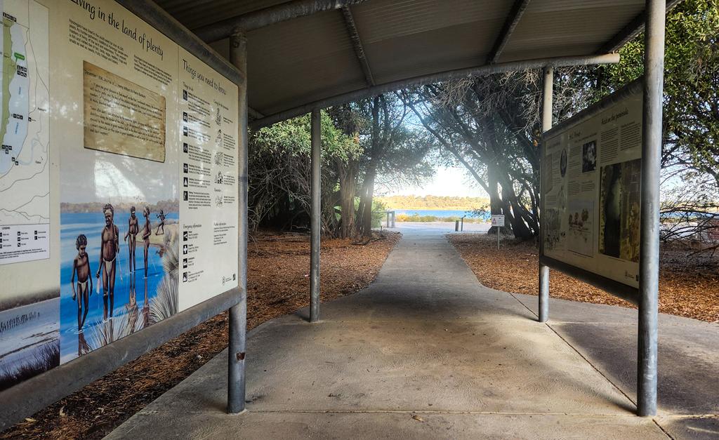
Leeuwin-Naturaliste National Park is undoubtedly one of the most popular attractions in Western Australia. Firstly, it is the best place to explore amazing cave formations, which are more than a hundred in the region, although only a few are open to public. Secondly, you can get up close to stingrays which frequent the waters of Hamelin Bay. Additionally, Leeuwin-Naturaliste National Park offers spectacular coastline with many beautiful swimming beaches, world-class surfing spots and fishing locations. Stretching for 120km along the coast in the South West, from Cape Naturaliste in the north to Cape Leeuwin in the south, the park is also known for its “Cape to Cape Walk” that so many locals and tourist alike undertake all year round. Lastly, Leeuwin Naturaliste NP is just next to famous Margaret River, where you can indulge in gourmet food and wine experience. To emphasise, this is one place to explore!
Caves of Leeuwin-Naturaliste National Park
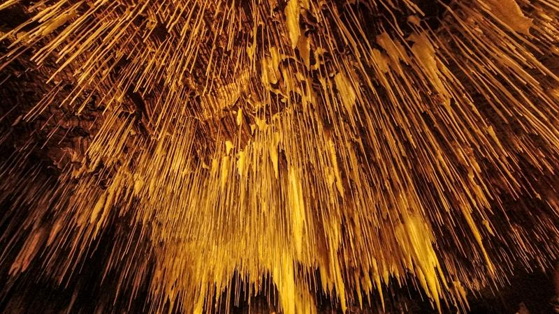
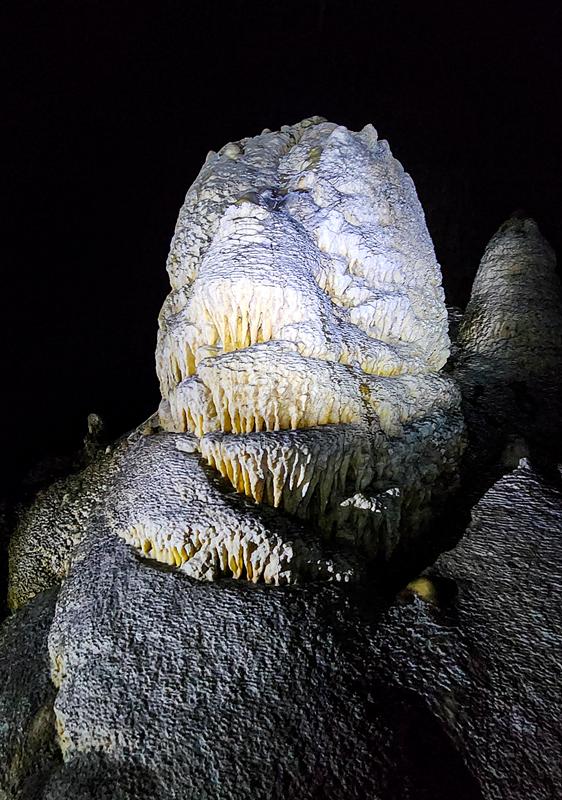
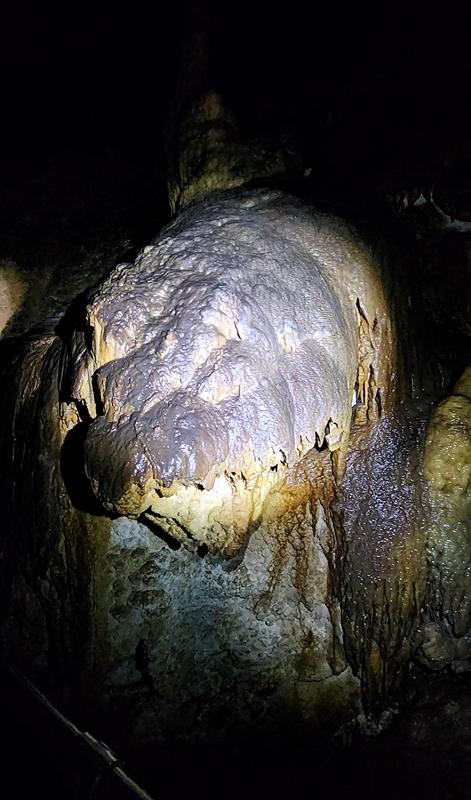
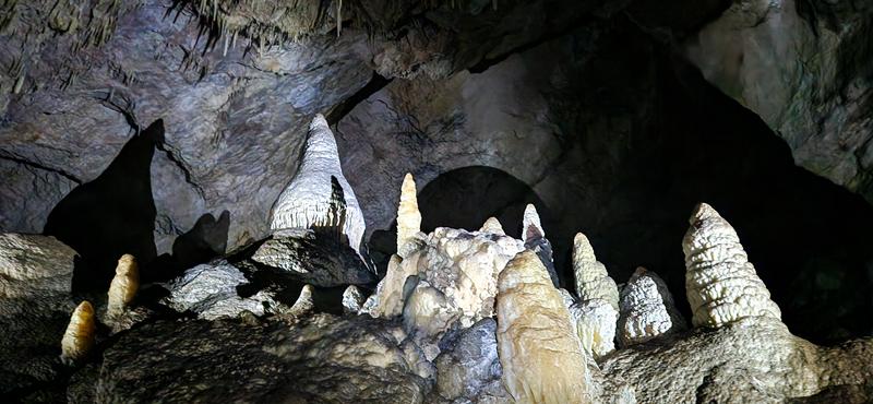
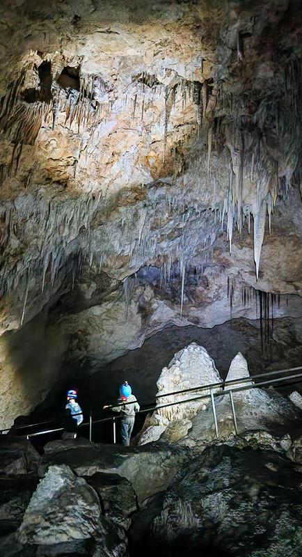
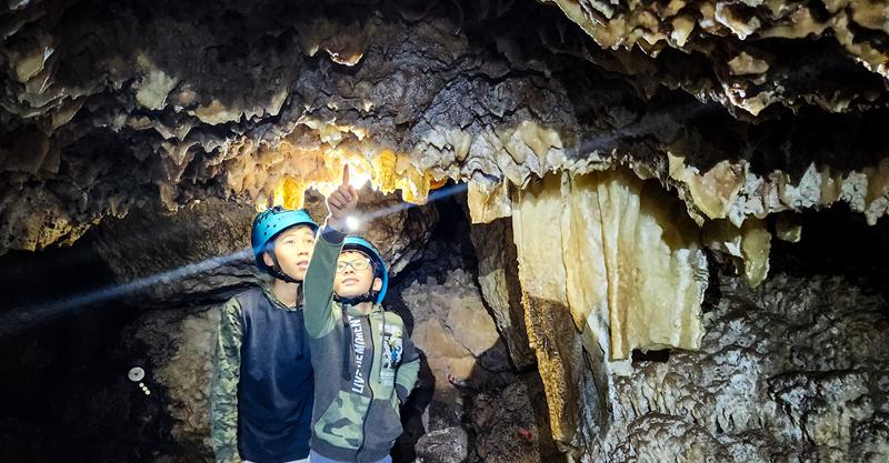
Spectacular limestone caves lying underneath the ground are unquestionably a reason to visit Leeuwin-Naturaliste National Park. One can marvel at immensely beautiful stalactites, stalagmites and shawls, created by nature over the period thousands of years. While there are more than hundred caves in Leeuwin-Naturaliste National Park, only 6 of them are open to public.
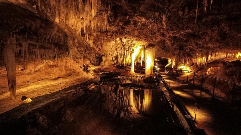
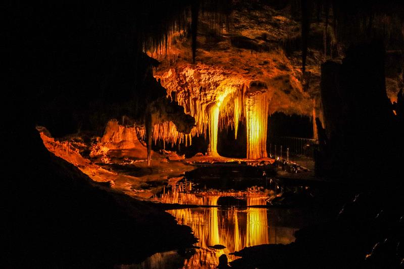
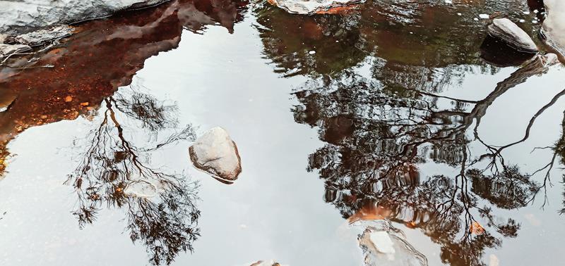
Lake Cave
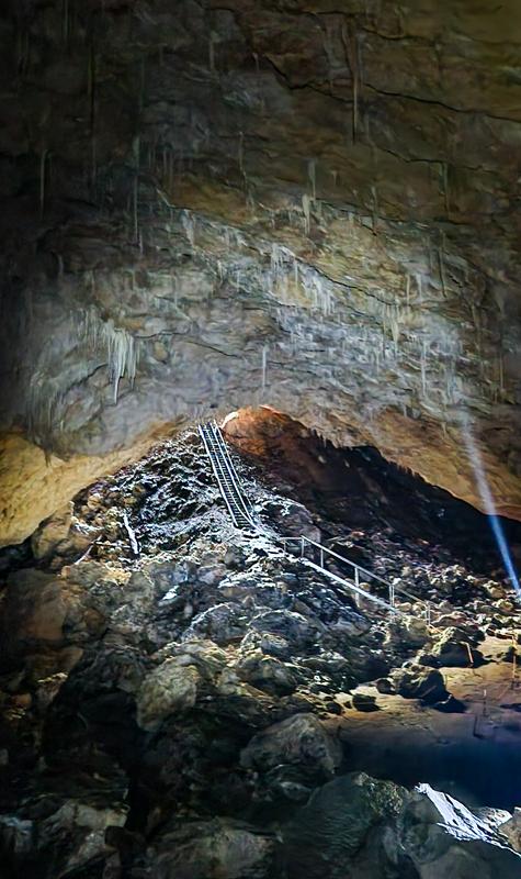
It is easily accessible, just off Caves Road. While Lake Cave is the smallest and not the grandest of all the caves open to public, it is our favourite. As the name suggests, there is a permanent lake inside the cave, in which you can see beautiful reflections of stalactites and straws. Even though the cave is not big, there are 350 steps to climb down (and then back up), hence one needs to be reasonably fit to accomplish this (our then 8- and 11-year-old kids were well ahead of me, jumping like monkeys over the steps!)
Lake Cave
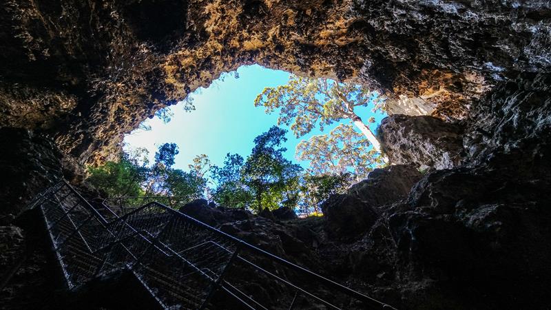
The entry to the cave (half way down the steps) is through a big sinkhole. Once you are down and inside, looking up into the sky through that hole is particularly an amazing experience.
Entry to Lake Cave
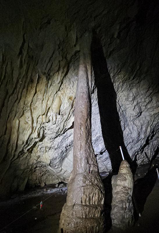
Another beautiful thing about this cave is Suspended Table – two massive columns hanging down from the ceiling, attached to the sheet of flowstone. Over the years the cave’s sandy floor has been completely washed away. As a result the whole structure, weighing several tones, floats on the surface of the lake.
Lake Cave is alive. Once inside, with the lights turned off you can tune to the silence, in which you can hear droplets of water dripping constantly from the tips of straws and stalactites.
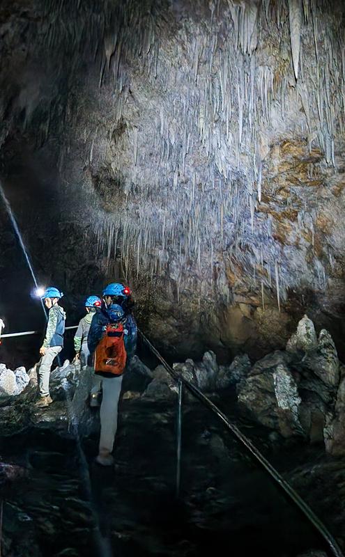
Entry to the cave is with the guided tour only. It is worthwhile to book in advance, especially during public and school holidays. We highly recommend this experience and are looking forward to visiting other caves in this region.
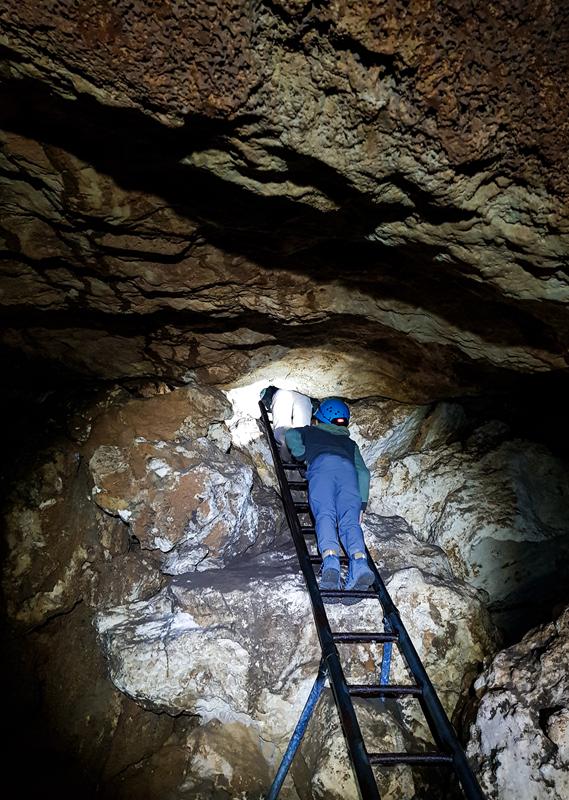
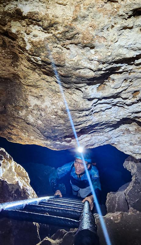
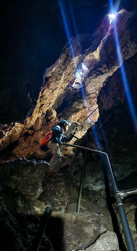
Giants Cave
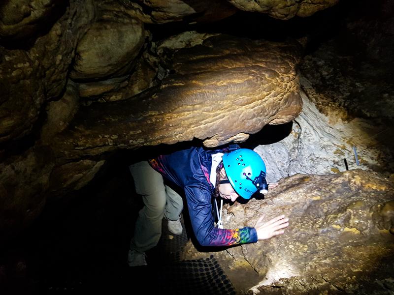
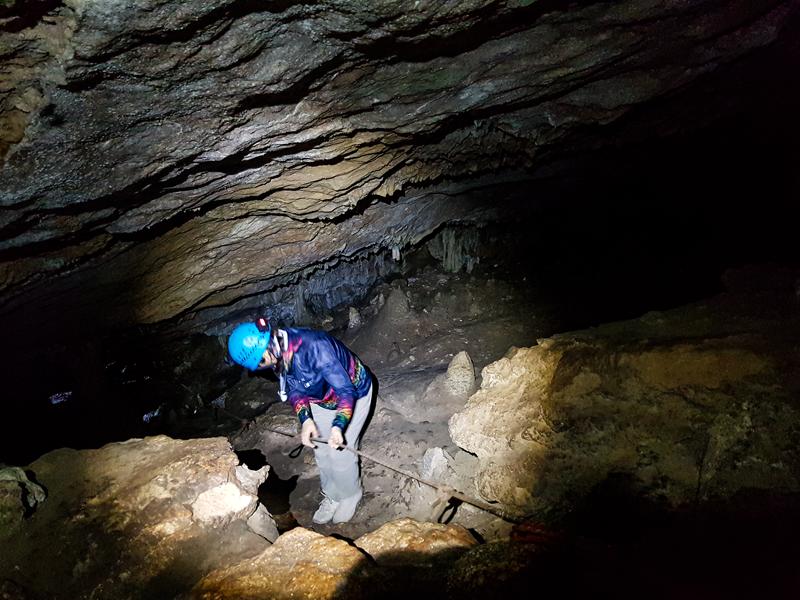
While Lake Cave is the most beautiful, in our opinion, Giants Cave promises the most fun and adventure. It includes climbing vertical ladders, scrambling over rocks, using ropes to get down steep slides.
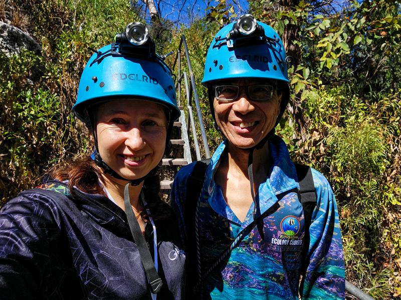
In addition, you need to squeeze through tight spots (eat more salad and not burgers, if you want to attempt that 😊). It is fun for children and adults alike, if you are up to adventure. Climbing the cave requires some degree of fitness. I felt like I had a very good workout after climbing out of the cave. There is no guide, so you explore this cave on your own, which is part of the fun! Inside it is completely dark but friendly staff provide helmets (really a must!) with torches, as well as brief explanation of what to expect to see.
Apart from the fun part of climbing rocks and ladders, there are beautiful chambers. One of them has a pretty name Ballroom. At 70 meters long, it is indeed big enough for a good dance 😊.
Like in any other limestone cave, you will see many nice nature-crafted decorations, which are very fragile.
Giants Cave is the deepest cave in the Margaret River region at 86 meters deep. It is 575 meters long and takes on average an hour to explore. Check out our short reel about this fun cave on Youtube,Tiktok or Facebook.
Giants Cave is located 20km south of Margaret River town, on Caves Road. It is easily accessible. The cost of visiting the cave is $19 ($9.50 for a child). Being one of the hardest caves to climb, minimum age to visit is 6 years old. It is also one of the quietest caves. For that reason you do not need to book in advance, even during public holidays.
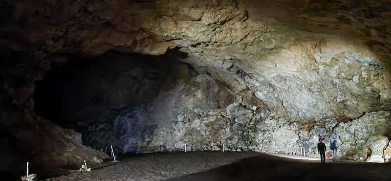
Mammoth Cave
It’s a surprisingly big cavern, although not the largest, filled with striking stalactite and stalagmite formations. It is best known for the fossil remains of long‑extinct Australian megafauna.
The walk is easy overall, even with the 160 steps at the exit. The cave is open for self‑guided audio tours, so there’s no need to book ahead. Here is a short reel about the Mammoth Cave.
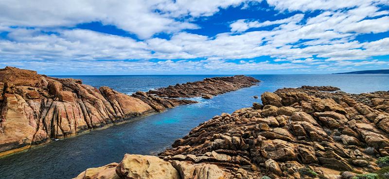
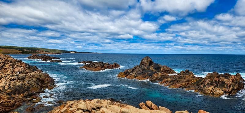
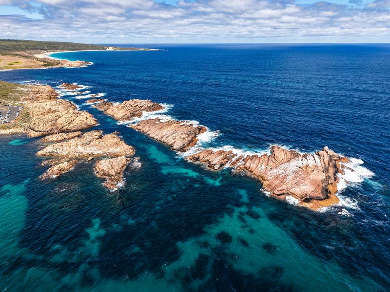
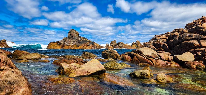
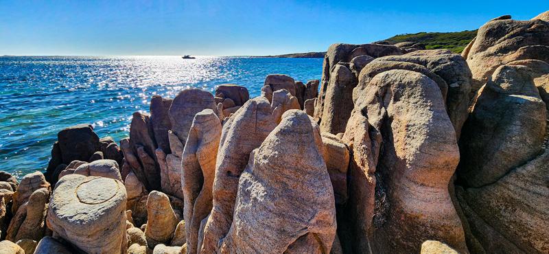
Canal Rocks
Canal Rocks is a natural attraction in Leeuwin-Naturaliste National Park. Over a period of thousands of years, mighty Indian Ocean has carved and sculptured granite rocks, cutting through them. This eventually resulted in a narrow channel between the rocks. The views of the canal rocks are simply amazing, no matter where you look from – from above , the bottom of the rocks or the side. Nature is so creative when it does its job. You can climb the rocks or walk across a boardwalk.
Canal Rocks are 4km south of Yallingup, via Canal Rocks Road.
Swimming and stingrays at Hamelin Bay
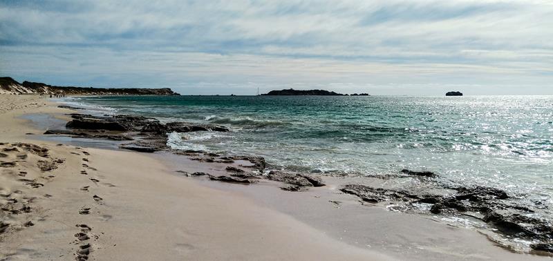
Hamelin Bay is a beautiful beach between Cape Leeuwin and Cape Naturaliste. It is a long stretch of white sand, turquoise water and coastal cliffs. Being sheltered and protected from the strong winds, Hamelin Bay is great for swimming, snorkeling, as well as fishing. It is especially popular as a place to spot stingrays, which frequent the bay and can get quite close to the shore.
Unfortunately, we didn’t see any (I suppose the timing was wrong – we visited Hamelin Bay in the afternoon, late January). Despite that, we still enjoyed walking on the beach, spotting Sooty Oystercatchers and Liolophura hirtosa (below).
Apparently, you can also drive on the beach (not from the main beach entrance). I learnt that by walking along the beach and spotting tyre tracks, a sign and vehicles in the distance.
Margaret River Mouth
Another place worth visiting is Margaret River Mouth in Prevelly. This is where Indian Ocean meets Margaret River. In summer the river is isolated from the ocean, creating a shallow warm pool, popular with families, as well for canoeing. You can even walk across it to the beach when the conditions are right. The beach itself is 500meter long, partly protected by the reefs. It can be windy there, which creates good surfing opportunities, albeit for beginners. Also there are excellent facilities with toilets and showers at the carpark.
World class surfing at Surfers Point
Surfers Point is undeniably one of the best places to go surfing and kite surfing. It is a prime location especially for advanced surfers, because the waves here are guaranteed year-round, reaching the height of 7-8 meters. A variety of breaks means that there are swells offering varying difficulty. For us, not surfers, it was fun and thrill to watch a group of surfers of various capabilities and experience to jump above the waves, fall into the water, get up and do it all over again time. For one thing, these surfers possess so much strength (mental and physical) to handle the cold, strong winds and numerous falls into the water.
Cowaramup Bay
Cowaramup is a small town known for its 42 life-sized fibreglass cows scattered around the town. It has many other attractions. Millers Ice Creamery was our favourite :). The beaches there are also worth visiting. Cowaramup Bay and particularly Gracetown Beach has interesting rock formations, which make an ideal subject for photography. Add to this clear blue waters, boat in the distance… You see the picture :).
Camping at Conto’s
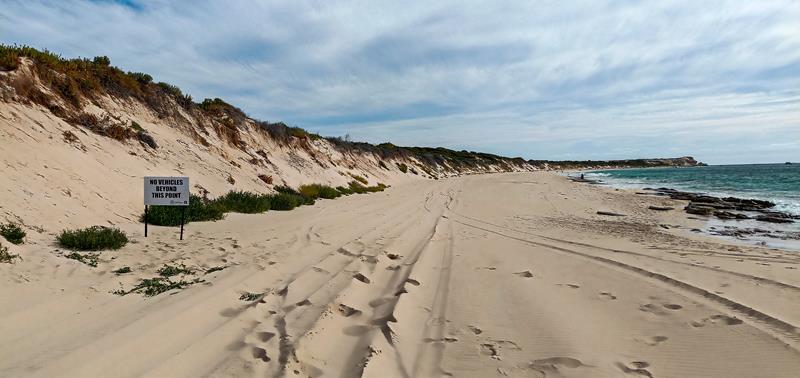
If you are looking for nature-based camping, look not further than Conto campground. It is a huge campground, 19km south of Margaret River, off Caves Road, just next to Lake Cave and 4km from the beach. Being close to all the main attractions in that region, it is a popular place, especially with families. Nestled among peppermint and grass trees, there are over 100 campsites located within 8 camping areas, arranged in loops.
All camping areas have drop toilets and non-drinking water and some (bigger ones) have shelters, bbqs and dishwashing facilities. Only 2 camping areas (Chudith and Quenda) are suitable for caravans and trailers. Others are for tents and swags, because you can’t reverse in and consequently have to park behind the poles. Some sites have low clearance and narrow parking, and as a result you won’t be able to open your awning.
We stayed at Hamelin in 2023 and were fine with that arrangement for this trip. The cost of the campground was $15 per adult per night. Extra facilities include table and fire ring for each camping spot, chopped wood and rubbish skip bins. Sites need to be booked online via Parkstay site. Being a national park, no dogs are allowed at Conto.
Two years later we stayed at Conto’s again. The price has gone up to $20 per person per night since then. We find it too expensive. In 2025 we stayed at Davies loop. The tiled toilets looked nice but we felt it was unnecessary luxury for bush camping. This did not justify the price increase, in our opinion. But, as the saying goes, beggars cannot be choosy. It is becoming increasingly difficult to find a camping spot close to Perth at a short notice. This campground had availability at the time of booking. So we decided to stay there and enjoy all that Margaret River had to offer.
If you camping at a large campground is not your cup of tea, we recommend camping at Boranup Campground, which is small and secluded.
Conto beaches
There are some good beaches in Leeuwin-Naturaliste National Park. Conto Spring Beach is 3km drive from Conto campground, just off the Caves Road, in the Margaret River region. It is accessible to all vehicles. The beach is great for swimming (on calm days), fishing, surfing and just exploring as it has beautiful rock formations and rock pools. Interestingly, the name of the beach comes from the actual freshwater spring that flows from the limestone ridge into the sand. “Cape to Cape walk track” passes through this beach.
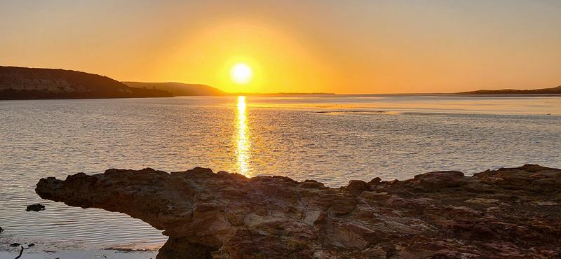
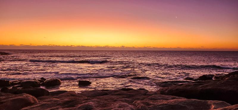
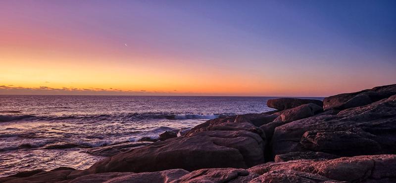
Sunset is always a special time at the beach.
A short driving distance from Conto Spring are a number of points of interest. We Round Rock and Merchant Rock of particular interest, both offering spectacular scenery. Merchant Pool has lots of rocks to climb and powerful waves to watch as they crush against the rocks, creating massive splashes. Not only the beaches are spectacular, but they are also great for fishing.
Below: Merchant Rock (left), Round Rock (right).
Small things to observe at Leeuwin-Naturaliste
Emu, the second-tallest bird (after the ostrich) and can only be found in the wild in Australia, where it is the largest bird (below left).
Welcome Swallow, a small and fast-flying bird (below right).
In conclusion
We hope you have most compelling evidence to visit Leeuwin-Naturaliste National Park. It is easily accessible, there is no entry fee and there is so much to see, do and wonder at, that without a doubt, you’ll find something for yourself there. We certainly didn’t see and experience everything and need to go back.
Do you have a favourite place or experience in Leeuwin-Naturaliste National Park?
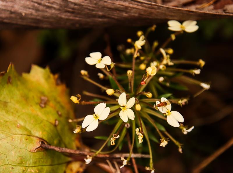
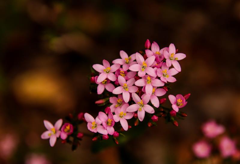
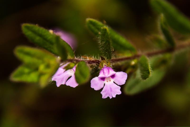
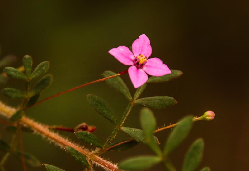
Wildflowers at Mount Frankland can be found blooming throughout the whole year, as different flowers bloom at different times of the year. We found Mount Frankland National Park quite abundant in wildflowers when we visited it early January. Below are some of the wildflowers we have seen and photographed.
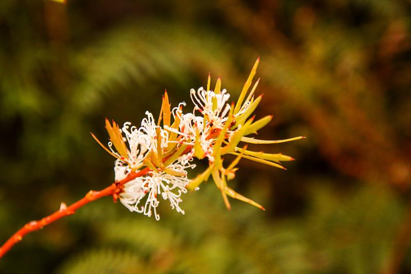
Top image: Tattered Trigger Plant (Stylidium laciniatum)
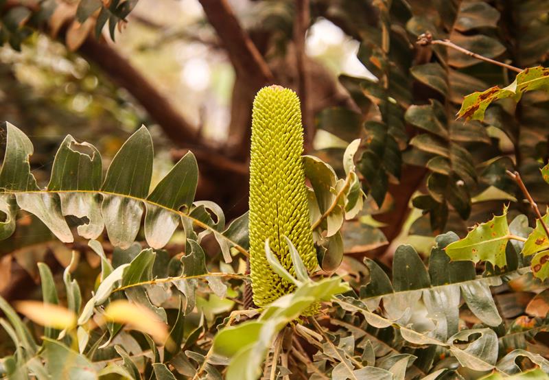
Below left: Bull Banksia Banksia grandis. Below middle: Candle-spike Hakea Hakea ruscifolia. Below right: Fly-away Trigger Plant Stylidium caespitosum.
Mount Frankland National Park, 29km north east of Walpole, in the South West, is part of the Walpole Wilderness. It is the area of wild landscape that is untouched by human activity and any technological intervention. You can have a bird’s eye view of that wilderness that includes majestic karri, tingle, marri and jarrah forest from Mt Frankland Wilderness Lookout. It is a short walk from the carpark, universally accessible.
Mount Frankland Wilderness Lookout
For those seeking more adventure and physical workout there are two trails leading to 411meter high granite rock Mt Frankland. We followed 600-meter-long bitumen Summit Trail to the base, while enjoying the scenery and wildflowers on the way. To get to the summit, one needs to climb a ladder and over 300 steps.
It is strenuous and quite steep 200 meters climb to the summit where there is a Towerman’s lookout. The sweeping views of the surrounding area from the summit are quite impressive. Interestingly, Towerman’s station is still in operation for recording weather and smoke (fire) during dry months between December and April. We even had a chance to go inside and talk to “the weather woman” Susan, who was on duty at the time.
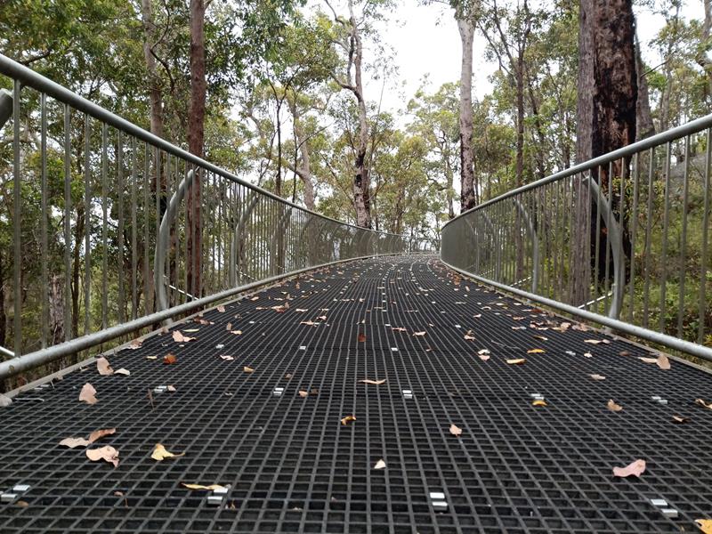
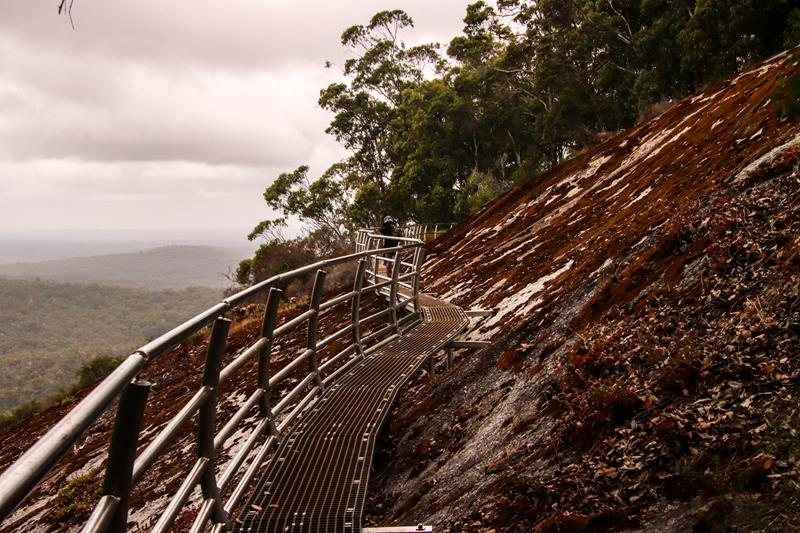
On the way down we took Caldyanup trail – 1,6km loop around the base of the granite rock. The trail goes up and down with some small rocks and uneven parts through a mixed forest (moderate difficulty walk). Part of the trail is Soho Lookout – a newly constructed metal bridge, offering views of the forest below and around.
Soho Lookout
There is no entry fee to the park. Dogs are not allowed.
Where to camp in Mount Frankland National Park
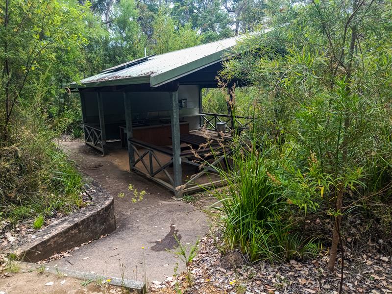
If you are visiting Mount Frankland and are looking for a camping place nearby, then Fernhook Falls DPAW managed campground is a great choice and is only 20km away. It offers excellent facilities, which are well-maintained and cleaned daily. There are only 8 camp spots there, each one with a picnic table, fire ring and rubbish bin. There are also 2 huts with a bunkbed (but can accommodate at least 2 more people on the floor) with a fireplace and outside rain water tank – perfect for hikers!
The campground also has a kitchen area with a sink, tables and bbq plate. For $15 per person per night, we thought it was a good value.
Camping spots have a lot of privacy, are well spaced from each other, yet close to amenities. The whole campground is within the mixed karri, jarrah and tingle forest.
There are some nice short walks around the campground leading to Fernhook Falls and Rowell’s Pool created by the Deep River, passing through the region. Interestingly, the Deep River, although it looks dark brown due to the presence of tannin from native plants breaking down in the river, is actually one of the purest rivers in the south, because 95% of it is flowing through the forested catchment areas.
You cannot book the campground and payment is by cash only. It is quite a popular place even during hot months, so it is best to arrive early. Unfortunately, you cannot bring a dog to the campground. We enjoyed our 2 -day stay at the campground in January and it’s one of the places we would love to visit again in winter when we could enjoy lighting a fire.
Big Brook Dam is one of the attractions along the Karri Forest Explorer Drive, near Pemberton. It was built in 1986 as an additional water supply for Pemberton. These days it is mostly the place for many recreational activities in the area. It is a great place for kayaking and fishing. The Big Brook Dam 4km sealed walk trail along the shores of the dam is very picturesque. It is a great place for walking, strolling and photographing. There is also a sandy beach area, ideal for swimming on a hot day or just picnicking, with shelters, picnic tables and bbqs. Dogs on leash are allowed around the dam (but not on the beach).
Big Brook Dam is a heaven for birdlife. Below: Grey Fantail (top left), Musk Duck (top right), Black Swan (bottom right), Purple Swamphen (bottom centre).
Where to camp
You can camp at Big Brook Arboretum, 3km away from Big Brook Dam along the Karri Forest Explorer Drive. Nestled in the forest, it is a nice small campground with only basic facilities (toilet) but it can accomodate both tents and caravans. We stayed at Drafty’s in nearby Warren National Park (only 20 minutes drive from Big Brook Arboretum) and highly recommend it.
Above: Big Brook Arboretum
If you are visiting Pemberton and have time, make sure you visit nearby Warren National Park with their famous Dave Evans Bicentennial and Marianne North trees and Warren River.
Travel Nut Family
Manage Cookie Consent
To provide the best experiences, we use technologies like cookies to store and/or access device information. Consenting to these technologies will allow us to process data such as browsing behavior or unique IDs on this site. Not consenting or withdrawing consent, may adversely affect certain features and functions.
Functional Always active
The technical storage or access is strictly necessary for the legitimate purpose of enabling the use of a specific service explicitly requested by the subscriber or user, or for the sole purpose of carrying out the transmission of a communication over an electronic communications network.
Preferences
The technical storage or access is necessary for the legitimate purpose of storing preferences that are not requested by the subscriber or user.
Statistics
The technical storage or access that is used exclusively for statistical purposes.The technical storage or access that is used exclusively for anonymous statistical purposes. Without a subpoena, voluntary compliance on the part of your Internet Service Provider, or additional records from a third party, information stored or retrieved for this purpose alone cannot usually be used to identify you.
Marketing
The technical storage or access is required to create user profiles to send advertising, or to track the user on a website or across several websites for similar marketing purposes.