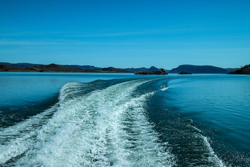
Kimberley is a land of great diversity, contrast, rich Aboriginal history and culture, immense beauty and uniqueness. It occupies the whole north western corner of Western Australia.
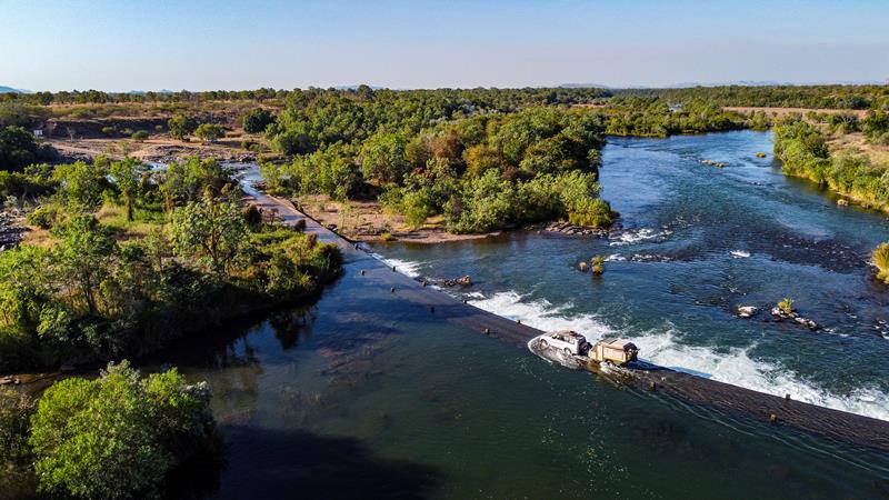
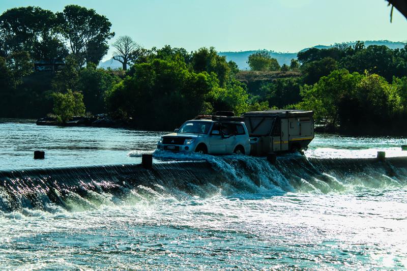
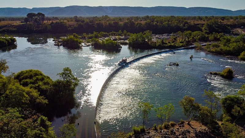
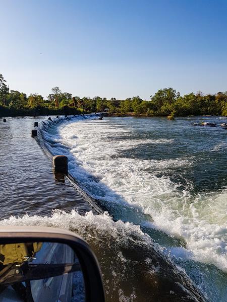
Ivanhoe River Crossing, north of Kununurra is an iconic place and a must do for any 4WD enthusiast travelling through the Kimberley Region and the Gibb River Road. It is a concrete one-way causeway over the Ord River, which was part of the main road to Wyndham during the old days. But nowadays, it is a place where travellers go to tick off their “bucket list”. So, it is really just crossing the river and going back. Many people (especially those with no 4WD) come just to watch others do it. It is also a popular fishing spot. Salt water crocodiles inhibit these waters, so swimming is not safe there.
The river crossing is closed during wet season (usually November to March). So, Australian winter, which is considered dry season, is best for visiting and crossing.
Where is Ivanhoe River Crossing?
It is along Ivanhoe Road, 10-15 minutes’ drive north of Kununurra in East Kimberley.
Roebuck Bay is the magical place that delighted and amazed us with its striking colours – red sand, turquoise ocean and green mangroves. It is a great place for a picnic, fishing, not to mention awesome photography (best at high tide). Camping is available at nearby Bird Observatory (we didn’t stay there, so can’t comment).
This place is an internationally significant wetland where you can see a huge number and variety of migratory shorebirds.
Where is Roebuck Bay?
It is on the coast in the Kimberley region of Western Australia. The actual place that is on the picture (Red Sand Beach) is about half an hour drive south of Broome, along Crab Creek Road, 1km from Broome Bird Observatory. The road is sandy and corrugated for 16km or so, so 4WD is recommended.
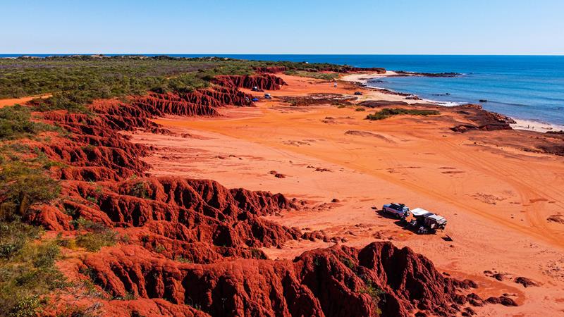
Camping at the base of Pindan cliffs at James Price Point
What is so unique about James Price Point?
James Price Point, 60km north of Broome is absolutely one of our favourites. It’s the place we would like to come back again, despite the corrugated road (roughly 32km of corrugation) to get there. The bright red pindan cliffs backing into the ocean make you feel like you are on another planet. Mars, maybe? The tidal currents at James Price Point are simply phenomenal and so fascinating to observe. Add to this, the thrill of the possibility of finding ancient dinosaur footsteps (at the right tidal conditions) or sight of a dangerous salt water crocodile. James Price Point is so pristine and exquisitely beautiful that you really want to thread lightly and leave no trace of human presence there.
Surprisingly, it is actually the place where you can camp for free. With absolutely no facilities provided, you need to be self-sufficient or hide the traces very carefully (and with hard rocks and no bushland, it is tricky 😊).
Honestly, we think this place is not going to be free forever. So, while it is, take a detour to see it, but take good care of this exceptional place.
Where is James Price Point?
James Prices Point is north of Broome, off Cape Leveque Road. You would need a 4WD to get there and deflate your tyres once you hit the corrugated dirt road.
Tides
The Kimberley coast has the biggest tides in the southern hemisphere. This is due to the shape and size of the continent which allows the tides to grow much larger compared to other places. The difference between high and low tides can be up to 10 meters.
The tide comes really fast. When the water recedes back into the ocean, it creates intricate patterns on the sand, many of which look like paintings of trees. It is such a delight for a photographer or a lover of nature.
James Price Point at dawn, dusk and night
The magical hour (an hour before sunrise and an hour after sunrise) is the best for taking landscape photos. The colours of the sky painted by the setting or rising sun are simply amazing.
Stars and the Milky Way have been attracting people’s attention since the beginning of time. In the old days, sailors and the local Aboriginal people alike, used them to navigate on their journeys. Nowadays, they add such a beautiful background to the pictures taken by many photographers. Even if you are not a photographer, there is hardly anyone, who would be impartial to see the arch of the Milky Way in the dark sky on a cold winter night. There is a sense of mystery and adventure that pulls people’s eyes and souls to the stars that are within many light years of reach from us.
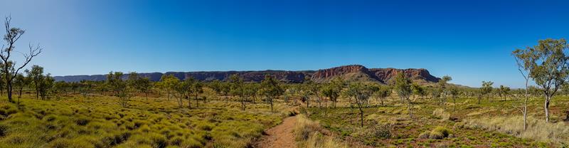
Cockburn Ranges is one of the iconic places in East Kimberley region, north-east of Western Australia. It is a prominent landmark, that rises over 600 meters high above the surrounding plains. This scenic place is a must to see for those travelling along the Gibb River Road or visiting El Questro. It is beautiful and every changing and one of the ways to see Cockburn Ranges is from the air.
Cockburn Ranges Scenic Flight
Seeing a landscape from a bird’s eye view gives you a different perspective. First, you can see different angles of the same place. Second, there is an opportunity to appreciate the vastness and the expanse of the land. Third, you can spot some details that might not be visible from below. This was the idea behind taking a scenic flight with Aviair from Kununurra to see Cockburn Ranges and the mighty Kimberley rivers. Unfortunately, it was not the best day for scenic flights. There was a lot of haze from controlled burning up in the air. In addition, the position of the sun was often in the wrong direction at times. Yet, we enjoyed the flight and made the best of our experience (despite feeling a bit airsick in that tiny airplane ☹).
Mudflats and Five Rivers Lookout at Wyndham
Wyndham is West Australia’s most northerly town, located 100km north from Kununurra, and it is the best place to see where the 5 Kimberley mighty rivers – the Durack, King, and Pentecost to the south, Forrest to the west and Ord to the east – combine and enter the Cambridge Gulf. Mesmerizing mudflats formed by the rivers, their colours, shapes and patterns are a photographer’s dream. We first saw these unique and beautiful mudflats from the Five Rivers Lookout on the top of the Bastion Range at Wyndham.
Kimberley native flora is fascinating for anyone who appreciates nature and photography. The northernmost region of Western Australia is one of the most beautiful and unique places on Earth, with rich landscape, flora and fauna. The diversity of the landscape means there is also a great diversity of the plants and trees. With over 2000 plant and tree species, many are unique to the Kimberley region and are, thus, an important part of the ecosystem, providing food for the animals, birds and insects.
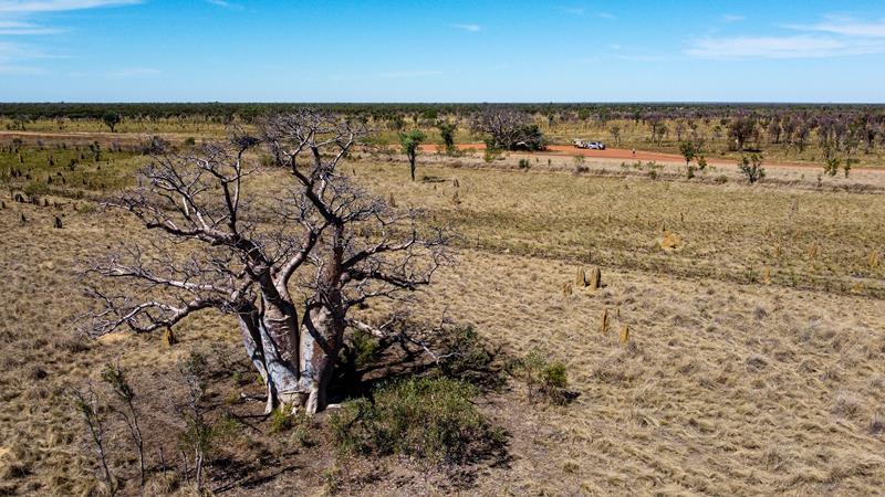
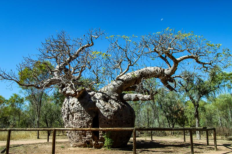
Boab tree
Boab tree (Adansonia gregorii) is an icon of the Kimberley region. It’s the only region in WA (and in the whole of Australia, with the exception of parts of NT) where it grows wild and in huge numbers. It is a large, slow growing deciduous tree, characterized by unique bottle-shaped trunk. These are very hardy trees, which can grow over a thousand years.
We found boab trees very fascinating. No boab tree is the same. Each boab tree has a unique shape, size and character. Each has a story to tell – some look huge, fat and mighty. Others look tall, slim and elegant. Still others look like Siamese twins with a few stems grown together.
Within the same season (even within the same week) you can find boab trees that look completely bare, some that are partially covered in leaves, some are quite green, full of leaves and even fruits.
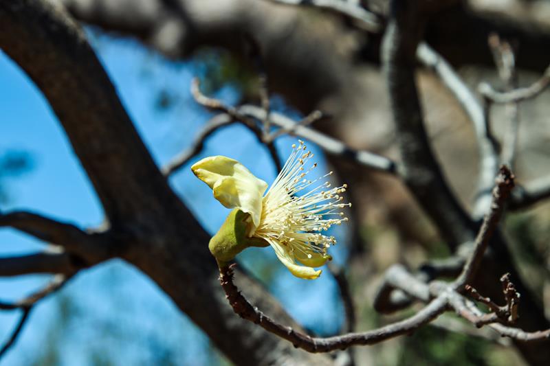
We consider ourselves very lucky to have seen a boab flower, which is a big creamy flower, normally occurring in summer and we have seen it in July, which is a dry winter season in Kimberley. Interestingly, each boab flower only lasts one day.
Boab tree flower
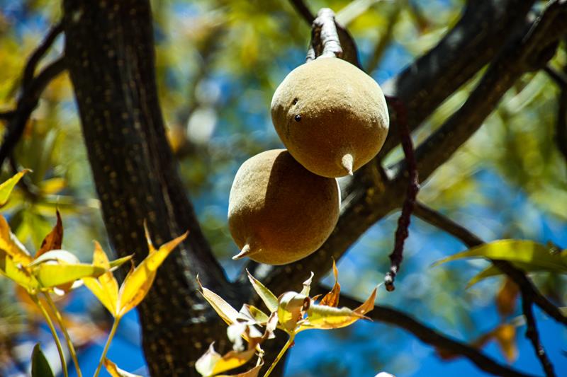
The fruits of boab tree are eatable by animals and people and are very rich in Vitamin C (although we haven’t tried them ourselves).
Boab tree fruit
This is the famous Prison Boab near Derby on the west coast. Its significance refers to the 1890s when it was used a rest point for police and escorted Aboriginal prisoners en-route to Derby.
Prison Boab near Derby
Apart from the Boab tree, there are a number of other interesting trees growing in the Kimberley.
Kapok tree
Kapok Tree (Cochlospermum fraseri) is a common deciduous tree found in Kimberley, in the north of Western Australia. It can grow up to 7 meters, has large pretty yellow flowers and large egg-shaped seed pods. Both flowers and young roots can be consumed. Likewise, the silky kapok inside the pod is put to good use too – to stuff mattresses and pillows. Hence theres is an alternative name for this tree – cotton tree.
Kimberley Rose
Kimberley Rose or the Sticky Kurrajong (Brachychiton viscidulus) tree only grows in the Kimberley region of Western Australia. It is a deciduous tree, that can be as high as 10 meters long. It produces massive display of scarlet red sticky flowers during the dry (winter) season, after it sheds its leaves.
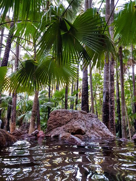
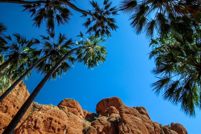
Livistona palm
Livistona palm (Livistona nasmophila) is native to Kimberley area in Western Australia (as well as part of Northern Territory). It can grow up to 18 meters high, forming a canopy above, providing cooling shade underneath. We saw this plant at Zebedee Springs in El Questro and also at Echidna Chasm gorge in Purnululu National Park (both in Kimberley).
Zebedee Springs in El Questro
Echidna Chasm in Purnululu NP
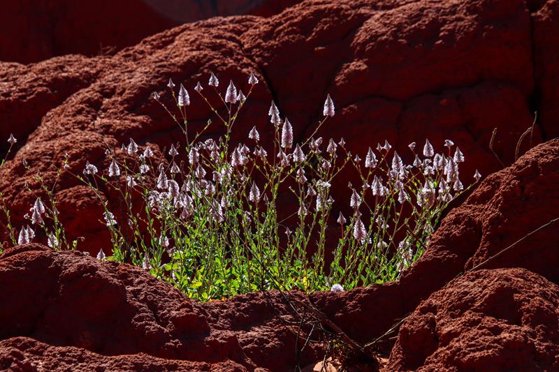
Mulla mulla
Mulla mulla (Ptilotus exaltatus) is a common annual plant growing up to 1,2 meters in most regions of Australia. We saw it first growing in Pilbara and we fell in love with it straightaway. This particular plant was photographed at James Price Point in West Kimberley.
Mimbi Caves nature-based campground in Kimberley on Great Northern Highway (between Fitzroy Crossing and Halls Creek) was a pleasant surprise and a real treat for us before heading back home after completing the Gibb River Road trip back in July. Owned and operated by Indigenous Gooniyandi people, the campground is located on a large property and has a bush feel, yet it has modern amenities, which include clean flushing toilets, hot showers, bbq shelter, kitchen sink and communal firepit.
The campground is small enough to feel secluded, yet big enough to meet fellow travellers. It so well laid out and organized that it is very easy to park when you have a caravan. The sites are big and separated from each other with pockets of space and some trees.
We liked the unique indigenous feel of this place, the outback setting and well-organized space. Highly recommended, not just as an overnight stop, but as a place to relax and get to know indigenous people and their culture.
The tour
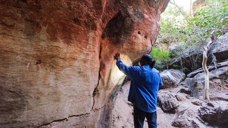
The Mimbi caves are accessible only through a tour with local Gooniyandi people and the tour was quite a highlight of our trip to Kimberley. We love caves but the experience of this cave started even before entering the cave itself. In fact, the limestone rock formations at Mimbi are so unique and beautiful that we were already happy just wandering around those amazing nature sculptured structures while hearing the ancient Dreamtime stories of the Blue Tongue Lizard that created the hills at Mimbi.
But our guide Ronnie also led us through the caves, pointing out fossils, ancient rock art, while sharing more stories.
Ancient rock art
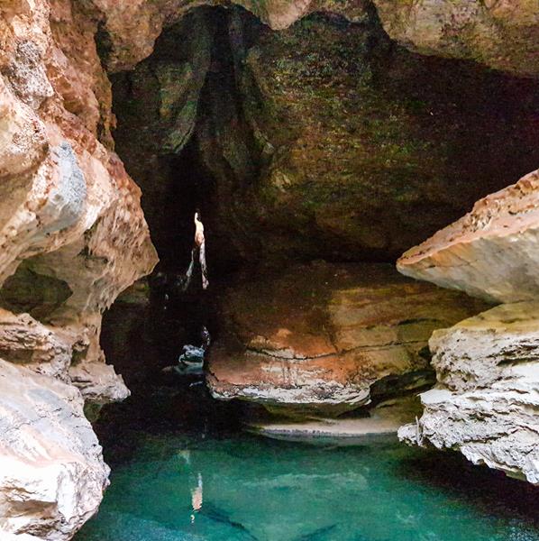
Those who were brave enough could swim in the icy cold freshwater pools flowing through the caves (not us 😊).
Inside the Mimbi Caves
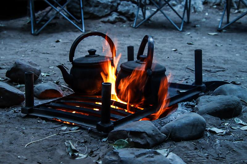
The tour concluded with tea, damper and walking around fire ceremony (and more stories 😊).
Kimberley fauna is unique, diverse and fascinating. The first thing that comes to mind when talking about fauna of Kimberley is crocodiles! There is no surprise. There are plenty of them in Kimberley and they can be extremely dangerous to humans.
Crocodiles
There are two types of crocodiles found in Australia (and both are in Kimberley) – saltwater or estuarine crocodiles and freshwater or Johnston’s river crocodiles. Saltwater crocodiles are big (up to 7 meters long) and are dangerous to humans and we’ve only seen from the far distance (at El Questro). Contrary to their name, they live in fresh waters too, up to 200km away from the coast and can attack in less than a second.
Saltwater crocodile seen from Branko’s Lookout at El Questro
Fresh waters crocodiles are much smaller (not more than 3 meters long), have smaller teeth and narrow snout. They live in creeks, rivers, billabongs and are often seen sunbathing on the shore. While they are non-aggressive, they can bite if disturbed, so it is still safer to admire them from a distance.
Lake Argyle is home to an estimated 30,000 fresh water crocodiles (and yes, you can still swim there – we did!). So, that is another place to see them and taking a cruise is the best way to see crocodiles (and many other interesting animals and birds).
Among other interesting creatures that we saw in Kimberley were olive python, rock wallabies and sugar glider.
Kimberley Fauna – more than crocodiles
Olive pythons are the second-largest Python species in Australia. They can grow up to 3.5 meters long and the sub-species in Pilbara region can grow up to 5 meters long (we saw one rather large olive python in Millstream Chichester NP). Olive pythons are found in northern parts of Australia. They can often be seen near creeks but also in woodlands, open forests and savannah. We were lucky to spot one in Silent Grove campground near the creek (Actually, we were shown the python by fellow travellers, for that we are very grateful).
Olive python
Sugar glider is a small nocturnal gliding possum, found in the northern parts of Australia in eucalyptus woodlands. It feeds on gum and the sap of eucalyptus trees. This little cute Sugar Glider was on the Eucalyptus next to our camping spot in Silent Grove campground. We were lucky enough to watch it feeding on the nectar of the Eucalyptus tree flowers for 2 days we spent there (although not lucky enough to see it flying).
Rock wallabies are yet another type of unique animals we saw in Kimberley – in Lake Argyle. We took a morning cruise and were shown the whole colony of them, sunbathing on the rocks.
Birds of Kimberley
The Kimberley region, comprising 420,000 square kilometres has diverse landscape, ranging from rugged ranges, savannas and pristine coastlines. The diversity of the landscape means great variety of the birds.
Australian Pelican (Left: Lake Argyle, right – Roebuck Bay)
Pied Heron near Lake ArgyleGreat Egret at Lake ArgyleBrown Goshawk, Hann River, Gibb River RoadBlack-fronted Dotterel, Windjana Gorge, the Gibb River RoadDouble-barred Finch Silent Grove, the Gibb River RoadGreat Bowerbird Silent Grove, the Gibb River RoadLittle Corella. Silent Grove, the Gibb River RoadWhite-faced Heron, Galvans Gorge, the Gibb River RoadYellow-tinted Honeyeater. Pentecost River, The Gibb River Road
Red-tailed Black-Cockatoo, the Gibb River Road
Zebra finch, Purnululu NPBudgerigar, Purnululu NP
Whistling Kite, Purnululu NP (above)
Masked Lapwing, 80 Mile Beach (above)
Black Falcon, DerbyRed Kite, Roebuck Bay
Grey Butcherbird, Stanley 24 hour rest area, 80 Mile Beach, West Kimberley (above)
Crested pigeon (right) and Grey Butcherbird (left), Stanley 24 hour rest area, 80 Mile Beach
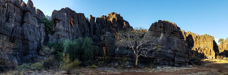
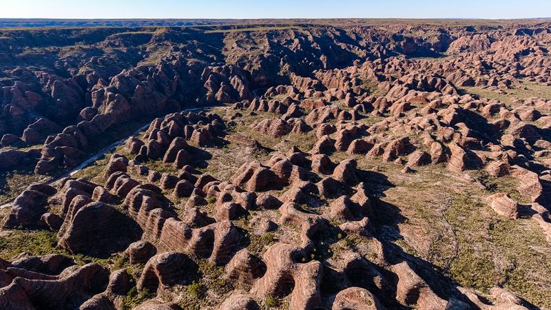
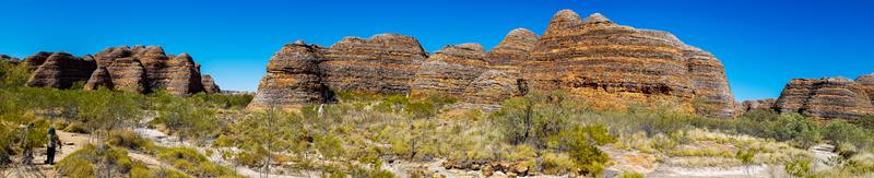
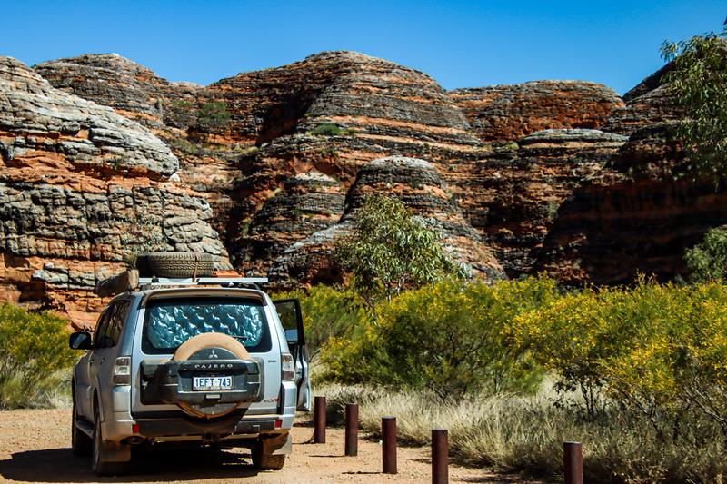
Purnululu NP (Bungle Bungles) in Eastern Kimberley is one of 4 in Western Australia World Heritage sites. It is listed for its incredible natural beauty and outstanding geological value. Purnululu means “sandstone” in Aboriginal language. It is an amazing place, which was on our bucket list for a long time. Finally, in 2022 we had a chance to visit it. We incorporated the visit there to our Gibb River Road trip.
Driving in Purnululu NP (Bungle Bungles) is an adventure in itself.
Southern walks
We spent 2 full days exploring the park. On the first day we explored the Southern part of the park, which is home to Bungle Bungle Range. This is where you can see amazing orange and black banded beehive-shaped domes. Some of which are as high as 250 meters and are believed to be 360 million years old. You can marvel at the beauty and amazing colours of the domes right from the Piccaninny Car Park.
Piccaninny Car Park
You can also go for a short walk around the domes to appreciate their incredible size, unique patterns and texture.
The size of the domes in comparison
The mystery behind the colours of the banding in the domes
The domes’ striking orange and black bands are caused by the presence or absence of the cyanobacteria. Dark bands indicate the presence of the cyanobacteria that form on the outer surface of the rock. This helps to slow down the erosion. The orange bands are oxidized iron compounds that have dried out too quickly for the cyanobacteria to grow.
Helicopter flight over the Bungle Bungle domes
To appreciate the size and beauty of the Bungle Bungle domes we took an afternoon helicopter flight over the range with HeliSpirit. It was a truly unforgettable and rewarding experience to see the whole range from the bird’s eye view and have a closer look at the surface of the range and domes.
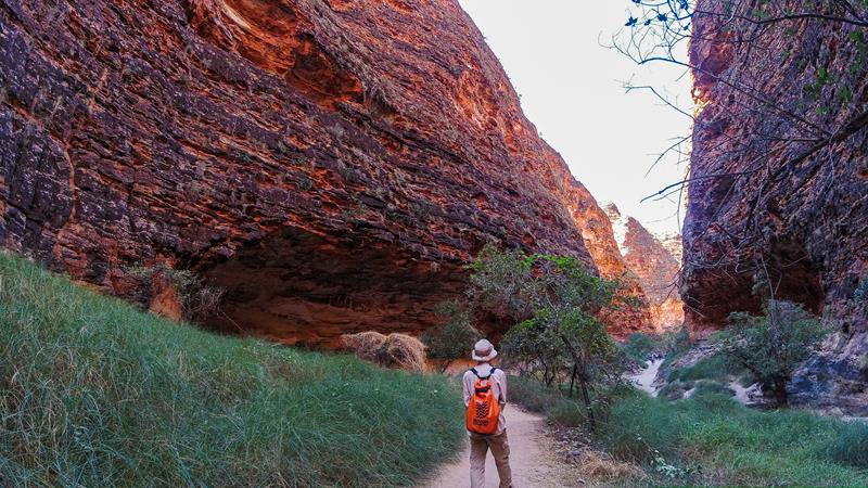
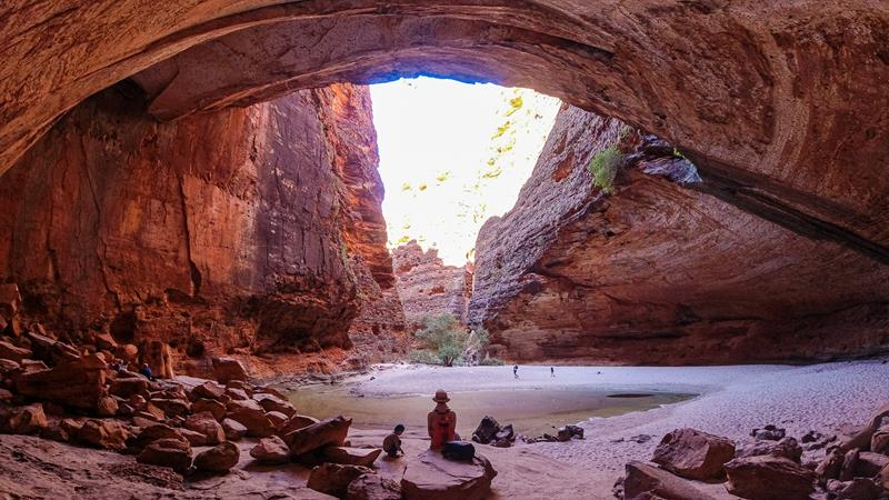
Cathedral Gorge
Part of the Bungle Bungle Range in Purnululu National Park is an incredible Cathedral Gorge. A moderate difficulty 2km return walk takes you through the domes, potholes, cliffs and honeycomb rocks to a natural amphitheatre which amplifies every sound and is such a delightful place to be, especially during warm sunny day, as it is very cooling inside.
Cathedral Gorge
Northern walks
Kungkalanayi Lookout
Kungkalanayi Lookout is an impressive lookout with 360-degree views of the surrounding land, including parts of the Bungle Bungle range. It is only a short (500 meters) walk from the carpark and a great stop on the way to see the gorges in the northern part of Purnululu National Park.
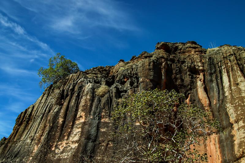
Echidna Chasm
While the domes are the highlight and one reason for Purnululu’s World Heritage Site listing, Echidna Chasm gorge is the highlight of the northern part of Purnululu park and the second reason for its World Heritage listing. Starting as an easy walk through the gorge, lined with lush green Livistona palms against the striking orange colours of the sandstone, this beautiful trail takes you into 180-meter-deep chasm, cut knife-like into the sandstone.
The best time to be inside Echidna Chasm is between 11 and 12 o’clock when the sun is directly overhead and casts a ray of light deep inside the chasm. The sunlight reflected from the sandstone glows in the striking orange colour in a narrow chasm creating incredible visual effect of lava like pouring through the sky.
Staying at Purnululu National Park
There are many accomodation options at Purnululu NP, ranging from caravan park at the entrance for those who are not able or willing to take a challenging 53km long 4WD road to the park, to tour operated luxury tents, to DPAW managed bush camps within the park.
We stayed at Walardi campground, which is 12km drive from the visitor centre in the southern park of the park (The northern park has its own similar campground). Both campgrounds need to be booked online. There are toilets and non-drinking water at the campground.
The nights in July there were very cold.
Breakfast in Walardi campground, Purnululu National Park.
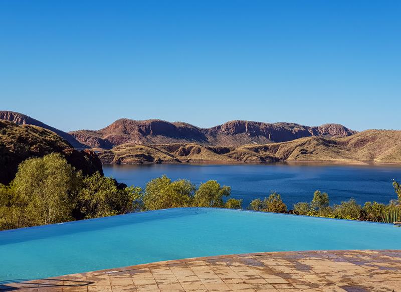
Lake Argyle, located 70km south of Kununurra in the Kimberley region in the north east is Western Australia’s largest and Australia’s second largest fresh water man-made lake. Holding as much water as 19 Sydney harbours, it has a surface of over 100 square km and more than 70 islands. The lake was created in 1973 by construction of a dam to direct the Ord River (once the fastest flowing river in Australia) which enabled development of the agricultural industry in the Ord Valley.
Famous 35-meter Infinity Pool at Lake Argyle Caravan Park, where we stayed
Wildlife and the speed boat cruise
Lake Argyle is home to an estimated 30,000 fresh water crocodiles (and yes, you can still swim there – we did!), 150,000 waterbirds, 26 species of fish and some unique animals, like rock wallabies.
Rock Wallabies
Fresh water crocodiles
One of the best ways to see all these animals, birds and fishes is to take a cruise. During our 2-hour morning cruise on a speed boat we only covered 25% of the lake, which gave us an idea of just how vast the lake is.
Hikes and walks
Lake Argyle has some amazing walks, hikes and drives around it. Dead Horse Springs and Spillway Creek (4 and 10km respectively from the Caravan Park) were nice spots for watching birdlife.
Dead Horse Springs (below)
Great Egret (above left). Pied Heron (above right)
Spillway Creek (above)
Pannikin Bay Sunset Lookout (via a short but quite rocky 4WD only track) offered magnificent views of the lake. The changing colours of the lake and bushes were mesmerizing to watch.
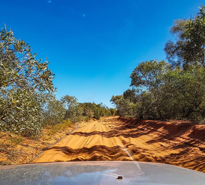
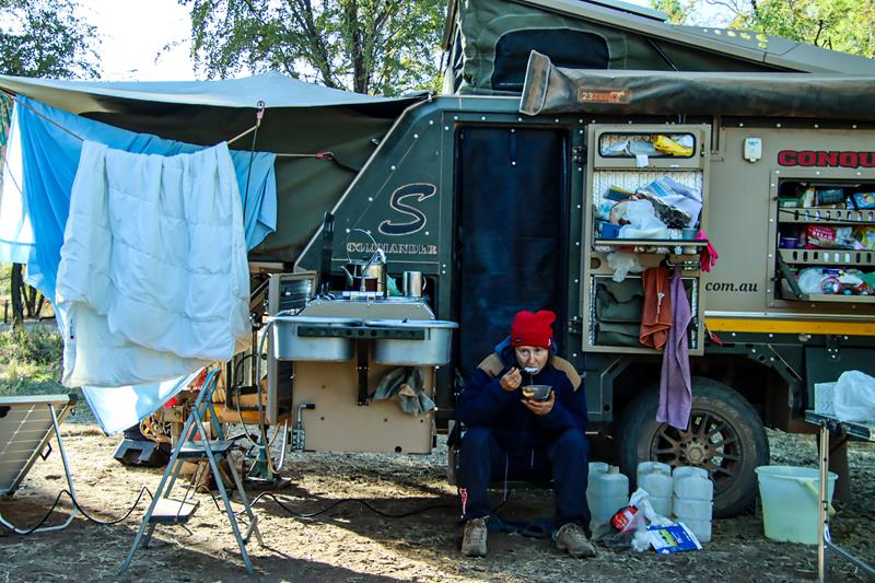
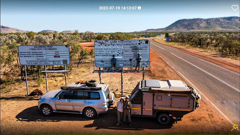
Before you embark on the Gibb River trip, it is good to know what to expect. Here, we share our experience.
The experience
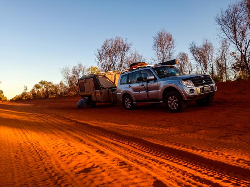
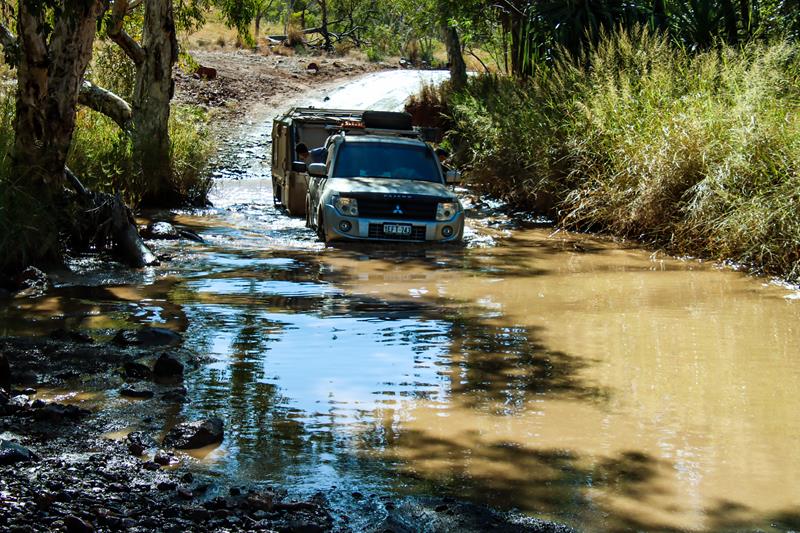
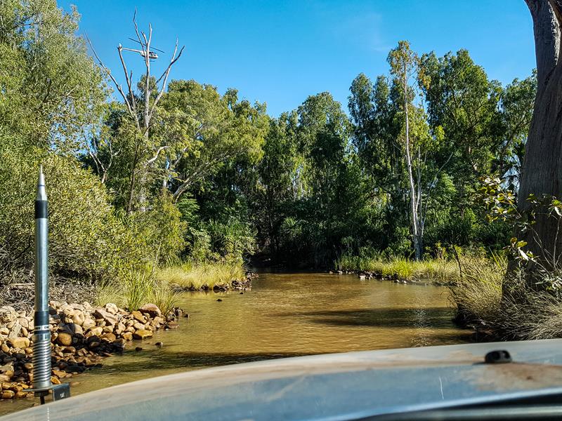
We completed our Gibb River Road journey on 19 of July 2022. It was definitely the most challenging trip, we’ve done so far, resulting in a few damages to the 4WD. At the same time, it was a very rewarding, interesting and fulfilling experience. We’ve met many wonderful fellow travelers on the road (hope we meet again!). We have encountered quite a lot of fresh water crocodiles. Not to mention, that we’ve seen a number of beautiful gorges, many rivers and creeks.
Pentecost River crossing near at El Questro
Quick summary
Our caravan has survived, travelling at mostly 20-40km/h on worst sections of the road (between Mt Barnett and Ellenbrae stations) at 26psi. Still more adventures to come with Lake Argyle and Bungles Bungles ahead of us!
Total 11 nights. Overnight stops:Windjana Gorge, Silent Grove, Mt Barnett and 3 nights free camping at Hann River, Durack river and Pentecost river plus 3 nights at El Questro. Damages: punched rear airbags on the 4WD, broken car key, main car battery holder broke, rear view mirror came off, UHF radio antenna broken, compressor pump hose leaked. And lots of dirt and dust in the car and van.
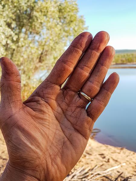
At the end
The end of Gibb River Road trip looked like this: red dust that is absorbed into your skin and won’t come off. Your palms will look 10 years older but your soul will feel 20 years younger after doing the Gibb – no manicure services required 😊.
It is an adventure of a lifetime, but we feel that we’ve only scratched the surface of what this beautiful part of the world can offer. We’ll definitely be back to explore what we’ve missed, going further into unknown, growing and evolving as we challenge ourselves to new experiences while exploring this world.
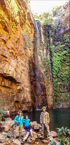
Travel Nut family at Emma Gorge
Manage Cookie Consent
To provide the best experiences, we use technologies like cookies to store and/or access device information. Consenting to these technologies will allow us to process data such as browsing behavior or unique IDs on this site. Not consenting or withdrawing consent, may adversely affect certain features and functions.
Functional Always active
The technical storage or access is strictly necessary for the legitimate purpose of enabling the use of a specific service explicitly requested by the subscriber or user, or for the sole purpose of carrying out the transmission of a communication over an electronic communications network.
Preferences
The technical storage or access is necessary for the legitimate purpose of storing preferences that are not requested by the subscriber or user.
Statistics
The technical storage or access that is used exclusively for statistical purposes.The technical storage or access that is used exclusively for anonymous statistical purposes. Without a subpoena, voluntary compliance on the part of your Internet Service Provider, or additional records from a third party, information stored or retrieved for this purpose alone cannot usually be used to identify you.
Marketing
The technical storage or access is required to create user profiles to send advertising, or to track the user on a website or across several websites for similar marketing purposes.