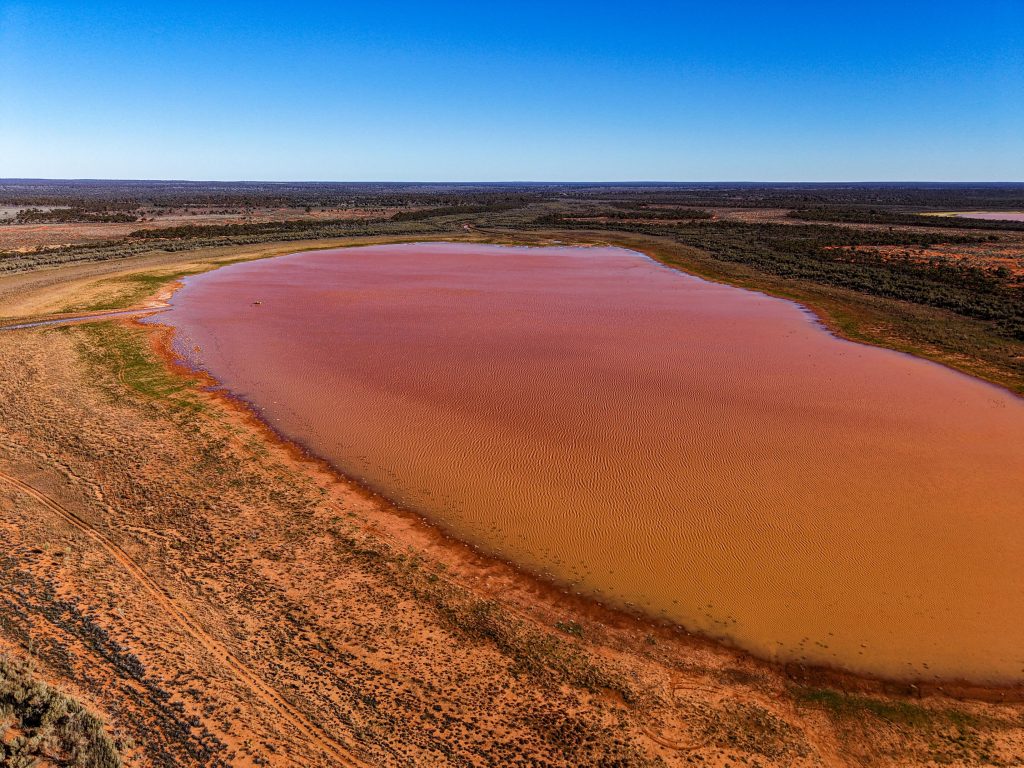
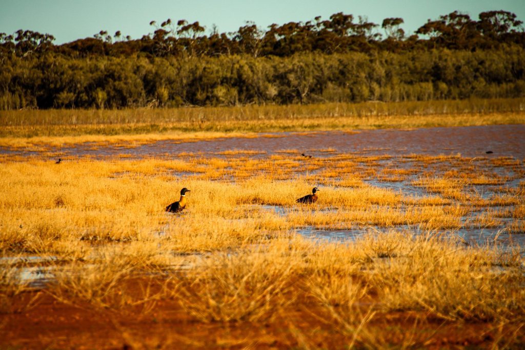
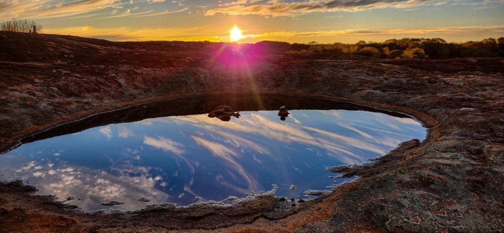
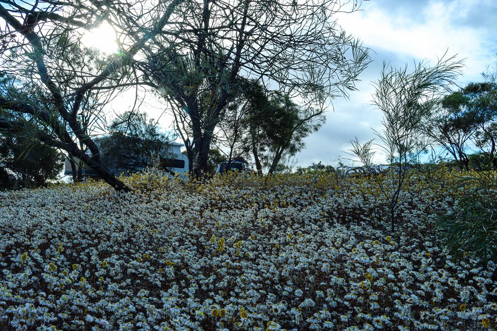
Rowles Lagoon is a semi permanent freshwater wetland in the Goldfields region. In the area where most wetlands are saline, a freshwater lake plays an important role for wildlife. It is home to 41 species of waterbirds, including rare Freckled duck. We were not so lucky to see it. In fact, even though there were plenty of waterbirds, all of them appeared to be Australian shelducks – male, female and ducklings. They were quite shy and I had to take pictures of them from a distance.
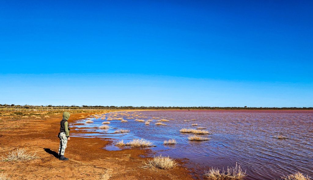
The lake can appear different depending on the weather and season. When we visited Rowles Lagoon, it looked pink with quite a lot of water in it. It was lovely to see it filled with water, as at times it can be dry.
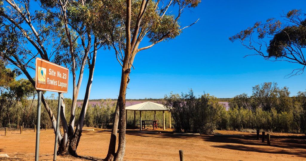
Camping at Rowles Lagoon
There is a picnic, as well as a free campground near the lake. Swimming and water-based recreational activities can be enjoyed there when there is enough water. Facilities include toilet and picnic tables. There are no camping fees and campfires are allowed in season. We did not stay there but merely stopped to have a look on our way to Lake Ballard.
How to get there
Rowles Lagoon is 70km north of Coolgardie via Coolgardie-North unsealed Road. It is one of the designated stops along the Golden Quest Discovery Trail.
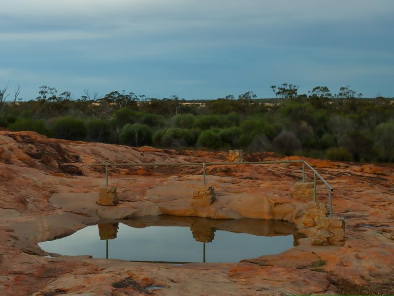
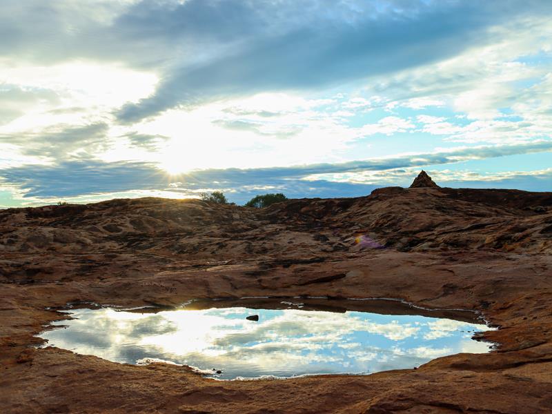
Karalee Rock is a natural attraction in the Goldfields region. It is part of the Golden Pipe Heritage Trail. This is the route of the historic water pipeline from Perth to Kalgoorlie. The place is known for the historic Karalee Reservoir, which was an important water supply for steam trains. The dam and the well were constructed in the 19th century at the base of the rock to catch the water during storms and heavy rain.
Free camping at Karalee Rock
Nowadays, Karalee Rock is a popular picnic spot and a free camping area. There are plenty of shaded spaces, with picnic tables and fire rings. The toilet is there, but unfortunately, no longer working.
You can walk around the dam and over the rock. The places are very picturesque, especially during sunset and sunrise when the nature really shines.
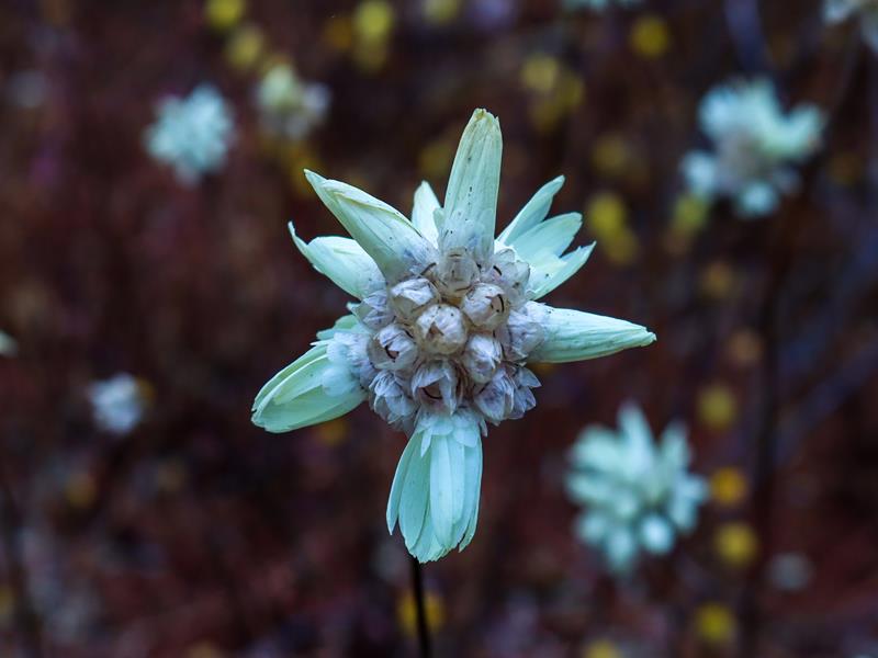
It is also a place to view beautiful wildflowers. We camped at Karalee Rock on our way to Central Australia in July 2025. There were not many wildflowers but I was happy to find these cute Pterostylis setulosa Hairy-stemmed Snail orchids.
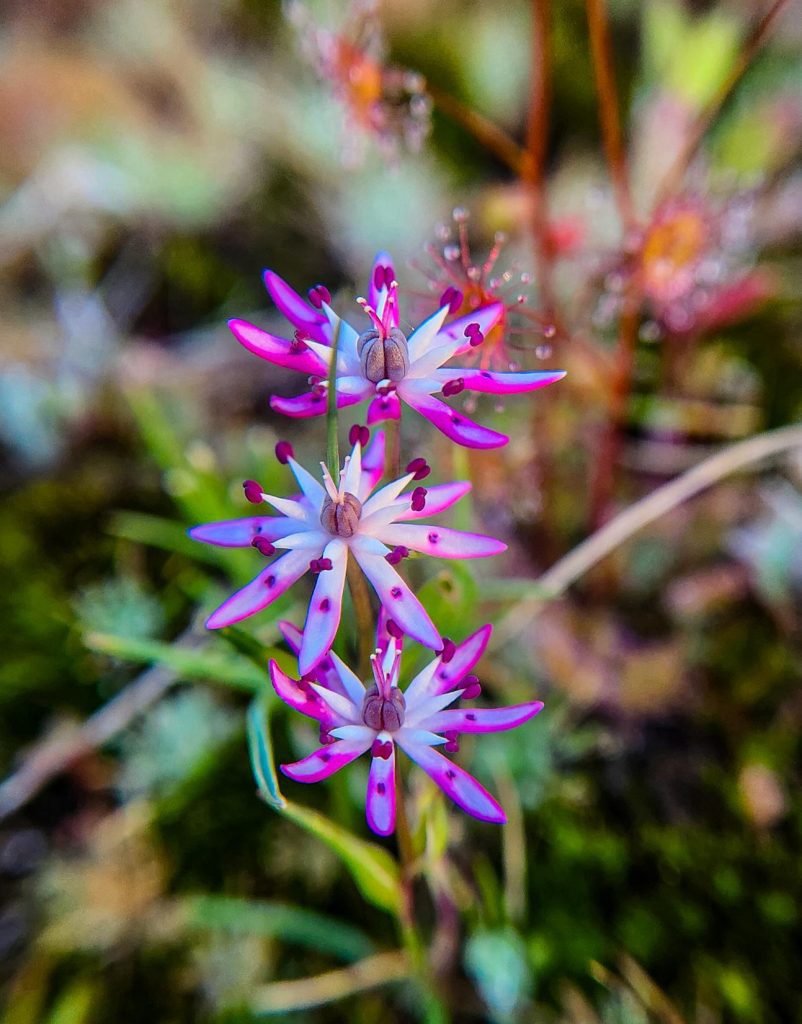
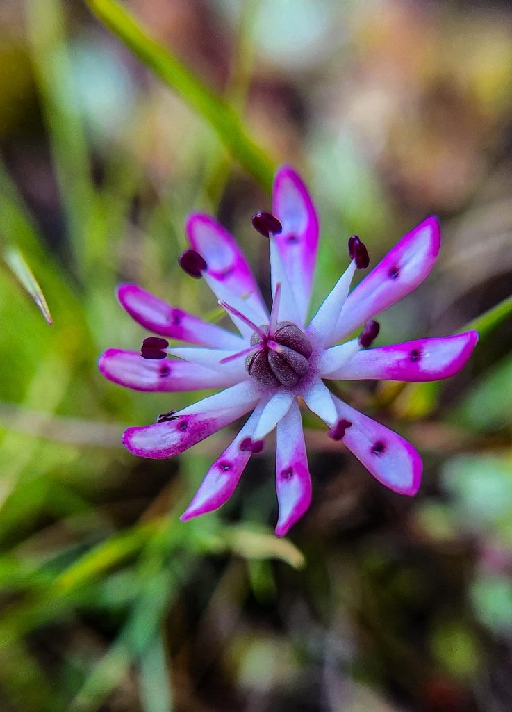
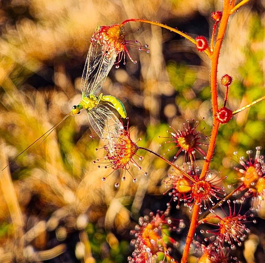
Other wildflowers I spotted were numerous drosera plants and Wurmbea tenella Eight Nancy.
(Wurmbea tenella Eight Nancy)
A team effort of drosera flowers to catch a meal :).
How to get there
Karalee Rock is located between Southern Cross and Coolgardie. It is 4km off the Great Eastern Hwy via dirt road.
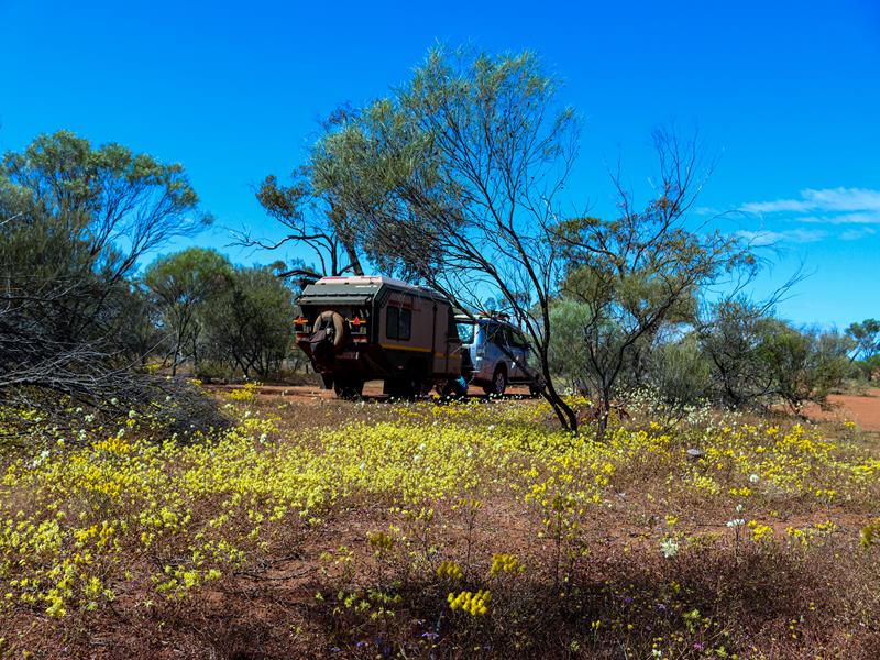
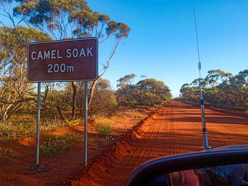
Camel Soak was a pleasant surprise. We were considering staying at Karara Rangeland Park during our Wildflower Country trip in September 2022, which included Coalseam Conservation Park,Depot Hill and Wreath Flowers near Pindar. Then we discovered this free camp ground just outside of Karara Ranglelands. It is a picnic, as well as a free camping spot with clean long drop toilet (and a sink with pump soap to wash hands), picnic tables and fire pits. There are plenty of spaces to choose from. During the wildflowers season, it is particularly picturesque, as the wildflowers are everywhere. In fact, as we set up our camp, we found that we were surrounded by gorgeous yellow everlastings. It was such a pleasure to wake up to such a beauty.
Camel Soak is also an interesting historical site. It has a man made granite watering hole, where men and their camels obtained the water while building the Rabbit Proof Fence in the early 1900. I suppose, this is where the name is coming from.
Although we only stayed one night, we could easily have stayed longer, if we had the luxury of time. It is such a wonderful spot to go for walks and also for bird watching and admiring wildflowers.
Where is Camel Soak?
Camel Soak is 47km east of Perenjori, just off the Perenjori-Rothsay Road in the Mid West region of Western Australia and is easily accessible via a 2WD. It is roughly 360km north of Perth. It is considered part of WA’s Wildflower Country.
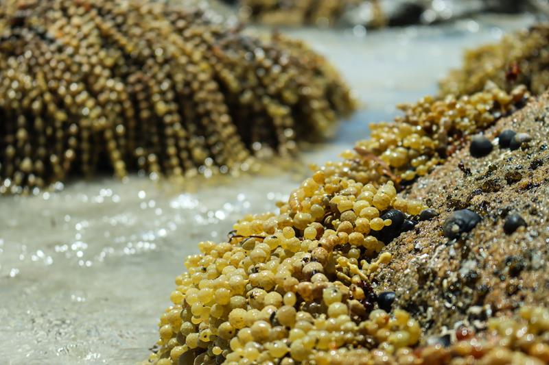
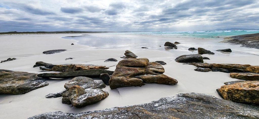
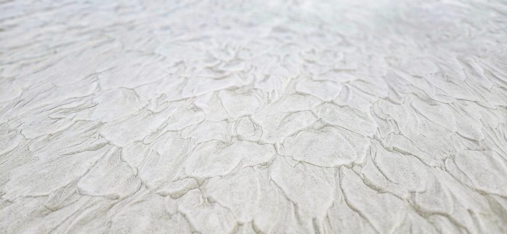
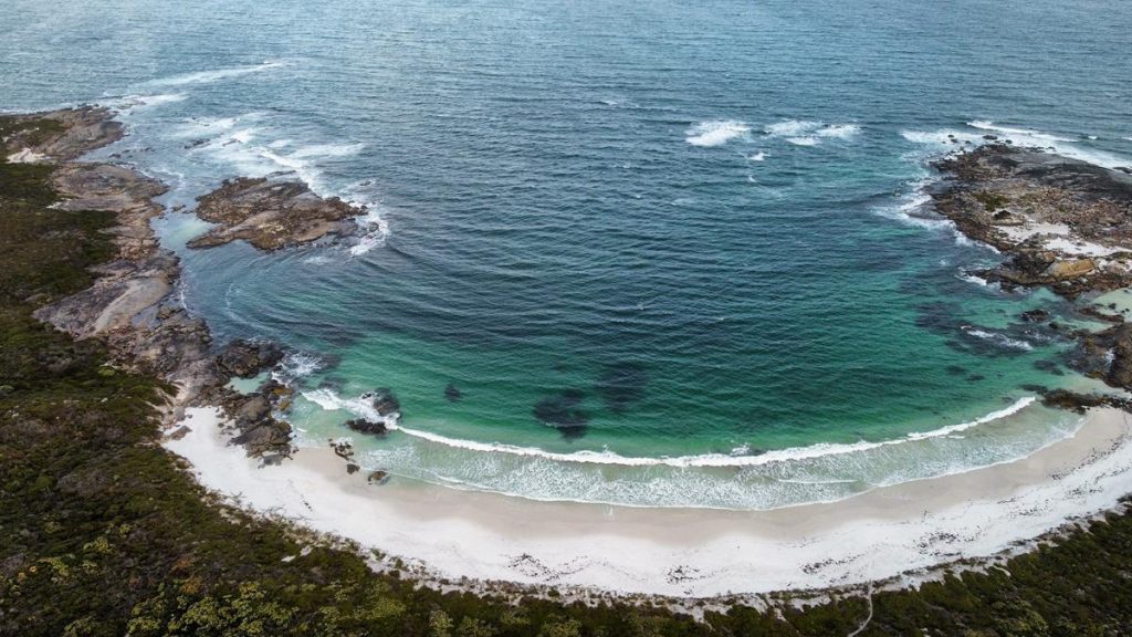
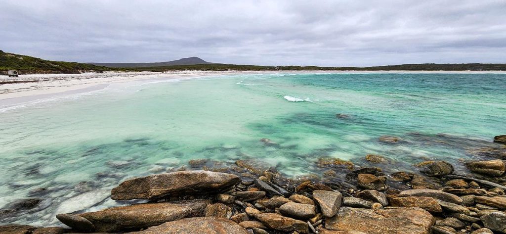
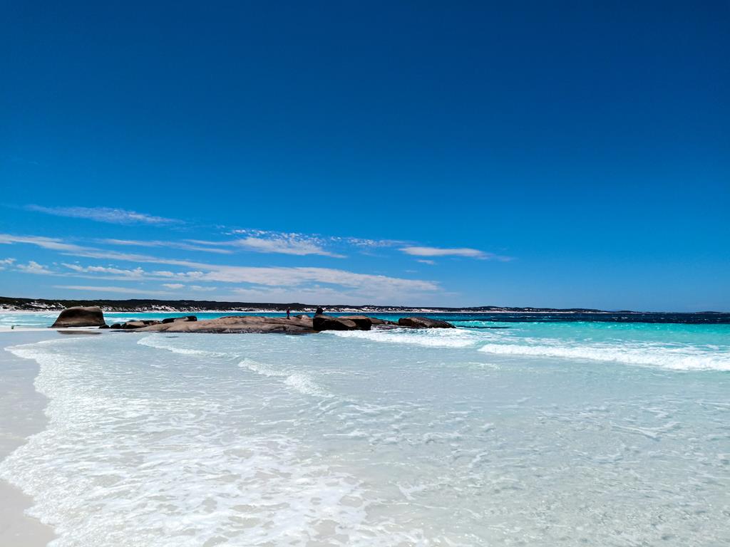
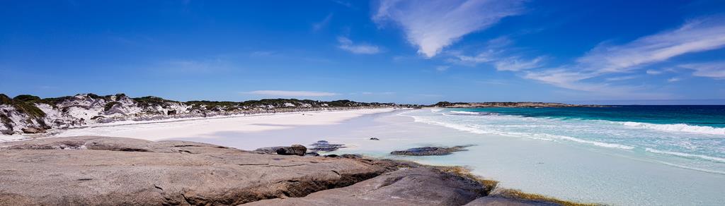
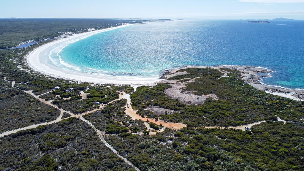
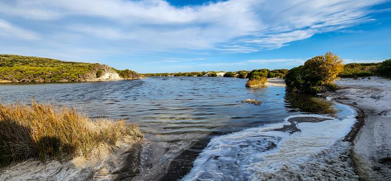
Stokes Inlet National Park is located 80km west of Esperance on the south coast of Western Australia. It is quite big, diverse and attractive. The park covers an area of more than 10,660 hectares, and there are more attractions there that you can visit in a single day. The actual inlet is 14 km long and mostly shallow (less than 2 meters deep). There are 2 large sheltered picnic areas with running non-drinking water, bbq and toilets near the inlet. There is also DPAW managed campground a short distance away). The place is great for fishing, kayaking and bush walking. One interesting thing about the Stokes Inlet for us was the amount of sea foam near the shore. Apparently, it is a normal process that happens when there is a large amount of algal bloom decays. It is not harmful and is a sign of a productive ocean ecosystem. It looks very picturesque and reminded us of snow.
Sea foam at Stokes Inlet
Fanny Cove
Fanny Cove is one of the few campgrounds within Stokes Inlet National Park. It is small (with only 4 sites suitable for camper trailers or tents) but it is free (although there is a fee to enter the national park) and is close to the beach. The campground has toilets and there is also a day use area with picnic tables. The beach is sheltered and is great for swimming and fishing. It also has some rock formations and pools, which are fun to explore, especially if you are into photography. The access to Fanny Cove is for 4WD only.
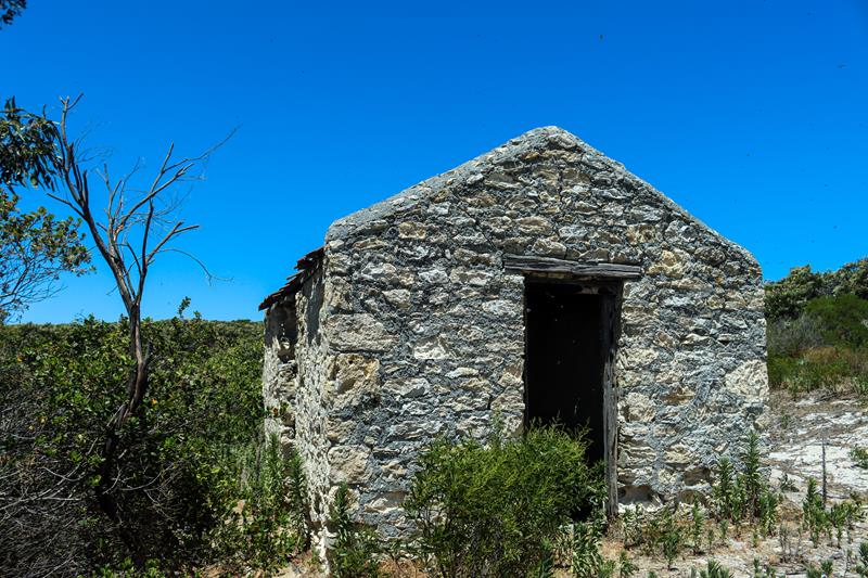
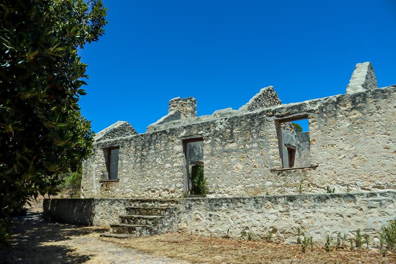
A short distance from Fanny Cove in Stokes Inlet National Park are ruins of 1870’s Moir Homestead. We felt a slight sense of ghosts hanging around this place, as we walked through the ruins, learning about history of an original settler at Fanny Cove and pastoralist, John Moir. Bees built huge bee hives inside the ruins, especially in one of the buildings closer to the entrance – a huge bee hive hanging down from the roof. It is an interesting place to visit to appreciate how lucky we are to live in the modern world.
Quagi beach on the south coast of Western Australia is roughly 80km west of Esperance. There is a basic bush camp on this beach, managed by Esperance Shire and operated on a first come, first serve basis. For $15 per vehicle per night, you get sheltered clearly designated bay and access to toilets and non-drinking water. This campsite is a very popular one but mostly for short term stays. When we visited it over Xmas period last year, we arrived early (around lunch time) and there were plenty of spaces but by evening, newcomers were strugling to find a spot. There are only 17 sites at this campground, which makes it quite cosy. In terms of a layout and facilities, it similar to Munglinup Beach camp.
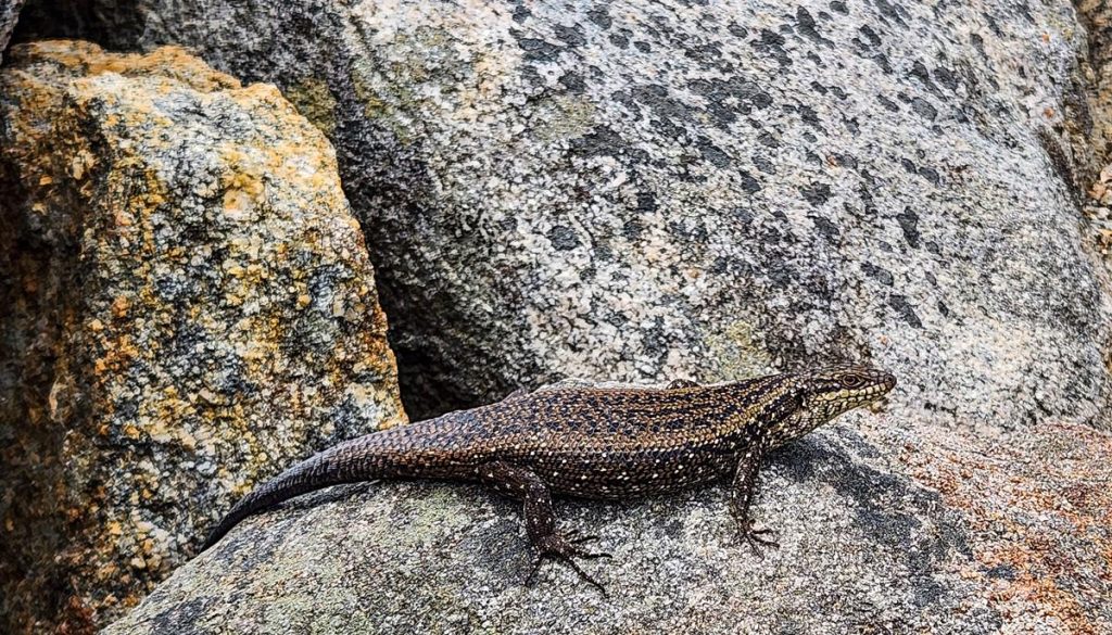
Legless lizard
The beach is only a short walk from the campground. It is quite interesting with its rock formations and water holes. There stayed at Quagi beach for a couple of nights, using it as a base to explore Stokes Inlet National Park. It can also be an alternative accomodation if you wish to visit Esperance or famous Cape Le Grand National Park.
The campground is accessed via gravel 2WD road (off Farrell road). You can bring your dog there, which makes the campground even more attractive.
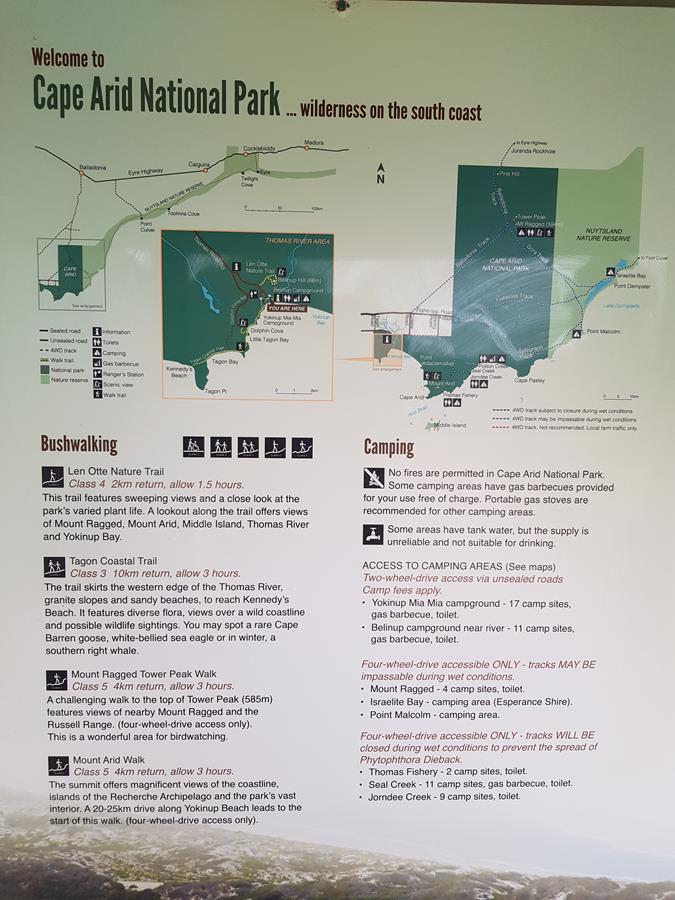
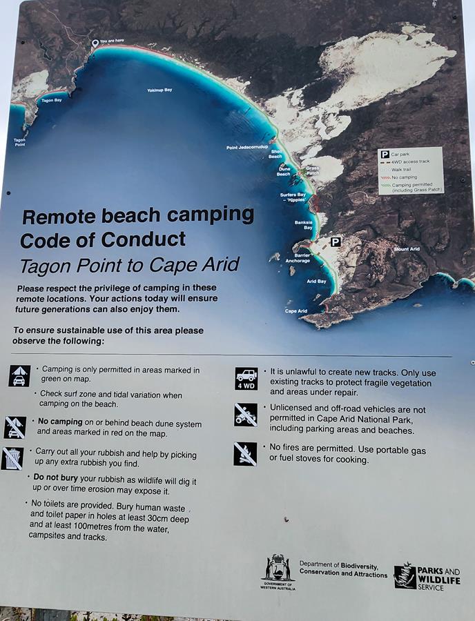
Being further away from Esperance, at 120km east, Cape Arid National Park is less popular than Cape Le Grand National Park but it has its own uniqueness and beauty, especially if you appreciate the outback and remoteness.
Dolphin Cove in Cape Arid
Most of Cape Arid National Park is accessible via a 4WD. However, some of it can be assessed with a 2WD via unsealed road.
What to see with a 2WD – western side
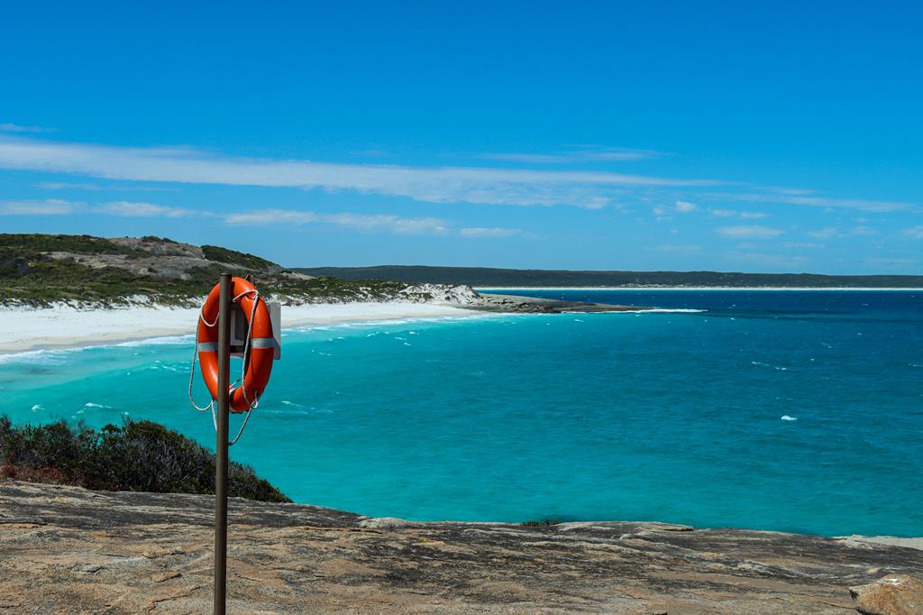
Dolphin Cove
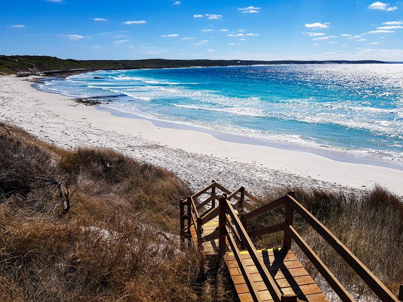
One of the places we visited there was Dolphin Cove, easily accessible. It was a little gem for us – a picturesque white squeaky sandy beach with crystal clear waters (similar to popular Lucky Bay) although a lot smaller. It is one of the best places to spot southern right and humpback whales during their migrating season (July to October) and it is also part of a beautiful Tagon Coastal Walk Trail (14km return moderate difficulty trail). For us, it was a beautiful place to enjoy the scenery and relax.
Dolphin Cove
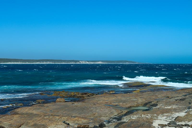
Yokinup Bay and Thomas River
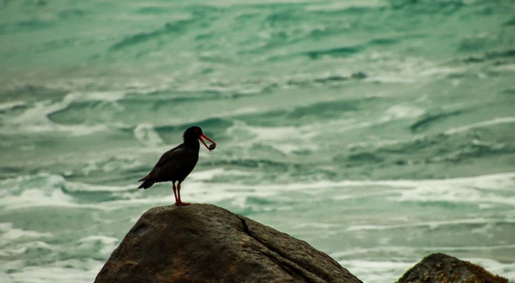
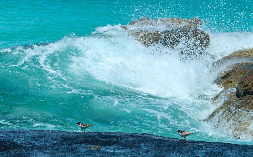
Yokinup Bay is very beautiful too. It is long, wide and scenic. We enjoyed looking for crabs at the rock pools and watching Sooty Oystercatchers when we stayed at Thomas River campground.
Thomas River separates the Belinup campground from the ocean. The access to the beach is a short walk near the mouth of the river.
Len Otte Nature trail
Len Otte Nature trail is short and easy (only 2km return). The trail leads up to Belinup Hill, featuring wonderful views of the nearby Belinup campground and the ocean. It is only a short drive (or even walk) from the campgrounds.
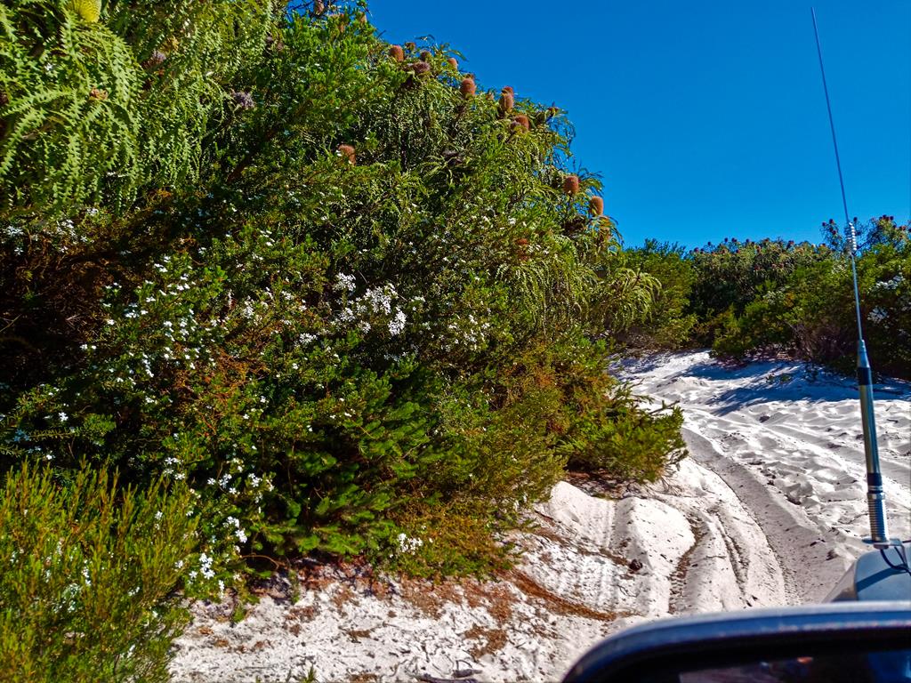
4WDriving on the western side of Cape Arid
Yokinup Bay 4WD beach
There is a 4WD beach access from the mouth of Thomas River. While camping on the beach is not permitted (hence there is a paid campground with facilities set up here), we found a sign that indicated that beach camping is allowed further down the beach at Yokinup Bay. As it was a long drive to the area where camping is permitted and the weather not being favourable over Xmas period, we didn’t attempt exploring. But we know that people go and camp there.
Tagon Beach
Tagon Beach track is a 4WD only access beach track in Cape Arid. It is listed as a track for experienced drivers only. The 2km track starts as hard rocky track and gets very soft and sandy closer to the beach. We did get bogged the very first time we attempted this track when we still had very little experience of 4WDriving (this is the story here). With the tyres down and maxtracks (just in case), slowly initially and then faster without stopping, we managed to drive through and get to the long stretch of white beach a couple of years later.
4WD track to Tagon Beach
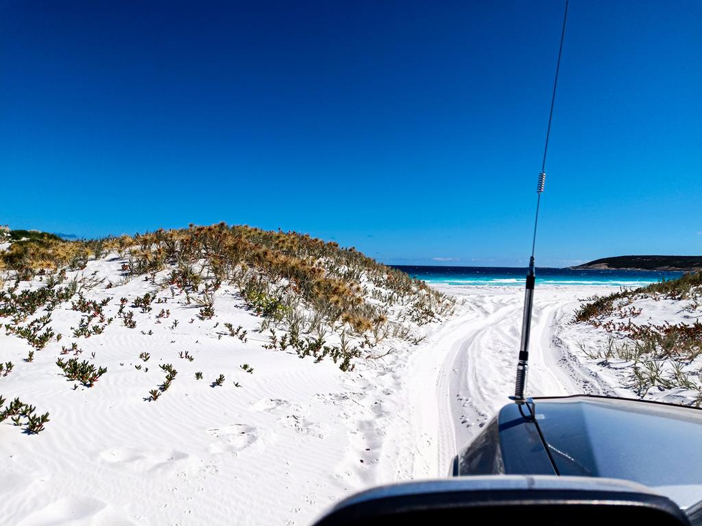
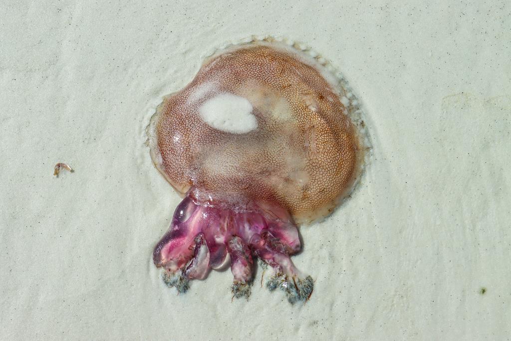
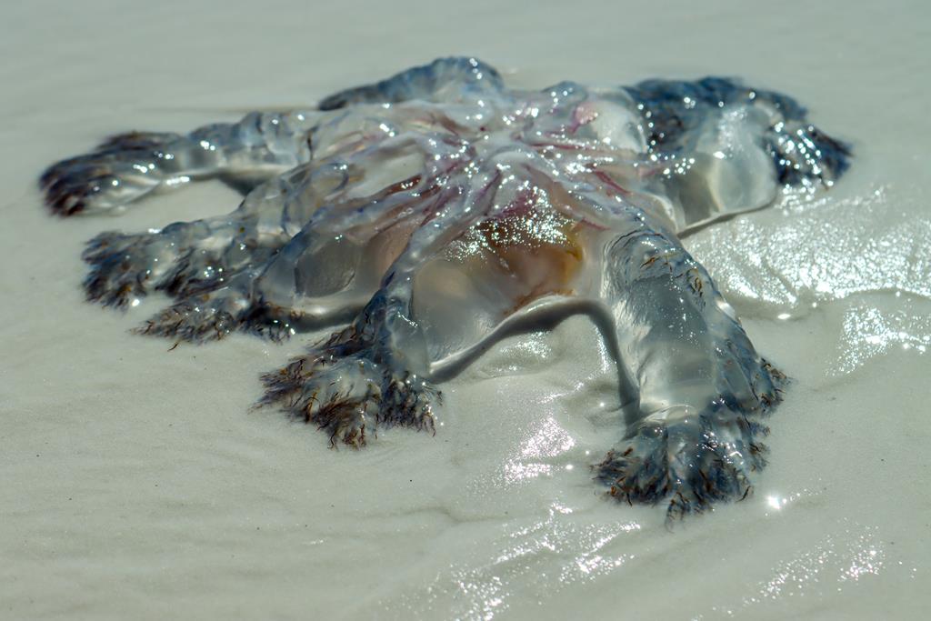
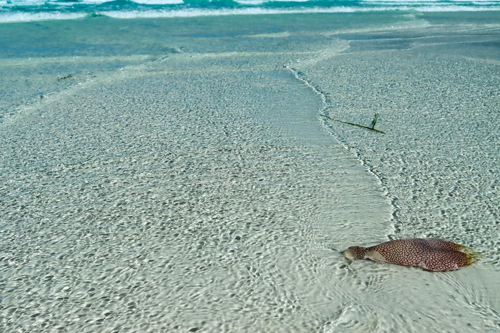
Apart from being beautiful, as all Esperance beaches are, this beach surprised us with unusually big and colourful jelly fishes which we have not seen in other nearby places.
Purple stinger Pelagia noctiluca (?)
Camping at Cape Arid – 2WD accessible
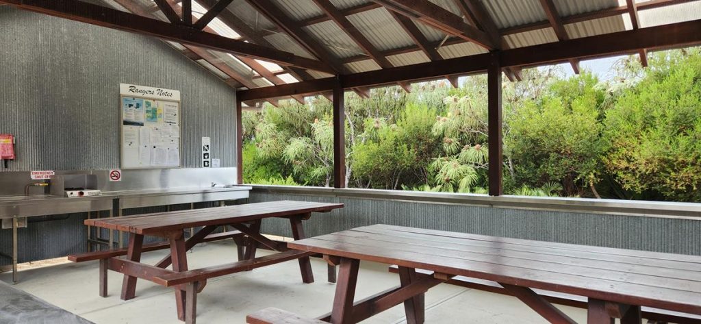
Thomas River (Belinup) and Yokinup Mia Mia campgrounds are the only 2 campgrounds within Cape Arid National Park that are assible with a 2WD via unsealed road. We found Belinup campground a bit quieter than the nearby Yokinup camp, located up on a hill. Both campgrounds have similar facilities which include long drop toilets, non-drinking water, shelter with bbq facilities. There are 11 sites of various sizes in Belinup campground (and 17 in Yokinup), all with lots of privacy. Yokinup camp has a kitchen, whereas Belinup camp doesn’t have one. Normally, there is a camphost in Yokinup campground but there was none at the time we visited. The ranger came daily to check on the payments and to do clean ups. He provided us with good information regarding the local area and the tracks, some of which were closed at that time.
The cost of staying at both campgrounds is the same, which is $15 per person per night, $5 per child, plus park entry fee (current at 2024). We spent a couple of days and really enjoyed our time at Belinup campground. Sites are non-bookable, so it is a good idea to arrive early if you travel during school or public holidays.
Additional info
As it is a national park, no dogs are allowed there. There are also no bins, so you would need to take all your rubbish with you. There is Optus reception (but no Telstra) there.
4WD accessible camping
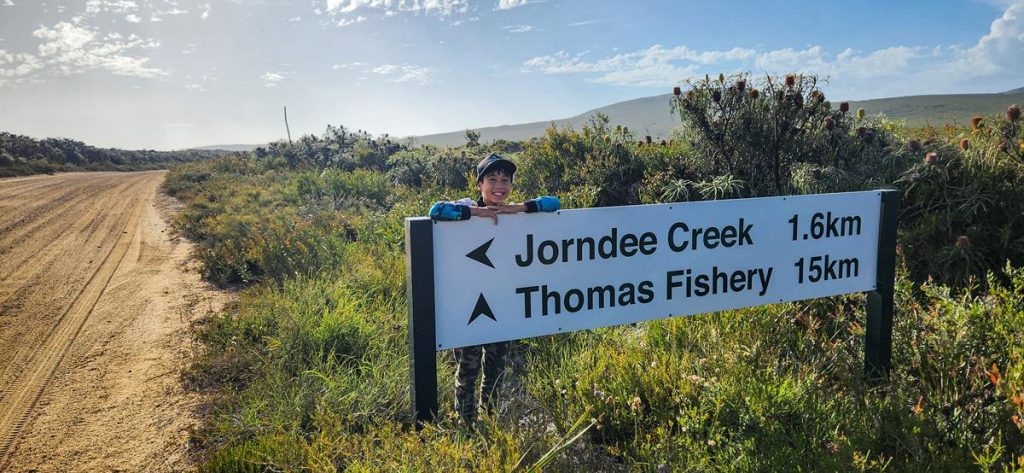
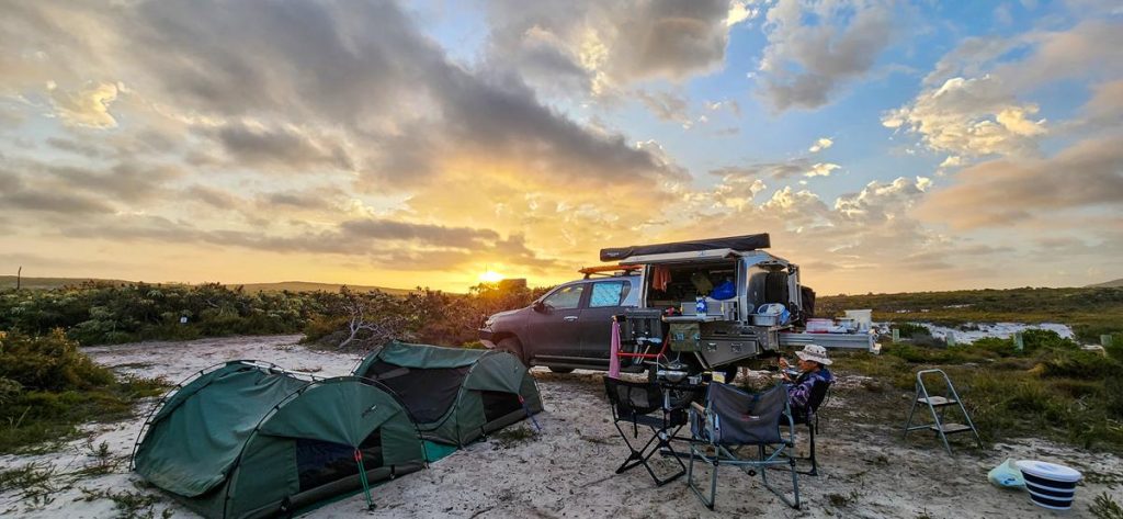
There are 4 campgrounds further eastward in Cape Arid National Park, that are 4WD accessible. We stayed at Jorndee Creek campground for New Year’s Eve.
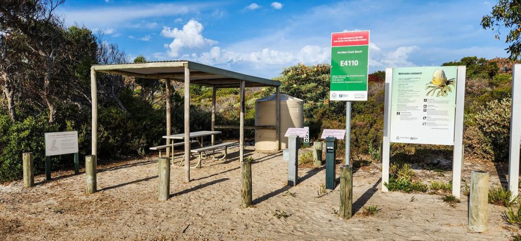
Jorndee Creek
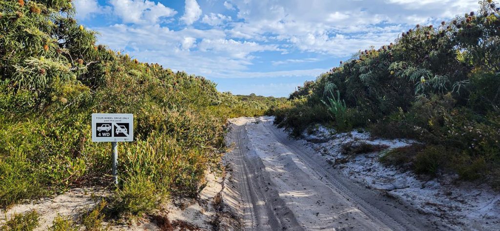
Jorndee Creek is accessible via 1,6km soft sand track from Poison Creek Road. There are 9 camping spots there, all are well protected from the wind, with lots of privacy. Some are not very leveled and some have ants but the sites are big enough to find a good place for your vehicle, van or tent within a camping spot. Facilities include one toilet, non-drinking water, 1 picnic table with shelter. There are no bins and no dogs are allowed. The sites are non-bookable. The cost is $10 per adult, $5 per child per night. The payment is cash only in the envelope. Due to remote location, ranger does not visit daily.
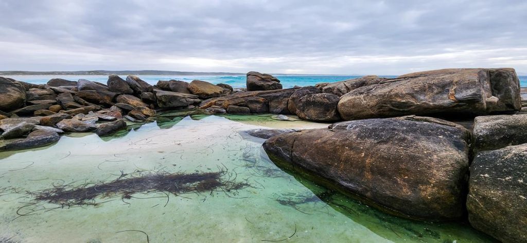
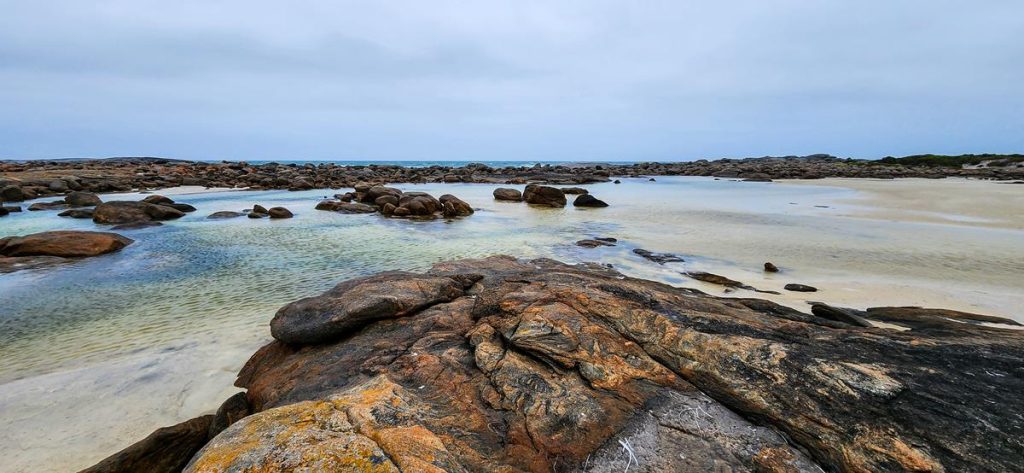
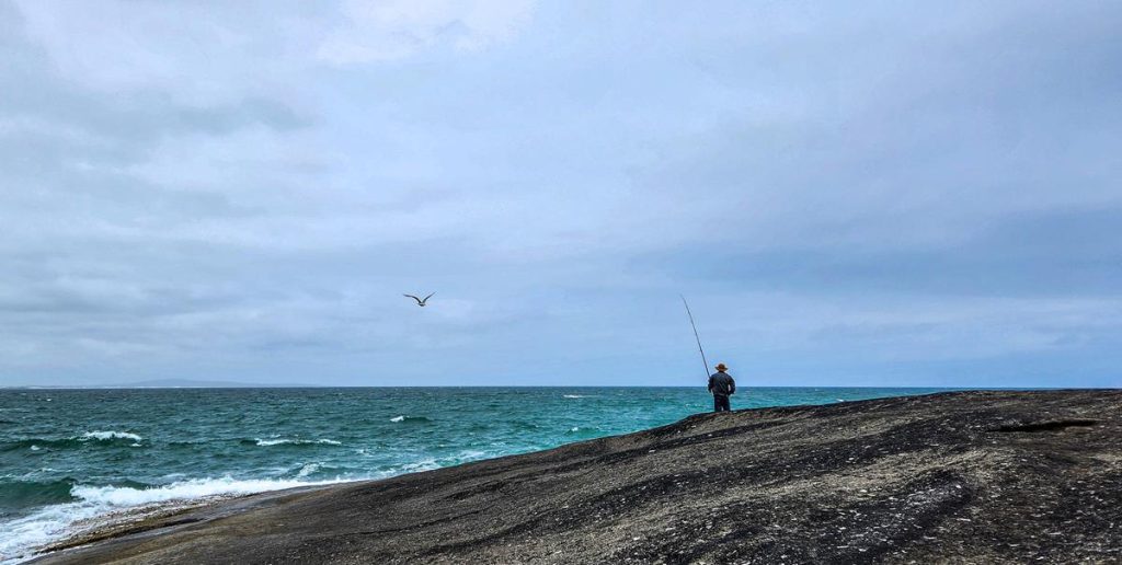
The beach at Jorndee Creek is quite pleasant, within a protected small bay, with clear water, white squeaky sand and lots of interesting rocks to explore. Unfortunately, there are no walk trails around the camp, other than a short walk to the beach. We attempted hiking to Jorndee Creek via the walk trail but it was overgrown and couldn’t be accessed past a certain point. Apart from that, we enjoyed our short stay at Jorndee Creek. Fishing is popular in this area (we didn’t fish), as well as spotting whales and wildflowers in season.
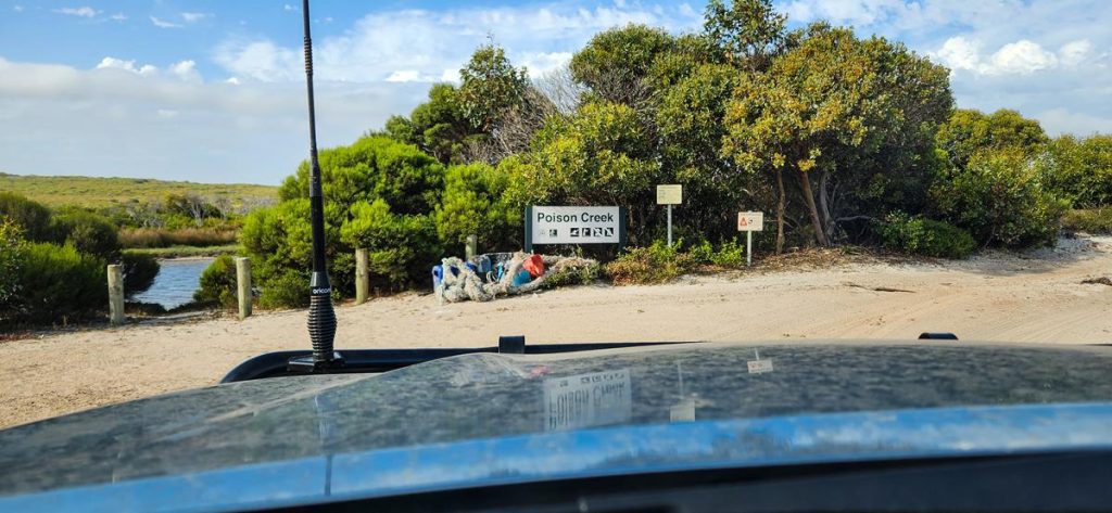
Nearby Poison Creek is a great place to visit when you stay at Jorndee Creek (or Seal Creek, which was closed at the time we visited). It is a day use only area, 6km east from Jorndee Creek campsite where we stayed. The creek joins the ocean, although there was a sand bar separating it from the ocean when we went there late December. So we drove to the beach passing the end of the creek. It is a nice place to visit for a day, if you enjoy beach and fishing.
Flora and fauna at Cape Arid
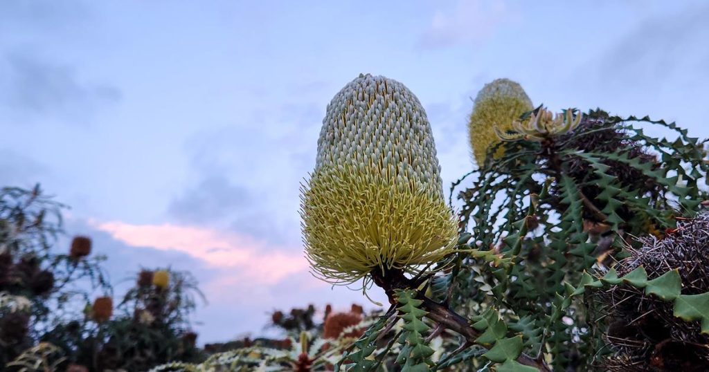
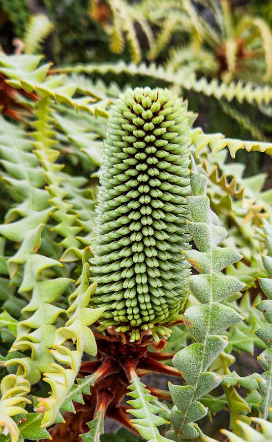
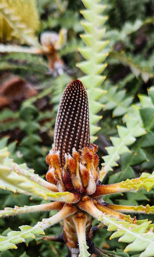
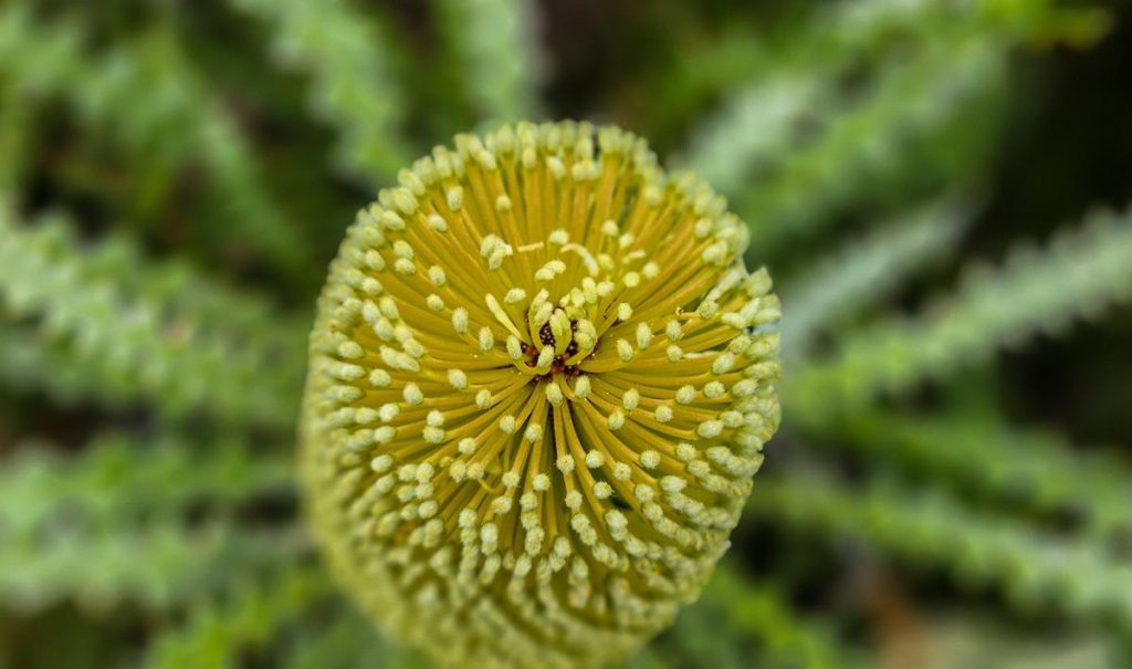
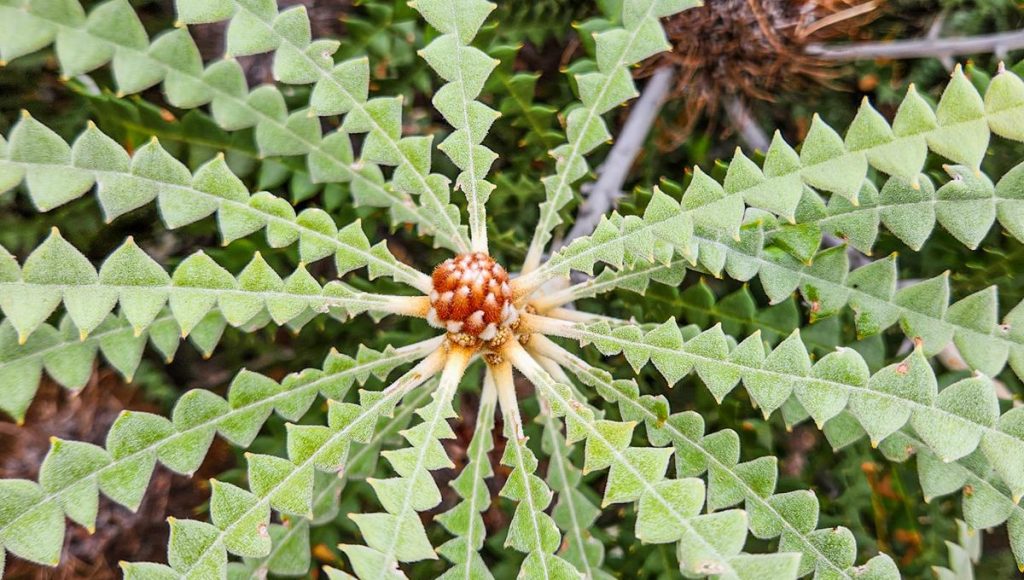
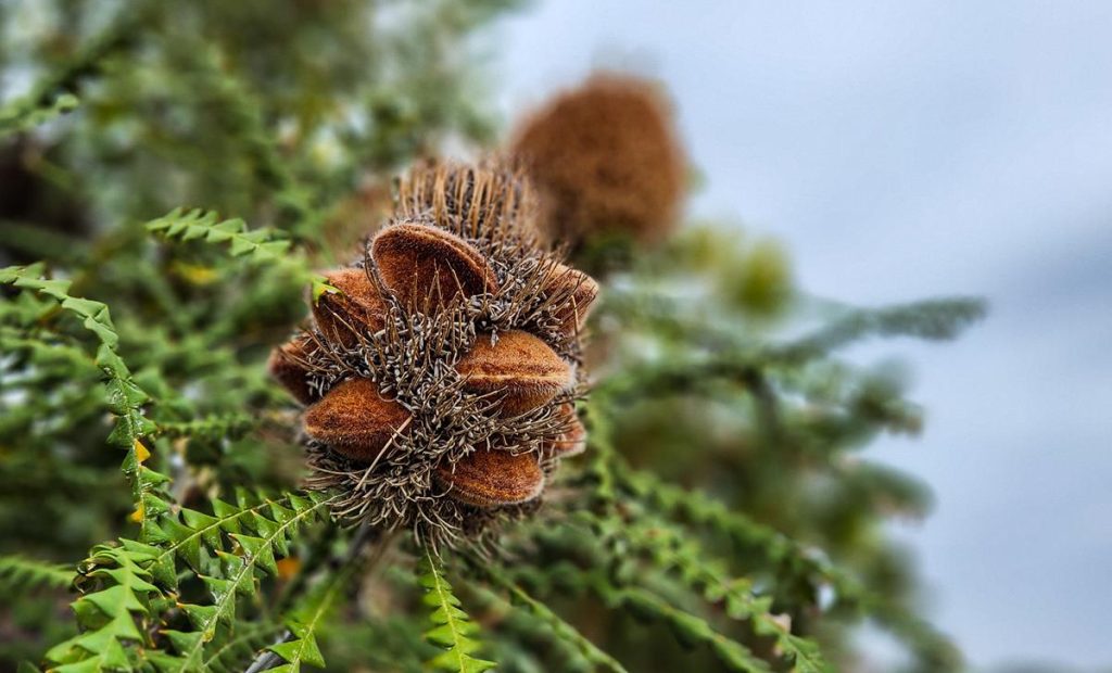
If you like nature or photography, you are in for a treat at Cape Arid National Park. The wildflowers are in abundance there any time of there (but more during the season). Banksia speciosa Showy Banksia is very common throughout the park. It looks beautiful at all its different stages of growing – from tiny bud to seed.
Unfortunately, big parts of the national park are affected by Phytophthora Dieback. That is the reason some 4WD tracks are closed in winter and during wet conditions to prevent the spread. Washing your vehicle after driving on 4WD tracks in the park is also highly recommended (we washed ours in Esperance on the way back – it only costs $5).
Other plants which we saw at Cape Arid late December:
Billardiera speciosa (above far left), Billardiera heterophylla Australian Bluebell (to my best knowledge but could be wrong) – above second left, Calytrix decandra (second right), Melaleuca nesophila (above far right).
Echiopsis curta (Bardick) – small poisonous snake, which is nocturnal but can come out in overcast weather.
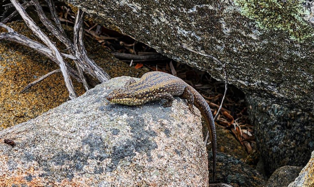
South-western Crevice Skink (above right).
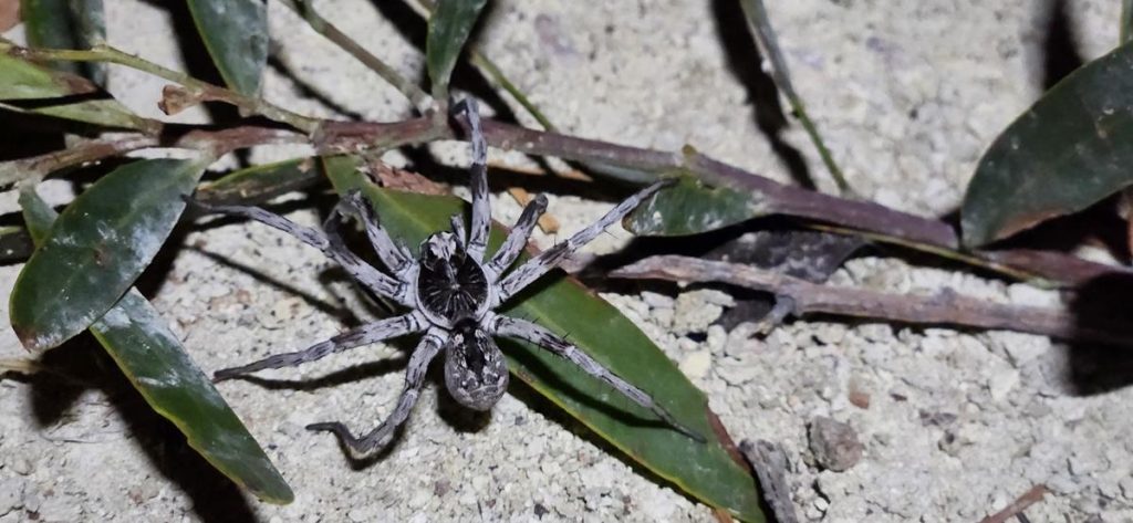
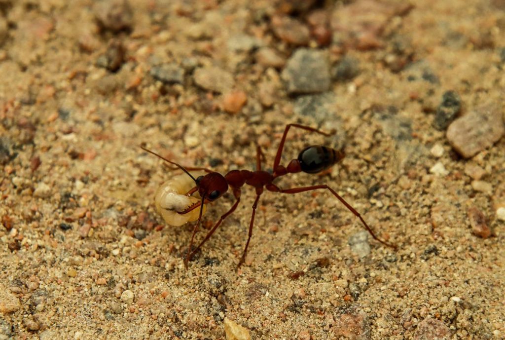
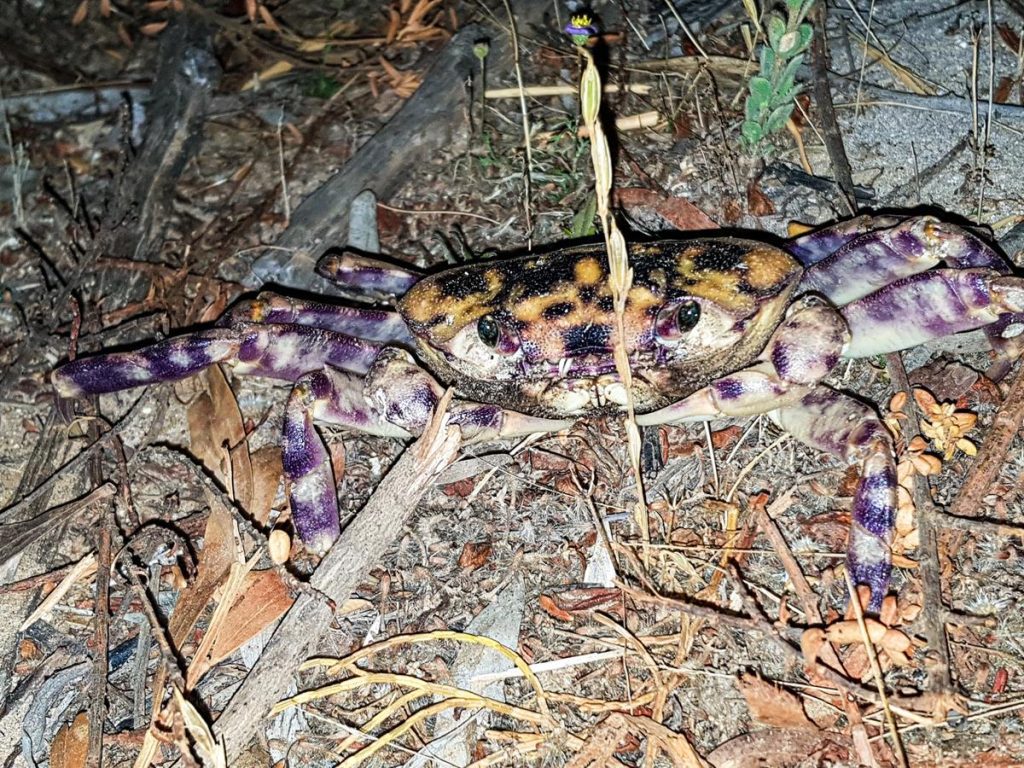
Black Wolf Spider (above left), Australia’s iconic red bull ant (above middle), crab (above right).
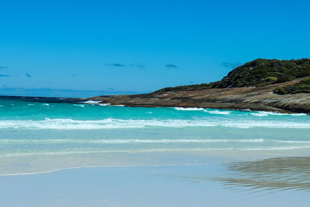
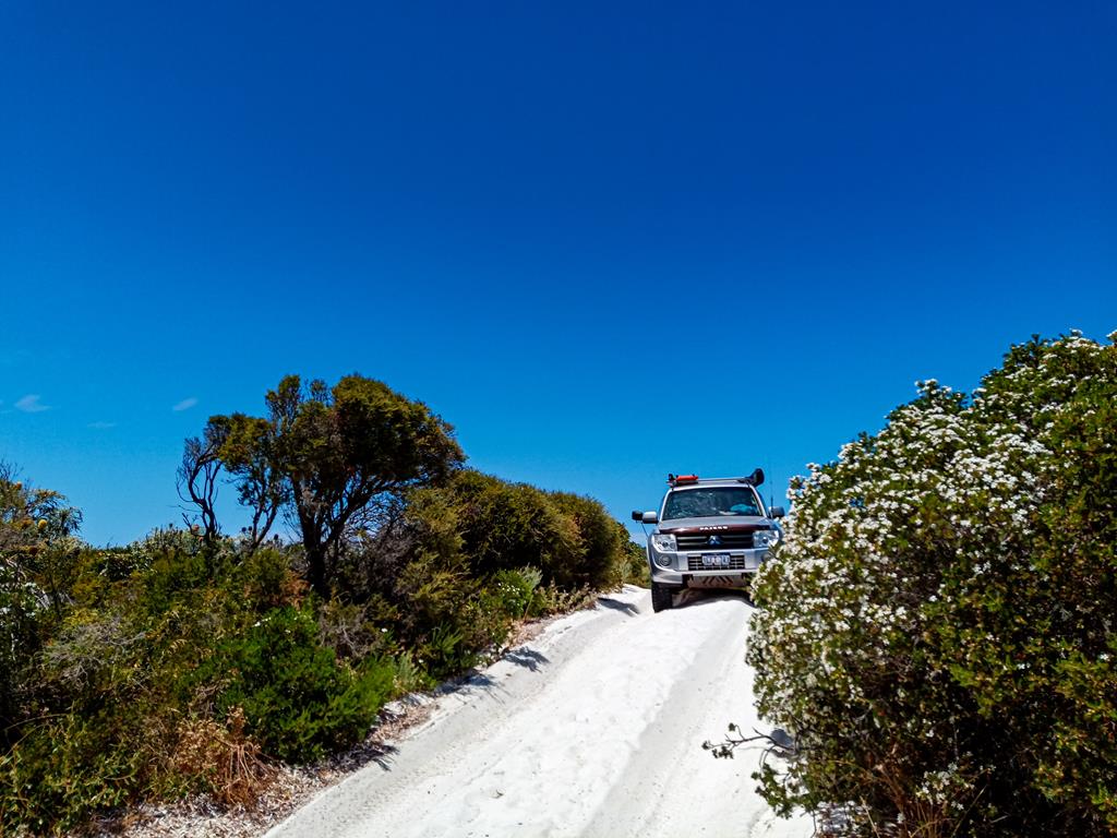
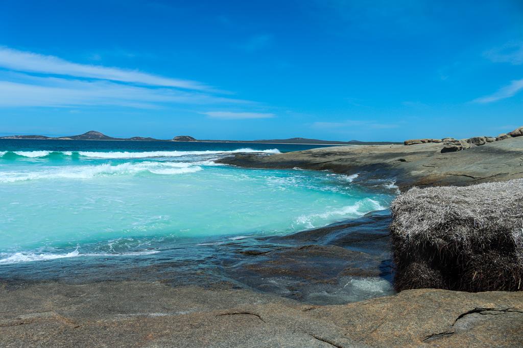
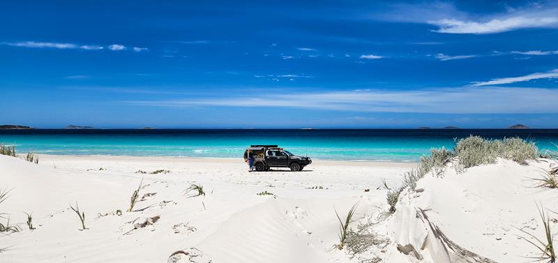
Located 100km east of Esperance, Alexander Bay (also known locally as A-Bay) in Howick is a long stretch of white firm squeaky sand, crystal clear turquoise water and beautifully nature crafted granite outcrops. It is accessible via a 4WD track.
4WD track to Alexander Bay beach
There is a campground, for which you pay $15 per nigh per site but cannot pre-book. While we did not stay at the campground, we drove around and noted that it looked like it has been recently upgraded, with more sites added, it was very well laid out and had new toilets installed. It was full when we visited it on 24 December last year, so obviously a very popular place. Great for fishing and surfing, long enough to drive on it (it is 1.7km long) with amazingly clear water, lots of white firm sand to dig for kids. It looked like an absolute paradise to us. We found it equal in beauty to famous Cape Le Grand beaches minus the crowds.
Alexander Bay beach is a great place for swimming, snorkerlling, kayaking, fishing or just relaxing. The turquoise colour of the water in combination with white sand is sure to blow your mind away. You can bring your furry friend there too.
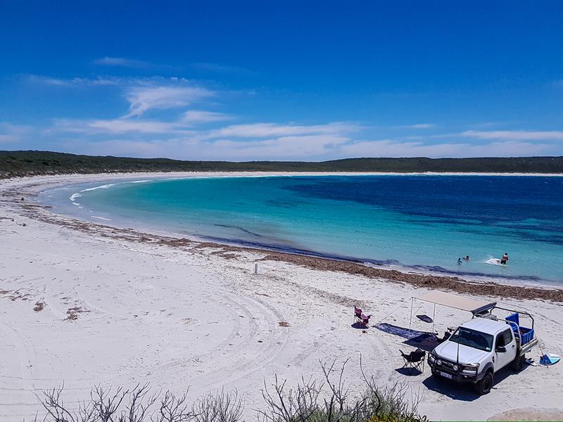
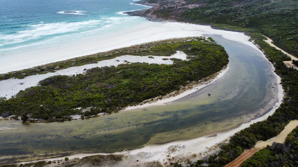
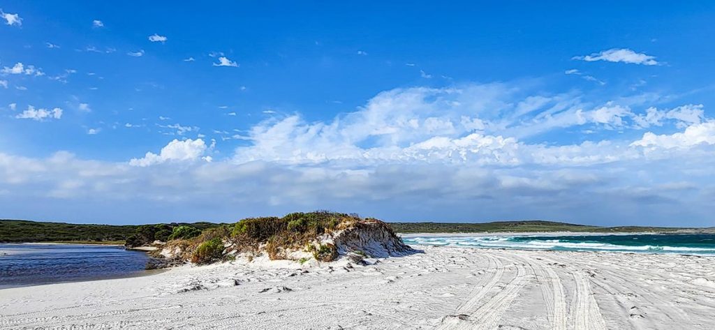
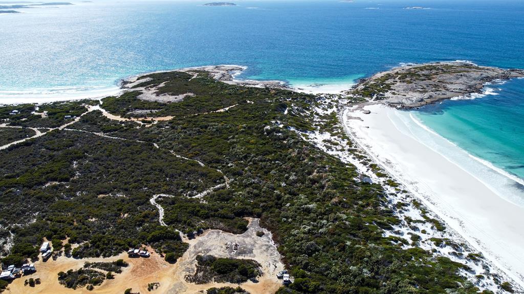
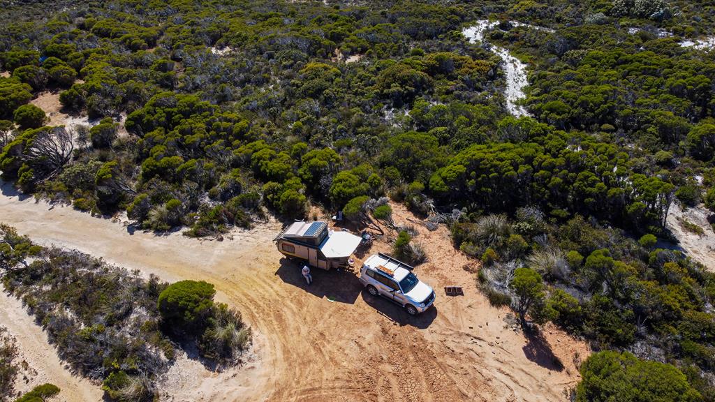
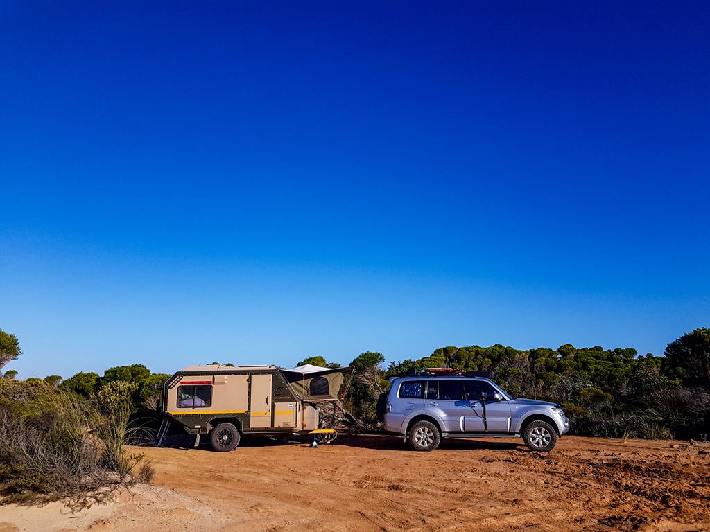
Located 70km east of Esperance, Membinup beach is one of the lesser known (but quite popular with locals). It offers free camping with no facilities. The beach and the campground is accessible via rough 4WD track from Daniels Road. There are a few camping areas (although not all clearly marked), so it is a matter of finding one suitable to your liking and also depending on how far your vehicle is able to travel. Some tracks are very soft sand which are not possible to drive on past certain point.
View of Membinup beach camping area
We managed to find a spot for ourselves which was sheltered by the dunes, had some privacy, was flat enough and only a 5-minute walk from the beach. We did have to climb up a very steep slope each time we went to the beach. But once on top of the slope, the view of the ocean was so mesmerizing, that it made us forget the hard work of climbing. And who can complain? We tend to get fitter every time after returning from our camping trips – mostly due to increased movements.
Dunes that we have to climb to get to the beach (above left), our camping spot (above right).
While some sites are soft sand, others, like the one we found, was dry earth, which turned into muddy glue with just a quarter of a bucket, which made taking shower a bit difficult. Imagine this place getting rain for 15 minutes – that place would become a mud plain.
We spent 4 fulfilling, relaxing and memorable days at Membinup beach, including Xmas Day. The beach itself is very much like the one at famous Cape Le Ground ,minus the crowd. It is just white squeaky firm sand, crystal clear turquoise waters, plus some rocky pools.
Beautiful Membinup beach
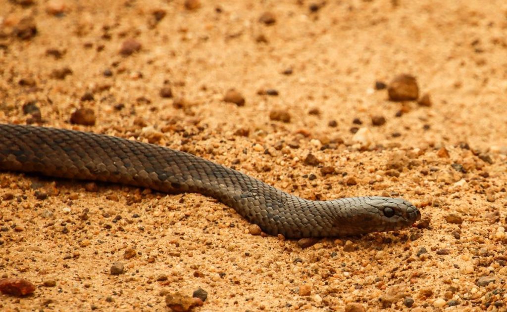
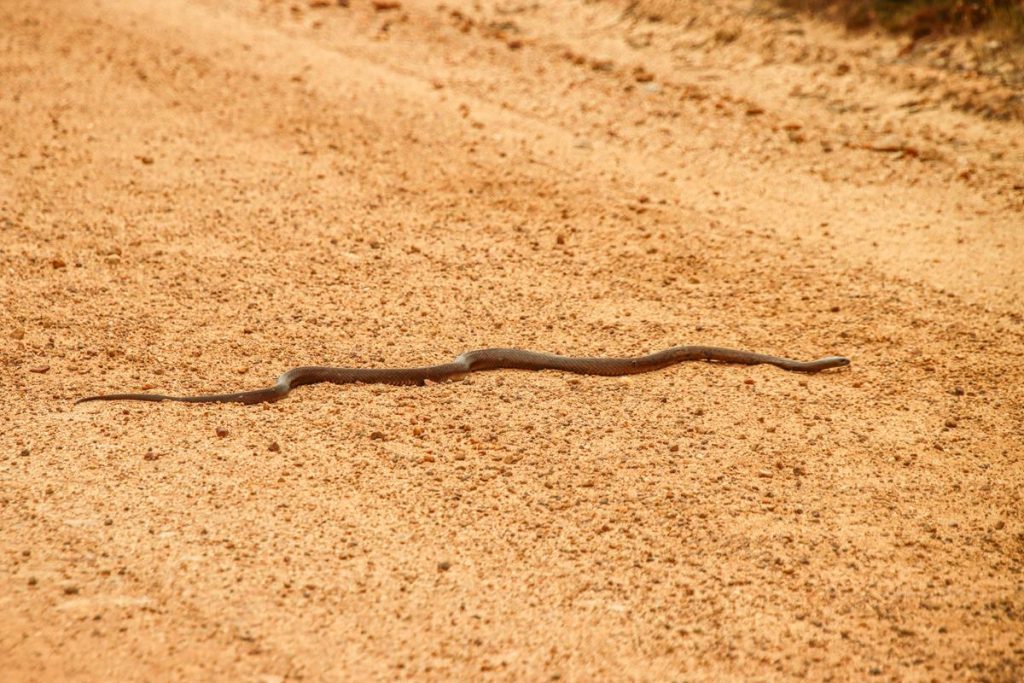
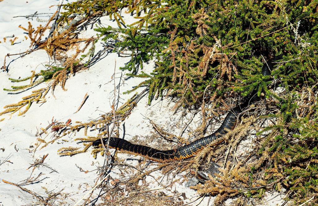
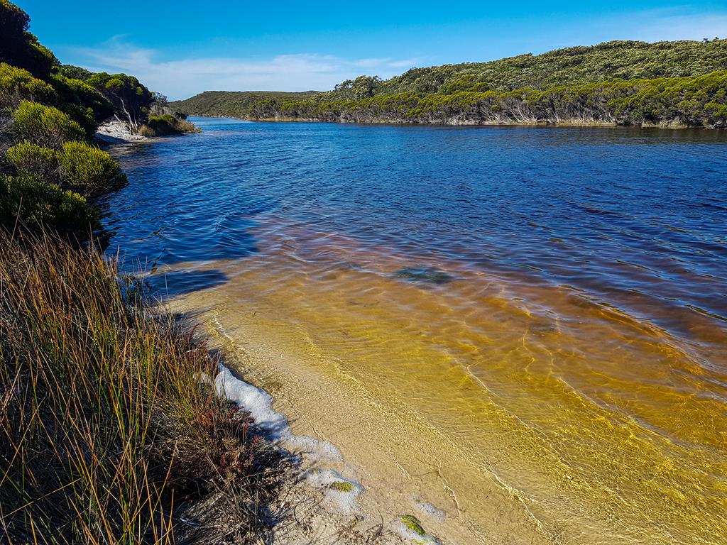
Tiger snake at the inlet
The more we travel, the more we see and learn about snakes. This time we’ve encountered Tiger Snake (Notechis scutatus), which is dangerously venomous and aggressive. Tiger snakes are most common in coastal and wetland environments, living primarily around swamps and inlets where they catch frogs. Tiger snakes when threatened, raise their head off the ground, like cobra. We saw this tiger snake near the inlet at Membinup Beach.
Tiger snake( Notechis scutatus) near inlet
The inlet where we spotted Tiger snake (above).
Driving on beach
Driving on the white squeaky firm sand on the beach is so much fun! Although first you need to get through a narrow single line track with bushes either side, scratching the vehicle 😊.
Driving on the beach is fun!
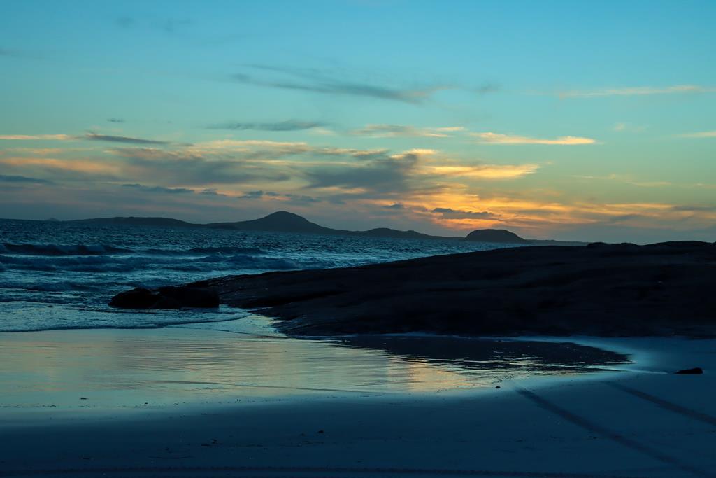
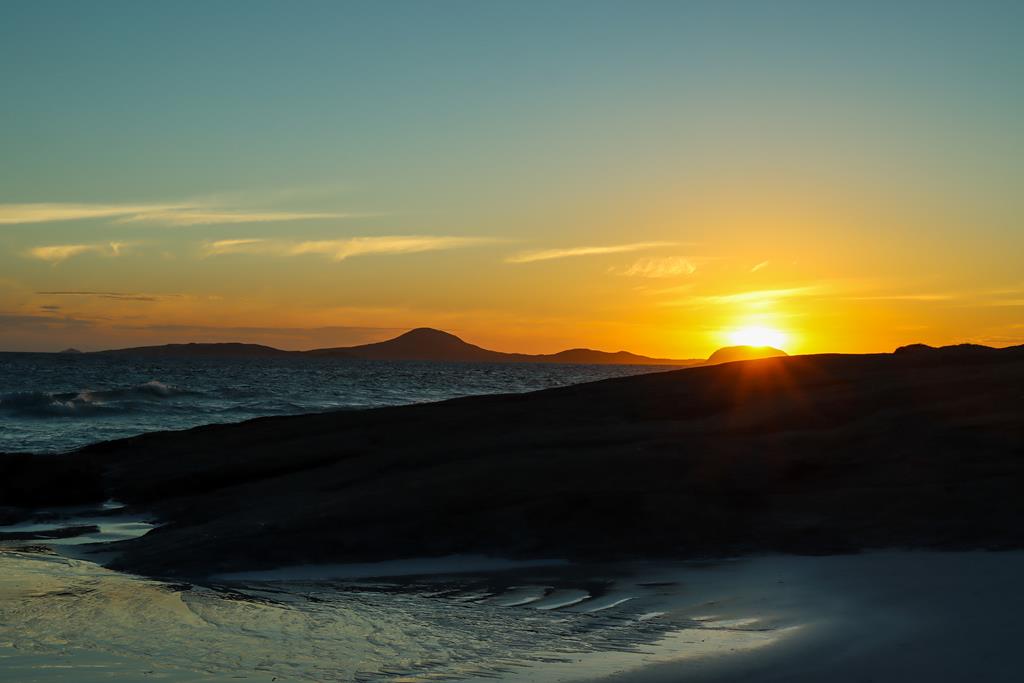
Sunset
There is something so mysterious in those sunsets – the colours, tranquillity and a sense of something very majestic…
Sunsets at Membinup beach
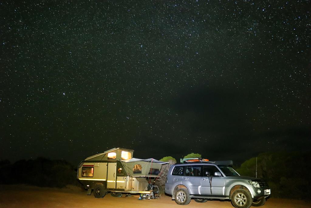
The nights in the outback are amazing! Millions and millions of stars were our companions.
Starry night at Membinup beach
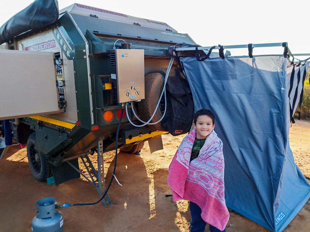
Taking showers in the bush
Taking showers in a bush is a luxury. We only took showers every second day and even less often in colder weather. While we do have hot water system to enjoy hot shower, the need to save water meant that each person had about a liter of water. But there is nothing to complain here. Camping in the bush with limited water taught us to appreciate so many things we would otherwise have taken for granted – like proper hot shower!
Taking shower in the bush environment is a luxury
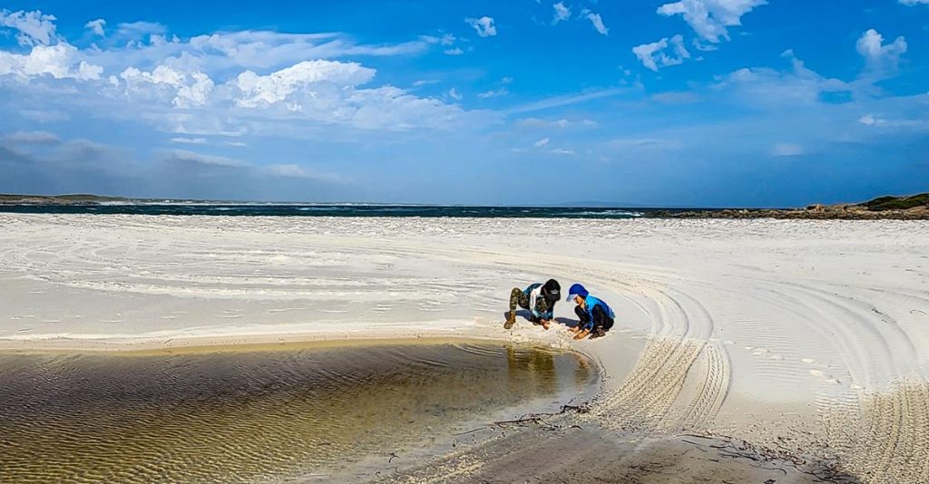
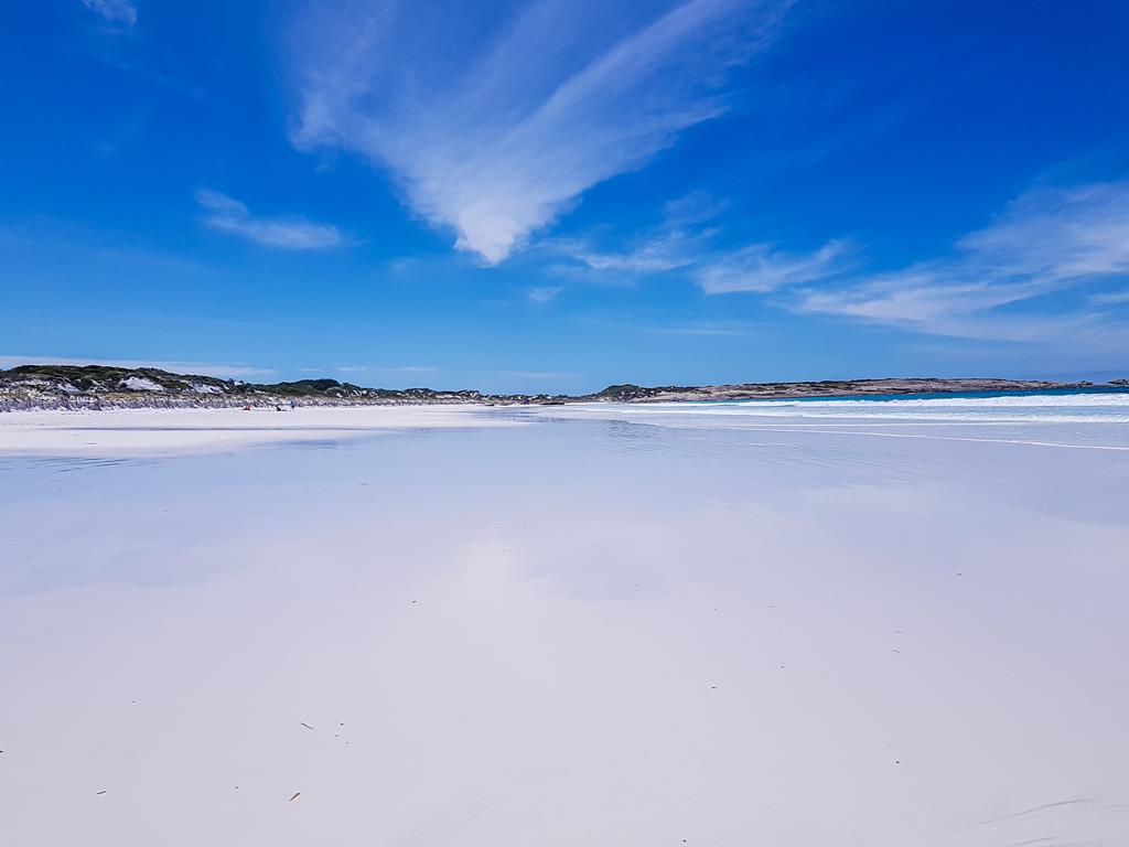
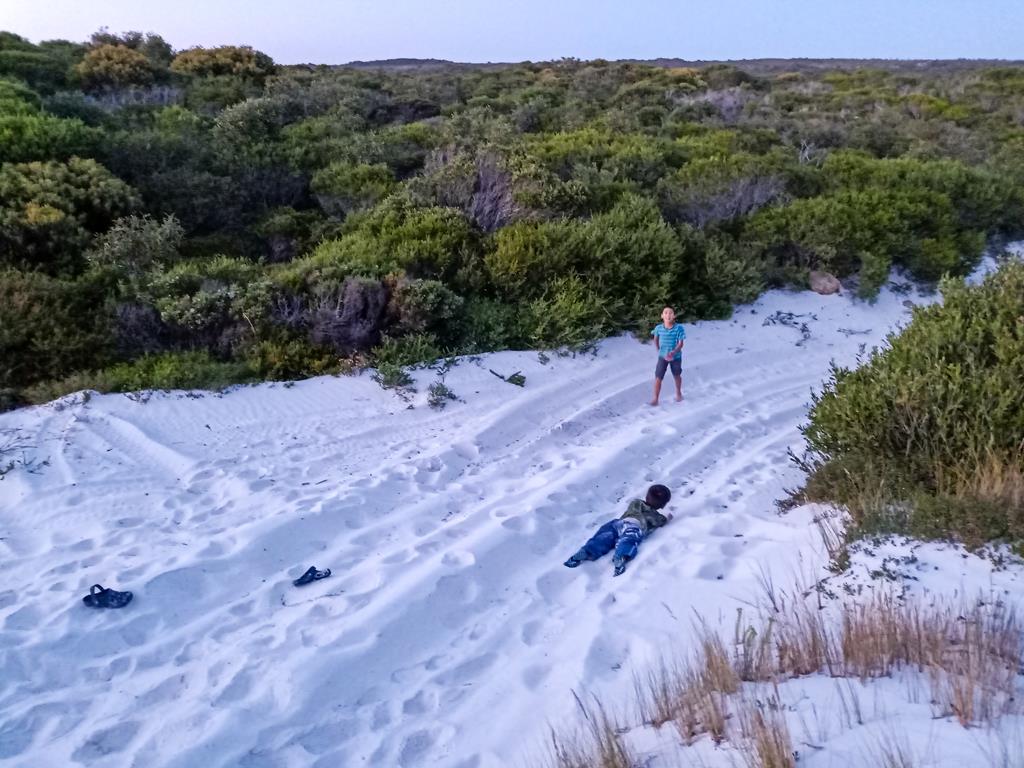
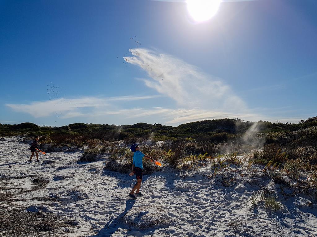
The white squeaky firm sand at Membinup beach is amazing. Take the kids to this kind of beach and they will find their own entertainment! Even before they got to the beach, fun began….
Kids had great fun playing with the sand
Photography
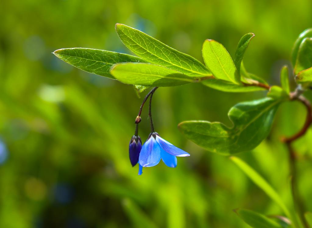
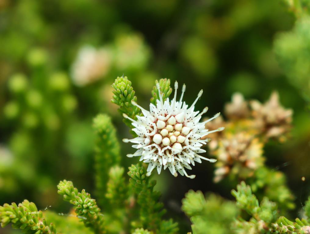
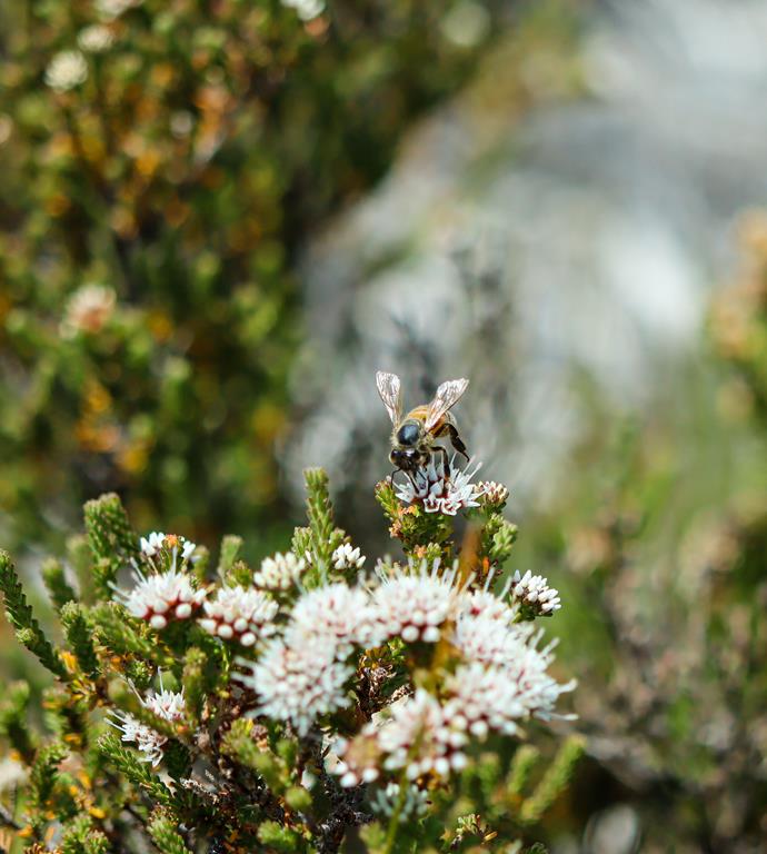
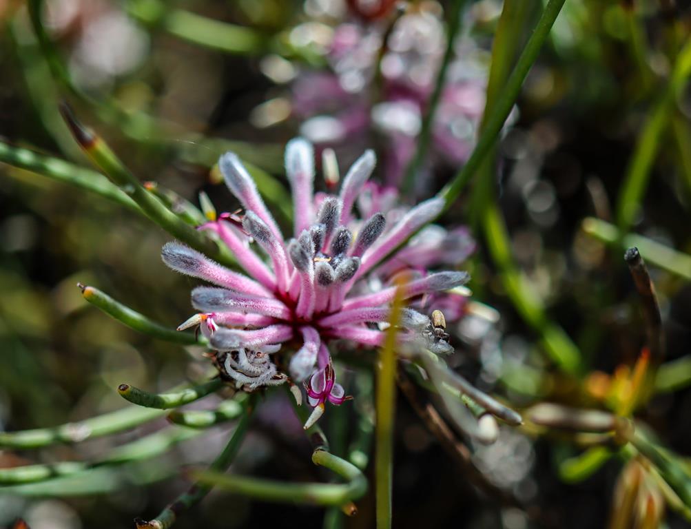
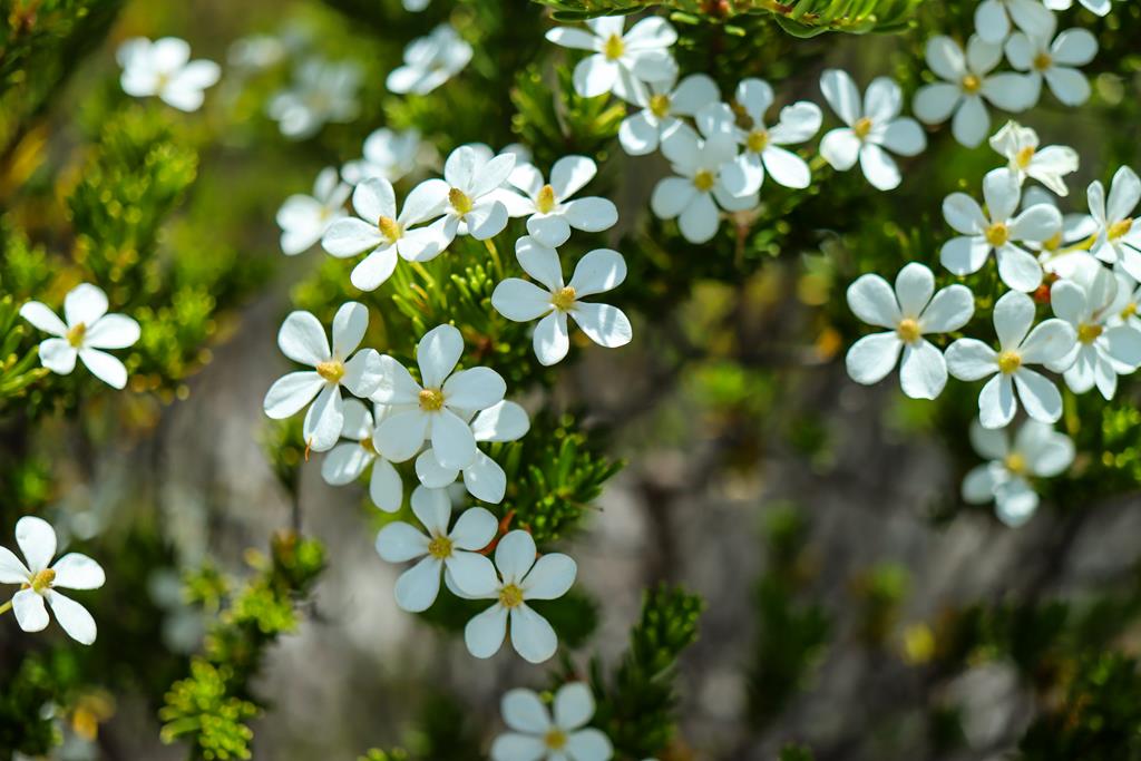
While beach is always the main attraction and entertainment for us, there are other interesting things to discover and observe on the beach, other than waves and white sand. The wildflower season on the south coast of WA lasts well into summer, so you can still find a number of pretty wildflowers.
Billardiera-heterophyllaDarwinia diosmoidesMelaleuca PulchellaDarwinia diosmoides with beePetrophile teretifoliaRicinocarpos megalocarpus – Wedding Bush
Membinup beach also offers an opportunity to watch the birds, including shore breeding birds Sooty Oystercatcher and Hooded Plover.
Hooded plovers
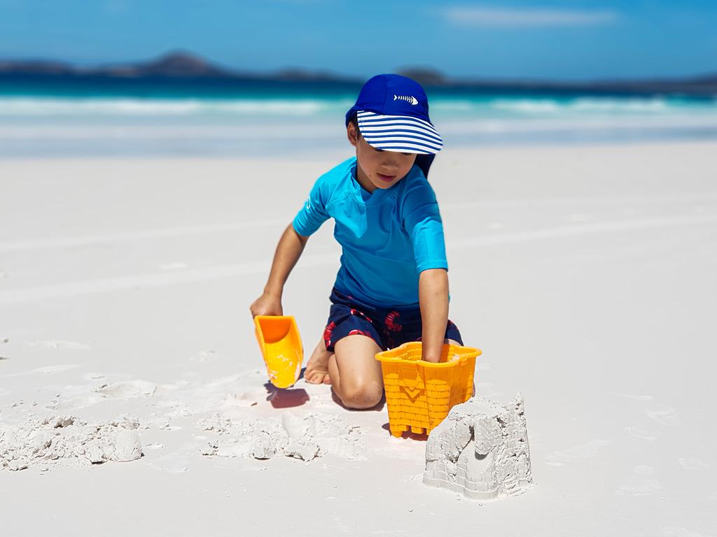
We walked on the beach, we drove on it, kids dug sand and built sandcastles. But mostly, we just relaxed gazing endlessly into the ocean, feeling splashes of the waves on the bare skin and hearing the roaring of the ocean at night. Magnificent!
Visiting Membinup 3 years later
Early January 2025, we decided to camp at Membinup Beach for a few nights to recuperate after a long and tiring driving trip to Eastern states. This time we got a better spot. It was secluded, closer to the beach and even had a private entrance to the beach, which looked so mysterious with those paperbark trees lining it up.
This is one place to come back too. As it has no amenities, please take care of it, should you decide to visit this beach. Please keep this awesome place clean so we all can still enjoy it in the future.
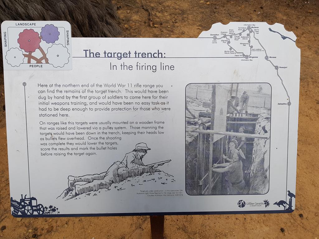
A 12km drive northwest of Mingenew in the Mid West region of WA is a magnificent reserve of Depot Hill. It is a wonderful place to spot many wildflowers all year around, but especially during wildflower season. Pink, orange, yellow, white, purple, violet – this place was full of colour when we visited it at the end of September. A stunning display of wildflowers in their natural environment.
Depot Hill is also a place of historical s significance. Following the bush trail all the way up through the reserve, you will find World War II Army Rifle Range with one remaining bunker there.
The bush walk was easy and very pleasant. Allow minimum 30 minutes for a return walk, but if you are a wildflower or photography enthusiast, you’ll probably spend a lot more time in this beautiful reserve – tranquil, yet very alive and vibrant.
If you are wondering where you can stay while visiting Depot Hill, we recommend camping at Coalseam Conservation Park, which is also another stunning place to view wildflowers.
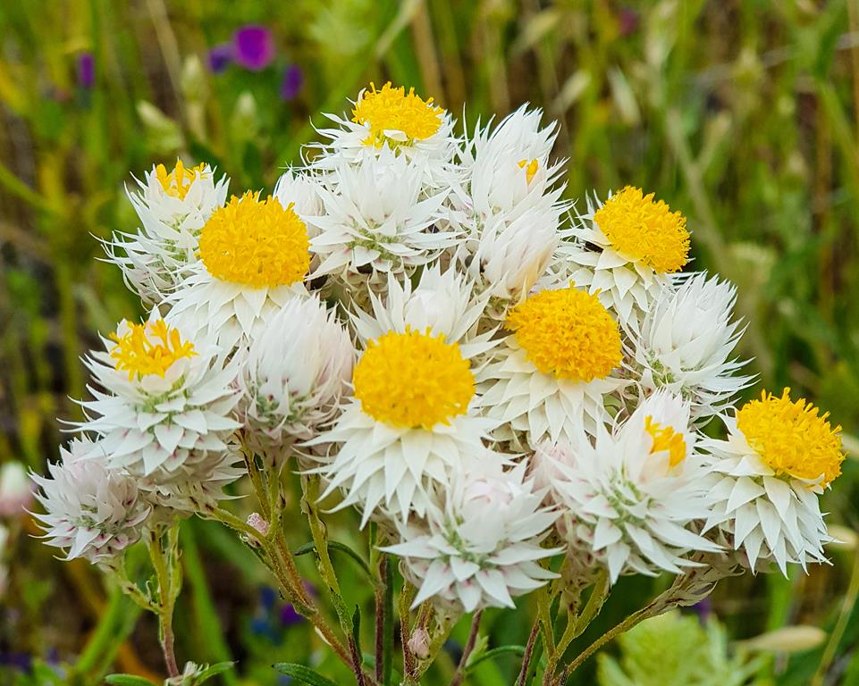
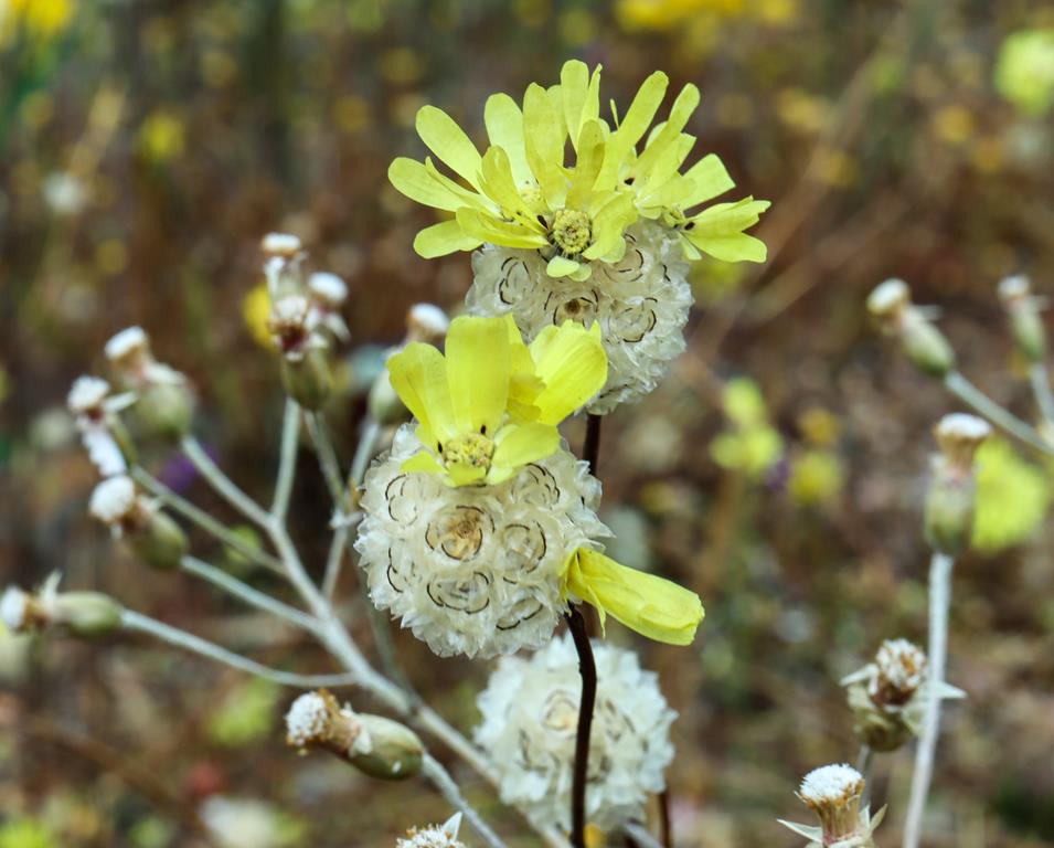
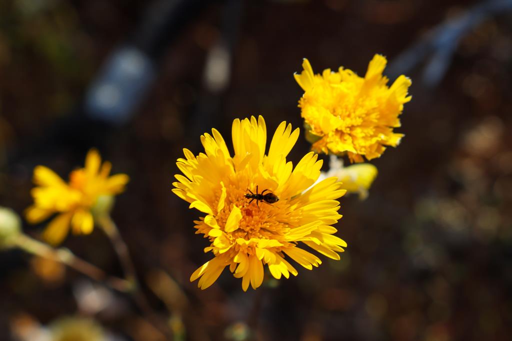
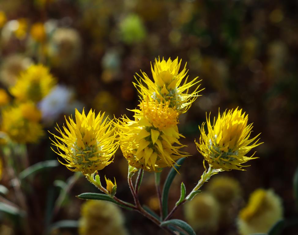
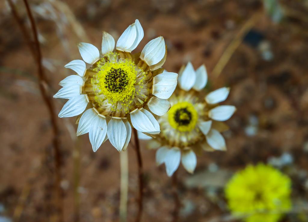
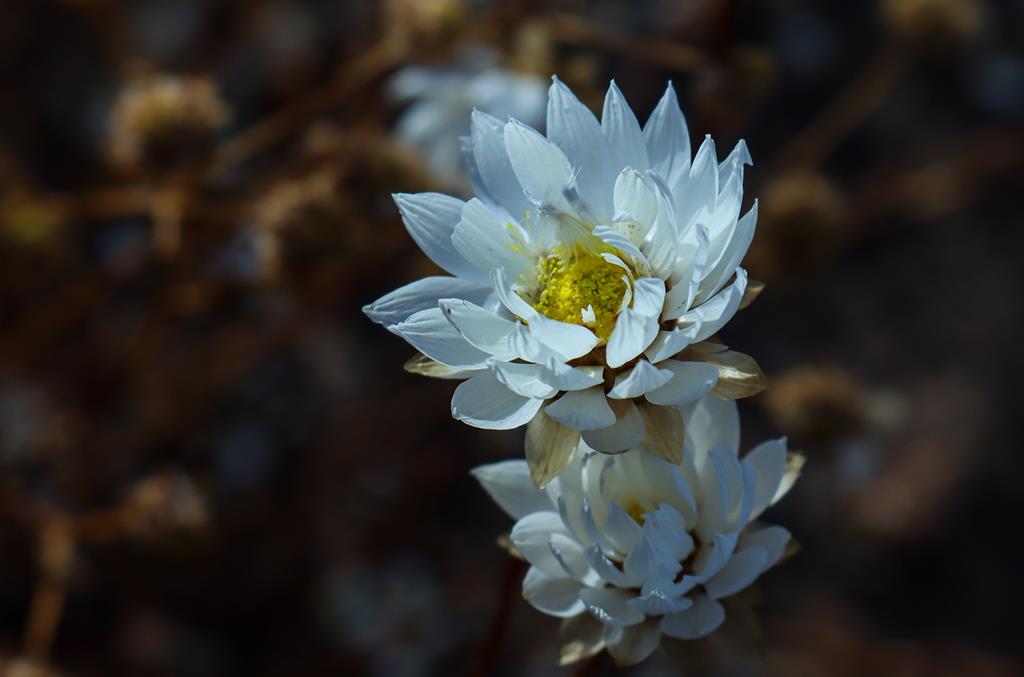
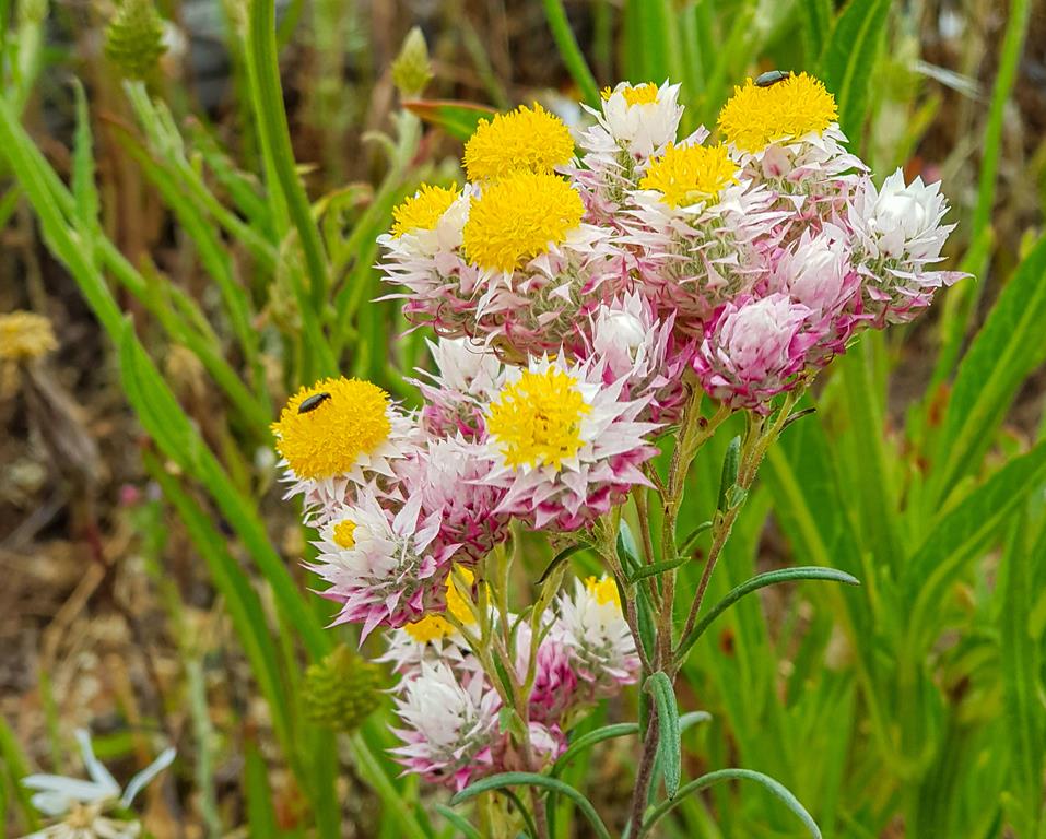
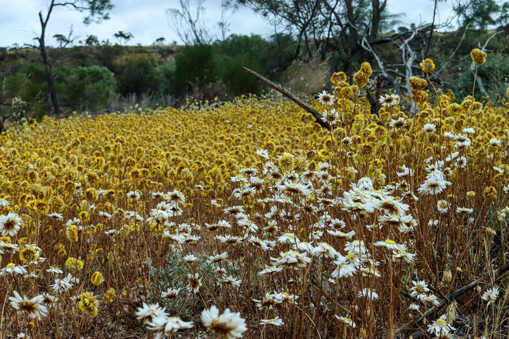
Located 33km north of Mingenew, Coalseam Conservation Park is best known for its stunning display of wildflowers, especially everlastings, which are best seen in August-September. Even though we missed the prime time of the wildflowers blooming by about 3 weeks, due to work and study commitments, we still enjoyed what was left of them. In fact, there is a certain beauty in the dried everlastings – maturity combined with beauty of gold.
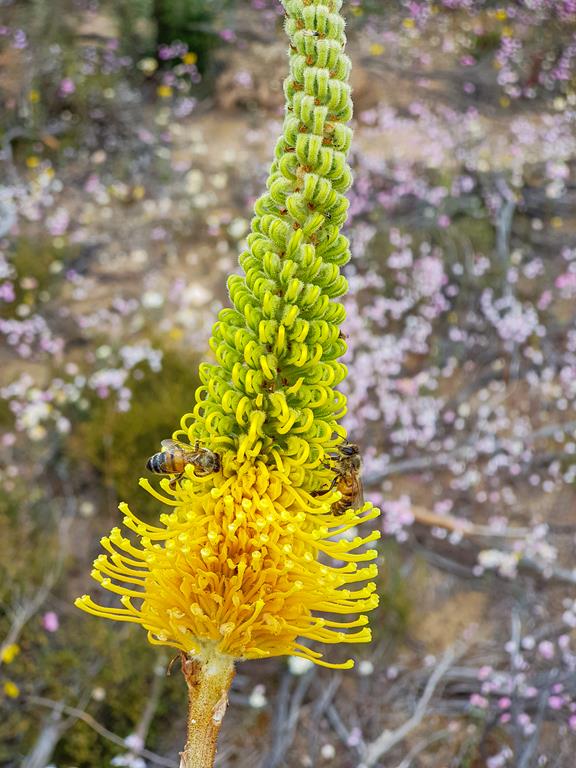
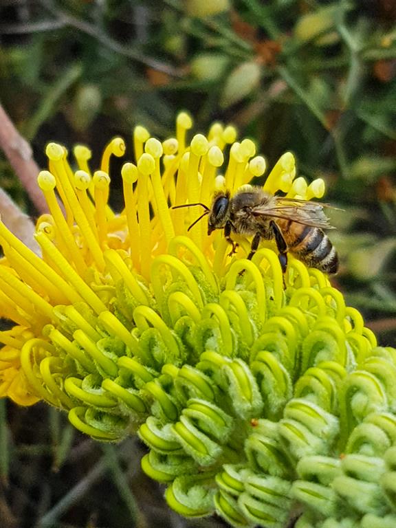
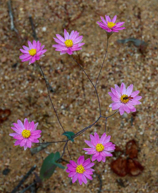
Cephalipterum drummondii Pompom headPodolepis aristata with insectOrange immortelle Waitzia acuminataRhodante chlorocephala Pink white everlastingRhodanthe chlorocephala Pink white everlastingWaitzia suaveolensThysanotus tuberosus Fringed LilyYork gumYork gum with ants
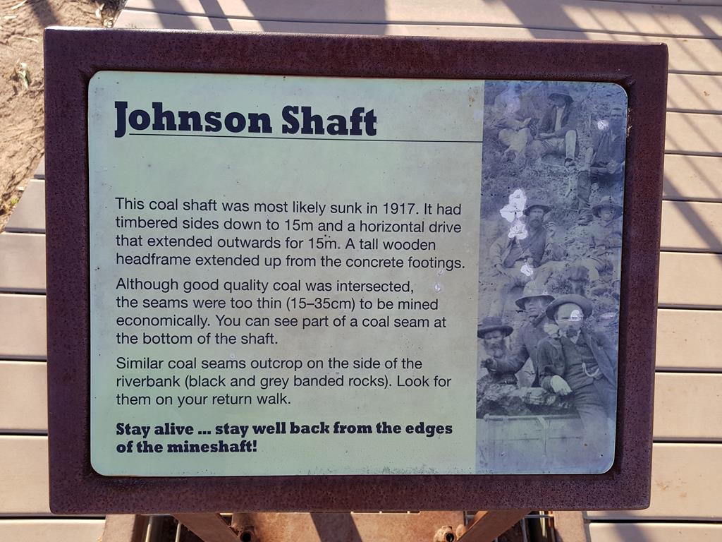
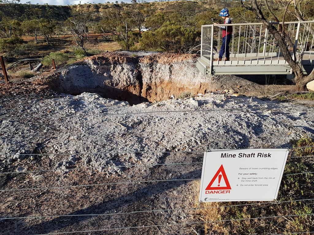
Coalseam is also rich in history and geology. It is the site of the first mined coal deposit in Western Australia, and exposed bands of coal seams can still be seen. The coal there turned out to be of not high enough quality to mine profitably, so the mines was eventually closed and the reserve became Coalseam Conservation Park. The part of the reverse near Johnson Shaft was turned into Miner’s camp ground.
Old Mine Shaft site
Camping at Coalseam Conservation Park
There are two campgrounds at Coalseam Conservation Park. We stayed at Miner’s camp which was very popular when we arrived on 25 of September, just at the beginning of school holidays. We were lucky to get one last out of 25 spots at around 4pm in the afternoon. Our lovely and friendly camphosts collected our money ($11 per adult, $3 per child – prices back in 2021), car registration and other necessary information. For those fees we enjoyed a spacious site to park our 4WD and caravan, beautiful views all around, clean drop toilet, company of the neighbours and communal fire every night. I would imagine this place looks absolutely stunning during the peak of wildflower season but it still looked very pretty even at the end of the season.
Miner’s Camp at Coalseam Conservation Park
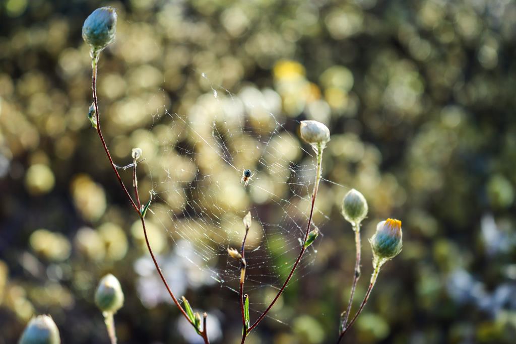
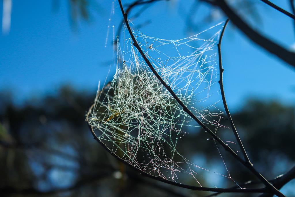
Not just the wildflowers
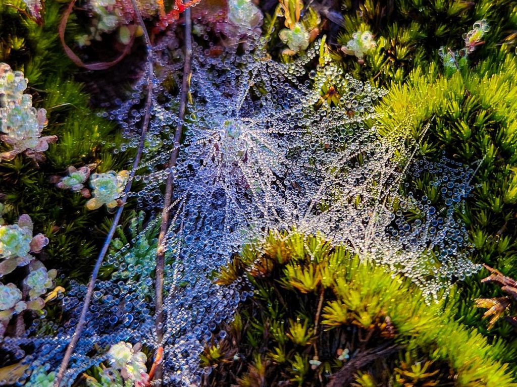
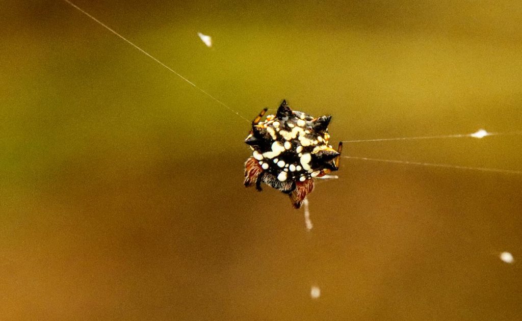
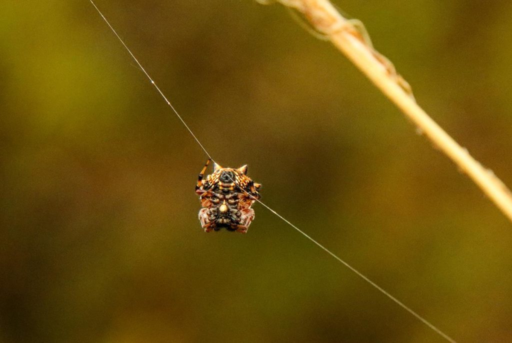
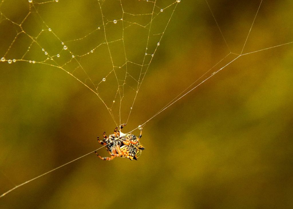
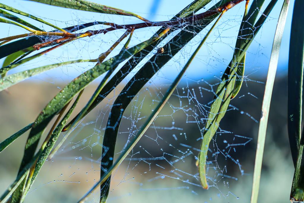
With 3 days to stay at Coalseam, we had plenty of time to go for numerous walks around. Going for a walk is not only a relaxation, exercise and leisure, it is also an opportunity to explore the area and see the beauty and extraordinary around us…. like the beautiful tapestry of the spider web .
Tapestry of the spider web
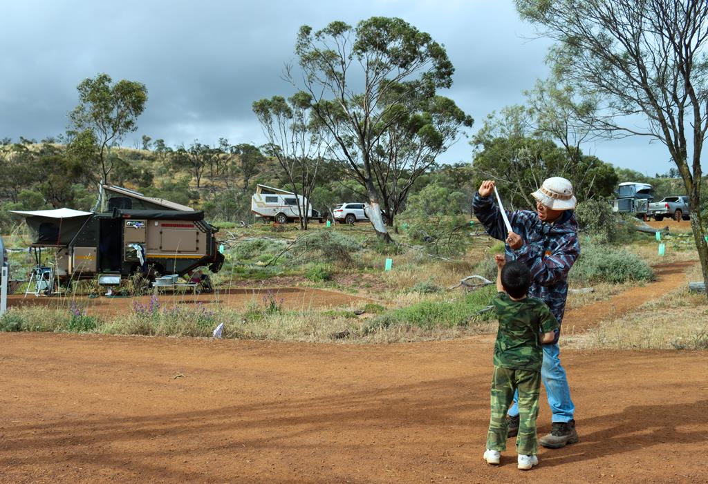
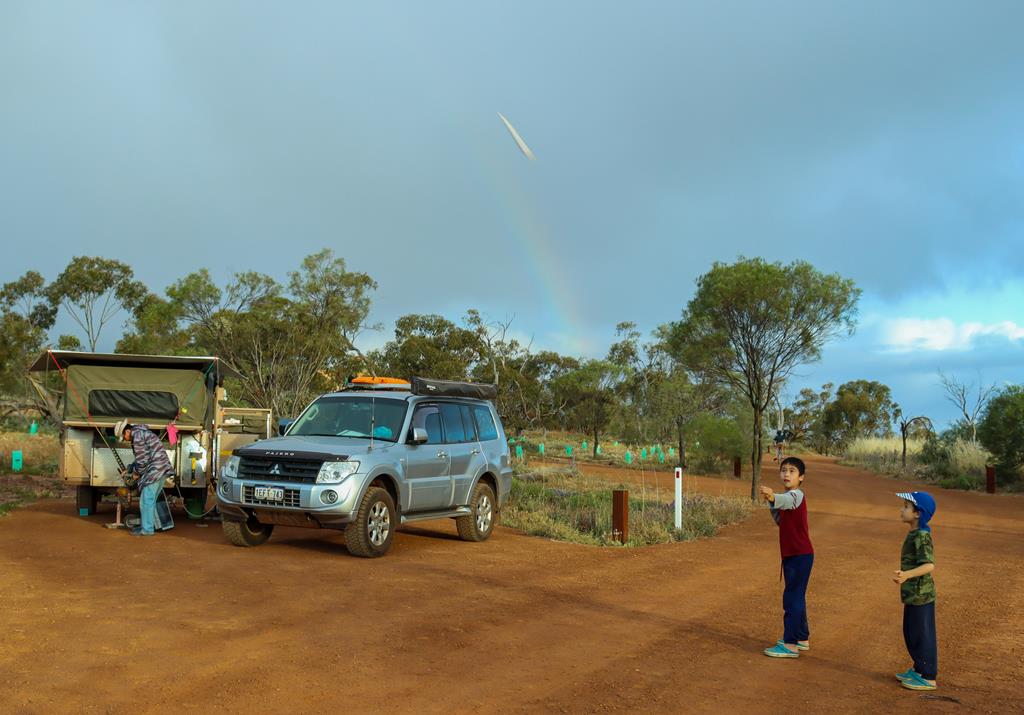
Kids found their own entertainments during our stay at Coalseam. One of the new fun games they discovered was building and shooting paper rockets. Some of the rockets flew as high as 60 meters up! What a thrill! Thank you, Daddy Brian for teaching the kids this fun activity.
Can you fly a paper rocket 60 meters high?
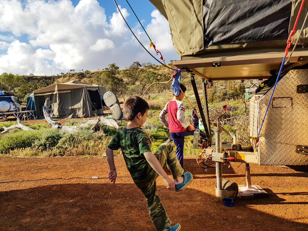
Kids also played with freesbie and….. a shoe! Can you spot a flying shoe? 🙂
Have you found where the shoe has gone? 🙂
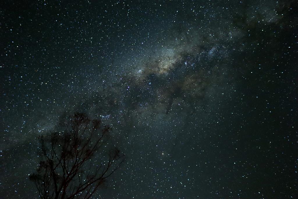
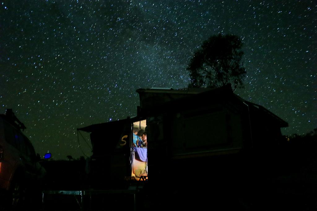
The night skies in the outback are dark and full of stars. It is such a relaxing and rewarding experience to look at the Milky Way and spot occasional stars falling.
Night skies at Coalseam Conservation Park
Lookouts and walking trails in Coalseam
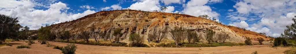
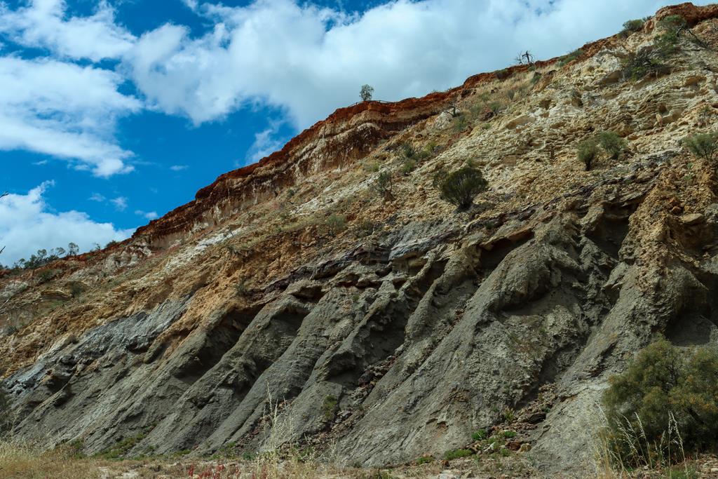
There are a few other things to see and places to visit apart from wildflowers in Coalseam Conservation park. 2km away from the Miner’s camp, there is Irwin River Lookout. An easy 500 meter loop walk to the cliff edge provides spectacular views over the Irwin River.
Irwin River Lookout
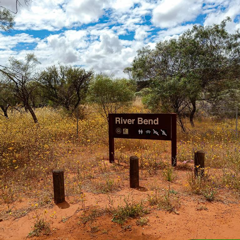
Below it (you would need to drive back and around to reach it) is River Bend, where you can view the banded layers in the cliff above. It is a nice picnic spot with bbq and toilets.
River Bend
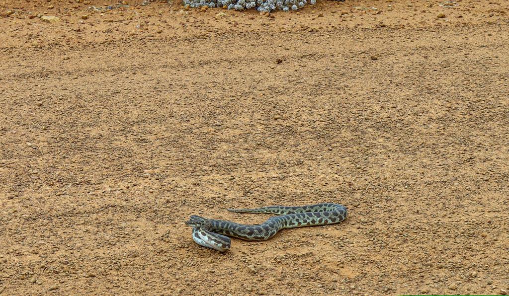
Seeing a snake is always a little bit terrifying but also exciting! After all, it is an opportunity to see it in their natural environment. We saw this Stimson’s python (also known as Children’s python) on our way to Irwin River Lookout, about 2km away from the Miner’s campground.
Stimson’s python
Manage Cookie Consent
To provide the best experiences, we use technologies like cookies to store and/or access device information. Consenting to these technologies will allow us to process data such as browsing behavior or unique IDs on this site. Not consenting or withdrawing consent, may adversely affect certain features and functions.
Functional Always active
The technical storage or access is strictly necessary for the legitimate purpose of enabling the use of a specific service explicitly requested by the subscriber or user, or for the sole purpose of carrying out the transmission of a communication over an electronic communications network.
Preferences
The technical storage or access is necessary for the legitimate purpose of storing preferences that are not requested by the subscriber or user.
Statistics
The technical storage or access that is used exclusively for statistical purposes.The technical storage or access that is used exclusively for anonymous statistical purposes. Without a subpoena, voluntary compliance on the part of your Internet Service Provider, or additional records from a third party, information stored or retrieved for this purpose alone cannot usually be used to identify you.
Marketing
The technical storage or access is required to create user profiles to send advertising, or to track the user on a website or across several websites for similar marketing purposes.