We are a family of four and are nuts about traveling. Our name reflects this! We love sharing the joy and love of traveling and adventure! Let's the fun begin!
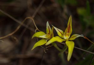
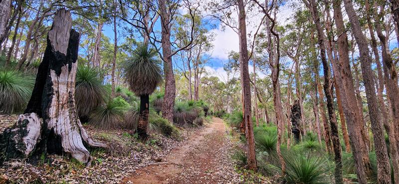
York and Beverley in Avon subregion within Wheatbelt are charming places to visit by themselves, but if you are looking for wildflowers, they are absolutely amazing. Both Yorkand Beverley visitor centres are very helpful, providing useful information, maps and resources to spot wildflowers, including orchids.
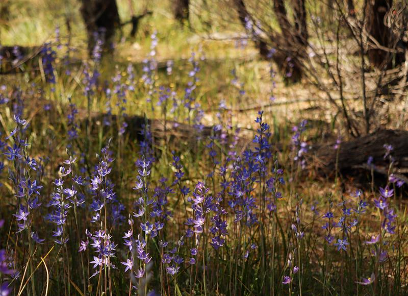
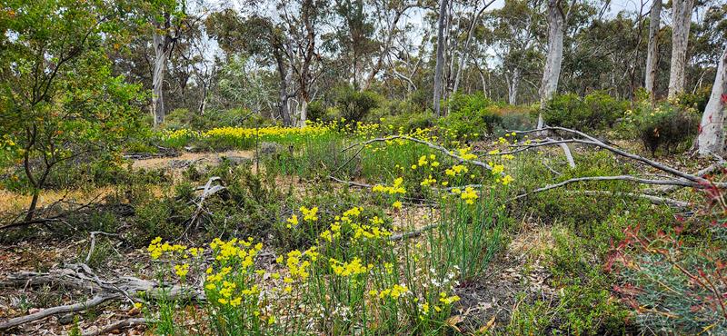
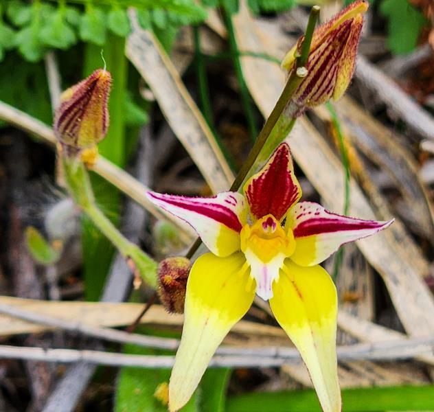
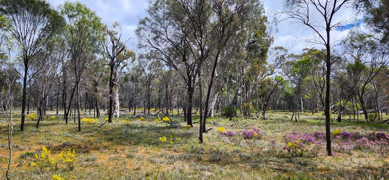
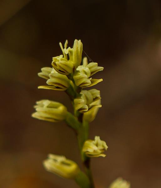
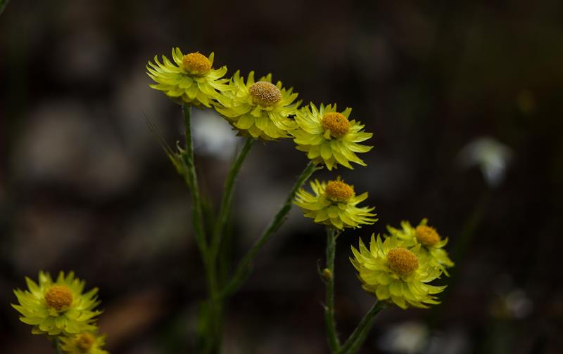
Sun Scented Orchids blooming at Brooking Street Reserve in Beverley
Brooking Street Reserve near Beverley
Brooking Street Reserve in Beverley is a small bushland reserve, walking distance from the main street of the town Beverley. However, it boasts 12 species of native orchids (most of them blooming from July to October). The walking trails are clearly marked, which makes it quite easy to spot the orchids. We feel so lucky to have seen 7 orchid species out of those 12 that grow there, just in one visit.
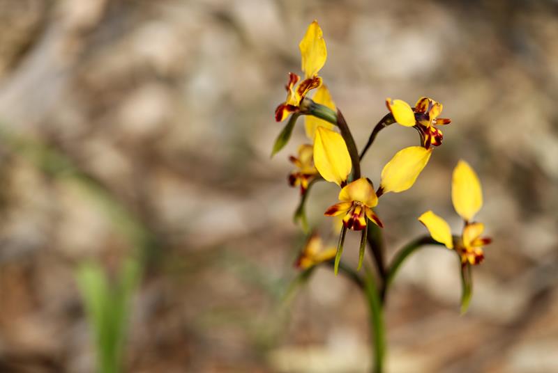
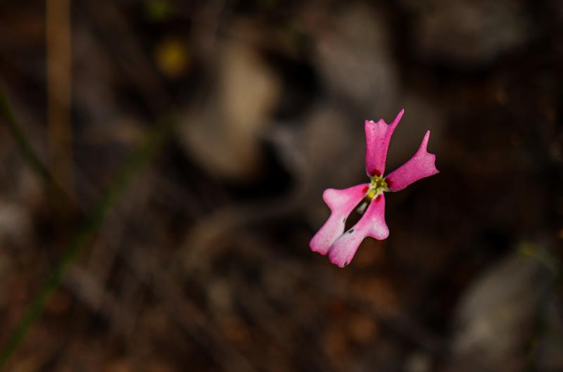
Pink Fairy Cowslip Hybrid Orchid (above left), Common Donkey Orchid Diuris species (above right).
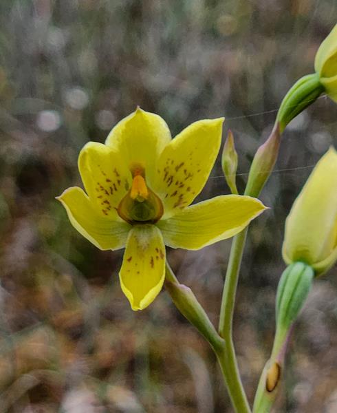
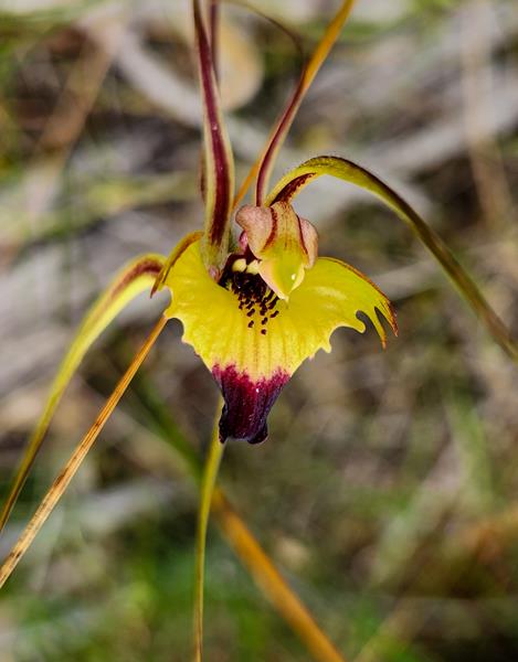
End of September orchids
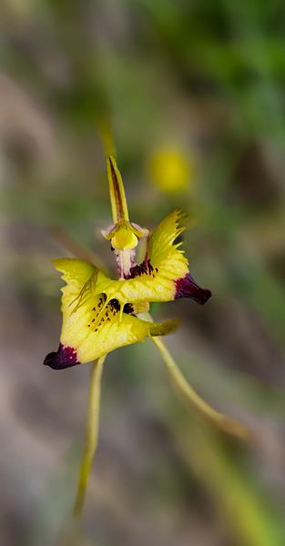
Fringed Mantis Orchid was still blooming one month later but none of the other orchids we’ve seen late August. However, we found 2 new different species.
Microtis media Common Mignonette orchid (above right), Scented sun orchid Thelymitra macrophylla (above left).
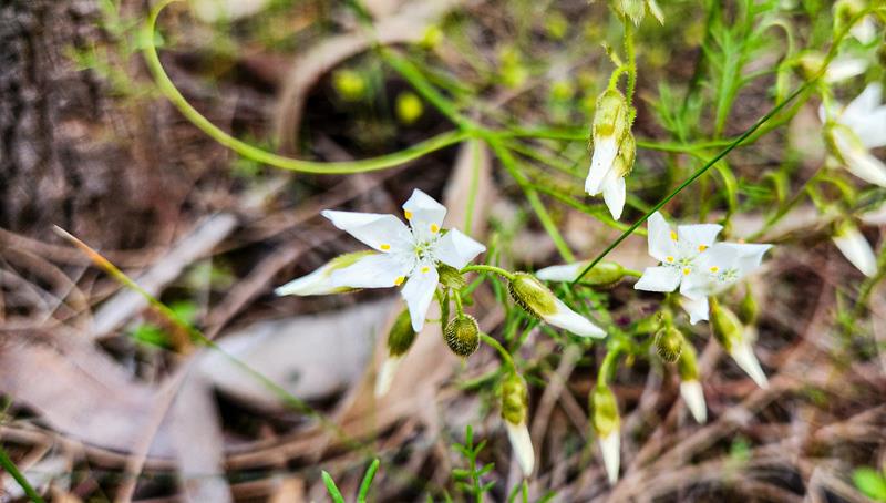
Drosera
There are not only orchids but a few other interesting wildflowers at Brooking Street Reserve. Pimpernel Sundew (Drosera glanduligera) is a tiny but quite spectacular and amazing carnivorous plant. I nearly missed it, mistaking it for a weed . It was flowering during our both visits to Brooking street reserve.
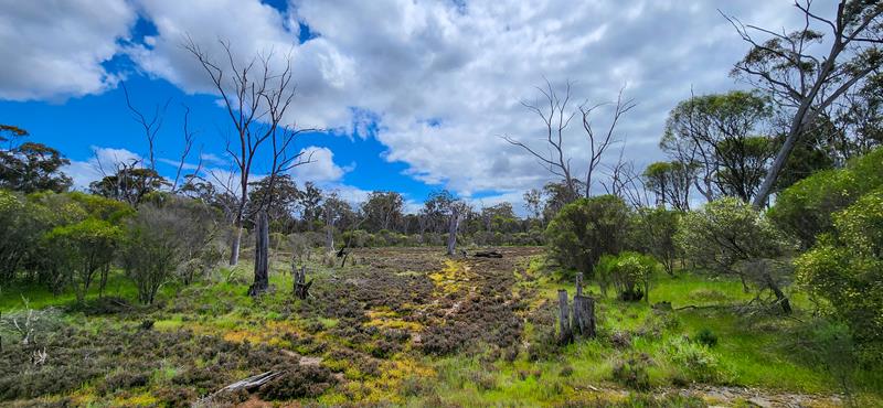
Wambyn Nature Reserve near York
Wambyn Nature Reserve is located 12km west of York, along Great Southern Highway. It is another great place to visit if you are searching for orchids. The pictures below were taken end of August 2023.
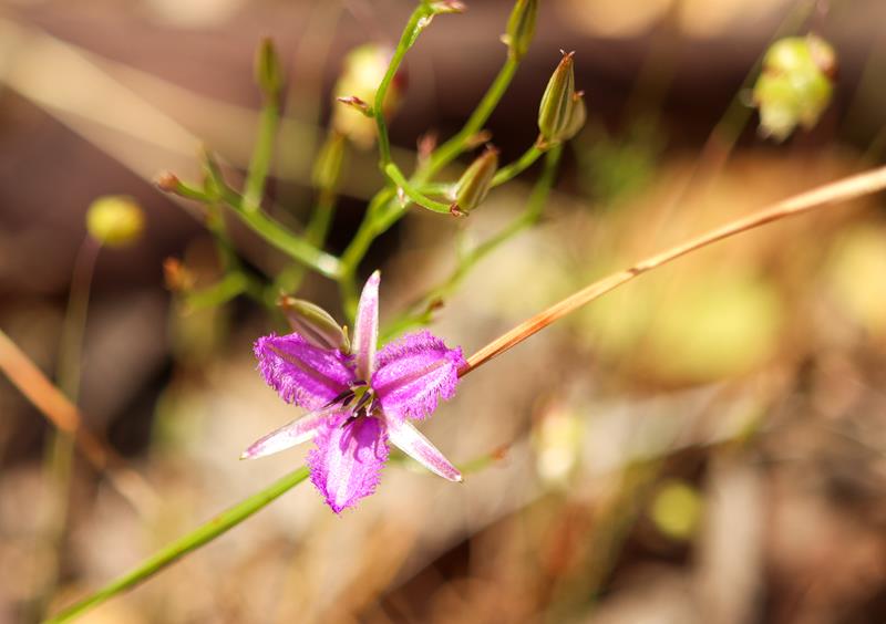
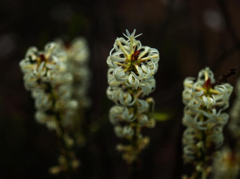
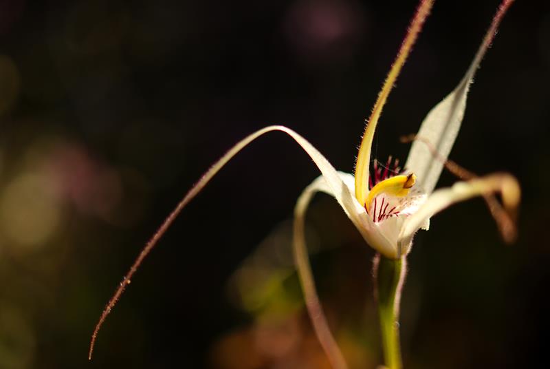
Caladenia longicauda Common White Spider Orchid (above left). This is a large spider orchid. Fringed Mantis Orchid Caladenia falcata (above top right), Sugar Candy Orchid Caladenia hirta (above top right).
Common Donkey Orchid Diuris species (above left), Bridal Rainbow Drosera macrantha (above right).
There are so many more reserves around York and Beverley! We’ll definitely be visiting them over the next few years and adding the updates to this post. Watch this space!
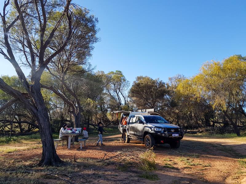
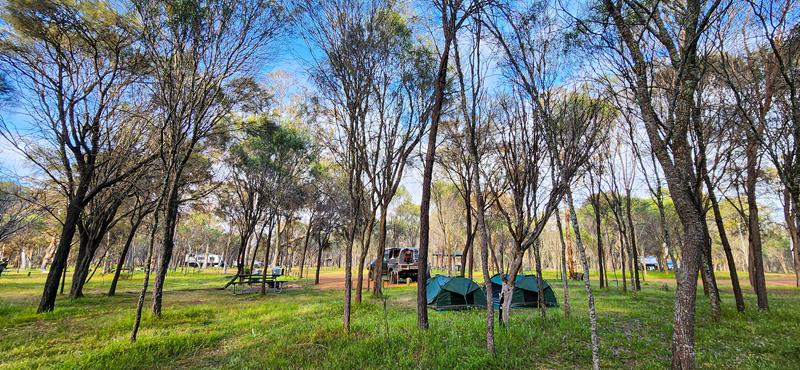
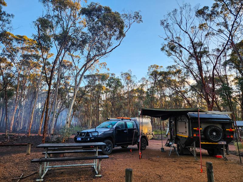
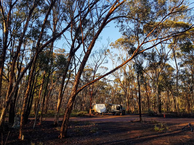
Kwolyin camp, near Bruce Rock in the Wheatbelt region – what a gem! We’ve stayed 3 nights there over the September long weekend and really enjoyed our stay. Facilities are amazing here and include 3 flushing toilets, kitchen with sink and gas stove, bbq, shelter, picnic tables, bins and some fire pits.
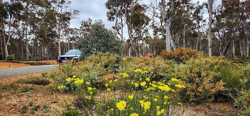
The campground is within the nature reserve, so there are plenty of wildflowers in season. At the end of September Waitzia Accuminata were nearly finished but there were still plenty of yellow Glyschrocaryon aureuam and blue Brunonia Australis, as well as blue Goodenia.
There are 3 walk trails of various length around the camp and over the Coarin Rock to enjoy. The best thing about Kwolyin camp is that it is free and you can stay up to 72 hours. Thank you, Shire of Bruce Rock for providing and maintaining so well these amazing facilities for us to enjoy!
Attractions near Kwolyin camp
There are plenty of activities and attractions sites around Kwolyin camp. It all depends how far you are prepared to travel and how much you want to spend in each place.
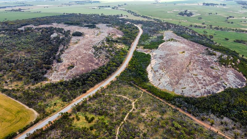
Kokerbin Rock
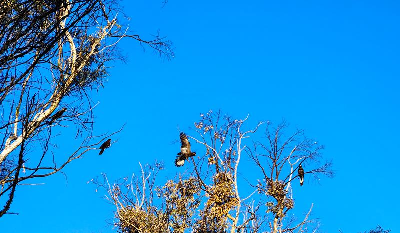
Kokerbin Rock is the 3rd largest monolith in Australia. While it is only 122 meters high, it is definitely worth a visit. 2km return hike to the summit is relatively easy. There is also a 2.8km Kokerbin Circuit Trail that circles half of the rock. With these two trails to enjoy, you can easily spend half a day there if you take the time to appreciate all that this place has to offer. Kokerbin Rock is within nature reserve, which means there are wildflowers in season, as well as many birds, butterflies and native animals.
Kokerbin Rock itself is very picturesque with many interesting rock formations, caves and boulders. Some rocks are hollow inside and big enough for you to walk into them, which makes them free standing caves.
The views from the summit are amazing. You can see long stretches of farming fields, more rock formations and towns of the Wheatbelt in the distance.
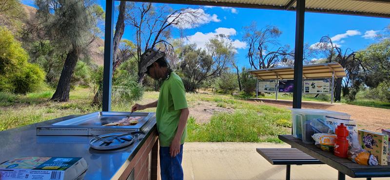
Facilities at Kokerbin Rock are quite good. It is actually a former campground (which was moved to nearby Kwolyin camp). Newly upgraded, there are toilets, shelter, picnic tables, bbq, rubbish bins and an information display. We enjoyed our lunch of freshly cooked eggs and bacon there.
Kokerbin Rock is 40km north west of Bruce Rock and 9km away from Kwolyin camp. There is no entry fee to the reserve. Unfortunately, no dogs are allowed within the reserve.
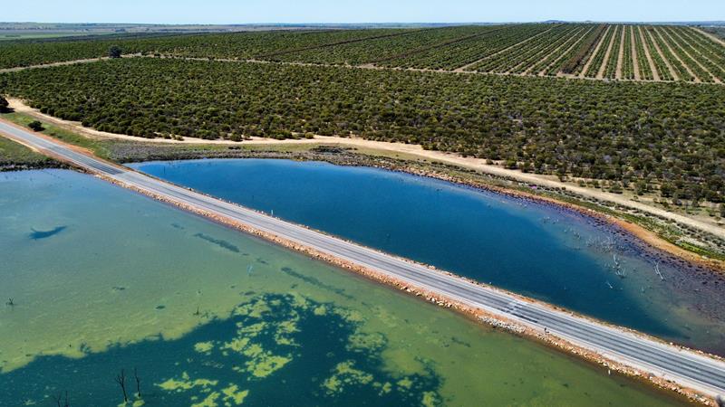
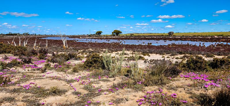
Quairading Pink Lake
There are 2 unusual things about this pink lake. First, the road (sealed) goes directly through the lake, so you literally drive through it. Second, one side of the lake gets pink at certain times of the day and year, while the other side always stays blue. When we saw this lake at the end of September, only the edges of one side of the lake were pink. Assumingly, because the water there is shallow and thus warmer. This blogger offers a good explanation of this phenomenon.
Quairading Pink Lake is on Bruce Rock-Quairading Road, 11km east of Quairading.
Shackleton
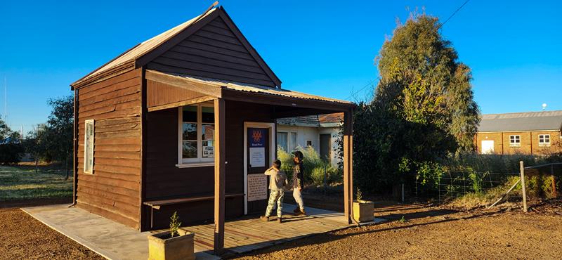
This little town is known for having the smallest bank in Australia. The bank is within 3 by 4 meter building. It closed the operation in 1997. Shackleton, a small town of just around 100 people is on the Bruce Rock-Quairading Road between towns of Bruce Rock and Quairading. It is 9km from Kwolyin camp. We found it was worth a stop.
Bruce Rock
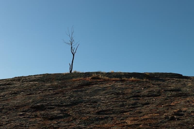
Bruce Rock is a rock, as well as the name of the town. While the rock is not as impressive and popular as nearby Kokerbin Rock, it is nevertheless a rock. With a lonely tree on top 😊. You can’t climb the rock, as it is a fenced area but you can have a picnic there, as facilities are provided (but no toilets). Bruce rock is a short drive from the town with the same name. It is about 40km east from Kwolyin camp. If you need to fill up fuel or buy food, it might be the place to visit.
Corrigin
We found Corrigin much nicer than Bruce Rock. Corrigin has a Dog Cemetry, 5km from the town, which is an attraction by itself (although, it could be a sad experience for some). Inside the town there are a few nice parks for kids to play or to have a picnic.
There is also Corrigin wildflower drive, which starts opposite the Corrigin Dog Cemetry. It is a 4km long drive trail with a variety of wildflowers blooming from August to November. We found it quite bright and colourful when we visited this place late September.
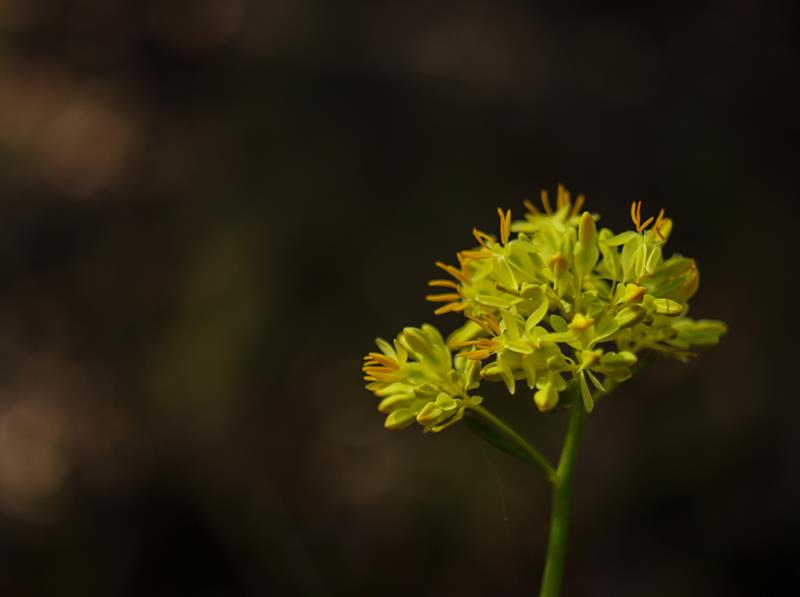
Petrophile brevifolia (above left), Dasymalla terminalis Native Foxglove (above top right), Glischrocaryon aureum Common Popflower (above bottom right).
Corrigin is 56km south of Kwolyin camp and is 235km east of Perth.
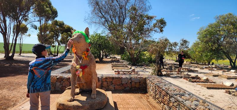
Babakin
Babakin is a very small town in the Wheatbelt region, between Bruce Rock and Corrigin. It is a quiet place with population of just 56 people. The reason it is known is because it is home to WA’s rarest plant – underground orchid Symonanthus bancroftii (also known as Rhizanthella gardneri). While it was not the right season to find this plant (and probably, almost impossible anyway, unless you are an expert), we stopped by to learn more.
Behind the town hall, we encountered a visitor – blue tongue lizard.
If you are into photography…
There are plenty of opportunities to utilise your skills and satisfy your passion as a photographer.
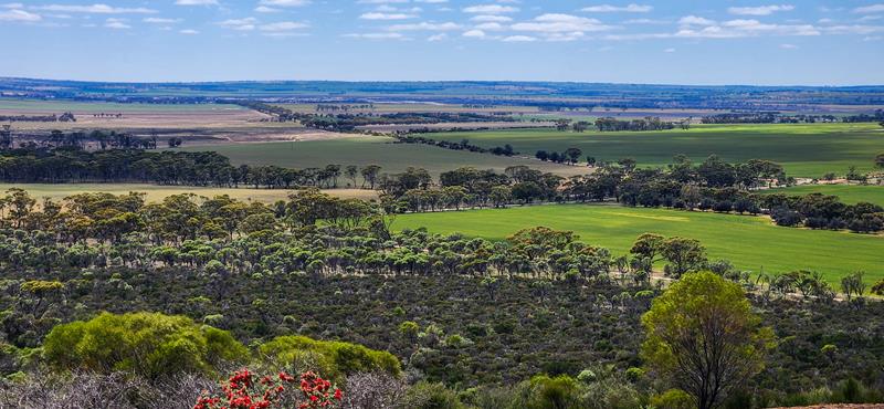
Farm fields in the Wheatbelt region look nice – green or yellow, from low or from high up.
There are various salt lakes, big and small, which could be dry during warmer months. They also look quite picturesque.
Rocks… There is no shortage of them in the Wheatbelt.
Kwolyin camp is located 40km north west of Bruce Rock, along Bruce Rock-Quairading Road. It is also 9km from Kokerbin Rock. Kwolyin camp is in the Central East Wheatbelt region of Western Australia.
There is no charge to stay at Kwolyin camp but you can only stay not more than for hours.
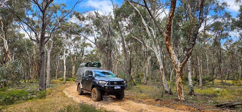
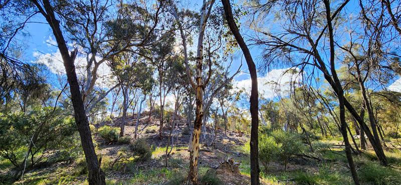
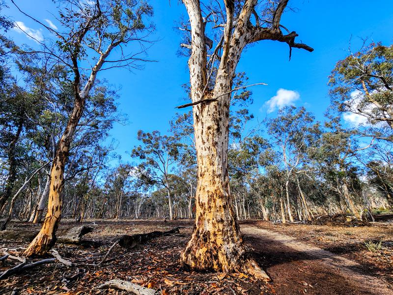
Boyagin nature reserve in the Wheatbelt area is an example of how the natural bushland looked like before the land was cleared for farming. It is a great place to observe wildlife and native wildflowers. Actually, you can drive through the reserve. Although the track gets steep and uneven at some places, so you would need a 4WD for that.
The heart of the reserve is Boyagin Rock, that rises 50 m above the land. There is a 1,1km moderately challenging and steep walk to the top of the rock. In spring and winter it is a nice place to enjoy the wildflowers.
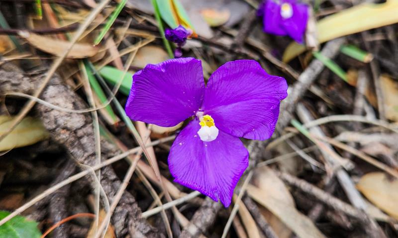
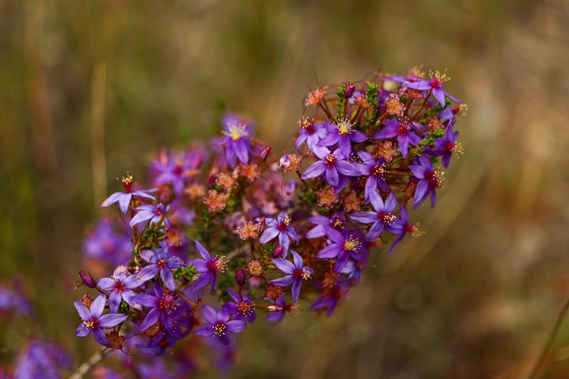
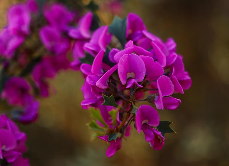
Fringed Mantis Orchid Caladenia falcata (above left), Cowslip Orchid Caladenia Flava (above middle), Patersonia Occidentalis Purple Flag (above right).
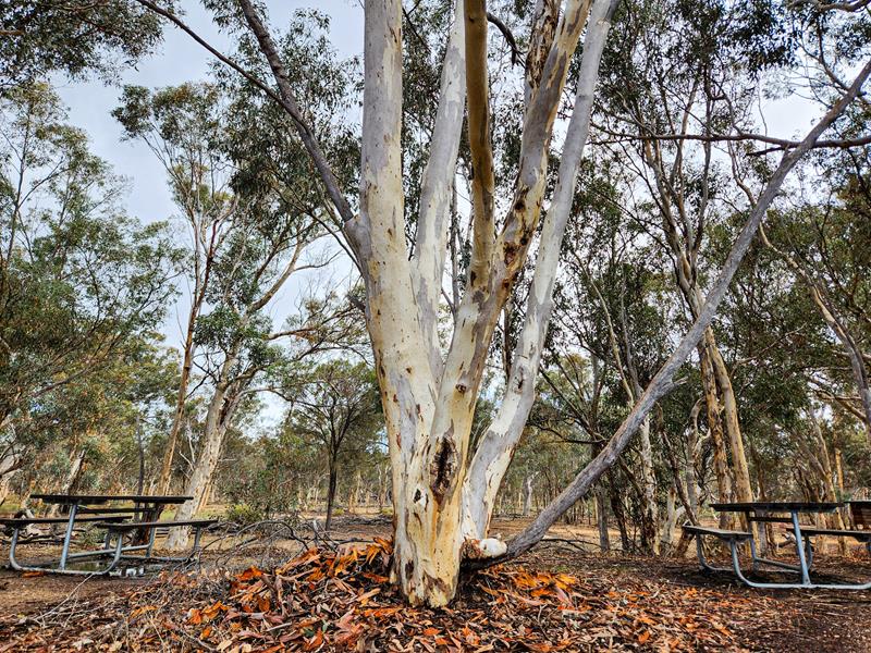
Facilites at Boyagin nature reserve
Near the Boyagin Rock carpark there is a picnic area with tables, gas bbq, toilets and an excellent information display. The posters depict rich information about the reserve and its history. You can also learn there how the Rock plays an important role for Noongar people. We didn’t actually climb the rock as we ran out of time driving through the reserve itself.
Additional information:
Byoagin Rock is 175km south east of Perth and 26km north west of Pingelly. Camping and dogs are not allowed at the reserve.
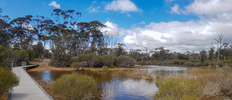
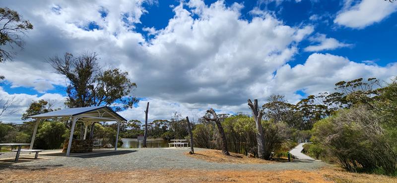
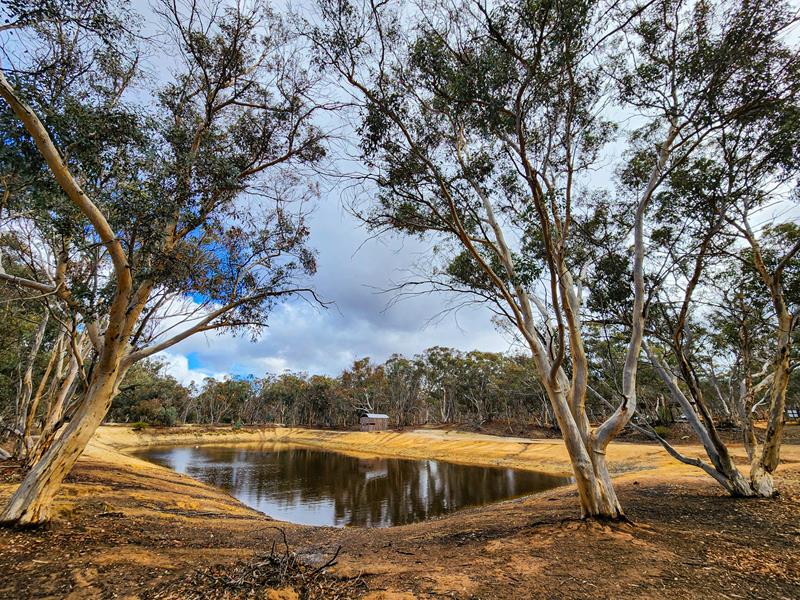
Yornaning Dam, 24km north of Narrogin in the Wheatbelt, turned out to be a nice surprise for us. The dam was originally built to provide water for steam locomotives on the railway line between Perth and Albany and fresh water for Narrogin. Nowadays the dam is used for recreational swimming and as a picnic spot. We stopped at Yornaning Dam on our way home after camping at Dryandra Woodland. Being it close to home, we decided to spend a bit of time at this place.
What’s on offer at Yornaning Dam
First,there are a couple of easy walk and cycling trails around the dam, which are quite picturesque.
If you are into photography, this is a great place to spend some time. Second, the dam also attracts many native birds and animals. Third, the area around Yornaning Dam is actually a reserve, which means you will find great flora and fauna. Late winter and spring is particulaly a good time for viewing wildflowers, including a few types of orchids.
Yornaing Dam has excellent facilities, which include picnic tables, bbq, toilets and children’s playground. The view on the dam is awesome, especially if it is a nice slightly cloudy day or, perhaps, at sunset. While we had our lunch at the dam, we saw a number of people camping there. Apparently, according to the Cuballing shire website, if you are self-sufficient, you can camp there for free, for a maximum of 3 nights. Dogs are welcome on the leash.
To sum up, Yornaning Dam is a great place to visit. We’ll probably be back one day camping there.
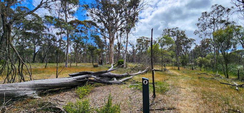
Foxes Lair is a bushland reserve, on the edge of Narrogin town in the Wheatbelt area. It is well known to wildflower enthusiasts and lovers of bird and wildlife. We visited it as part of our trip to Dryandra Woodland, searching for wildflowers, late September. It was a wonderful addition to our camping trip, as we took our time to take it slow and enjoy the outdoors.
Valley Loop Trail
What to do in Foxes Lair
Foxes Lair is a great place to enjoy nature, go hiking, cycling or picnicing. There are 5 walking trails within the reserve, all quite easy. In addition, there is also a cycle trail and 3 picnic grounds within the reserve. Facilities include shelter and picnic tables but no toilets (you can find public toilets a short drive away in Narrogin).
Marri picnic ground
Wildflowers at Foxes Lair
These are the flowers spotted late September along Valley Loop trail.
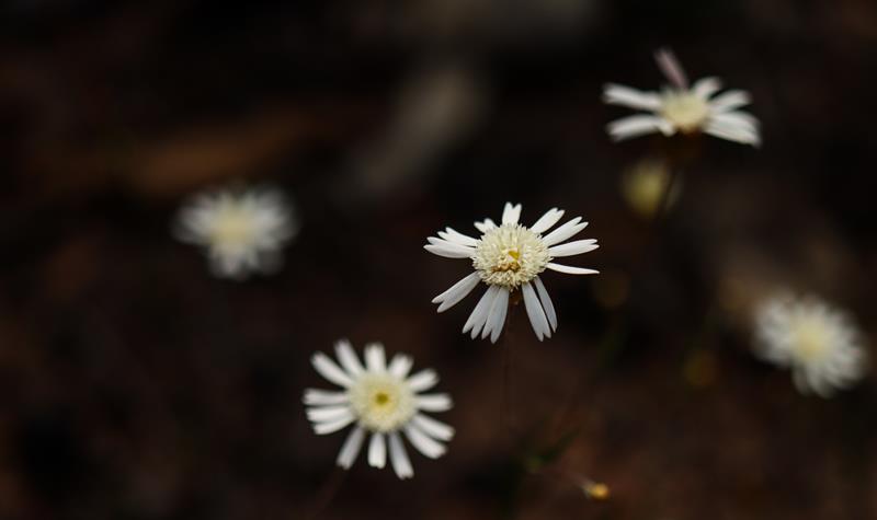
White Banjine Pimelea ciliata (above left), Stylidium caricifolium (above right).
Narrogin
While you visit Foxes Lair nature reserve, it is worthwhile to drop at nearby Narrogin visitor centre. We were pleasantly surprised with this nice little information centre, run by friendly volunteers. The centre is well stocked with lots of information on the surrounding parks, reserves and other attractions.
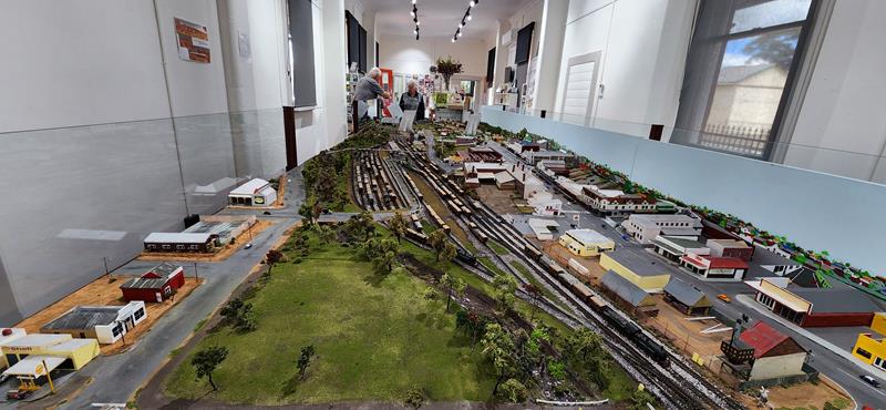
Furthermore, Dryandra Country Visitor Centre in Narrogin has an interesting interactive display – diorama of Narrogin back in 1960s. Apparently, it is still work in progress, so next time you visit it, there might be a bigger and more detailed display on offer.
Diorama of Narrogin
Apart from the visitor centre, Narrogin is quite a nice town by itself. It is relatively large, which means you can easily stock up on food and fuel. Also, there are also a number of pretty and interesting parks within the town.
Memorial park in Narrogin
So, next time you are passing by, we recommend you stop by at Narrogin! And, of course, Foxes Lair is a must if you are searching for wildflowers.
Dryandra Woodland, being only 164km from Perth, is a perfect place for a short getaway. First, it is the diversity of flora and fauna that is so amazing. It is a rather large and significant nature conservation area. Second, the park has a number of walking trails with interpretative signs, providing opportunity to enjoy nature and learn about the place and its history. Third, there is an opportunity to see wild native animals in their environment. The best thing? You can camp at Dryandra Woodland, which means you have more time to explore this wonderful place.
Camping at Dryandra Woodland
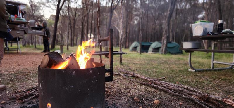
Camping in the woods is always lovely, especially in colder months when you can have a campfire. There are 2 bush camp grounds within Dryandra Woodland National Park, managed by Parks and Wildlife Service – Congelin campground and Gnaala Mia campground. They are both similar in terms of the facilities provided – large camping spots, spaced well apart, each with a picnic table and fire ring (with wood provided), well maintained long drop toilets, bbq and kitchen shelter. You cannot book a site, but we didn’t find it was an issue to find a spot, although, the campgrounds are quite popular.
Congelin campground
We stayed at Congelin campground in September 2023 and paid $11 per person per night ($3 per child). Please check Parks and Wildlife website for current pricing and bookings.
We were happy for an opportunity to still have fire on the last day of September.
Gnaala Mia campground
Over the long June weekend in 2024 we visited Dryandra Woodland again. This time we stayed at Gnaala Mia campground. It has two loops with 27 bays suitable for caravans and 8 bays for tents. Unlike Congelin campground, the sites at Gnaala Mia do not have grass.
Dryandra Woodland flora and fauna
Most importantly, it is the feel of the woodland with its smells, sounds and sights that was very appealing for us. The highlights were cowslip and spider orchids among other wildflowers only steps away from the tent – a pure delight for wildflower enthusiasts. This was late September 2023.
Blue China Orchid Cyanicula gemmata (above left), Common Dragon Orchid Caladenia barbarossa (above middle), Cowslip orchid Caladenia flava subspecies sylvestris (above right).
There is a great variety of trigger plants at Dryandra Woodland:
Above, from left to right: Stylidium ecorne, Stylidium petiolare Horn Triggerplant, Stylidium uniflorum orange, Stylidium uniflorum.
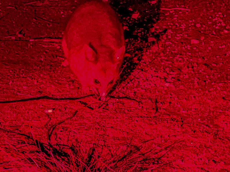
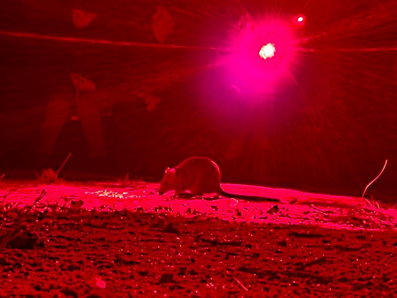
Black Carnaby’s cockatoos and a variety of parrots were among the many birds we spotted. And of course, the main treat was seeing the nocturnal woodland marsupials. We had a couple of different visitors come to our campfire. They were too busy to stop for a good picture or proper species identification 😊.
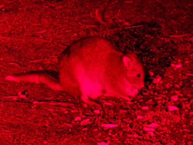
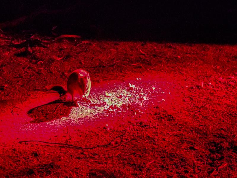
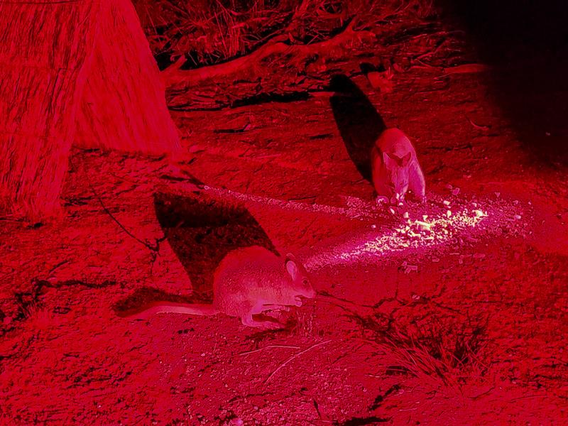
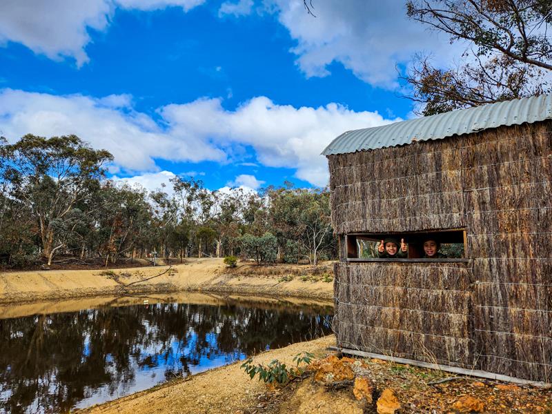
Barna Mia nocturnal tour
Barna Mia nocturnal tours are very popular and need to be booked in advance. We missed out on the opportunity when we visited Dryandra first time in 2023, so decided to book weeks ahead for the June long weekend the following year (2024). The tour was very informative and educational, great for adults and kids alike. The animals were cooperative and came out to say hello, except for Mala (Rufous Hare Wallaby). We saw Bilby, Woylie and Boodie – all are endangered native animals.
Brushtail Possum also joined the party (he is not endangered but was allowed to be there 😊). It would be good to have a better lighting, but you can only use red light with nocturnal animals to protect their well-being.
Old Mill Dam is a nice picnic area, close to Dryandra Village in Dryandra Woodland. There are 2 easy walks of various lengths, starting from the Dam to enjoy the woodlands with the opportunity to spot wildlife. Facilities include picnic tables, bbs, toilet. Unfortunately, dogs are not allowed.
Additional info
Dryandra Woodland is roughly a 2 hour drive south east from Perth and 22km north west of Narrogin. It is within Wheatbelt region of Western Australia. The entry to Dryandra Woodland Park is free. Unfortunately, no dogs. The cost of both Congelin and Gnaala Mia campgrounds is $15 per person ($5 per child) per night in 2024.
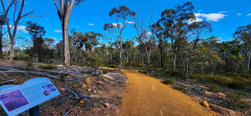
Korung National Park, is in Western Australia, 26 kilometres south-east of Perth. It was formerly known as Pickering Brook National Park. There are 2 designated hiking and mountain bike trails (Carmel walk and Lion’s Lookout) in the park. Both have an abundance of wildflowers in spring. We visited Lion’s Lookout.
Lion’s Lookout walk
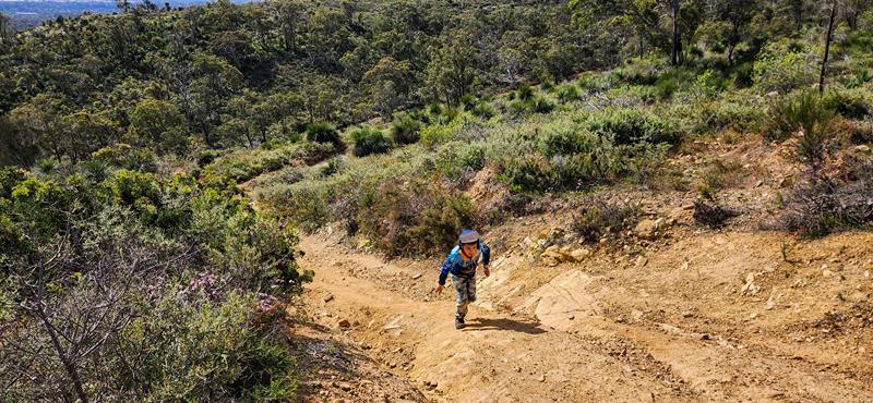
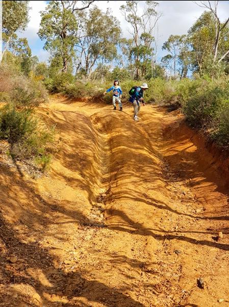
Lion’s Lookout Walk within Korung National Park, just off Welshpool Road in Lesmurdie is a great hiking trail to do in winter and spring. With wide but bumpy track going up and down, and at times being challenging, it was fun for our kids. They were running up and down the slopes, while the adults were struggling to go down on some steep sections.
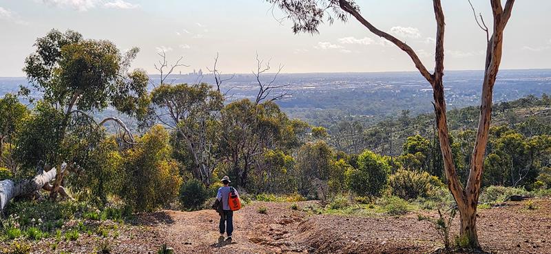
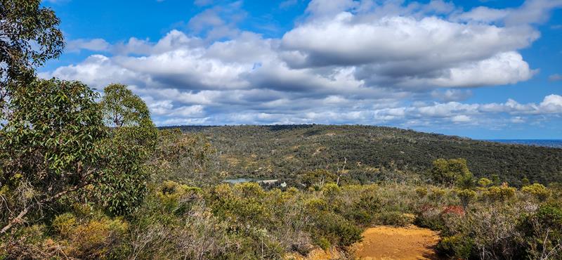
Lion’s Lookout is a loop trail, 4km long. The highest point of the track offers great views over Bickley Reservoir and Perth city.
Wildflowers at Korung National Park
There are plenty of widlflowers along the way. We find looking at wildflowers so fascinating, that went to the trouble of learning their names, so we know what we are photographing.
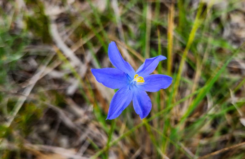
Banksia armata (above left). Blue Squill Chamaescilla corymbosa (above top right). Drumstick Isopogon sphaerocephalus (above bottom right).
Hairy Jug Flowerr Adenanthos barbiger (above right). Honeypot Dryandra Banksia nivea (above top right). Leschenaultia Biloba (above bottom right).
Pimelea ciliata – White Banjine (above left). Swamp spider orchid (above top right). Tetratheca species (above bottom right).
Calytrix glutinosa (above left top). Stypandra glauca – Blind Grass (above right). Philotheca spicata Pepper and Salt (above left bottom).
Facilites at Korung National Park (Lion’s Lookout)
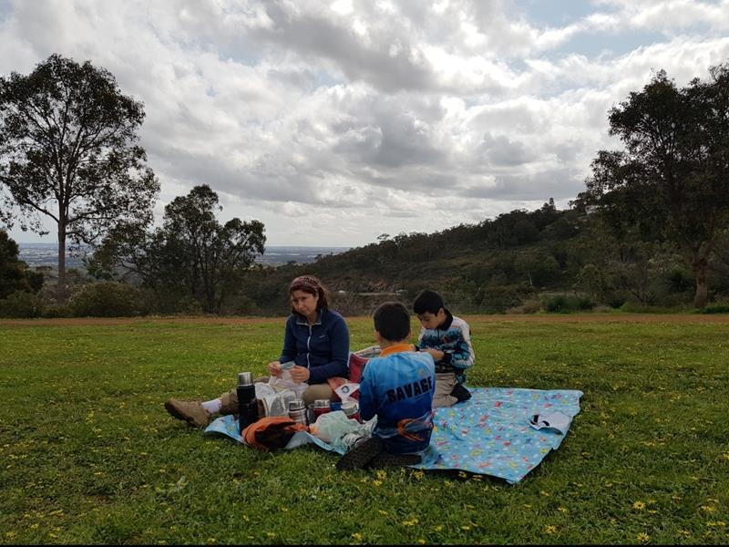
After the walk (or before) you can enjoy a picnic on the grass or at the picnic tables provided near carpark while enjoying the views of the city. There are picnic tables, shelter, bbq and rubbish bins (but no toilets) there.
Additional information
The entry to the park is free. Unfortunatley, no dogs are allowed.
Armadale Setters Common is located in Bedfordale, Western Australia. It is a large bushland reserve that is known for a variety of wildflowers in spring, boasting 318 plant species. It is also home to diverse fauna.
There are a number of hiking trails in Armadale Settlers Common, offering a range of experiences, from easy walks to picnicking, wildlife observation and photography. We visited this place late August, searching for wildflowers. Surely enough, we found quite a selection of them.
Settlers Common East
This is the smaller part of the reserve, which has great picnic facilities with benches, picnic tables and shelters. Observation Circle has gravel trails, offering bushland hiking experience. Next to it, is paved path for pram and wheelchair access.
There is also the greater Settlers Common on the other side of Carradine Road with longer trails (all gravel). We haven’t covered that place, hence we can’t write much about it. So all the pictures were taken in Settlers Common East.
Hairy Jug Flower – Adenanthos barbiger (above left). Red Ink Sundew – Drosera erythrorhiza (above top right). Wilson’s Grevillea – above bottom right.
Location and additional info
In conclusion, there is some practical information. Armadale Settlers Common is about 40 minutes drive from Perth. You can access it from Canns Road or Carradine Road, Bedfordale. There is no entry fee and dogs are allowed in this place.
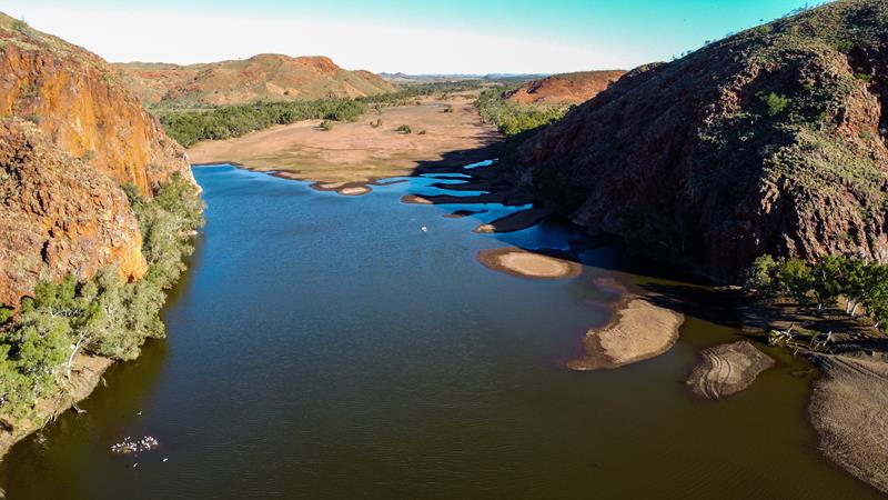
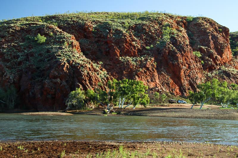
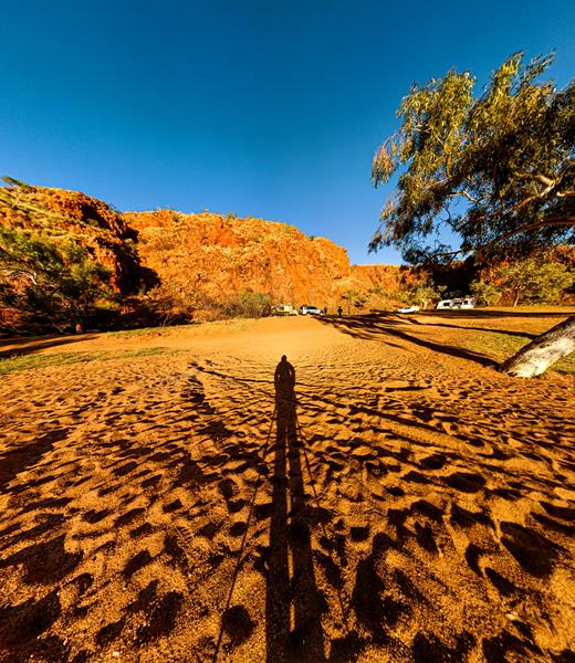
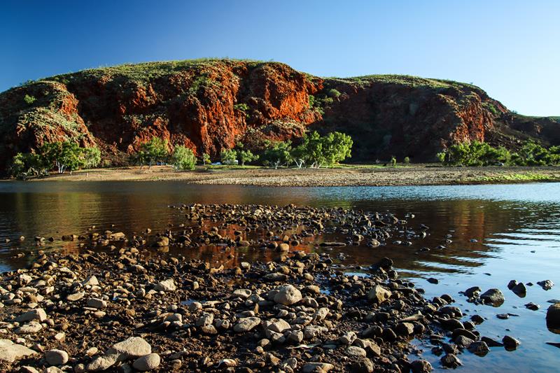
Pilbara doesn’t stop to surprise us. There always seems to be the next hidden gem, waiting to be discovered, explored and delight our eyes and souls. On our way to the Gibb River Road last year, we stopped at Doolena Gorge near Marble Bar. It is a marvelous place with nice scenery. When there is enough of water, the gorge fills up with water from the De Drey River. It becomes then a pleasant picnic and camping spot. Swimming is permitted there and dogs are allowed.
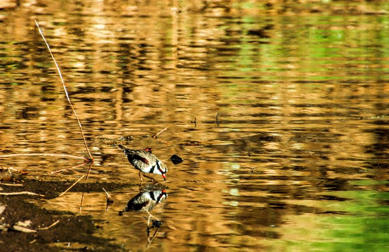
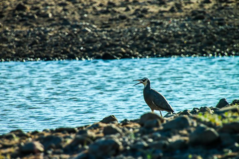
Doolena Gorge is also a heaven for birds. (Below left: Black-fronted Dotterel. Below right: White-faced Heron.)
You can camp for free there but must be self-sufficient as there are no facilities.
It is a privilege and honour to camp for free at places like this – pristine, rugged and beautiful. So, please look after our outback.
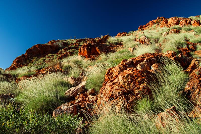
Perspective
There is a distinct beauty in the rugged landscape of the Pilbara outback – red iron rich rocks, yellow-green spinifex against the bright blue sky.
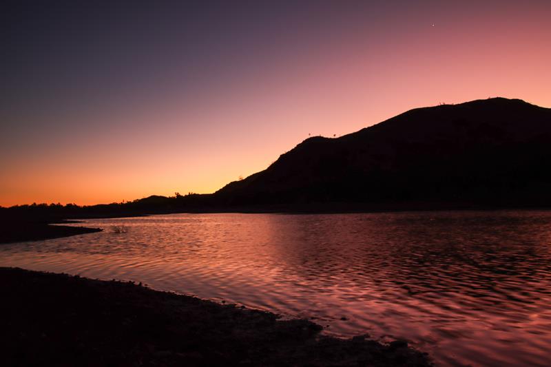
Sunsets and sunrises are particularly beautiful and special in the outback. There is no better way to watch them then when you camp as you can catch different colours of the sky minut changed by setting and rising sun, minute by minute.
Where is Doolena Gorge?
Doolena Gorge is approximately 41 kilometres north of Marble Bar on the Marble Bar-Port Hedland Road. The turning is just after Coongan River crossing on the left. Even though it is rated as 4WD, the dirt road is not long and we think it would be fine for a 2WD if you take it easy and slow (although you might not be able to go all the way). When you get to the place, you can go closer to the actual gorge if you have a 4WD.
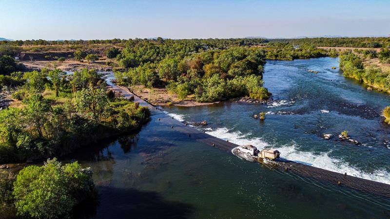
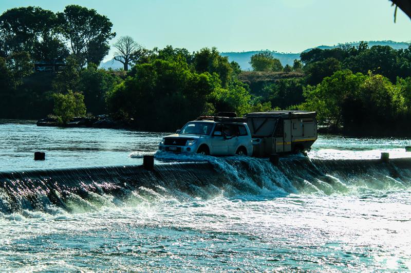
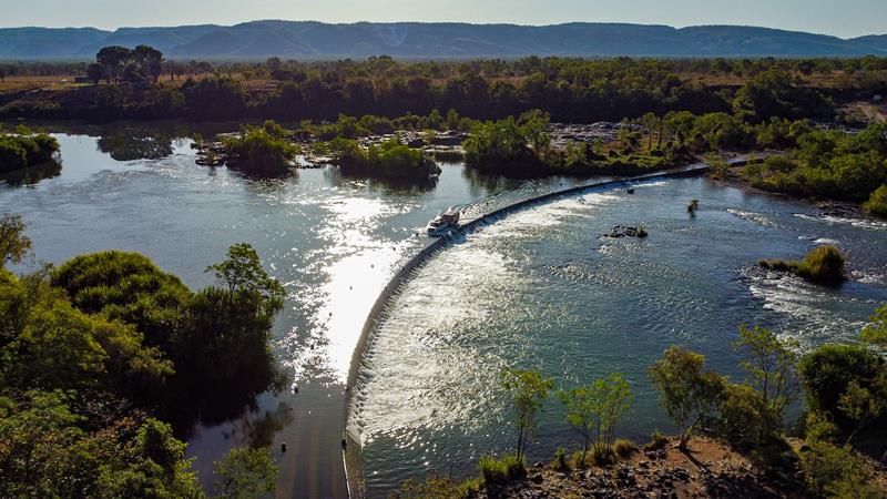
Ivanhoe River Crossing, north of Kununurra is an iconic place and a must do for any 4WD enthusiast travelling through the Kimberley Region and the Gibb River Road. It is a concrete one-way causeway over the Ord River, which was part of the main road to Wyndham during the old days. But nowadays, it is a place where travellers go to tick off their “bucket list”. So, it is really just crossing the river and going back. Many people (especially those with no 4WD) come just to watch others do it. It is also a popular fishing spot. Salt water crocodiles inhibit these waters, so swimming is not safe there.
The river crossing is closed during wet season (usually November to March). So, Australian winter, which is considered dry season, is best for visiting and crossing.
Where is Ivanhoe River Crossing?
It is along Ivanhoe Road, 10-15 minutes’ drive north of Kununurra in East Kimberley.
Manage Cookie Consent
To provide the best experiences, we use technologies like cookies to store and/or access device information. Consenting to these technologies will allow us to process data such as browsing behavior or unique IDs on this site. Not consenting or withdrawing consent, may adversely affect certain features and functions.
Functional Always active
The technical storage or access is strictly necessary for the legitimate purpose of enabling the use of a specific service explicitly requested by the subscriber or user, or for the sole purpose of carrying out the transmission of a communication over an electronic communications network.
Preferences
The technical storage or access is necessary for the legitimate purpose of storing preferences that are not requested by the subscriber or user.
Statistics
The technical storage or access that is used exclusively for statistical purposes.The technical storage or access that is used exclusively for anonymous statistical purposes. Without a subpoena, voluntary compliance on the part of your Internet Service Provider, or additional records from a third party, information stored or retrieved for this purpose alone cannot usually be used to identify you.
Marketing
The technical storage or access is required to create user profiles to send advertising, or to track the user on a website or across several websites for similar marketing purposes.